Clay Hard Point

Coastal Feature, Headland, Point in Dorset

England

Clay Hard Point

Inland section of coast path, north of Wyke Wood, Rodden
Inland section of coast path, north of Wyke Wood, Rodden Credit: Colin Park

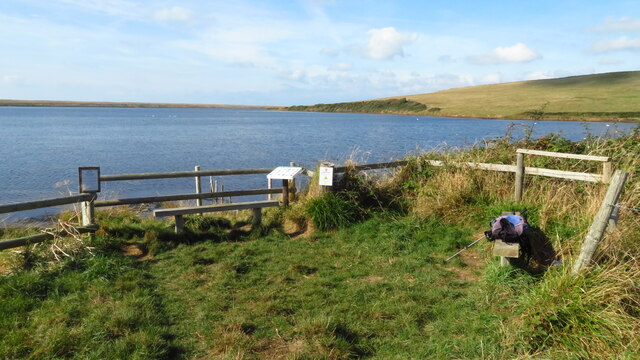
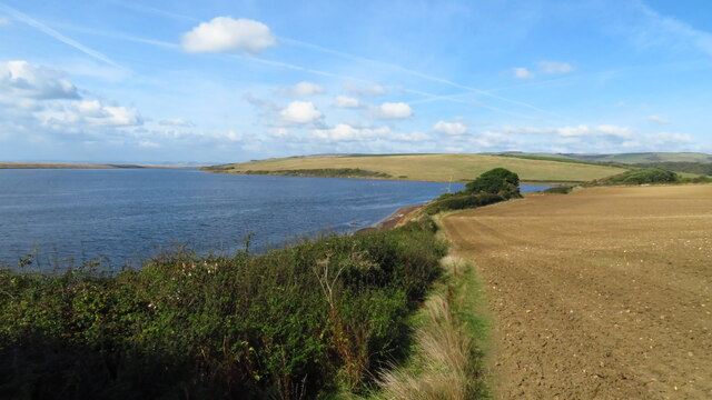
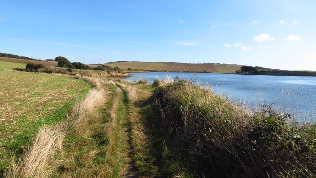
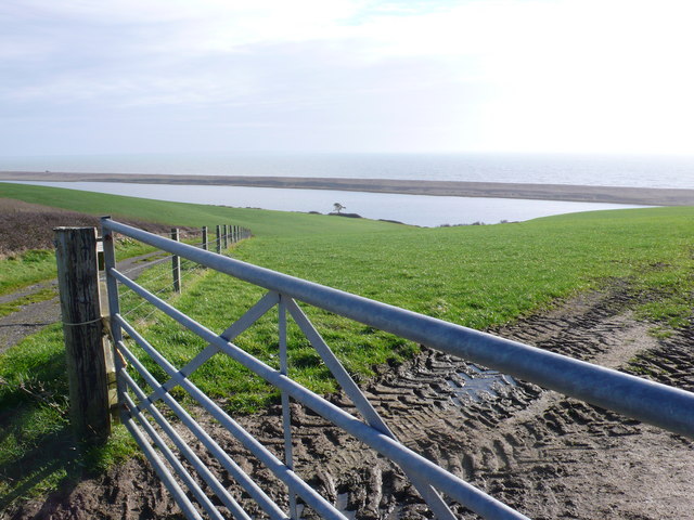
Clay Hard Point is a prominent coastal feature located in Dorset, England. Situated along the English Channel, it is a headland that juts out into the sea, forming a distinct point along the coast. The headland is composed of clay, which gives it its name, and is characterized by its rugged cliffs and unique geological formations.

The cliffs at Clay Hard Point are known for their impressive height and sheer drop to the sea below. They are made up of layers of clay, sand, and other sedimentary rocks, which have been shaped and eroded by the relentless force of the waves over thousands of years. The ruggedness of the cliffs adds to the dramatic beauty of the landscape.

The headland offers stunning panoramic views of the surrounding coastline and the open sea. From the top of the cliffs, visitors can witness the power of the waves crashing against the rocks below, creating a mesmerizing spectacle. The area is also home to various species of seabirds, which can be observed perched on the cliffs or soaring above the water.

Clay Hard Point is a popular destination for hikers, geology enthusiasts, and nature lovers. There are several walking trails that allow visitors to explore the headland and enjoy its natural beauty. However, caution should be exercised near the cliff edges, as they can be unstable and dangerous.

Overall, Clay Hard Point is a remarkable coastal feature that showcases the geological diversity and natural splendor of Dorset's coastline. It is a must-visit location for those who appreciate the breathtaking beauty of nature and the power of the sea.

If you have any feedback on the listing, please let us know in the comments section below.

Clay Hard Point Images

Images are sourced within 2km of 50.634416/-2.5592829 or Grid Reference SY6081. Thanks to Geograph Open Source API. All images are credited.

Inland section of coast path, north of Wyke Wood, Rodden
Path junction N of Wyke Wood, Rodden
Rodden Hive, West Fleet
West Fleet at Clay Hard Point, Langton Herring
Following the coast path east from Langton Hive Point near Langton Herring
On the coast path by Gore Cove - view to Herbury
Wave Action on Chesil Beach Rough wave conditions hitting the coastline of Chesil Beach. This coastal feature was built by the movement of shingle by wave action along the coast by longshore drift. This image was taken during almost gale-force conditions on a low tide; person in shot used to show wave height.
Wave Action on Chesil Beach
Rough wave conditions hitting the coastline of Chesil Beach. This coastal feature was built by the movement of shingle by wave action along the coast by longshore drift. This image was taken during almost gale-force conditions on a low tide; person in shot used to show wave height.
Chesil Beach with Langton Herring in the distance To see some 360°Panoramas of Dorset please visit this <span class="nowrap"><a title="www.360panoramas.co.uk" rel="nofollow ugc noopener" href="http://www.360panoramas.co.uk">Link</a><img style="margin-left:2px;" alt="External link" title="External link - shift click to open in new window" src="https://s1.geograph.org.uk/img/external.png" width="10" height="10"/></span>
Chesil Beach with Langton Herring in the distance
To see some 360°Panoramas of Dorset please visit this LinkExternal link
West Fleet and Chesil Beach This is the view across the square looking S down the track from that runs from Higher Barns due south to the West Fleet
West Fleet and Chesil Beach
This is the view across the square looking S down the track from that runs from Higher Barns due south to the West Fleet
Higher Barns near Abbotsbury This is the view of the barns looking from the track that runs S down to the Fleet
Higher Barns near Abbotsbury
This is the view of the barns looking from the track that runs S down to the Fleet
South Sleight Coppice near Abbotsbury This is the view looking SE from the track just S of Higher Barns
South Sleight Coppice near Abbotsbury
This is the view looking SE from the track just S of Higher Barns
Higher Barns near Abbotsbury (2) The farmer stores his irrigation equipment in this lean-to at Higher Barns. the track that runs N from the barn to the road can be seen out the back door.
Higher Barns near Abbotsbury (2)
The farmer stores his irrigation equipment in this lean-to at Higher Barns. the track that runs N from the barn to the road can be seen out the back door.
New Barn Farm Near Abbotsbury This view NE of the farm was taken from the track running N from Higher Barns
New Barn Farm Near Abbotsbury
This view NE of the farm was taken from the track running N from Higher Barns
Farm Track to Higher Barns This farm track to Higher barns runs off the road from Rodden to Abbotsbury. It is a very well made track as it also services some landing stages on the West Fleet. this is the view north.
Farm Track to Higher Barns
This farm track to Higher barns runs off the road from Rodden to Abbotsbury. It is a very well made track as it also services some landing stages on the West Fleet. this is the view north.
Chesil Beach, Dorset This part of Chesil Beach is characterized by small pebble shingle. Portland is just about visible on the horizon. Position verified by GPS, a necessity at low water level as there is nothing to provide a visual reference. Next image west to east <a title="https://www.geograph.org.uk/photo/792427" href="https://www.geograph.org.uk/photo/792427">Link</a>
Chesil Beach, Dorset
This part of Chesil Beach is characterized by small pebble shingle. Portland is just about visible on the horizon. Position verified by GPS, a necessity at low water level as there is nothing to provide a visual reference. Next image west to east Link
Chesil Beach, Dorset This is a view west near the northern gridline of the square. Attractive as it is the beach is not suitable for swimming. It is popular with sea-anglers. Position verified by GPS. Next image west to east <a title="https://www.geograph.org.uk/photo/792958" href="https://www.geograph.org.uk/photo/792958">Link</a>
Chesil Beach, Dorset
This is a view west near the northern gridline of the square. Attractive as it is the beach is not suitable for swimming. It is popular with sea-anglers. Position verified by GPS. Next image west to east Link
Footprints in Chesil Beach, Dorset The footprints were made by the photographer about two hours before this picture was taken, on the outbound leg of the trek along the beach. This part of the Chesil bank consists of small pebbles, not easy to walk across. Next image west to east <a title="https://www.geograph.org.uk/photo/792329" href="https://www.geograph.org.uk/photo/792329">Link</a>
Footprints in Chesil Beach, Dorset
The footprints were made by the photographer about two hours before this picture was taken, on the outbound leg of the trek along the beach. This part of the Chesil bank consists of small pebbles, not easy to walk across. Next image west to east Link
Brick Hut on Chesil Beach This listing hut on the crest of Chesil Beach  is next to a more modern one still upright. The shingle on the beach moves and shifts and all buildings eventually succumb. View west.
Brick Hut on Chesil Beach
This listing hut on the crest of Chesil Beach is next to a more modern one still upright. The shingle on the beach moves and shifts and all buildings eventually succumb. View west.
Show me another place!

Clay Hard Point is located at Grid Ref: SY6081 (Lat: 50.634416, Lng: -2.5592829)

Unitary Authority: Dorset

Police Authority: Dorset

What 3 Words

///sang.shipyards.sweeter. Near Chickerell, Dorset

Related Wikis

St Peter's Church, Langton Herring

St Peter's Church is a Grade II listed church in the village of Langton Herring, Dorset, England. The church stands behind The Elm Tree Inn public house...

Langton Herring

Langton Herring is a village and civil parish in the county of Dorset in South West England. It lies about 5 miles (8.0 km) north-west of the coastal resort...

Uggescombe Hundred

Uggescombe Hundred was a hundred in the county of Dorset, England, containing the following parishes: Abbotsbury Chilcombe Fleet Hawkchurch (part) Kingston...

Gore Cove

Gore Cove is an inlet cove in the Fleet lagoon behind Chesil Beach, on the south coast of Dorset, England, located on the Jurassic Coast World Heritage...

Nearby Amenities

Located within 500m of 50.634416,-2.5592829
Created By: almien_coastlines
Source: PGS
Lat/Long: 50.631154/-2.564127
Source: PGS
Lat/Long: 50.6377903/-2.5630082
Source: PGS
Lat/Long: 50.6381691/-2.5612232
Source: PGS
Lat/Long: 50.6375197/-2.5605657
Source: PGS
Lat/Long: 50.6363653/-2.5602777
Source: PGS
Lat/Long: 50.635565/-2.5600069
Source: PGS
Lat/Long: 50.6354009/-2.560085
Source: PGS
Lat/Long: 50.6343597/-2.5598676
Source: PGS
Lat/Long: 50.6334824/-2.5590172
Source: PGS
Lat/Long: 50.6328478/-2.5587381
Source: PGS
Lat/Long: 50.6323265/-2.5585798
Source: PGS
Lat/Long: 50.6316626/-2.5584079
Source: PGS
Lat/Long: 50.6312679/-2.5583435
Source: PGS
Lat/Long: 50.6310229/-2.5582577
Source: PGS
Lat/Long: 50.6308187/-2.5580646
Source: PGS
Lat/Long: 50.6306826/-2.5576569
Source: PGS
Lat/Long: 50.6304785/-2.5570132
Source: PGS
Lat/Long: 50.630424/-2.5564982
LANGTONHERRING1
Disused: yes
Man Made: petroleum_well
Ref GB Decc: L97/13-2
Source: DECC
Lat/Long: 50.6346667/-2.5566667
Barrier: kissing_gate
Lat/Long: 50.6364432/-2.5595183
Bench
Backrest: no
Material: wood
Lat/Long: 50.6364117/-2.5601477
Barrier: kissing_gate
Lat/Long: 50.6309541/-2.5576168
Barrier: kissing_gate
Lat/Long: 50.6309106/-2.5573668
Bench
Backrest: no
Material: wood
Lat/Long: 50.6364298/-2.5600908
The data included in this document is from www.openstreetmap.org. The data is made available under ODbL.

Have you been to Clay Hard Point?

Leave your review of Clay Hard Point below (or comments, questions and feedback).