Fishnet Point

Coastal Feature, Headland, Point in Lancashire Lancaster

England

Fishnet Point

OS Bench Mark OS cut bench mark on corner of house at crossroads in Overton. 33.1 feet above old datum.
OS Bench Mark Credit: Phil Johnstone

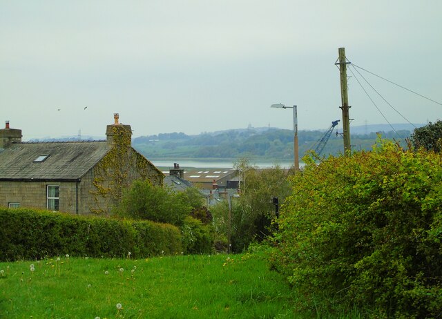
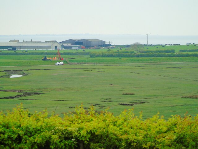
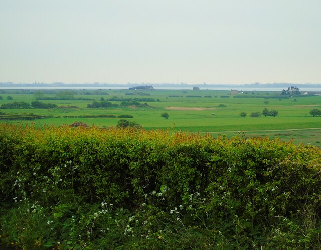
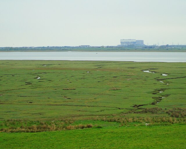
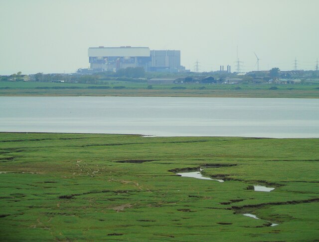
Fishnet Point is a prominent coastal feature located in Lancashire, England. Situated in the northwestern part of the country, it is specifically found on the coastline of Morecambe Bay, a large bay that borders Lancashire and Cumbria. Fishnet Point is classified as a headland and point, extending out into the bay and forming a distinct geographical feature.

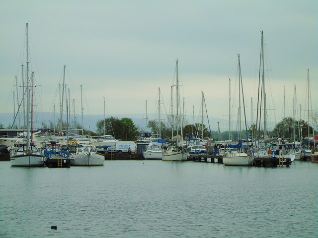
The name "Fishnet Point" is derived from its historical association with fishing activities in the area. The headland was once a hub for local fishermen, who would cast their nets in the surrounding waters to catch fish. Today, however, fishing is less prevalent, and the area has become more of a recreational and scenic spot for locals and tourists alike.

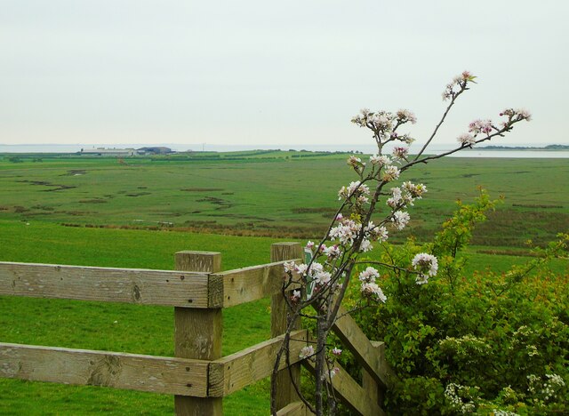
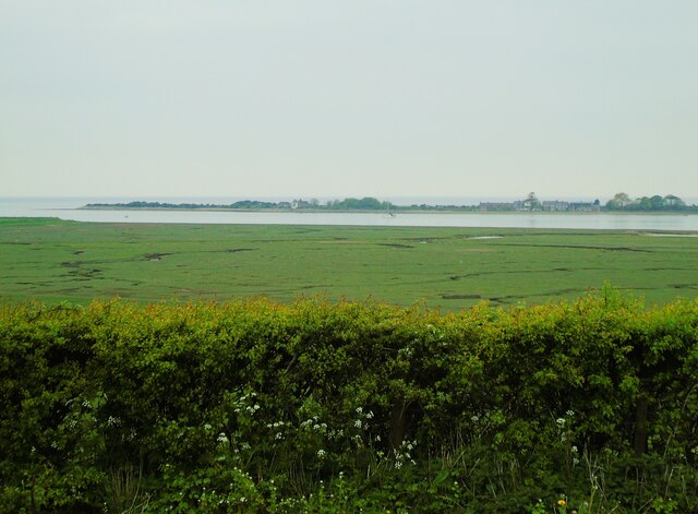
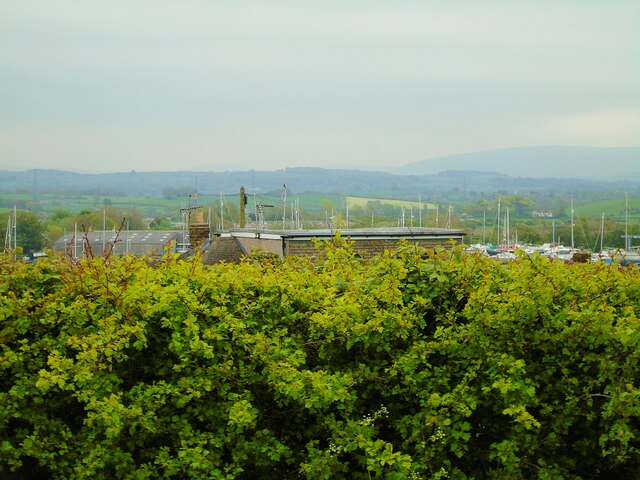
The headland offers breathtaking views of the bay and the vast expanse of the Irish Sea beyond. Its elevated position provides visitors with an ideal vantage point to observe the surrounding landscape, including the stunning sunsets that paint the sky in vibrant hues.

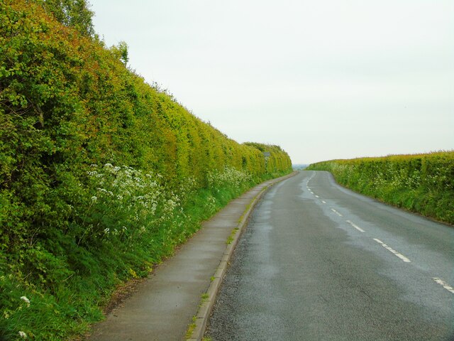
The coastal path leading to Fishnet Point is a popular walking route, allowing visitors to immerse themselves in the natural beauty of the area. The headland is also home to a variety of bird species, making it a haven for birdwatchers and nature enthusiasts.

Despite its relatively small size, Fishnet Point holds historical and ecological significance in Lancashire. Its picturesque views, rich history, and thriving wildlife make it a cherished destination for those seeking a connection with nature and a glimpse into the region's maritime heritage.

If you have any feedback on the listing, please let us know in the comments section below.

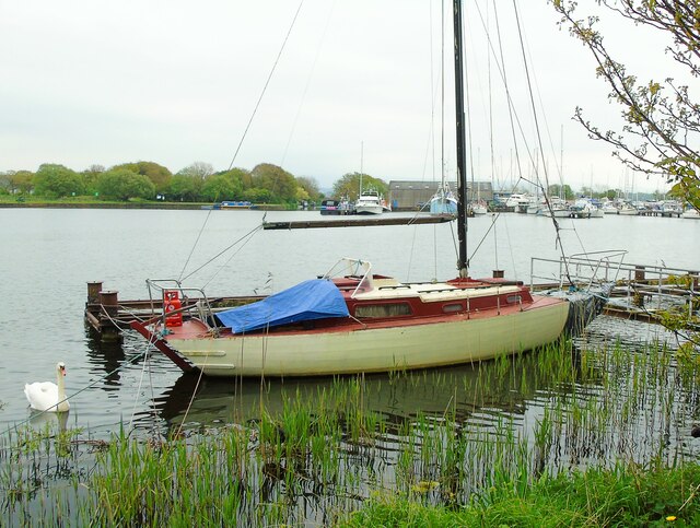
Fishnet Point Images

Images are sourced within 2km of 53.999925/-2.8515472 or Grid Reference SD4456. Thanks to Geograph Open Source API. All images are credited.

OS Bench Mark OS cut bench mark on corner of house at crossroads in Overton. 33.1 feet above old datum.
OS Bench Mark
OS cut bench mark on corner of house at crossroads in Overton. 33.1 feet above old datum.
OS Bench Mark OS cut bench mark on wall of house opposite Mission Room. 36.6 feet above old datum. Helpfully painted black. This BM is shown on the 1890 25" map but not the 1910 25" map, but it is shown on the 1845, 1890 and 1910 6" maps.
OS Bench Mark
OS cut bench mark on wall of house opposite Mission Room. 36.6 feet above old datum. Helpfully painted black. This BM is shown on the 1890 25" map but not the 1910 25" map, but it is shown on the 1845, 1890 and 1910 6" maps.
Mission Room Sunderland Point Mission Room, now apparently given by the diocese to the community, who hope to turn it into a Heritage Centre.
Mission Room
Sunderland Point Mission Room, now apparently given by the diocese to the community, who hope to turn it into a Heritage Centre.
OS Bench Mark OS cut bench mark on corner of Parish Church of St Helen, Overton. 62.3 feet above old datum.
OS Bench Mark
OS cut bench mark on corner of Parish Church of St Helen, Overton. 62.3 feet above old datum.
OS Bench Mark OS cut bench mark from the 19th century levelling, on wall of Stork Inn. 25.25 feet above old datum. Now rather obscured by painting.
OS Bench Mark
OS cut bench mark from the 19th century levelling, on wall of Stork Inn. 25.25 feet above old datum. Now rather obscured by painting.
OS Bench Mark OS pivot bench mark from the 19th century levelling, on edge of canal by Brick Kiln Bridge. 19.3 feet above old datum. (Other bench marks along this stretch of canal are rivets - see <a href="https://www.geograph.org.uk/photo/3364134">SD4555 : Rivet on the towpath below Thurnham Bridge</a>, <a href="https://www.geograph.org.uk/photo/3364195">SD4655 : Rivet benchmark on the Fifth Lock Glasson Branch</a>, <a href="https://www.geograph.org.uk/photo/3364190">SD4655 : Rivet benchmark on the Sixth Lock Glasson Branch</a> etc.)
OS Bench Mark
OS pivot bench mark from the 19th century levelling, on edge of canal by Brick Kiln Bridge. 19.3 feet above old datum. (Other bench marks along this stretch of canal are rivets - see SD4555 : Rivet on the towpath below Thurnham Bridge, SD4655 : Rivet benchmark on the Fifth Lock Glasson Branch, SD4655 : Rivet benchmark on the Sixth Lock Glasson Branch etc.)
Old Boundary Marker on the B5290 in Glasson Dock Railway Boundary Marker in Glasson Dock on the verge of the B5290 between the dock and the disused railway line, now a cycleway. Thurnham parish. Raised lettering partially buried but presumably L & N W R / BOUNDARY to mark the boundary of the London and North Western Railway line opened in 1883.

Milestone Society National ID: LA_THURN01em
Old Boundary Marker on the B5290 in Glasson Dock
Railway Boundary Marker in Glasson Dock on the verge of the B5290 between the dock and the disused railway line, now a cycleway. Thurnham parish. Raised lettering partially buried but presumably L & N W R / BOUNDARY to mark the boundary of the London and North Western Railway line opened in 1883. Milestone Society National ID: LA_THURN01em
Glasson Marina (1) Taken from beside the children's play area in Glasson Dock, near Lancaster, I am looking across to Glasson Marina. The tree line beside the boat shed marks the opening of the Lancaster Canal.
Glasson Marina (1)
Taken from beside the children's play area in Glasson Dock, near Lancaster, I am looking across to Glasson Marina. The tree line beside the boat shed marks the opening of the Lancaster Canal.
Glasson Marina (2) Taken from near the children's play area in Glasson Dock, near Lancaster, I am looking across to Glasson Marina.
Glasson Marina (2)
Taken from near the children's play area in Glasson Dock, near Lancaster, I am looking across to Glasson Marina.
Bodie Hill to Fleetwood Taken at the viewing point where Bodie Hill meets Tithebarn Hill above Glasson Dock, near Lancaster, I am looking south west across Glasson Marsh towards Fleetwood.
Bodie Hill to Fleetwood
Taken at the viewing point where Bodie Hill meets Tithebarn Hill above Glasson Dock, near Lancaster, I am looking south west across Glasson Marsh towards Fleetwood.
Tithebarn Hill, Glasson I am on Tithebarn Hill, Glasson Dock, near Lancaster, and looking south towards School Lane.
Tithebarn Hill, Glasson
I am on Tithebarn Hill, Glasson Dock, near Lancaster, and looking south towards School Lane.
Sunderland Point Taken on Tithebarn Hill, Glasson, near Lancaster, I am looking west across the Lune estuary to Sunderland Point.
Sunderland Point
Taken on Tithebarn Hill, Glasson, near Lancaster, I am looking west across the Lune estuary to Sunderland Point.
Ashton Memorial from Glasson Taken at the viewing point on Tithebarn Hill, Glasson, I am looking north east across the River Lune to Lancaster and the Ashton Memorial which is visible at the top of the hill on the horizon.
Ashton Memorial from Glasson
Taken at the viewing point on Tithebarn Hill, Glasson, I am looking north east across the River Lune to Lancaster and the Ashton Memorial which is visible at the top of the hill on the horizon.
Glasson Sailing Club Taken at the viewing point on Tithebarn Hill, Glasson, near Lancaster, I am looking north towards Glasson Sailing Club on the south bank of the River Lune, marked in this shot by the collection of sailing masts straddling the centre. The Fells of south Cumbria can be seen in the distance.
Glasson Sailing Club
Taken at the viewing point on Tithebarn Hill, Glasson, near Lancaster, I am looking north towards Glasson Sailing Club on the south bank of the River Lune, marked in this shot by the collection of sailing masts straddling the centre. The Fells of south Cumbria can be seen in the distance.
Crook Farm and Marsh Lane Taken on the viewing point on Tithebarn Hill, Glasson, near Lancaster, I am looking south west across Glasson Marsh to Marsh Lane and Crook Farm. Fleetwood and Rossall Point can be glimpsed across the south section of the bay.
Crook Farm and Marsh Lane
Taken on the viewing point on Tithebarn Hill, Glasson, near Lancaster, I am looking south west across Glasson Marsh to Marsh Lane and Crook Farm. Fleetwood and Rossall Point can be glimpsed across the south section of the bay.
Cockersand Abbey Taken on the viewing point on Tithebarn Hill, Glasson, near Lancaster, I am looking south west towards what remains of Cockersand Abbey. If visibility had been better on this murky day, Blackpool Tower would be much more clearly discernible across the bay; the eagle-eyed can just make out its outline to the centre of shot.
Cockersand Abbey
Taken on the viewing point on Tithebarn Hill, Glasson, near Lancaster, I am looking south west towards what remains of Cockersand Abbey. If visibility had been better on this murky day, Blackpool Tower would be much more clearly discernible across the bay; the eagle-eyed can just make out its outline to the centre of shot.
Heysham Power Stations 1 and 2 (a) Taken on the viewing point on Tithebarn Hill, Glasson, near Lancaster, I am looking north west across Glasson Marsh and the Lune estuary towards the nuclear power stations in Heysham, known as Heysham 1 (furthest from shot) and Heysham 2. According to news sources, Heysham 1 is set to stop generating power in 2024 and Heysham 2 in 2028 (<span class="nowrap"><a title="https://www.bbc.co.uk/news/uk-england-lancashire-59938400," rel="nofollow ugc noopener" href="https://www.bbc.co.uk/news/uk-england-lancashire-59938400,">Link</a><img style="margin-left:2px;" alt="External link" title="External link - shift click to open in new window" src="https://s1.geograph.org.uk/img/external.png" width="10" height="10"/></span> viewed 11/05/2022)
Heysham Power Stations 1 and 2 (a)
Taken on the viewing point on Tithebarn Hill, Glasson, near Lancaster, I am looking north west across Glasson Marsh and the Lune estuary towards the nuclear power stations in Heysham, known as Heysham 1 (furthest from shot) and Heysham 2. According to news sources, Heysham 1 is set to stop generating power in 2024 and Heysham 2 in 2028 (LinkExternal link viewed 11/05/2022)
Heysham Power Stations 1 and 2 (b) Taken on the viewing point on Tithebarn Hill, Glasson, near Lancaster, I am looking north west across Glasson Marsh and the Lune estuary towards the nuclear power stations in Heysham, known as Heysham 1 (furthest from shot) and Heysham 2. According to news sources, Heysham 1 is set to stop generating power in 2024 and Heysham 2 in 2028 (<span class="nowrap"><a title="https://www.bbc.co.uk/news/uk-england-lancashire-59938400," rel="nofollow ugc noopener" href="https://www.bbc.co.uk/news/uk-england-lancashire-59938400,">Link</a><img style="margin-left:2px;" alt="External link" title="External link - shift click to open in new window" src="https://s1.geograph.org.uk/img/external.png" width="10" height="10"/></span> viewed 11/05/2022)
Heysham Power Stations 1 and 2 (b)
Taken on the viewing point on Tithebarn Hill, Glasson, near Lancaster, I am looking north west across Glasson Marsh and the Lune estuary towards the nuclear power stations in Heysham, known as Heysham 1 (furthest from shot) and Heysham 2. According to news sources, Heysham 1 is set to stop generating power in 2024 and Heysham 2 in 2028 (LinkExternal link viewed 11/05/2022)
Show me another place!

Fishnet Point is located at Grid Ref: SD4456 (Lat: 53.999925, Lng: -2.8515472)

Administrative County: Lancashire

District: Lancaster

Police Authority: Lancashire

What 3 Words

///doctor.insurance.announce. Near Overton, Lancashire

Related Wikis

Glasson Dock

Glasson Dock, also known as Glasson, is a village in Lancashire, England, south of Lancaster at the mouth of the River Lune. In 2011, it had a population...

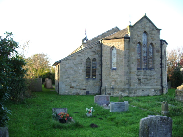
Christ Church, Glasson

Christ Church is in the village of Glasson, Lancashire, England. It is an active Anglican parish church in the deanery of Lancaster and Morecambe, the...

Glasson Dock railway station

Glasson Dock railway station served the town of Glasson Dock, in Thurnham, Lancashire, England, with trains to nearby Conder Green and Lancaster along...

River Conder

The River Conder is a river in the English county of Lancashire. The source of the River Conder is a spring at Conder Head on Black Fell near Littledale...

Nearby Amenities

Located within 500m of 53.999925,-2.8515472
Source: PGS
Lat/Long: 53.9981254/-2.8455234
Source: PGS
Lat/Long: 53.9992643/-2.8474254
Source: PGS
Lat/Long: 53.9999182/-2.8482205
Source: PGS
Lat/Long: 53.9995022/-2.8486377
Source: PGS
Lat/Long: 53.99817/-2.8479433
Source: PGS
Lat/Long: 53.9980597/-2.8482025
Source: PGS
Lat/Long: 53.9979608/-2.8486533
Source: PGS
Lat/Long: 53.9991106/-2.8496085
Source: PGS
Lat/Long: 53.9992018/-2.8496594
Source: PGS
Lat/Long: 53.999255/-2.849613
Source: PGS
Lat/Long: 53.9996978/-2.8491122
Source: PGS
Lat/Long: 53.9999968/-2.8526505
Source: PGS
Lat/Long: 53.9995295/-2.8528082
Source: PGS
Lat/Long: 53.9983115/-2.8530788
Source: PGS
Lat/Long: 53.9979698/-2.8533282
Source: PGS
Lat/Long: 53.9977724/-2.8535528
Source: PGS
Lat/Long: 53.9970185/-2.8538215
Source: PGS
Lat/Long: 53.9968082/-2.854402
Source: PGS
Lat/Long: 54.0001099/-2.8498289
Source: PGS
Lat/Long: 54.0004012/-2.8503049
Source: PGS
Lat/Long: 54.0005302/-2.8506244
Source: PGS
Lat/Long: 54.0004456/-2.851103
Source: PGS
Lat/Long: 54.0004275/-2.852211
Glasson Dock
Place: village
Wikidata: Q1529787
Wikipedia: en:Glasson Dock
Lat/Long: 53.9970644/-2.8499743
Barrier: lift_gate
Lat/Long: 53.9978695/-2.8478353
Barrier: lift_gate
Lat/Long: 53.9977604/-2.8480853
Turning Circle
Lat/Long: 53.9956715/-2.8505402
Turning Circle
Lat/Long: 53.9957742/-2.8495318
Source: PGS
Lat/Long: 54.0002714/-2.8586684
Source: PGS
Lat/Long: 54.0004886/-2.857493
Source: PGS
Lat/Long: 54.0006191/-2.855723
Source: PGS
Lat/Long: 54.0005806/-2.8544286
Source: PGS
Lat/Long: 54.0004958/-2.8533726
Source: PGS
Lat/Long: 54.0004802/-2.8523832
Seamark Type: gate
Waterway: lock_gate
Lat/Long: 53.9977287/-2.8477827
Seamark Type: gate
Waterway: lock_gate
Lat/Long: 53.9979556/-2.8480632
Source: PGS
Lat/Long: 53.9991303/-2.8525935
Tourism: viewpoint
Lat/Long: 53.9964988/-2.8521079
Bench
Backrest: yes
Lat/Long: 53.9966155/-2.8520033
Bench
Backrest: yes
Lat/Long: 53.9965579/-2.8520623
Bench
Backrest: yes
Lat/Long: 53.9965726/-2.8523711
Bench
Backrest: yes
Lat/Long: 53.9969411/-2.8524593
Glasson Dock
Location: outdoor
Operator: Electricity North West
Power: substation
Substation: minor_distribution
Lat/Long: 53.9983639/-2.8499521
Barrier: stile
Foot: designated
Material: wood
Step Count: 1
Stile: stepover
Lat/Long: 53.9966726/-2.8523951
Post Box
Collection Times: Mo-Fr 09:00; Sa 07:00
Post Box Type: lamp
Ref: LA2 151
Royal Cypher: EIIR
Royal Cypher Wikidata: Q33102113
Lat/Long: 53.9976174/-2.8492789
Bus Stop
Swingbridge
Bench: no
Bin: no
Description: Not currently in use
Lit: no
Naptan AtcoCode: 2500832
Naptan Bearing: E
Naptan BusStopType: MKD
Naptan CommonName: Swingbridge
Naptan Indicator: by
Naptan Landmark: Swingbridge
Naptan LocalityCode: E0015963
Naptan NaptanCode: landadpw
Naptan Street: Tithebarn Hill
Public Transport: platform
Ref: landadpw
Shelter: no
Tactile Paving: no
Lat/Long: 53.9978144/-2.8485601
Bus Stop
Victoria Inn
Bench: no
Bin: no
Check Date Shelter: 2022-10-18
Lit: no
Naptan AtcoCode: 2500LAA16390
Naptan Bearing: SW
Naptan CommonName: Victoria Inn
Naptan Indicator: opp
Naptan Landmark: Victoria Inn
Naptan LocalityCode: E0015963
Naptan NaptanCode: lanpagtj
Naptan Street: Glason Dock Road
Naptan Verified: yes
Public Transport: platform
Ref: lanpagtj
Shelter: no
Tactile Paving: no
Lat/Long: 53.9980834/-2.8472001
Bus Stop
Victoria Inn
Bench: no
Bin: no
Bus: yes
Description: Currently only in use for school buses.
Lit: yes
Naptan AtcoCode: 250011730
Naptan Bearing: SE
Naptan BusStopType: MKD
Naptan CommonName: Victoria Inn
Naptan Indicator: o/s
Naptan Landmark: Victoria Inn
Naptan LocalityCode: E0015963
Naptan NaptanCode: lanagmpd
Naptan Street: Glasson Dock Road
Public Transport: platform
Ref: lanagmpd
Shelter: no
Tactile Paving: no
Lat/Long: 53.9981224/-2.8466327
Noexit: yes
Lat/Long: 53.9985762/-2.8465287
Entrance: service
Ref: 11
Lat/Long: 53.9984909/-2.8503863
Entrance: main
Lat/Long: 53.9988041/-2.8501448
Entrance: main
Lat/Long: 53.9988658/-2.8499026
Bowland View
Bus: yes
Naptan AtcoCode: 2500833
Naptan Bearing: W
Naptan CommonName: Bowland View
Naptan Indicator: o/s
Naptan Landmark: Post Office
Naptan LocalityCode: E0015963
Naptan NaptanCode: landadta
Naptan Street: Tithebarn Hill
Naptan Verified: yes
Public Transport: stop_position
Ref: landadta
Lat/Long: 53.997529/-2.8495003
Give Way
Direction: backward
Lat/Long: 53.9981853/-2.8470741
Victoria Inn
Bus: yes
Public Transport: stop_position
Lat/Long: 53.998115/-2.8472314
Bus Stop
Bowland View
Bench: no
Bin: no
Bus: yes
Lit: yes
Naptan AtcoCode: 2500833
Naptan NaptanCode: landadta
Public Transport: platform
Shelter: no
Tactile Paving: no
Lat/Long: 53.997516/-2.8494907
Post Office
Glasson Dock Post Office
Addr City: Glasson Dock
Addr Housename: Glasson Dock Village Hall
Addr Postcode: LA2 0DF
Addr Street: Bodie Hill
Brand: Post Office
Brand Wikidata: Q1783168
Opening Hours: Mo,Th 12:30-16:30
Ref Pol Id: 178170
Lat/Long: 53.9977905/-2.8515948
Source: PGS
Lat/Long: 53.9986568/-2.8528521
Victoria Inn
Bus: yes
Public Transport: stop_position
Lat/Long: 53.9980791/-2.8466509
Generator Method: photovoltaic
Generator Orientation: south_west
Generator Output Electricity: yes
Generator Solar Modules: 20
Generator Source: solar
Generator Type: solar_photovoltaic_panel
Location: roof
Power: generator
Lat/Long: 53.9955766/-2.8503128
Generator Method: photovoltaic
Generator Orientation: south
Generator Output Electricity: yes
Generator Solar Modules: 19
Generator Source: solar
Generator Type: solar_photovoltaic_panel
Location: roof
Power: generator
Lat/Long: 53.9960255/-2.8495361
Traffic Signals
Traffic Signals: signal
Traffic Signals Direction: forward
Lat/Long: 53.9979124/-2.8476921
Traffic Signals
Traffic Signals: signal
Traffic Signals Direction: backward
Lat/Long: 53.997719/-2.8482166
Covered: no
Leisure: picnic_table
Lat/Long: 53.9979182/-2.8483936
Addr City: Glasson Dock
Addr Postcode: LA2 0DB
Addr Street: West Quay
Disused Shop: butcher
Old Name: The Port of Lancaster Smokehouse
Lat/Long: 53.9988756/-2.8498229
Recycling
Recycling Cardboard: yes
Recycling Paper: yes
Recycling Type: container
Lat/Long: 53.998061/-2.8463026
Recycling
Recycling Cans: yes
Recycling Plastic Bottles: yes
Recycling Type: container
Lat/Long: 53.9980531/-2.8463088
Source: PGS
Lat/Long: 53.9979299/-2.8450927
Barrier: bollard
Bicycle: yes
Bollard: fixed
Foot: yes
Motor Vehicle: no
Lat/Long: 53.9978246/-2.8455255
Lancaster Port Commission
Addr City: Glasson Dock
Addr Postcode: LA2 0DB
Addr Street: West Quay
Office: harbour_master
Seamark Building Function: harbour_master
Website: https://www.lancasterport.org/
Lat/Long: 53.9987688/-2.8501257
Artwork Type: installation
Description: Old anchor
Tourism: artwork
Lat/Long: 53.9983013/-2.8501143
Waste Basket
Lat/Long: 53.9983455/-2.8500771
Waste Basket
Lat/Long: 53.997906/-2.8486488
Give Way
Direction: backward
Lat/Long: 53.9977613/-2.8485841
Entrance: main
Lat/Long: 53.9977922/-2.8486882
Entrance: main
Lat/Long: 53.9979245/-2.848812
Give Way
Direction: backward
Lat/Long: 53.9975703/-2.8494852
Give Way
Direction: forward
Lat/Long: 53.9977146/-2.8488131
Waste Basket
Lat/Long: 53.9980157/-2.8477456
Bench
Backrest: no
Lat/Long: 53.9980503/-2.8477755
Bench
Backrest: no
Lat/Long: 53.9981042/-2.8478394
Barrier: entrance
Lat/Long: 53.9983403/-2.8475064
Entrance: main
Lat/Long: 53.9982717/-2.8469626
Addr Flats: 1-5
Entrance: home
Level: 0
Lat/Long: 53.9984721/-2.8475311
Addr Flats: 6
Entrance: home
Level: 0
Lat/Long: 53.9984406/-2.8474431
Addr Flats: 7
Entrance: home
Level: 0
Lat/Long: 53.9984033/-2.8473391
Board Type: welcome_sign
Description: Bay Cycle Way start/finish sign
Image: https://www.cyclestreets.net/location/188250/cyclestreets188250.jpg
Information: map_board
Operator: Morecambe Bay Partnership
Tourism: information
Lat/Long: 53.9978802/-2.8483278
Give Way
Direction: forward
Lat/Long: 53.9965889/-2.8522264
Bench
Backrest: yes
Lat/Long: 53.9967975/-2.8524056
Bench
Survey Date: 2023-08-01
Lat/Long: 53.997565/-2.8458587
Covered: no
Leisure: picnic_table
Survey Date: 2023-08-01
Lat/Long: 53.9979195/-2.8483319
Bench
Survey Date: 2023-08-01
Lat/Long: 53.9978287/-2.8451955
Bench: yes
Covered: no
Leisure: picnic_table
Material: wood
Lat/Long: 53.9978192/-2.8476075
Bench
Backrest: no
Material: wood
Lat/Long: 53.9979076/-2.8474611
Life Ring
Emergency: life_ring
Lat/Long: 53.9982279/-2.8488668
Life Ring
Emergency: life_ring
Lat/Long: 53.9984853/-2.8480751
Life Ring
Emergency: life_ring
Lat/Long: 53.9981666/-2.8479016
Life Ring
Emergency: life_ring
Lat/Long: 53.9977639/-2.8479283
Life Ring
Emergency: life_ring
Lat/Long: 53.9979148/-2.8479057
Bench
Backrest: yes
Lat/Long: 53.9966388/-2.8519637
Bench
Backrest: yes
Material: wood
Lat/Long: 53.9964319/-2.8520502
Entrance: main
Wheelchair: limited
Lat/Long: 53.9980152/-2.8488846
The data included in this document is from www.openstreetmap.org. The data is made available under ODbL.

Have you been to Fishnet Point?

Leave your review of Fishnet Point below (or comments, questions and feedback).