Glenbenna Head

Landscape Feature in Peeblesshire

Scotland

Glenbenna Head

Middlebar Knowe Trees being harvested in Elibank Forest.
Middlebar Knowe Credit: Richard Webb

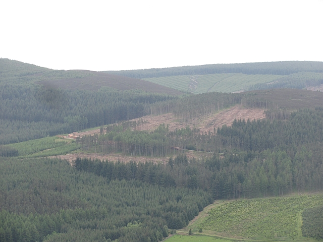
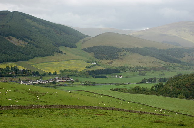
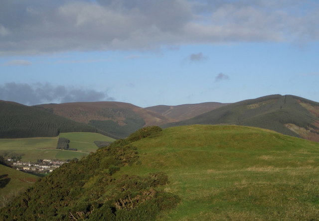
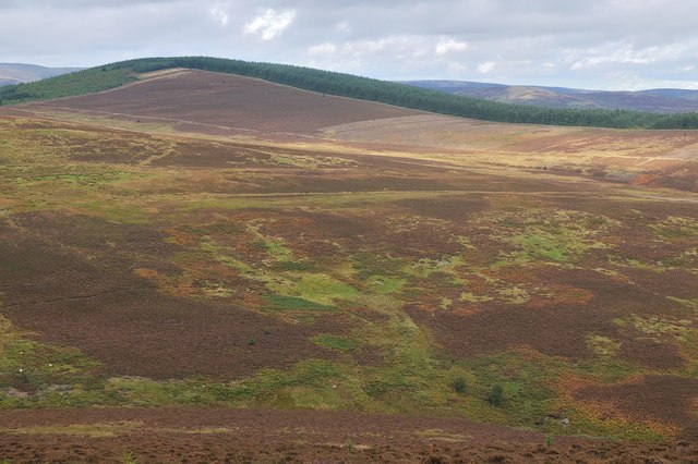
Glenbenna Head is a prominent landscape feature located in Peeblesshire, Scotland. Standing at an impressive height of 800 meters (2,625 feet), it is part of the Southern Uplands range and offers breathtaking panoramic views of the surrounding area.

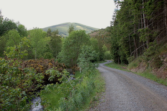
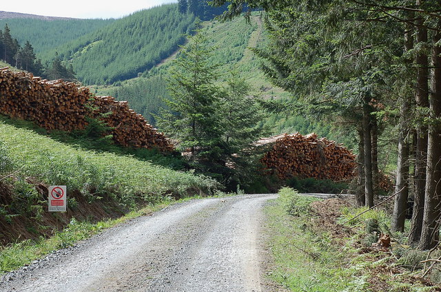
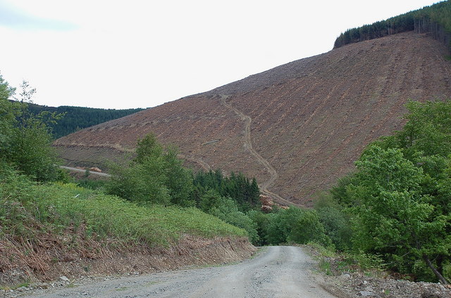
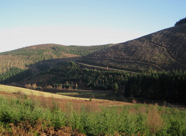
The head is characterized by its rugged and rocky terrain, with steep slopes and sheer cliffs that make it a challenging but rewarding destination for hikers and mountaineers. The exposed rocks, predominantly composed of granite, add to the dramatic beauty of the landscape.

Flora and fauna thrive in this remote and wild habitat. The slopes of Glenbenna Head are covered in heather, moss, and grasses, providing a home for a variety of plant species. The area is also home to several species of birds, including golden eagles, kestrels, and peregrine falcons, which can often be seen soaring through the sky.

Glenbenna Head is a haven for outdoor enthusiasts, offering a range of activities such as hillwalking, rock climbing, and birdwatching. Its challenging terrain and stunning vistas attract adventurers seeking an adrenaline rush as well as nature lovers in search of tranquility.

Due to its remote location, Glenbenna Head provides a peaceful retreat away from the hustle and bustle of urban life. Its unspoiled beauty and untouched wilderness make it a truly unforgettable destination for those who appreciate the grandeur of the natural world.

If you have any feedback on the listing, please let us know in the comments section below.

Glenbenna Head Images

Images are sourced within 2km of 55.603293/-2.9892139 or Grid Reference NT3734. Thanks to Geograph Open Source API. All images are credited.

Middlebar Knowe Trees being harvested in Elibank Forest.
Middlebar Knowe
Trees being harvested in Elibank Forest.
Forest road by the Bold Burn This meets the public minor road at Glenbenna. Cairn Hill is in the background.
Forest road by the Bold Burn
This meets the public minor road at Glenbenna. Cairn Hill is in the background.
Timber stacks near Glenbenna Plenty of timber awaiting transport from Traquair and Elibank Forest.
Timber stacks near Glenbenna
Plenty of timber awaiting transport from Traquair and Elibank Forest.
Clear felled slope on Glenbenna Head Logging in the Traquair and Elibank Forest, seen here from the forest road contouring Bold Rig.
Clear felled slope on Glenbenna Head
Logging in the Traquair and Elibank Forest, seen here from the forest road contouring Bold Rig.
Walkerburn and the Tweed from Bold Rig The east end of Walkerburn is in view with Cairn Hill and Early Knowe (R) beyond.
Walkerburn and the Tweed from Bold Rig
The east end of Walkerburn is in view with Cairn Hill and Early Knowe (R) beyond.
View of the Eildon Hills The view from the signpost for Minch Moor on the Southern Upland Way, looking to the east side towards the Eildon Hills.
View of the Eildon Hills
The view from the signpost for Minch Moor on the Southern Upland Way, looking to the east side towards the Eildon Hills.
Elibank and Traquair Forest Various stages of tree growth are in view here with clear felling on part of the ridge from Glenbenna Head and mature forest on Middlebar Knowe (L).
Elibank and Traquair Forest
Various stages of tree growth are in view here with clear felling on part of the ridge from Glenbenna Head and mature forest on Middlebar Knowe (L).
Too late to buy these trees 'Standing Timber For Sale' proclaims the notice, but the closing date of 30th November has passed.
Too late to buy these trees
'Standing Timber For Sale' proclaims the notice, but the closing date of 30th November has passed.
Hill fort, Bold Rig Hill fort remains on the end of Bold Rig, with part of Walkerburn in view and Cairn Hill to the right.
Hill fort, Bold Rig
Hill fort remains on the end of Bold Rig, with part of Walkerburn in view and Cairn Hill to the right.
Forest track above the Plora Burn A view down to the Tweed valley and Cairn Hill above Walkerburn. The track continues to contour a long way around, almost encircling the whole Minchmoor Forest.
Forest track above the Plora Burn
A view down to the Tweed valley and Cairn Hill above Walkerburn. The track continues to contour a long way around, almost encircling the whole Minchmoor Forest.
Elibank and Traquair Forest View from the Minchmoor road.
Elibank and Traquair Forest
View from the Minchmoor road.
Signpost, Minch Moor The Minchmoor drove road is crossed by a logging road here.
Signpost, Minch Moor
The Minchmoor drove road is crossed by a logging road here.
Moorland strip, Hare Law A gap in the extensive plantations around the old Minchmoor drove road.
Moorland strip, Hare Law
A gap in the extensive plantations around the old Minchmoor drove road.
Logging road, Minchmoor The road contours the slope above Lewinshope.
Logging road, Minchmoor
The road contours the slope above Lewinshope.
Boggy moorland below Far Hill Progress is laborious on this type of ground - where it's not boggy, the heather is deep.
Boggy moorland below Far Hill
Progress is laborious on this type of ground - where it's not boggy, the heather is deep.
Across the moorland to Elibank Law Heather and rough grass by South Grain, looking to the forested summit of Elibank Law (522m).
Across the moorland to Elibank Law
Heather and rough grass by South Grain, looking to the forested summit of Elibank Law (522m).
Heather and conifers, Hare Law Trees of differing ages on the moorland NW of Hare Law, near the route of the Southern Upland Way.
Heather and conifers, Hare Law
Trees of differing ages on the moorland NW of Hare Law, near the route of the Southern Upland Way.
Hill runners on Little Minch Moor A run along the Southern Upland Way to the Three Brethren, a fine high level route with good views.
Hill runners on Little Minch Moor
A run along the Southern Upland Way to the Three Brethren, a fine high level route with good views.
Show me another place!

Glenbenna Head is located at Grid Ref: NT3734 (Lat: 55.603293, Lng: -2.9892139)

Unitary Authority: The Scottish Borders

Police Authority: The Lothians and Scottish Borders

What 3 Words

///parkland.grief.marker. Near Innerleithen, Scottish Borders

Nearby Locations

Glenbenna Head Glen Pest

Related Wikis

Walkerburn railway station

Walkerburn railway station served the village of Walkerburn, Scottish Borders, Scotland from 1867 to 1962 on the Peebles Railway. == History == The station...

Thornielee railway station

Thornielee railway station served the smallholding of Thornielee, Scottish Borders, Scotland from 1866 to 1950 on the Peebles Railway. == History == The...

The Kirna

The Kirna, known locally as Kirna House (previously also as Grangehill), is a Category A listed villa in Walkerburn, Peeblesshire, Scotland. It is one...

Walkerburn

Walkerburn (Scottish Gaelic: Allt an Fhùcadair) is a small village in the Scottish Borders area of Scotland, on the A72 about 8 miles (13 km) from Peebles...

Have you been to Glenbenna Head?

Leave your review of Glenbenna Head below (or comments, questions and feedback).