Bracks Head

Landscape Feature in Lanarkshire

Scotland

Bracks Head

Fell Shin Heather moorland on Fell Shin.
Fell Shin Credit: James T M Towill

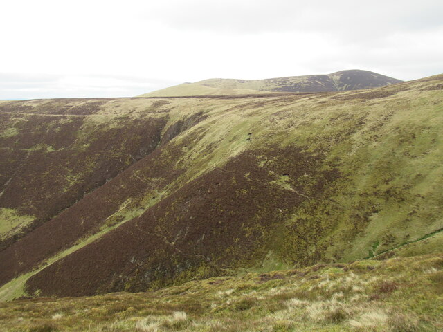
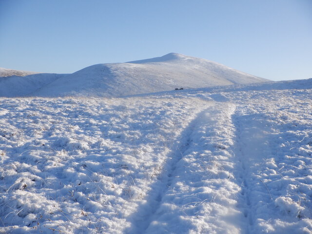
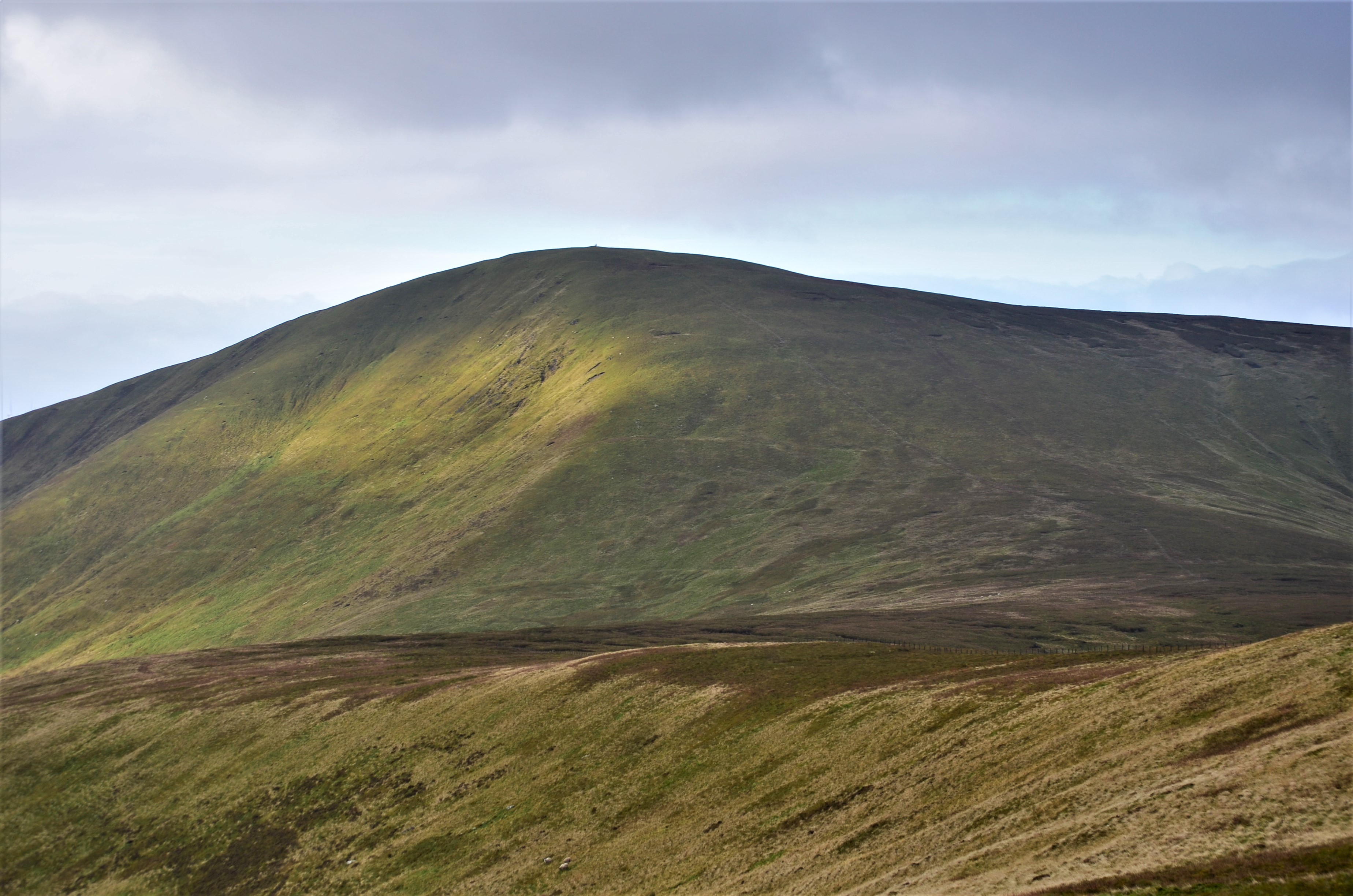
Bracks Head is a prominent landscape feature located in Lanarkshire, one of the central counties of Scotland. Situated in the southern part of the county, Bracks Head is a striking natural formation that rises above the surrounding terrain, offering breathtaking views of the surrounding countryside.

The headland is characterized by its rugged and rocky cliffs, which stand tall against the backdrop of rolling hills and lush greenery. The cliff faces are composed of sedimentary rocks, displaying layers of sandstone and shale, which have been shaped over millions of years by the forces of erosion and weathering.

At the peak of Bracks Head, visitors can enjoy panoramic vistas of the Lanarkshire countryside, with views extending as far as the eye can see. On a clear day, the nearby Tinto Hill, a prominent landmark in the area, can be seen in the distance. The expanse of open skies above Bracks Head also offers a perfect spot for stargazing, away from the light pollution of urban areas.

The area surrounding Bracks Head is teeming with wildlife, making it a popular destination for nature enthusiasts. Birdwatchers can spot various species, including kestrels and peregrine falcons, soaring through the skies above the cliffs. The rugged terrain also provides a habitat for a diverse range of plant species, adding to the area's natural beauty.

Bracks Head is easily accessible via well-marked walking trails, making it a popular destination for hikers and outdoor enthusiasts. Its awe-inspiring beauty and tranquil atmosphere make it a must-visit location for those seeking to explore the natural wonders of Lanarkshire.

If you have any feedback on the listing, please let us know in the comments section below.

Bracks Head Images

Images are sourced within 2km of 55.567062/-3.5246373 or Grid Reference NT0331. Thanks to Geograph Open Source API. All images are credited.

Fell Shin Heather moorland on Fell Shin.
Fell Shin
Heather moorland on Fell Shin.
A path on Fell Shin Gentler gradients approaching the 'summit' of this flank of Culter Fell.
A path on Fell Shin
Gentler gradients approaching the 'summit' of this flank of Culter Fell.
Path towards Culter Fell
Looking down into King's Beck from Glenharvie Moss Very unusual to find the term Beck being used to describe a stream in Scotland - one theory behind this name is that a landowner from northern England once held these lands and that the name dates from this time.
Looking down into King's Beck from Glenharvie Moss
Very unusual to find the term Beck being used to describe a stream in Scotland - one theory behind this name is that a landowner from northern England once held these lands and that the name dates from this time.
Western spur of Culter Fell A line of grouse butts on the hillside above the valley of the Culter Water.
Western spur of Culter Fell
A line of grouse butts on the hillside above the valley of the Culter Water.
Path on Fell Shin Tinto is the prominent hill in the distance.
Path on Fell Shin
Tinto is the prominent hill in the distance.
Grouse Butt on Fell Shin One of several stone grouse butts closely spaced up the hill path on Fell Shin.
Grouse Butt on Fell Shin
One of several stone grouse butts closely spaced up the hill path on Fell Shin.
Culter Water viewed from Hungry Knees The second part of this odd place name comes from 'kneis' - a Scots word found in placenames, denoting a projecting hillside.  No idea about where the Hungry part comes from!
Culter Water viewed from Hungry Knees
The second part of this odd place name comes from 'kneis' - a Scots word found in placenames, denoting a projecting hillside. No idea about where the Hungry part comes from!
Gullies at the head of King's Beck The term 'beck', rather than 'burn' is very unusual in Scotland. Some have suggested that the name might have been given to this area by an English landowner many centuries ago.
Gullies at the head of King's Beck
The term 'beck', rather than 'burn' is very unusual in Scotland. Some have suggested that the name might have been given to this area by an English landowner many centuries ago.
Track on Wardlaw Culter Fell in the background.
Track on Wardlaw
Culter Fell in the background.
Ward Law towards Birthwood
Culter Water Sheep graze beside the Culter Water. Taken from the excellent, once public road which is supposedly barred to vehicles and walking groups with more than 4 folk.
Culter Water
Sheep graze beside the Culter Water. Taken from the excellent, once public road which is supposedly barred to vehicles and walking groups with more than 4 folk.
Bridge, Culter Water Small footbridge, useful at times like this when there is a lot of water in the burn.
Bridge, Culter Water
Small footbridge, useful at times like this when there is a lot of water in the burn.
Shooting butt
Shooting butt
King Bank Head Typical peat hag in this part of the world, with a fence leading N to Dun Knees
King Bank Head
Typical peat hag in this part of the world, with a fence leading N to Dun Knees
Culter Allers Farm up the Culter Water. View north.
Culter Allers
Farm up the Culter Water. View north.
Culter Water Deep glen between Hudderstone and Culter Fell. The road leads up to the Culter Dam.
Culter Water
Deep glen between Hudderstone and Culter Fell. The road leads up to the Culter Dam.
Tippet Knowe One of many heathery ridges running off Culter Fell.
Tippet Knowe
One of many heathery ridges running off Culter Fell.
Show me another place!

Bracks Head is located at Grid Ref: NT0331 (Lat: 55.567062, Lng: -3.5246373)

Unitary Authority: South Lanarkshire

Police Authority: Lanarkshire

What 3 Words

///departure.uproot.crumb. Near Biggar, South Lanarkshire

Nearby Locations

Bracks Head

Related Wikis

Unthank, South Lanarkshire

Unthank is a small village in South Lanarkshire, Scotland. == Note == The geographic coordinates are from the Ordnance Survey. == References ==

Culter Fell

Culter Fell is a hill in the Culter Hills range, part of the Southern Uplands of Scotland. It is the county top of the historic county of Lanarkshire,...

Coulter, South Lanarkshire

Coulter or Culter (both spellings in use, pronounced "Cooter" with no "l") is a small village and civil parish in South Lanarkshire, Scotland. It lies...

Coulter railway station

Coulter railway station served the village of Coulter, South Lanarkshire, Scotland from 1860 to 1965 on the Symington, Biggar and Broughton Railway....

Related Videos

Ayr & District Rambling Club, Gathersnow Hill, Coulter, March 4th 2023

Back down to the Coulter area as ADRC walk a Gathersnow and Hudderstone Hill route. A great day out on the hills with good ...

Kilmarnock Ramblers, Culter Fell and Chapelgill Hill, Coulter, Sept 9th 2020

We head on down to Coulter and walk from Culter Allers Farm to Chapelgill Hill and then onto Culter Fell. A good day made a bit ...

Nearby Amenities

Located within 500m of 55.567062,-3.5246373
Bracks Head
Place: locality
Lat/Long: 55.5668824/-3.5245014
Bracks
Place: locality
Source: old map
Lat/Long: 55.5679743/-3.5277629
Barrier: stile
Stile: stepover
Lat/Long: 55.5681325/-3.5257329
The data included in this document is from www.openstreetmap.org. The data is made available under ODbL.

Have you been to Bracks Head?

Leave your review of Bracks Head below (or comments, questions and feedback).