Badminton

Settlement in Gloucestershire

England

Badminton

Old Milestone, B4040, Acton Turville On the South verge of the B4040, West of Acton Turville, in Tormarton parish. Rivet Benchmark on top representing 138.5 m ASL.

Inscription (was): Chipping Sodbury 5 / Chippenham 10

Milestone Society National ID: GL_SYCP05
Old Milestone, B4040, Acton Turville Credit: Mr Red

Badminton is a small village located in the county of Gloucestershire, England. Situated approximately 10 miles northeast of the city of Bristol, it falls within the Cotswolds Area of Outstanding Natural Beauty. With a population of around 300, Badminton is a picturesque and idyllic rural community.

The village is renowned for being the birthplace of the sport of badminton. In the mid-19th century, the Duke of Beaufort introduced the game to his country estate, Badminton House, where it was played extensively. This historic association with the sport has contributed to Badminton becoming a popular destination for badminton enthusiasts from around the world.

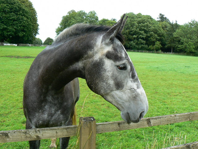
Aside from its sporting heritage, Badminton is also famous for the annual Badminton Horse Trials. This prestigious equestrian event takes place on the grounds of the Badminton House and attracts top riders and horses from across the globe. The trials consist of dressage, cross-country, and show jumping phases, making it a thrilling event for both competitors and spectators.

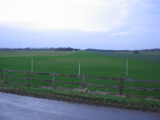
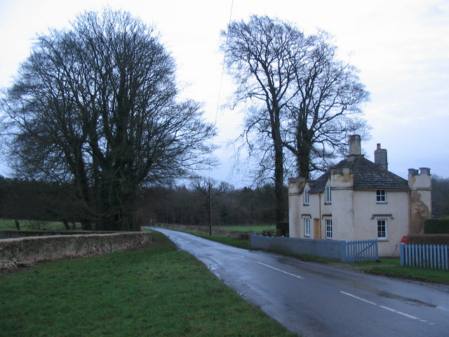
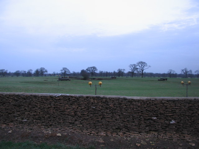
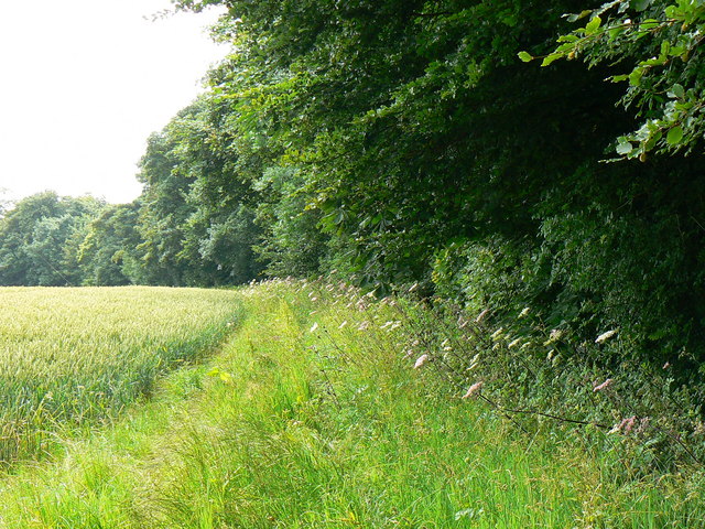
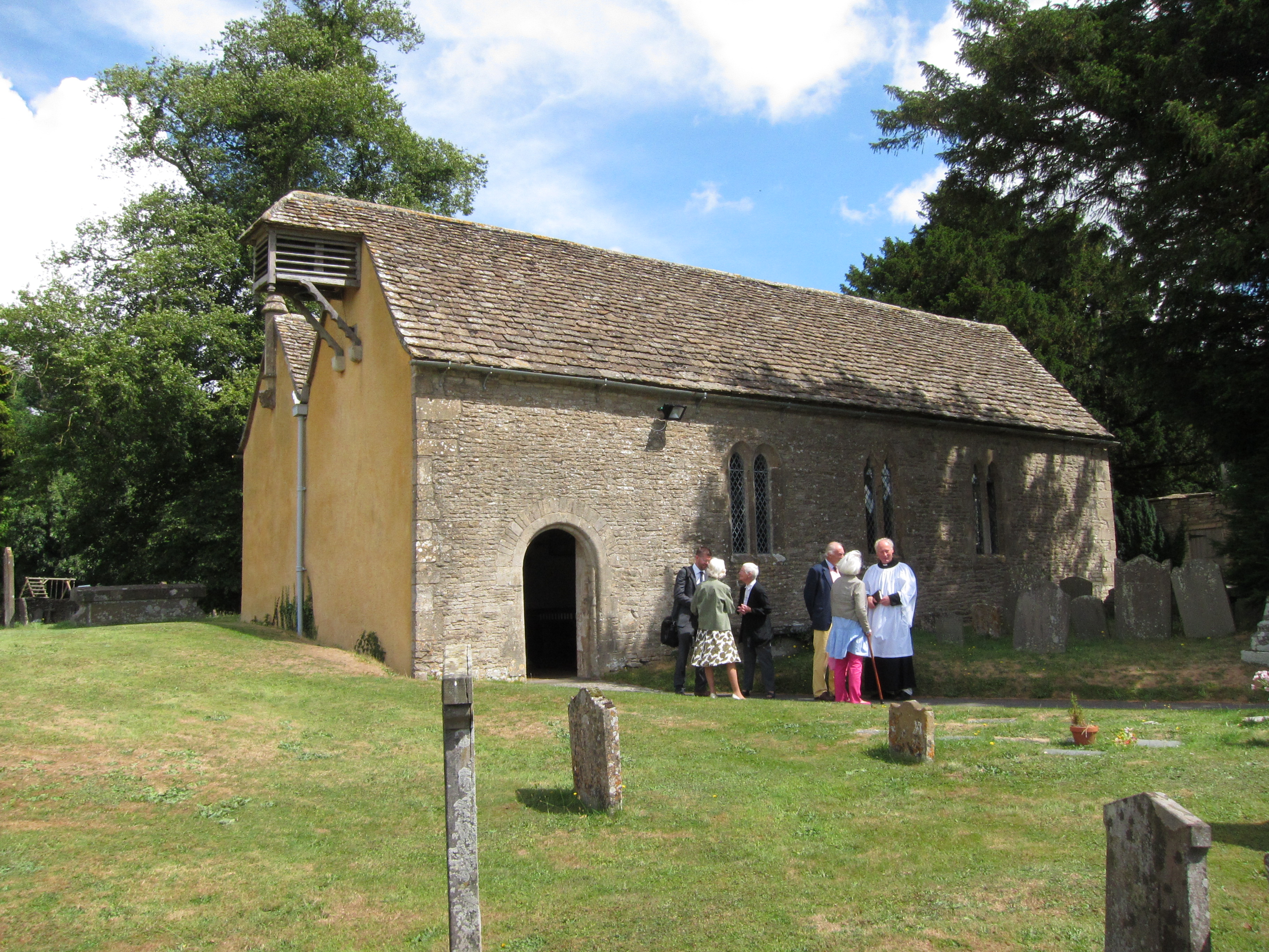
The village itself is characterized by charming stone cottages, a picturesque parish church, and a friendly community atmosphere. Its rural setting offers residents and visitors an opportunity to enjoy tranquil walks through scenic countryside, as well as explore the nearby Cotswolds, famous for its rolling hills and quaint villages.

In terms of amenities, Badminton provides a primary school, a village hall, and a pub, offering a sense of community and providing essential services for its residents. Overall, Badminton, Gloucestershire, offers a serene and historic place to live or visit, with its rich sporting heritage and natural beauty.

If you have any feedback on the listing, please let us know in the comments section below.
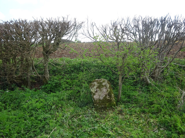
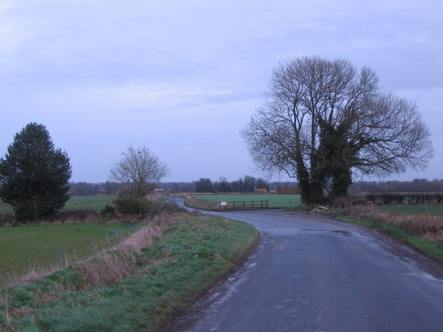
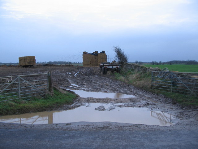
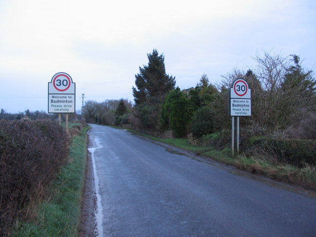
Badminton Images

Images are sourced within 2km of 51.542612/-2.285512 or Grid Reference ST8082. Thanks to Geograph Open Source API. All images are credited.

Old Milestone, B4040, Acton Turville On the South verge of the B4040, West of Acton Turville, in Tormarton parish. Rivet Benchmark on top representing 138.5 m ASL.

Inscription (was): Chipping Sodbury 5 / Chippenham 10

Milestone Society National ID: GL_SYCP05
Old Milestone, B4040, Acton Turville
On the South verge of the B4040, West of Acton Turville, in Tormarton parish. Rivet Benchmark on top representing 138.5 m ASL. Inscription (was): Chipping Sodbury 5 / Chippenham 10 Milestone Society National ID: GL_SYCP05
Hawkesbury : Little Badminton - Grassy Field Looking across a grassy field.
Hawkesbury : Little Badminton - Grassy Field
Looking across a grassy field.
Hawkesbury : Little Badminton - Field A muddy field in the countryside.
Hawkesbury : Little Badminton - Field
A muddy field in the countryside.
Hawkesbury : Little Badminton - Field Looking across a grassy field.
Hawkesbury : Little Badminton - Field
Looking across a grassy field.
Hawkesbury : Little Badminton - Field A ploughed field in the countryside.
Hawkesbury : Little Badminton - Field
A ploughed field in the countryside.
Hawkesbury : Little Badminton - Field From the end of the track leading to American Barn.
Hawkesbury : Little Badminton - Field
From the end of the track leading to American Barn.
Old Down Road A view looking to the east along Old Down Road on the way to Badminton.
Old Down Road
A view looking to the east along Old Down Road on the way to Badminton.
Field entrance on Old Down Road A view looking south across Old Down Road towards a waterlogged field entrance following recent heavy rain.
Field entrance on Old Down Road
A view looking south across Old Down Road towards a waterlogged field entrance following recent heavy rain.
Approaching Badminton A view looking to the northeast approaching Badminton along Old Down Road.
Approaching Badminton
A view looking to the northeast approaching Badminton along Old Down Road.
Badminton Airstrip A view looking to the southwest across the lane from Badminton to Little Badminton, along the centreline of the grass airstrip.
Badminton Airstrip
A view looking to the southwest across the lane from Badminton to Little Badminton, along the centreline of the grass airstrip.
Slait Lodge A view looking south approaching to Badminton, showing Slait Lodge on the right.
Slait Lodge
A view looking south approaching to Badminton, showing Slait Lodge on the right.
Badminton Deer Park A view looking east into the grounds of Badminton Deer Park, from the lane between Badminton and Little Badminton. The approach lights for the Badminton airstrip can be seen, together with some of the jumps used during the Badminton Horse Trials.
Badminton Deer Park
A view looking east into the grounds of Badminton Deer Park, from the lane between Badminton and Little Badminton. The approach lights for the Badminton airstrip can be seen, together with some of the jumps used during the Badminton Horse Trials.
Little Badminton folk
Field margin, near Little Badminton The viewpoint is from the north-eastern corner of Peaked Down Clump, a semi-circular plantation. The field margin is on the left. In the distance in the next square north is the American Barn.
Field margin, near Little Badminton
The viewpoint is from the north-eastern corner of Peaked Down Clump, a semi-circular plantation. The field margin is on the left. In the distance in the next square north is the American Barn.
Field margin, near Badminton The field margin runs alongside the last stretch of Seven Mile Plantation visible on the right of the image.
Field margin, near Badminton
The field margin runs alongside the last stretch of Seven Mile Plantation visible on the right of the image.
Fordson tractor, American Barn, Little Badminton A Fordson Major tractor. What it would have looked like once <span class="nowrap"><a title="http://www.rttuk.co.uk/Assets/Images/fordson_major_large_restored.jpg" rel="nofollow ugc noopener" href="http://www.rttuk.co.uk/Assets/Images/fordson_major_large_restored.jpg">Link</a><img style="margin-left:2px;" alt="External link" title="External link - shift click to open in new window" src="https://s1.geograph.org.uk/img/external.png" width="10" height="10"/></span>
Fordson tractor, American Barn, Little Badminton
A Fordson Major tractor. What it would have looked like once LinkExternal link
Horse near Badminton ...rather disappointed when I didn't.
Horse near Badminton
...rather disappointed when I didn't.
Horse near Badminton Hoping I had something to give him to eat...
Horse near Badminton
Hoping I had something to give him to eat...
Show me another place!

Badminton is located at Grid Ref: ST8082 (Lat: 51.542612, Lng: -2.285512)

Unitary Authority: South Gloucestershire

Police Authority: Avon and Somerset

What 3 Words

///tonal.framework.kitchen. Near Luckington, Wiltshire

Related Wikis

Badminton, Gloucestershire

Badminton is a village and civil parish in South Gloucestershire, England. The only settlement in the parish is Badminton village, sometimes called Great...

St Michael and All Angels Church, Badminton

St Michael and All Angels is a Grade I listed church on the estate of the Duke of Beaufort in the village of Great Badminton, Gloucestershire, England...

Badminton House

Badminton House is a large country house and Grade I Listed Building in Badminton, Gloucestershire, England, which has been the principal seat of the Dukes...

Badminton railway station

Badminton railway station is a closed railway station in Gloucestershire, England on the line between Wootton Bassett to the east, and Patchway and Filton...

Little Badminton

Little Badminton is a small village in Hawkesbury parish in South Gloucestershire, England.The name of the settlement distinguishes it from Badminton village...

Chipping Sodbury Tunnel

Chipping Sodbury Tunnel is a railway tunnel that is situated on the South Wales Main Line in England. It runs under the Cotswold Hills for 4444 yards,...

Acton Turville

Acton Turville is a parish in the Cotswold Edge ward within South Gloucestershire, England. It lies 17 miles (27 km) east-northeast of Bristol and 93 miles...

Swangrove

Swangrove is a Grade I listed country house in Hawkesbury, South Gloucestershire, England. The listing includes Swangrove House, its garden walls, four...

Nearby Amenities

Located within 500m of 51.542612,-2.285512
Badminton
Is In: South Gloucestershire, England, UK
Place: village
Postal Code: GL9 1
Wikidata: Q799600
Wikipedia: en:Badminton, Gloucestershire
Lat/Long: 51.5442374/-2.2854442
Post Box
Collection Times: Mo-Fr 09:00; Sa 07:00; Su off
Drive Through: no
Operator: Royal Mail
Post Box Type: wall
Ref: GL9 213D
Royal Cypher: GR
Royal Cypher Wikidata: Q33102273
Source: survey
Lat/Long: 51.539284/-2.2832415
Bus Stop
Old Down Cottages
Bus: yes
Naptan AtcoCode: 0170SGB20823
Naptan Bearing: W
Naptan CommonName: Old Down Cottages
Naptan Crossing: Station Road
Naptan NaptanCode: sglpdpw
Naptan Street: Old Down Road
Naptan Verified: no
Public Transport: platform
Shelter: yes
Source: naptan_import
Lat/Long: 51.5390513/-2.2839011
Bus Stop
Old Down Cottages
Bus: yes
Naptan AtcoCode: 0170SGB20824
Naptan Bearing: E
Naptan CommonName: Old Down Cottages
Naptan Crossing: Station Road
Naptan NaptanCode: sglpdpt
Naptan Street: Old Down Road
Naptan Verified: no
Public Transport: platform
Shelter: no
Source: naptan_import
Lat/Long: 51.5391195/-2.2839767
Bus Stop
Badminton Post Office
Bus: yes
Naptan AtcoCode: 0170SGZ01483
Naptan Bearing: E
Naptan CommonName: Badminton Post Office
Naptan Crossing: The Limes
Naptan NaptanCode: sglpdpm
Naptan Street: High Street
Naptan Verified: no
Public Transport: platform
Shelter: yes
Source: naptan_import
Lat/Long: 51.542771/-2.2846067
BT Cabinet 1 - Badminton
Man Made: street_cabinet
Note: FTTC enabled
Operator: BT
Street Cabinet: telecom
Utility: telecom
Lat/Long: 51.5392061/-2.2834275
Give Way
Direction: backward
Lat/Long: 51.5426156/-2.2856194
Post Box
Collection Times: Mo-Fr 16:15; Sa 10:30; Su off
Drive Through: no
Operator: Royal Mail
Post Box Type: pillar
Ref: GL9 194
Royal Cypher: EIIR
Royal Cypher Wikidata: Q33102113
Source: survey
Lat/Long: 51.5427829/-2.2846639
Defibrillator
Defibrillator Location: On wall under bus shelter next to Drewetts Stores / Post Office
Emergency: defibrillator
Indoor: no
Location: in bus shelter
Mapillary: 567990864614182
Operator: Community Heartbeat
Ref: CHT-14-1160
Source: survey
Survey Date: 2022-04-24
Lat/Long: 51.542783/-2.2846442
Post Office
Badminton Post Office
Addr City: Badminton
Addr Country: GB
Addr Postcode: GL9 1DG
Addr Street: High Street
Brand: Post Office
Brand Wikidata: Q1783168
Brand Wikipedia: en:Post Office Ltd
Contact Website: https://www.postoffice.co.uk/branch-finder/2775484/badminton
Opening Hours: Mo-Fr 09:00-18:00; Sa 09:00-13:00
Operator: Drewetts Stores
Ref Pol Id: 11108
Lat/Long: 51.5427785/-2.284759
Drewetts Stores
Addr City: Badminton
Addr Postcode: GL9 1DG
Addr Street: High Street
Shop: convenience
Source: survey;pol_branch_list_2020‑02‑20
Lat/Long: 51.5427763/-2.2847326
Power: pole
Lat/Long: 51.5394969/-2.2906217
Power: pole
Lat/Long: 51.5407349/-2.291774
Power: pole
Lat/Long: 51.5411813/-2.2899685
Power: pole
Lat/Long: 51.5416694/-2.2880084
Power: pole
Lat/Long: 51.5420671/-2.2864034
Telephone
Booth: K6
Lat/Long: 51.5413645/-2.2853261
Waste Basket
Lat/Long: 51.5427852/-2.2846316
Waste Basket
Lat/Long: 51.5427878/-2.2845802
Bench
Lat/Long: 51.5427823/-2.2846088
Advertising: board
Support: wall_mounted
Lat/Long: 51.54279/-2.284617
Power: pole
Lat/Long: 51.5425292/-2.2869378
Power: pole
Lat/Long: 51.5415365/-2.2860052
Power: pole
Lat/Long: 51.5406901/-2.2853983
Power: pole
Lat/Long: 51.5403324/-2.2851133
Power: pole
Lat/Long: 51.5399692/-2.2846055
Power: pole
Lat/Long: 51.5411182/-2.2868088
Power: pole
Lat/Long: 51.5426093/-2.2862227
Power: pole
Lat/Long: 51.5396556/-2.2841811
Power: pole
Lat/Long: 51.5392206/-2.2834755
The data included in this document is from www.openstreetmap.org. The data is made available under ODbL.

Have you been to Badminton?

Leave your review of Badminton below (or comments, questions and feedback).