Greensforge

Settlement in Staffordshire South Staffordshire

England

Greensforge

Mill farm Estate farm in Mill Lane.
Mill farm Credit: John M

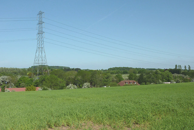
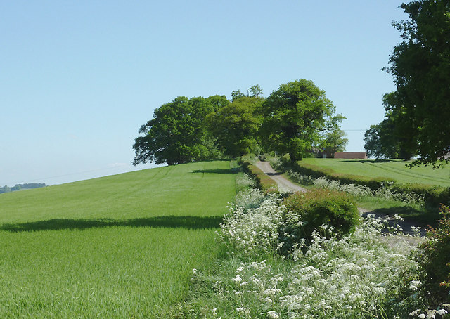
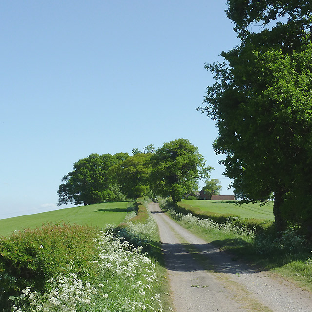
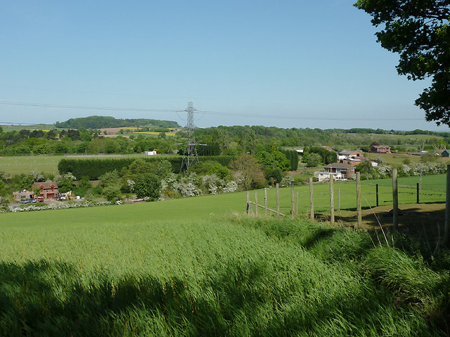
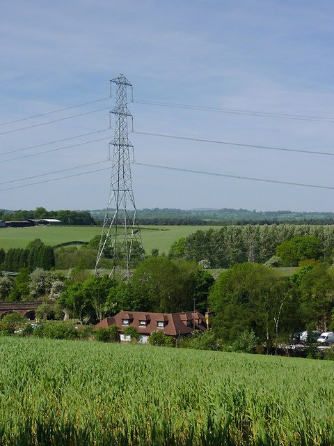
Greensforge is a small village located in the county of Staffordshire, England. Situated on the western border of the county, it lies approximately 6 miles southwest of the town of Stourbridge and 10 miles north of Kidderminster. The village is set amidst picturesque countryside, offering a tranquil and rural environment.

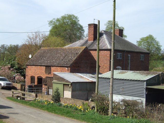
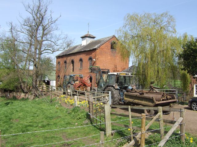
Historically, Greensforge was centered around the Greensforge Forge, a prominent ironworks that operated during the 18th and 19th centuries. The forge played a crucial role in the Industrial Revolution, producing various iron products such as chains, anchors, and agricultural tools. Today, remnants of the forge can still be seen, including the preserved forge pond and some of the original buildings.

The village itself is relatively small, with a population of around 500 residents. It comprises a mix of traditional cottages and more modern houses, giving it a charming and diverse architectural character. Greensforge is known for its strong sense of community, with various local events and activities organized throughout the year, fostering a close-knit atmosphere.

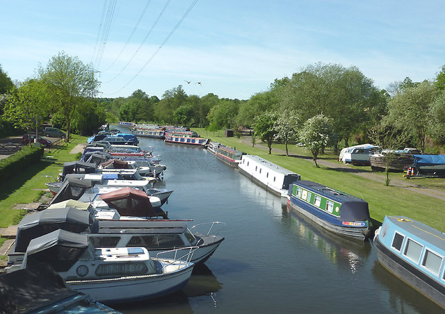
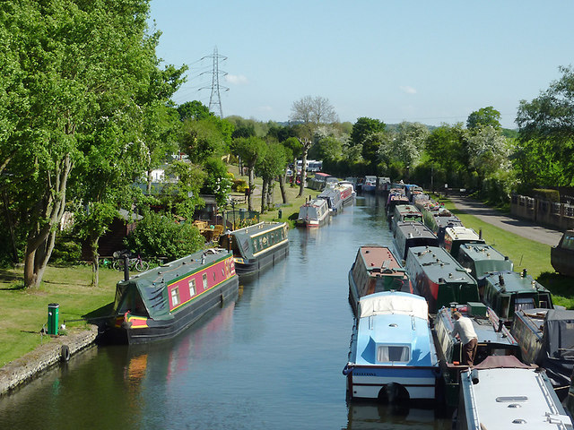
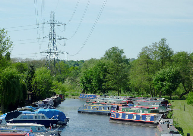
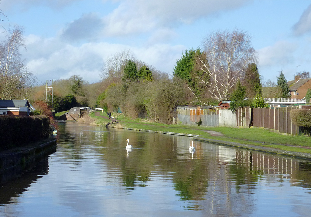
The surrounding countryside offers ample opportunities for outdoor enthusiasts, with scenic walking trails, cycling routes, and fishing spots nearby. The Staffordshire and Worcestershire Canal runs close to the village, providing additional recreational options such as canal boat trips and waterside walks.

While Greensforge is primarily a residential area, amenities such as a local pub and a village hall cater to the needs of the community. For further services, residents often rely on nearby towns and cities, including Stourbridge and Kidderminster, which offer a wider range of shops, schools, and healthcare facilities.

Overall, Greensforge is a peaceful and idyllic village, steeped in history and surrounded by natural beauty, making it an attractive place to live for those seeking a rural lifestyle.

If you have any feedback on the listing, please let us know in the comments section below.
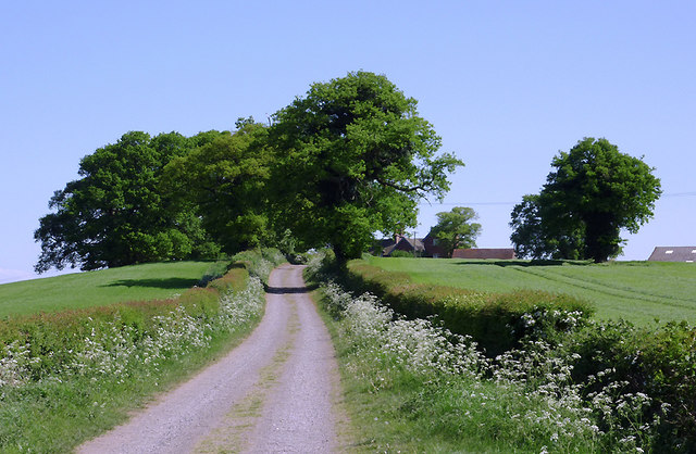
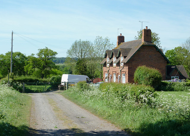
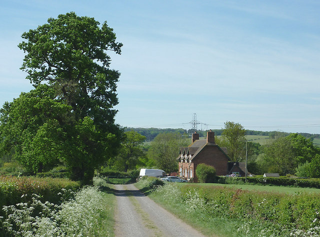
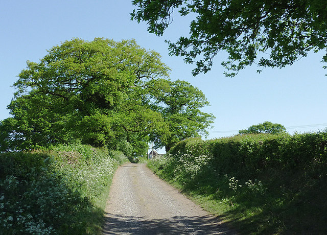
Greensforge Images

Images are sourced within 2km of 52.497886/-2.206193 or Grid Reference SO8688. Thanks to Geograph Open Source API. All images are credited.

Mill farm Estate farm in Mill Lane.
Mill farm
Estate farm in Mill Lane.
Spittlebrook Mill Estate property on the Enville Estate.
Spittlebrook Mill
Estate property on the Enville Estate.
Grazing near Gothersley, Staffordshire Seen from Greensforge Lane, many of the fields have been divided into paddocks so that horses can graze and have "their own space". Someone told me that horses can be cantankerous with others they do not know. These two beauties are definitely good friends, enjoying some early warm spring grazing. The Smestow River is behind the trees.
Grazing near Gothersley, Staffordshire
Seen from Greensforge Lane, many of the fields have been divided into paddocks so that horses can graze and have "their own space". Someone told me that horses can be cantankerous with others they do not know. These two beauties are definitely good friends, enjoying some early warm spring grazing. The Smestow River is behind the trees.
Horses grazing near Gothersley, Staffordshire Many of the fields in this area have been divided into paddocks for use by the horse riding community. These two beauties had been grazing separately, quite calmly, when the bay decided to communicate with her friend. <a href="https://www.geograph.org.uk/photo/2379017">SO8686 : Friendly horses near Gothersley, Staffordshire</a>
In this image they are separating to continue enjoying the warm dry conditions.

See also <a href="https://www.geograph.org.uk/photo/2378981">SO8686 : Grazing near Gothersley, Staffordshire</a>
Horses grazing near Gothersley, Staffordshire
Many of the fields in this area have been divided into paddocks for use by the horse riding community. These two beauties had been grazing separately, quite calmly, when the bay decided to communicate with her friend. SO8686 : Friendly horses near Gothersley, Staffordshire In this image they are separating to continue enjoying the warm dry conditions. See also SO8686 : Grazing near Gothersley, Staffordshire
Friendly horses near Gothersley, Staffordshire Many of the fields in this area have been divided into paddocks for use by the horse riding community. These two beauties had been grazing separately, quite calmly, when they decided on a bit of communication. Charming.

See <a href="https://www.geograph.org.uk/photo/2379006">SO8686 : Horses grazing near Gothersley, Staffordshire</a>
and <a href="https://www.geograph.org.uk/photo/2378981">SO8686 : Grazing near Gothersley, Staffordshire</a>
Friendly horses near Gothersley, Staffordshire
Many of the fields in this area have been divided into paddocks for use by the horse riding community. These two beauties had been grazing separately, quite calmly, when they decided on a bit of communication. Charming. See SO8686 : Horses grazing near Gothersley, Staffordshire and SO8686 : Grazing near Gothersley, Staffordshire
Greensforge Lane near Gothersley, Staffordshire The lane to the right leads to Gothersley Lodge, by the Smestow River. Much of the land nearby is divided into paddocks for the use of horses.
Greensforge Lane near Gothersley, Staffordshire
The lane to the right leads to Gothersley Lodge, by the Smestow River. Much of the land nearby is divided into paddocks for the use of horses.
Ashwood Marina near Kingswinford, Staffordshire Looking towards the Staffordshire and Worcestershire Canal.

The canal arm and basin were originally constructed to handle coal carrying narrow-boats from the railway which was built to connect with local collieries in 1827.
Ashwood Marina near Kingswinford, Staffordshire
Looking towards the Staffordshire and Worcestershire Canal. The canal arm and basin were originally constructed to handle coal carrying narrow-boats from the railway which was built to connect with local collieries in 1827.
Ashwood Marina near Kingswinford, Staffordshire The defunct "lostlabours.co.uk" webpage informs us that "In 1827 James Foster of 'John Bradley & Co', the Iron-masters from Stourbridge, and Lord Dudley, (The Fourth Viscount Dudley & Ward) agreed to build a railway from Ashwood Basin, on the Staffs & Worcs Canal, to Shut End on Pensnett Chase." The railway was more recently owned by the National Coal Board.

The basin, which extends well beyond the bend seen in the distance, is now an attractive marina for pleasure boats. <a href="https://www.geograph.org.uk/photo/657483">SO8688 : Viaduct across Ashwood Canal Basin, Staffordshire</a>
Ashwood Marina near Kingswinford, Staffordshire
The defunct "lostlabours.co.uk" webpage informs us that "In 1827 James Foster of 'John Bradley & Co', the Iron-masters from Stourbridge, and Lord Dudley, (The Fourth Viscount Dudley & Ward) agreed to build a railway from Ashwood Basin, on the Staffs & Worcs Canal, to Shut End on Pensnett Chase." The railway was more recently owned by the National Coal Board. The basin, which extends well beyond the bend seen in the distance, is now an attractive marina for pleasure boats. SO8688 : Viaduct across Ashwood Canal Basin, Staffordshire
Ashwood Marina near Kingswinford, Staffordshire This is a telephoto assisted image taken from Ashwood Lower Lane Bridge, looking towards the Staffordshire and Worcestershire Canal. The junction is just beyond the furthest blue narrowboat.

The defunct "lostlabours.co.uk" webpage informs us that "In 1827 James Foster of 'John Bradley & Co', the Iron-masters from Stourbridge, and Lord Dudley, (The Fourth Viscount Dudley & Ward) agreed to build a railway from Ashwood Basin, on the Staffs & Worcs Canal, to Shut End on Pensnett Chase." The railway was more recently owned by the National Coal Board.

The basin is now an attractive marina for pleasure boats.
Ashwood Marina near Kingswinford, Staffordshire
This is a telephoto assisted image taken from Ashwood Lower Lane Bridge, looking towards the Staffordshire and Worcestershire Canal. The junction is just beyond the furthest blue narrowboat. The defunct "lostlabours.co.uk" webpage informs us that "In 1827 James Foster of 'John Bradley & Co', the Iron-masters from Stourbridge, and Lord Dudley, (The Fourth Viscount Dudley & Ward) agreed to build a railway from Ashwood Basin, on the Staffs & Worcs Canal, to Shut End on Pensnett Chase." The railway was more recently owned by the National Coal Board. The basin is now an attractive marina for pleasure boats.
Farmland near Ashwood, Staffordshire Looking across the Wom and Smestow valleys. The canal arm, formerly a coal wharf, crosses the scene hidden in the dip by the pylon beyond this crop field. The water is now used as a marina for narrowboats and other pleasure craft.
Farmland near Ashwood, Staffordshire
Looking across the Wom and Smestow valleys. The canal arm, formerly a coal wharf, crosses the scene hidden in the dip by the pylon beyond this crop field. The water is now used as a marina for narrowboats and other pleasure craft.
Farmland near Ashwood, Staffordshire The bridleway leads from Ashwood to the A449 Kidderminster Road, then continues as Lodge Lane to Kingswinford. The terrain slopes left to the Wom and Smestow valleys.
Farmland near Ashwood, Staffordshire
The bridleway leads from Ashwood to the A449 Kidderminster Road, then continues as Lodge Lane to Kingswinford. The terrain slopes left to the Wom and Smestow valleys.
Bridleway towards Kingswinford, Staffordshire The bridleway leads between fields from Ashwood to the A449 Kidderminster Road, then continues as the surfaced Lodge Lane to Kingswinford. The terrain slopes left to the Smestow Valley.
Bridleway towards Kingswinford, Staffordshire
The bridleway leads between fields from Ashwood to the A449 Kidderminster Road, then continues as the surfaced Lodge Lane to Kingswinford. The terrain slopes left to the Smestow Valley.
Bridleway towards Kingswinford, Staffordshire The bridleway leads between fields from Ashwood to the A449 Kidderminster Road, then continues as the surfaced Lodge Lane to Kingswinford. Buildings at Ashwood Lodge Farm can be seen on the right behind the trees. The terrain slopes left to the Wom and Smestow valleys.
Bridleway towards Kingswinford, Staffordshire
The bridleway leads between fields from Ashwood to the A449 Kidderminster Road, then continues as the surfaced Lodge Lane to Kingswinford. Buildings at Ashwood Lodge Farm can be seen on the right behind the trees. The terrain slopes left to the Wom and Smestow valleys.
Bridleway to Ashwood, Staffordshire The bridleway has led between fields from the A449 Kidderminster Road, and meeting Doctor's Lane here.
Bridleway to Ashwood, Staffordshire
The bridleway has led between fields from the A449 Kidderminster Road, and meeting Doctor's Lane here.
Bridleway to Ashwood, Staffordshire The bridleway has led between fields from the A449 Kidderminster Road, and meeting Doctor's Lane by the cottages.
Bridleway to Ashwood, Staffordshire
The bridleway has led between fields from the A449 Kidderminster Road, and meeting Doctor's Lane by the cottages.
Bridleway towards Kingswinford, Staffordshire The bridleway leads between fields from Ashwood to the A449 Kidderminster Road, then continues as the surfaced Lodge Lane to Kingswinford. Buildings at Ashwood Lodge Farm can be seen on the right behind the trees.
Bridleway towards Kingswinford, Staffordshire
The bridleway leads between fields from Ashwood to the A449 Kidderminster Road, then continues as the surfaced Lodge Lane to Kingswinford. Buildings at Ashwood Lodge Farm can be seen on the right behind the trees.
Farmland near Ashwood, Staffordshire Looking across the Wom and Smestow valleys. The former coal wharf/canal arm crosses the scene, hidden in the dip beyond this crop field, by the electricity pylon. It is now a marina for pleasure boats.
Farmland near Ashwood, Staffordshire
Looking across the Wom and Smestow valleys. The former coal wharf/canal arm crosses the scene, hidden in the dip beyond this crop field, by the electricity pylon. It is now a marina for pleasure boats.
Farmland near Ashwood, Staffordshire This is a telephoto assisted view across the farm land of the wide Smestow Valley. Ashwood Marina is hidden in the dip this side of the electricity pylon. Narrowboats are just visible on the left on the short (about 500 metres) canal arm, formerly used as a coal wharf. The actual Staffordshire and Worcestershire Canal crosses the view by the line of trees beyond the pylon.
Farmland near Ashwood, Staffordshire
This is a telephoto assisted view across the farm land of the wide Smestow Valley. Ashwood Marina is hidden in the dip this side of the electricity pylon. Narrowboats are just visible on the left on the short (about 500 metres) canal arm, formerly used as a coal wharf. The actual Staffordshire and Worcestershire Canal crosses the view by the line of trees beyond the pylon.
Show me another place!

Greensforge is located at Grid Ref: SO8688 (Lat: 52.497886, Lng: -2.206193)

Administrative County: Staffordshire

District: South Staffordshire

Police Authority: Staffordshire

What 3 Words

///midfield.quilt.freed. Near Kingswinford, West Midlands

Nearby Locations

Greensforge

Related Wikis

Greensforge

Greensforge is a scattered hamlet on the boundary of Kinver and Swindon parishes, in South Staffordshire, England. It is noted for its Roman associations...

Ashwood, Staffordshire

Ashwood is a small area of Staffordshire, England. It is situated in the South Staffordshire district, approximately two miles west of the West Midlands...

Summerhill School, Kingswinford

Summerhill School is a mixed community secondary school located in Kingswinford, West Midlands, England. == History == The school was built by Brierley...

Swindon, Staffordshire

Swindon is a village and civil parish located in the district of South Staffordshire, in the county of Staffordshire, England. It is 6 miles (6 km) west...

Nearby Amenities

Located within 500m of 52.497886,-2.206193
Greensforge
Created By: Potlatch 0.10f
Place: hamlet
Wikidata: Q5604506
Lat/Long: 52.4965027/-2.2066663
Seamark Type: gate
Waterway: lock_gate
Lat/Long: 52.4953744/-2.20504
Barrier: cycle_barrier
Source: survey
Lat/Long: 52.4954009/-2.2050872
Seamark Type: gate
Waterway: lock_gate
Lat/Long: 52.4955584/-2.2048677
Marker: pedestal
Operator: Esso
Ref: Km 212.6
Utility: oil
Lat/Long: 52.5003706/-2.2037567
Waste Disposal
Lat/Long: 52.4954128/-2.2051282
Water Point
Greensforge Water Point
Access: permissive
Centralkey: no
Drinking Water: yes
Fee: no
Fixme: location is not correct
Man Made: water_tap
Operator: Canal and River Trust
Waterway: water_point
Lat/Long: 52.4960164/-2.2047654
Crossing
Lat/Long: 52.4953897/-2.2052961
Greensforge Roman Fort
Access: private
Historic: fort
Lat/Long: 52.4955392/-2.2037626
Colour: white
Marker: post
Material: concrete
Utility: oil
Lat/Long: 52.4988354/-2.1994718
The data included in this document is from www.openstreetmap.org. The data is made available under ODbL.

Have you been to Greensforge?

Leave your review of Greensforge below (or comments, questions and feedback).