Rubha na Mòine

Landscape Feature in Stirlingshire

Scotland

Rubha na Mòine

On Loch Katrine viewing Black Island To the right is the Black Island- obscured behind it, attached to the loch's shore, is the Clan McGregor burial ground. The smaller islet to the left is Eilean Ban. The peak is Meall na Boineide.
On Loch Katrine viewing Black Island Credit: Kim McGillivray

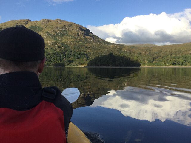
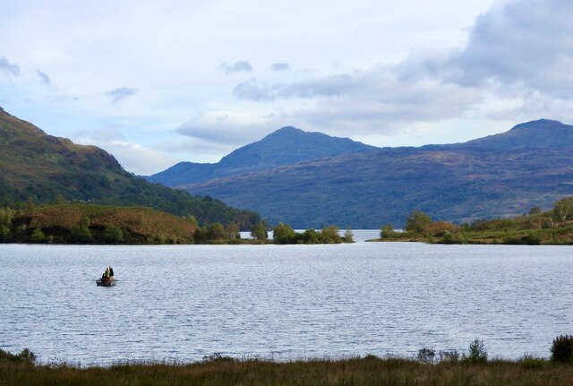
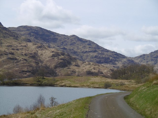
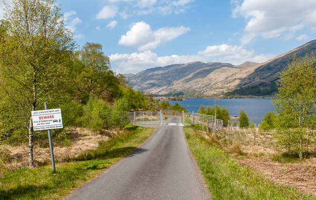
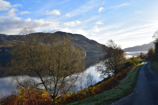
Rubha na Mòine, also known as the Point of the Moss, is a prominent landscape feature located in Stirlingshire, Scotland. Situated on the eastern shores of Loch Lomond, it is a peninsula that extends into the loch, offering stunning views of the surrounding area.

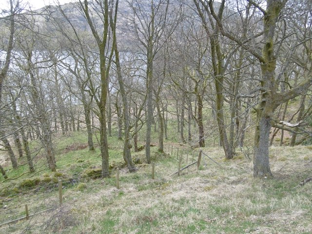
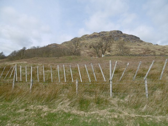
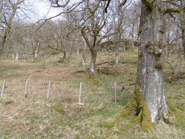
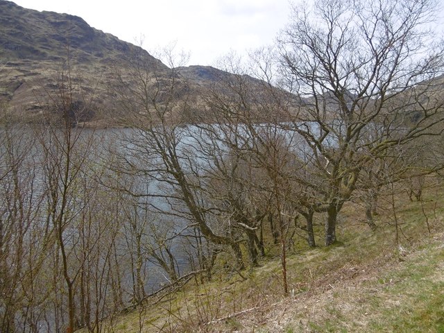
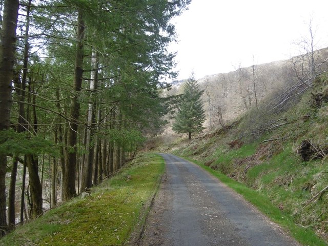
The peninsula is characterized by its diverse natural features. On one side, there are dense woodlands filled with native Scottish trees such as oak, birch, and pine. These woodlands provide a habitat for a variety of wildlife including red squirrels, deer, and different species of birds.

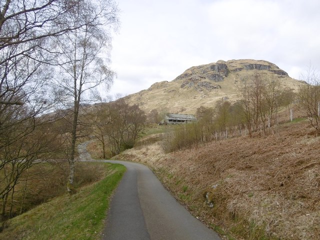
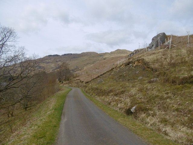
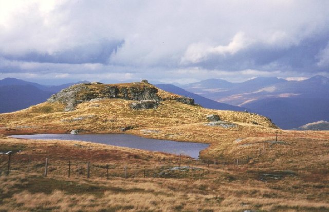
As one ventures further along the peninsula, the landscape transitions into an open moorland, covered with heather, moss, and other low-lying vegetation. This moorland is interspersed with small streams and lochs, creating a picturesque and tranquil setting.

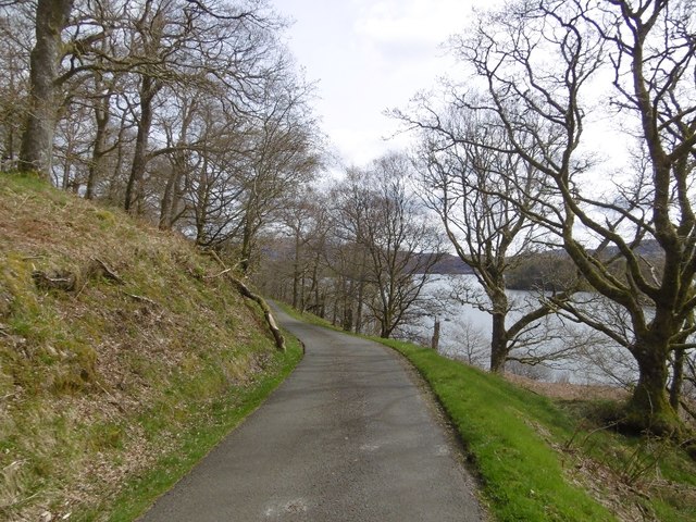
Rubha na Mòine is a popular destination for nature enthusiasts and hikers due to its exceptional natural beauty and the various walking trails that crisscross the area. Visitors can enjoy leisurely strolls along the shoreline, taking in the breathtaking views of Loch Lomond and the surrounding mountains.

Additionally, the peninsula is home to several archaeological sites, including ancient burial mounds and standing stones, which offer a glimpse into the area's rich history and cultural heritage.

Overall, Rubha na Mòine is a captivating landscape feature in Stirlingshire, offering a unique blend of woodlands, moorlands, and stunning views of Loch Lomond, making it a must-visit destination for nature lovers and history enthusiasts alike.

If you have any feedback on the listing, please let us know in the comments section below.

Rubha na Mòine Images

Images are sourced within 2km of 56.277211/-4.598389 or Grid Reference NN3912. Thanks to Geograph Open Source API. All images are credited.

On Loch Katrine viewing Black Island To the right is the Black Island- obscured behind it, attached to the loch's shore, is the Clan McGregor burial ground. The smaller islet to the left is Eilean Ban. The peak is Meall na Boineide.
On Loch Katrine viewing Black Island
To the right is the Black Island- obscured behind it, attached to the loch's shore, is the Clan McGregor burial ground. The smaller islet to the left is Eilean Ban. The peak is Meall na Boineide.
Looking down Loch Katrine from the Glen Gyle end An autumnal view of a special place: Rob Roy country!  The Glen Gyle end of Loch Katrine is steeped in history, as is the whole area.  The fishing group in the boat appeared contented and the view down to Ben Venue is so good, there were many positives for me in this image. As is well known, Loch Katrine is a main source of water for the Glasgow conurbation. A natural loch, its level has been raised three times.
Looking down Loch Katrine from the Glen Gyle end
An autumnal view of a special place: Rob Roy country! The Glen Gyle end of Loch Katrine is steeped in history, as is the whole area. The fishing group in the boat appeared contented and the view down to Ben Venue is so good, there were many positives for me in this image. As is well known, Loch Katrine is a main source of water for the Glasgow conurbation. A natural loch, its level has been raised three times.
Oakwood, Loch Katrine
East Portnellan Old sheds from the days when sheep were run on the hillsides north of Loch Katrine (now wooded).
East Portnellan
Old sheds from the days when sheep were run on the hillsides north of Loch Katrine (now wooded).
Meall na Boineide Craggy hillside above Loch Katrine. The fence is surrounding a young plantation which has replaced the sheep walk here.
Meall na Boineide
Craggy hillside above Loch Katrine. The fence is surrounding a young plantation which has replaced the sheep walk here.
Loch Katrine road Nearing the head of the loch.
Loch Katrine road
Nearing the head of the loch.
Oak wood, Portnellan Woodland beside Loch Katrine.
Oak wood, Portnellan
Woodland beside Loch Katrine.
Road, Loch Katrine Passing through some fine oak woods by Portnellan.
Road, Loch Katrine
Passing through some fine oak woods by Portnellan.
Loch Katrine road On the private road round the loch, north of Stronachlachar.
Loch Katrine road
On the private road round the loch, north of Stronachlachar.
Road alongside Loch Katrine. Lovely October morning.
Road alongside Loch Katrine.
Lovely October morning.
Loch Katrine road The road along the north shore, passing new fences protecting native woodland plantations.
Loch Katrine road
The road along the north shore, passing new fences protecting native woodland plantations.
Woodland, Loch Katrine The wooded north shore near the head of the loch.
Woodland, Loch Katrine
The wooded north shore near the head of the loch.
Road, Loch Katrine A more sedate visit than my last one to this square - no flogging up steep slopes covered in long grass in the rain.  The road runs for 20 almost traffic free kilometres between Stronachlachar and Trossachs pier.
Road, Loch Katrine
A more sedate visit than my last one to this square - no flogging up steep slopes covered in long grass in the rain. The road runs for 20 almost traffic free kilometres between Stronachlachar and Trossachs pier.
Wetland by Loch Katrine A more natural looking shoreline than is usual on this enlarged loch.
Wetland by Loch Katrine
A more natural looking shoreline than is usual on this enlarged loch.
Road and pines, Glengyle Woodland beside Loch Katrine.
Road and pines, Glengyle
Woodland beside Loch Katrine.
Road up Glen Gyle The road follows the power line but beware, there are reports on here that the bridge further up is a bit shoogly <a href="https://www.geograph.org.uk/photo/4902009">NN3713 : Bridge over Glengyle Water</a>.
Road up Glen Gyle
The road follows the power line but beware, there are reports on here that the bridge further up is a bit shoogly NN3713 : Bridge over Glengyle Water.
Loch Katrine road Heading for Stronachlachar.
Loch Katrine road
Heading for Stronachlachar.
Slopes of Maol Mòr Woodland regeneration project behind the fence.
Slopes of Maol Mòr
Woodland regeneration project behind the fence.
Show me another place!

Rubha na Mòine is located at Grid Ref: NN3912 (Lat: 56.277211, Lng: -4.598389)

Unitary Authority: Stirling

Police Authority: Forth Valley

What 3 Words

///alley.clicker.eradicate. Near Tyndrum, Stirling

Related Wikis

Meall Mor (Loch Katrine)

Meall Mor (747 m) is a mountain in the Grampian Mountains of Scotland. It lies in the Stirling region, on the northern side of Loch Katrine in the Trossachs...

Loch Lomond and The Trossachs National Park

Loch Lomond and The Trossachs National Park (Scottish Gaelic: Pàirc Nàiseanta Loch Laomainn is nan Tròisichean) is a national park in Scotland centred...

Loch Arklet

Loch Arklet is a freshwater loch and reservoir in the Trossachs area of the Scottish Highlands. It is within the historic county and registration county...

Beinn a' Chòin

Beinn a' Choin (769 m) is a mountain in the Grampian Mountains of Scotland. It lies on the border of the Stirling region and Argyll at the northern end...

Nearby Amenities

Located within 500m of 56.277211,-4.598389
Design: barrel
Power: tower
Lat/Long: 56.2732311/-4.5998582
Design: barrel
Power: tower
Lat/Long: 56.2753004/-4.6034093
The data included in this document is from www.openstreetmap.org. The data is made available under ODbL.

Have you been to Rubha na Mòine?

Leave your review of Rubha na Mòine below (or comments, questions and feedback).