Rubha Gainmheine
Landscape Feature in Argyllshire
Scotland
Rubha Gainmheine

Rubha Gainmheine, located in Argyllshire, Scotland, is a captivating landscape feature that showcases the natural beauty of the region. Situated on the western coast of Scotland, this rocky promontory juts out into the Atlantic Ocean, providing stunning views of the surrounding seascape.
The rugged cliffs of Rubha Gainmheine are a prominent feature, reaching heights that can exceed 100 feet in some areas. The cliffs are composed of ancient rocks, displaying layers of sedimentary deposits that reveal the area's geological history. This makes Rubha Gainmheine a popular spot for geologists and nature enthusiasts alike.
The landscape is also adorned with a variety of flora and fauna. The cliffs provide nesting sites for numerous seabirds, including puffins, guillemots, and razorbills, which can be observed during the breeding season. In addition, the surrounding waters are home to a diverse array of marine life, such as seals, dolphins, and porpoises, further adding to the natural splendor of the area.
Visitors to Rubha Gainmheine can explore the rugged coastline through walking trails that lead to viewpoints offering breathtaking vistas of the ocean. The crashing waves, dramatic cliffs, and the ever-changing colors of the sky make it a photographer's paradise. The remote and untouched nature of the location also adds to its appeal, as it provides a sense of tranquility and escape from the hustle and bustle of everyday life.
Overall, Rubha Gainmheine in Argyllshire is a captivating landscape feature that offers a glimpse into the wild beauty of the Scottish coastline, making it a must-visit destination for nature lovers and adventure seekers.
If you have any feedback on the listing, please let us know in the comments section below.
Rubha Gainmheine Images
Images are sourced within 2km of 56.288074/-5.2383612 or Grid Reference NM9915. Thanks to Geograph Open Source API. All images are credited.


Rubha Gainmheine is located at Grid Ref: NM9915 (Lat: 56.288074, Lng: -5.2383612)
Unitary Authority: Argyll and Bute
Police Authority: Argyll and West Dunbartonshire
What 3 Words
///removers.hoping.podcast. Near Inveraray, Argyll & Bute
Nearby Locations
Related Wikis

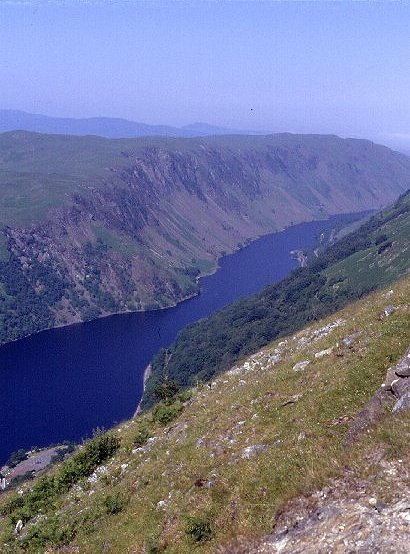
Loch Awe
Loch Awe (Scottish Gaelic: Loch Obha; also sometimes anglicised as Lochawe, Lochaw, or Lochow) is a large body of freshwater in Argyll and Bute, Scottish...
Battle of Red Ford
The Battle of Red Ford or Battle of the String of Lorne was a battle in 1294 or else after September 1296 between Clan Campbell and Clan MacDougall in...

Beochlich
Beochlich (the Living Stone) is the name of a hydro electric project (taken from the burn of the same name) to the south-east of Loch Awe, and 9 km north...
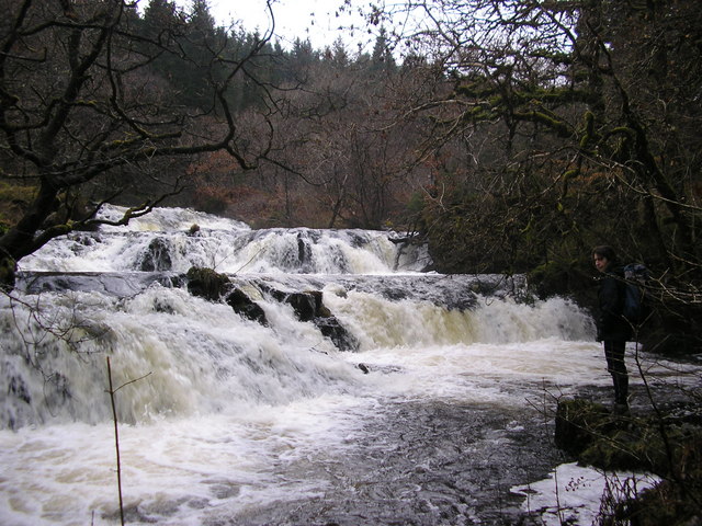
Avich Falls
Avich Falls near Dalavich in Argyll and Bute is a waterfall in Scotland.The River Avich flows about 1 mile (1.6 km) down the steep glacial valley of Loch...
Have you been to Rubha Gainmheine?
Leave your review of Rubha Gainmheine below (or comments, questions and feedback).