Àird na h-Eibhe

Landscape Feature in Ross-shire

Scotland

Àird na h-Eibhe

NC500 The A832 runs 127 miles from the Black Isle to Braemore Junction <a href="https://www.geograph.org.uk/photo/7232275">NH2077 : Braemore Junction</a>.
<span class="nowrap"><a title="https://www.sabre-roads.org.uk/wiki/index.php?title=A832" rel="nofollow ugc noopener" href="https://www.sabre-roads.org.uk/wiki/index.php?title=A832">Link</a><img style="margin-left:2px;" alt="External link" title="External link - shift click to open in new window" src="https://s1.geograph.org.uk/img/external.png" width="10" height="10"/></span>
NC500 Credit: N Chadwick

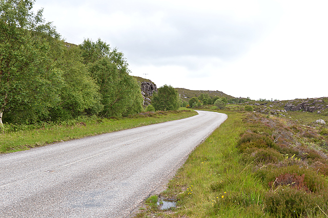
Àird na h-Eibhe is a landscape feature located in Ross-shire, Scotland. It is situated on the western coast of the Highlands, overlooking the North Atlantic Ocean. The name Àird na h-Eibhe translates to "Headland of the Birds" in English, which is a fitting name for this picturesque location.

The landscape of Àird na h-Eibhe is characterized by rugged cliffs that rise steeply from the sea, providing stunning views of the surrounding area. These cliffs are composed of ancient rock formations, showcasing the geological history of the region. The area is also known for its diverse wildlife, with numerous species of birds making their nests on the cliffs, including puffins, guillemots, and razorbills.

In addition to the cliffs, Àird na h-Eibhe features a sandy beach that stretches along the coastline. This beach is a popular spot for visitors to relax, take walks, and enjoy the natural beauty of the area. The crystal-clear waters of the Atlantic Ocean provide opportunities for swimming, snorkeling, and other water activities.

The landscape of Àird na h-Eibhe is largely untouched by human development, preserving its natural beauty and charm. Visitors can explore the area by hiking along the coastal trails, which offer breathtaking views of the ocean and surrounding landscapes. The tranquility and serenity of Àird na h-Eibhe make it an ideal destination for nature lovers and those seeking a peaceful escape from the hustle and bustle of everyday life.

If you have any feedback on the listing, please let us know in the comments section below.

Àird na h-Eibhe Images

Images are sourced within 2km of 57.678553/-5.4496031 or Grid Reference NG9470. Thanks to Geograph Open Source API. All images are credited.

NC500 The A832 runs 127 miles from the Black Isle to Braemore Junction <a href="https://www.geograph.org.uk/photo/7232275">NH2077 : Braemore Junction</a>.
<span class="nowrap"><a title="https://www.sabre-roads.org.uk/wiki/index.php?title=A832" rel="nofollow ugc noopener" href="https://www.sabre-roads.org.uk/wiki/index.php?title=A832">Link</a><img style="margin-left:2px;" alt="External link" title="External link - shift click to open in new window" src="https://s1.geograph.org.uk/img/external.png" width="10" height="10"/></span>
NC500
The A832 runs 127 miles from the Black Isle to Braemore Junction NH2077 : Braemore Junction. LinkExternal link
A832 The A832 runs 127 miles from the Black Isle to Braemore Junction <a href="https://www.geograph.org.uk/photo/7232275">NH2077 : Braemore Junction</a>.
<span class="nowrap"><a title="https://www.sabre-roads.org.uk/wiki/index.php?title=A832" rel="nofollow ugc noopener" href="https://www.sabre-roads.org.uk/wiki/index.php?title=A832">Link</a><img style="margin-left:2px;" alt="External link" title="External link - shift click to open in new window" src="https://s1.geograph.org.uk/img/external.png" width="10" height="10"/></span>
A832
The A832 runs 127 miles from the Black Isle to Braemore Junction NH2077 : Braemore Junction. LinkExternal link
Letterewe Pier
Letterewe Pier
Ob gorm on Loch Maree Watson speaks of Ob gorm mor and beag, big and little green bay.
Ob gorm on Loch Maree
Watson speaks of Ob gorm mor and beag, big and little green bay.
Rocks at shore of Loch Maree Sandstone rocks at the edge of Loch Maree in the foreground; fresh, late spring snow on Slioch in the distance.
Rocks at shore of Loch Maree
Sandstone rocks at the edge of Loch Maree in the foreground; fresh, late spring snow on Slioch in the distance.
Road to the pier at Loch Maree The pier is used for access by boat to Letterewe House across the loch.
Road to the pier at Loch Maree
The pier is used for access by boat to Letterewe House across the loch.
The shore at Loch Maree
Loch Maree with Eilean Ghrùididh
Crags by Loch Maree
Crags by Loch Maree
Cliffs above a gulley This square is next north to <a href="https://www.geograph.org.uk/photo/3498152">NG9367 : Sandstone pavements</a>, which we claimed on a walk over Beinn a’Chearcaill in 2013, but it is a step too far from that walk. In fact, it is only about 500m from the main road along Loch Maree, and a quick yomp up the hillside claimed it.  The cliff (Torridonian sandstone) across the gully is named as An Cearcaill on the 1:25000 sheet. Up behind it in the square is Loch na Teangaich Fhiadhaich – wouldn’t it be good to get a photo of that! -- And in January 2023 that is just what Pete Lynn did <a href="https://www.geograph.org.uk/photo/7387368">NG9368 : Loch na Teangaidh Fhiadhaich</a> -- congratulations!
Cliffs above a gulley
This square is next north to NG9367 : Sandstone pavements, which we claimed on a walk over Beinn a’Chearcaill in 2013, but it is a step too far from that walk. In fact, it is only about 500m from the main road along Loch Maree, and a quick yomp up the hillside claimed it. The cliff (Torridonian sandstone) across the gully is named as An Cearcaill on the 1:25000 sheet. Up behind it in the square is Loch na Teangaich Fhiadhaich – wouldn’t it be good to get a photo of that! -- And in January 2023 that is just what Pete Lynn did NG9368 : Loch na Teangaidh Fhiadhaich -- congratulations!
Rough territory by Loch Maree Typical of what's found if not on road or path.
Rough territory by Loch Maree
Typical of what's found if not on road or path.
Stony ground by the A832 With Loch Maree in the middle distance, and Beinn Làir climbing off to the left.
Stony ground by the A832
With Loch Maree in the middle distance, and Beinn Làir climbing off to the left.
The A832 near Ob nan Muc (bay)
Loch Maree and Slioch
View across Loch Maree to Beinn Làir, in October A time of year for stunning colours. Rugged though this side of Beinn Làir is, the other side caps it, consisting of an unbroken line of crags some 4km long, and reaching 1500' in height.
View across Loch Maree to Beinn Làir, in October
A time of year for stunning colours. Rugged though this side of Beinn Làir is, the other side caps it, consisting of an unbroken line of crags some 4km long, and reaching 1500' in height.
Show me another place!

Àird na h-Eibhe is located at Grid Ref: NG9470 (Lat: 57.678553, Lng: -5.4496031)

Unitary Authority: Highland

Police Authority: Highlands and Islands

What 3 Words

///slanting.fans.agent. Near Kinlochewe, Highland

Related Wikis

Letterewe

Letterewe is a large estate of several tens of thousands of acres on the north-eastern shore of Loch Maree, South-East of Poolewe, in Wester Ross, Scotland...

Loch Maree

Loch Maree (Scottish Gaelic: Loch Ma-ruibhe) is a loch in Wester Ross in the Northwest Highlands of Scotland. At 21.7 km (13.46 mi) long and with a maximum...

Eilean Sùbhainn

Eilean Sùbhainn is the largest of several small islands in Loch Maree, Wester Ross, Scotland. It is the second largest freshwater island in Scotland after...

Talladale

Talladale is a village on the southwestern shore of Loch Maree in Ross-shire, Scottish Highlands and is in the Scottish council area of Highland. Talladale...

Nearby Amenities

Located within 500m of 57.678553,-5.4496031
Ploc Aird na h-Eibhe
Place: locality
Lat/Long: 57.6788809/-5.4540925
Power: pole
Lat/Long: 57.6758916/-5.4559258
Power: pole
Lat/Long: 57.6763059/-5.4549285
Power: pole
Lat/Long: 57.6767002/-5.4540365
Power: pole
Lat/Long: 57.6770319/-5.4532241
Power: pole
Lat/Long: 57.6775527/-5.4524165
Power: pole
Lat/Long: 57.6780859/-5.4516135
Power: pole
Lat/Long: 57.6786166/-5.45078
Power: pole
Lat/Long: 57.6791273/-5.4500004
The data included in this document is from www.openstreetmap.org. The data is made available under ODbL.

Have you been to Àird na h-Eibhe?

Leave your review of Àird na h-Eibhe below (or comments, questions and feedback).