Aird na Ban-fhàidhe

Landscape Feature in Ross-shire

Scotland

Aird na Ban-fhàidhe

South over Loch Kernsary The end of a long day's walk towards Carnmore leaving Loch Kernsary behind on the way back to Poolewe. Looking towards the mountains of Torridon.
South over Loch Kernsary Credit: Julian Paren

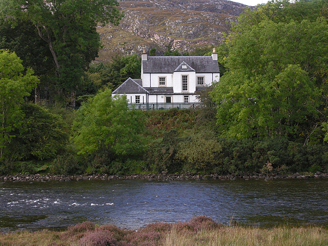
Aird na Ban-fhàidhe, located in Ross-shire, Scotland, is a prominent landscape feature that captivates visitors with its stunning natural beauty. Situated on the west coast of Scotland, this coastal headland offers breathtaking views of the surrounding landscape and the vast Atlantic Ocean.

The name "Aird na Ban-fhàidhe" translates to "Headland of the Prophetess" in English, which adds a sense of mystery and intrigue to the site. The headland is characterized by its rugged cliffs, which rise dramatically from the sea, creating a dramatic and awe-inspiring sight.

The area is abundant in diverse wildlife, including various seabirds, dolphins, and seals, which can often be spotted frolicking in the surrounding waters. The headland is also known for its rich marine life, making it a popular spot for fishing enthusiasts.

Visitors to Aird na Ban-fhàidhe can explore the many walking trails that wind through the headland, offering breathtaking panoramic views of the coastline and the nearby mountains. The area is also home to several archaeological sites, including ancient burial mounds and ruins, providing a glimpse into the region's rich history.

Aird na Ban-fhàidhe is a place of natural beauty, tranquility, and historical significance, attracting nature lovers, photographers, and history enthusiasts alike. Whether one is seeking a peaceful retreat or an adventure-filled exploration, this landscape feature offers a memorable experience that showcases the raw and untamed beauty of the Scottish coast.

If you have any feedback on the listing, please let us know in the comments section below.

Aird na Ban-fhàidhe Images

Images are sourced within 2km of 57.746432/-5.586302 or Grid Reference NG8678. Thanks to Geograph Open Source API. All images are credited.

South over Loch Kernsary The end of a long day's walk towards Carnmore leaving Loch Kernsary behind on the way back to Poolewe. Looking towards the mountains of Torridon.
South over Loch Kernsary
The end of a long day's walk towards Carnmore leaving Loch Kernsary behind on the way back to Poolewe. Looking towards the mountains of Torridon.
On the Loch Kernsary circuit Showing Loch Kernsary itself with its crannog to the left.  The central peaks in the distance are Beinn Airigh Charr (791m) and to the right the Munro, Slioch (980m).
On the Loch Kernsary circuit
Showing Loch Kernsary itself with its crannog to the left. The central peaks in the distance are Beinn Airigh Charr (791m) and to the right the Munro, Slioch (980m).
The River Ewe near Poolewe
Loch Kernsary from path below Meall an Leathaid Dharaich Loch Kernsary is viewed to the south from a path on its northern side; the very rocky but relatively low mountain, Creag Mhor Thollaidh, is seen distantly.
Loch Kernsary from path below Meall an Leathaid Dharaich
Loch Kernsary is viewed to the south from a path on its northern side; the very rocky but relatively low mountain, Creag Mhor Thollaidh, is seen distantly.
Road by the River Ewe
Fishing weirs on the River Ewe The Ewe is renowned for the variety of its salmon and sea trout fishing, even though the river is only 2 miles long, providing the link between Loch Maree and the sea.
Fishing weirs on the River Ewe
The Ewe is renowned for the variety of its salmon and sea trout fishing, even though the river is only 2 miles long, providing the link between Loch Maree and the sea.
Looking down the River Ewe
House overlooking the River Ewe With a commanding view.
House overlooking the River Ewe
With a commanding view.
River Ewe
River Ewe
River Ewe
River Ewe
Weirs and breakwaters in the Ewe From much of the track that runs generally southwards towards Kernsary, the view looks out across the attractive River Ewe. The weirs have been installed to break up the flow of the river and provide resting pools for the fish (salmon & sea trout) on migration.
Weirs and breakwaters in the Ewe
From much of the track that runs generally southwards towards Kernsary, the view looks out across the attractive River Ewe. The weirs have been installed to break up the flow of the river and provide resting pools for the fish (salmon & sea trout) on migration.
Upstream view on the Ewe Looking up the short River Ewe towards the rather prominent Creag Mhòr Thollaidh at 343m.
Upstream view on the Ewe
Looking up the short River Ewe towards the rather prominent Creag Mhòr Thollaidh at 343m.
On the road to Kernsary Undertaking a quick time-and-map check on the ride in towards Kernsary. This first part of the road is metalled, but that peters out in <a href="https://www.geograph.org.uk/gridref/NG8778">NG8778</a> near the house at Inveran.
On the road to Kernsary
Undertaking a quick time-and-map check on the ride in towards Kernsary. This first part of the road is metalled, but that peters out in NG8778 near the house at Inveran.
Shore near Poolewe A fairly substantial croft house beside the track to Kernsary, near the banks of the River Ewe.
Shore near Poolewe
A fairly substantial croft house beside the track to Kernsary, near the banks of the River Ewe.
View towards Loch Maree From the start of the Slattadale path. Beinn Airigh Charr is the mountain in the centre, one of the few tops not in cloud on this dullish but dry day.
View towards Loch Maree
From the start of the Slattadale path. Beinn Airigh Charr is the mountain in the centre, one of the few tops not in cloud on this dullish but dry day.
The view towards Tollie Farm and Loch Maree Taken from a layby on the A832.
The view towards Tollie Farm and Loch Maree
Taken from a layby on the A832.
Tollie Farm With Loch Maree in the distance.
Tollie Farm
With Loch Maree in the distance.
Loch Tollaidh There's a small fish farm in the loch.
Loch Tollaidh
There's a small fish farm in the loch.
Show me another place!

Aird na Ban-fhàidhe is located at Grid Ref: NG8678 (Lat: 57.746432, Lng: -5.586302)

Unitary Authority: Highland

Police Authority: Highlands and Islands

What 3 Words

///hiker.turns.update. Near Gairloch, Highland

Nearby Locations

Aird na Ban-fhàidhe

Related Wikis

Poolewe

Poolewe (Scottish Gaelic: Poll Iù) is a small village in Wester Ross in the North West Highlands of Scotland, about 75 miles (120 kilometres) northwest...

Poolewe Stone

The Poolewe Stone is a Class-I Pictish stone discovered in 1992 in the cemetery at Poolewe (Poll Iùbh) in Wester Ross. The stone carries the common Pictish...

Londubh

Londubh (Scottish Gaelic: An Lòn Dubh) is a village on the south shore of Loch Ewe in Poolewe, Ross-shire, Scottish Highlands and is in the Scottish council...

Inverewe Garden

Inverewe Garden (Scottish Gaelic: Gàradh Inbhir Iù) is a botanical garden in Wester Ross in the Scottish Highlands. It is located just to the north of...

Nearby Amenities

Located within 500m of 57.746432,-5.586302
Power: pole
Lat/Long: 57.7467575/-5.5868463
Power: pole
Lat/Long: 57.7470843/-5.5883042
Power: pole
Lat/Long: 57.7474167/-5.5898327
Power: pole
Lat/Long: 57.7478078/-5.590152
Power: pole
Lat/Long: 57.7482199/-5.590487
Power: pole
Lat/Long: 57.7486123/-5.5909529
Power: pole
Lat/Long: 57.7491291/-5.5915863
Power: pole
Lat/Long: 57.7462868/-5.5857339
Power: pole
Lat/Long: 57.7476311/-5.5789223
Power: pole
Lat/Long: 57.7469328/-5.5798332
Power: pole
Lat/Long: 57.74655/-5.5803121
Power: pole
Lat/Long: 57.7456729/-5.5813486
Tollie Farm
Name Gd: Tollaidh
Place: isolated_dwelling
Lat/Long: 57.7463001/-5.5899501
The data included in this document is from www.openstreetmap.org. The data is made available under ODbL.

Have you been to Aird na Ban-fhàidhe?

Leave your review of Aird na Ban-fhàidhe below (or comments, questions and feedback).