Àird Ghlas

Landscape Feature in Inverness-shire

Scotland

Àird Ghlas

Remote settlement This settlement was probably for summer use only. There is a good supply of stream water and plenty of grazing available. Several ruins were here including shielings and walls. The big scale OS map shows these clearly.
Remote settlement Credit: Graham Cole

Àird Ghlas is a prominent landscape feature located in Inverness-shire, Scotland. Situated in the western part of the county, it is known for its stunning natural beauty and diverse ecosystem. The name Àird Ghlas translates to "green height" in English, which aptly describes the verdant character of the area.

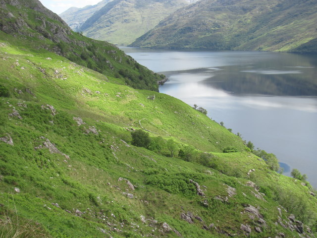
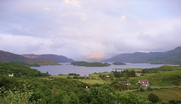
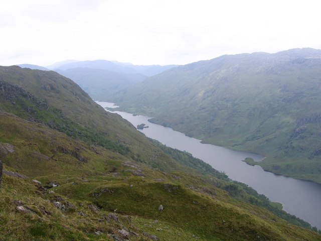
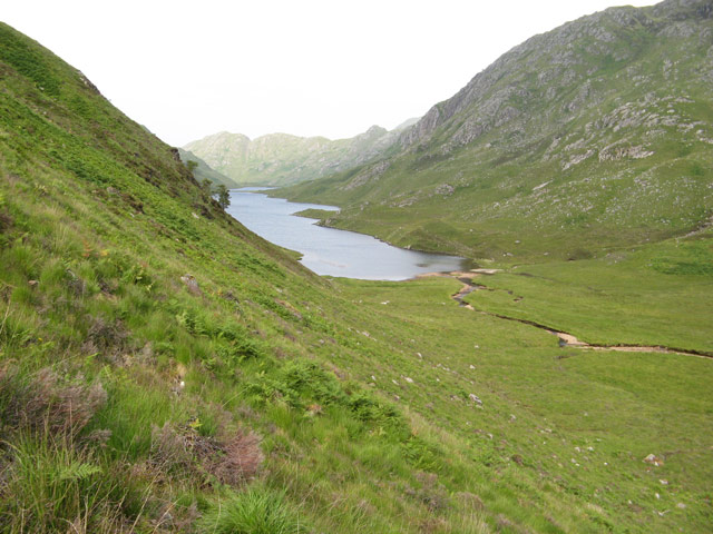
The landscape of Àird Ghlas is characterized by rolling hills and lush green meadows. The terrain is predominantly hilly, with several peaks scattered throughout the region. The highest point in Àird Ghlas reaches an elevation of approximately 1,000 meters, offering breathtaking panoramic views of the surrounding countryside.

One of the notable features of Àird Ghlas is its rich biodiversity. The area is home to a wide variety of plant and animal species, making it a popular destination for nature enthusiasts and wildlife lovers. Dense forests of oak, birch, and pine trees cover the slopes, providing a habitat for numerous bird species, including golden eagles and red kites. Additionally, the meadows are adorned with colorful wildflowers during the spring and summer months.

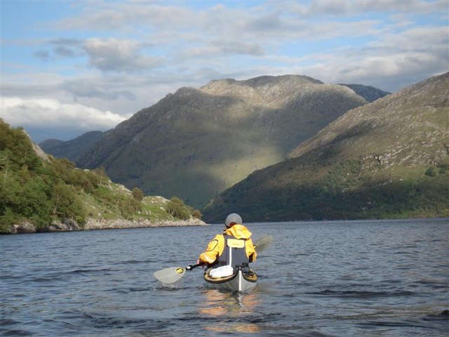
The landscape of Àird Ghlas also boasts several freshwater lochs and rivers that meander through the valleys and hillsides. These water bodies provide a habitat for various fish species, such as trout and salmon, attracting anglers from far and wide.

Overall, Àird Ghlas is a picturesque landscape feature in Inverness-shire, offering a harmonious blend of rolling hills, lush greenery, and diverse wildlife. It is a destination that showcases the natural beauty and serenity of the Scottish countryside.

If you have any feedback on the listing, please let us know in the comments section below.

Àird Ghlas Images

Images are sourced within 2km of 56.943648/-5.6126814 or Grid Reference NM8089. Thanks to Geograph Open Source API. All images are credited.

Remote settlement This settlement was probably for summer use only. There is a good supply of stream water and plenty of grazing available. Several ruins were here including shielings and walls. The big scale OS map shows these clearly.
Remote settlement
This settlement was probably for summer use only. There is a good supply of stream water and plenty of grazing available. Several ruins were here including shielings and walls. The big scale OS map shows these clearly.
Steep terrain The Loch is the deepest of all freshwater lochs and the steep sides are a clue to this fact. There was no Geograph for this square until 2017 and for a good reason; the terrain is difficult to cross with no paths except those made by deer.
Steep terrain
The Loch is the deepest of all freshwater lochs and the steep sides are a clue to this fact. There was no Geograph for this square until 2017 and for a good reason; the terrain is difficult to cross with no paths except those made by deer.
Stream providing water to a former settlement Whoever lived at the ruined settlement here would have used this stream for water in preference to scrambling steeply down to the loch.
Stream providing water to a former settlement
Whoever lived at the ruined settlement here would have used this stream for water in preference to scrambling steeply down to the loch.
A shieling; farming settlement This was one of several ruins here and is probably the main dwelling of a summer farmstead, known as a shieling in Scotland.
A shieling; farming settlement
This was one of several ruins here and is probably the main dwelling of a summer farmstead, known as a shieling in Scotland.
A stream giving shelter for trees The streams on this mountainside were invariably host to trees whereas the surrounding areas were mostly without trees.
A stream giving shelter for trees
The streams on this mountainside were invariably host to trees whereas the surrounding areas were mostly without trees.
Overview of old shielings This may have been a productive place for farming but the access was difficult. By land the going was very tough and arriving by water entailed a steep climb up the mountainside.
Overview of old shielings
This may have been a productive place for farming but the access was difficult. By land the going was very tough and arriving by water entailed a steep climb up the mountainside.
Home for a fox? This area would not have much food for a fox to find but the hole seemed about the right size for this rather than rabbits.
Home for a fox?
This area would not have much food for a fox to find but the hole seemed about the right size for this rather than rabbits.
Aird Ghlas from Loch Morar
Allt an Aird Ghlas from Loch Morar
Druim a' Chuirn from Loch Morar
Loch Morar, headland below Sron Mhor This headland is about the only piece of land in this grid square- 500m to the right Loch Morar drops to a depth of over 250m. The prominent hill in the background is An Stac.
Loch Morar, headland below Sron Mhor
This headland is about the only piece of land in this grid square- 500m to the right Loch Morar drops to a depth of over 250m. The prominent hill in the background is An Stac.
Loch Morar, south shore The hill in the background slopes down to Tarbet
Loch Morar, south shore
The hill in the background slopes down to Tarbet
View from Druim a' Chuirn ridge Superb view across Loch Morar, Loch Nevis to Skye.
View from Druim a' Chuirn ridge
Superb view across Loch Morar, Loch Nevis to Skye.
The Allt Slaite Coire Near the top of a good path that leads up from Meoble. The path can just be made out on the right hand bank of the stream.
The Allt Slaite Coire
Near the top of a good path that leads up from Meoble. The path can just be made out on the right hand bank of the stream.
Slaite Coire View from Druim a'Chuirn of the Allt Slaite Coire meandering on a flatter section of Slaite Coire. The hill beyond is the Graham, Meith Bheinn.
Slaite Coire
View from Druim a'Chuirn of the Allt Slaite Coire meandering on a flatter section of Slaite Coire. The hill beyond is the Graham, Meith Bheinn.
Slopes of Druim a'Chuirn View of Slaite Coire with Druim a'Chuirn to the left.
Slopes of Druim a'Chuirn
View of Slaite Coire with Druim a'Chuirn to the left.
Waterfall on the Allt Slaite Coire
Allt Slaite Coire
Allt Slaite Coire
Show me another place!

Àird Ghlas is located at Grid Ref: NM8089 (Lat: 56.943648, Lng: -5.6126814)

Unitary Authority: Highland

Police Authority: Highlands and Islands

What 3 Words

///overtones.dreading.callers. Near Arisaig, Highland

Nearby Locations

Àird Ghlas

Related Wikis

Tarbet, Loch Nevis

Tarbet (Scottish Gaelic: An Tairbeart or Tairbeart Loch Nibheis) is a place on the south shore of Loch Nevis in Scotland, about 6 miles (10 kilometres...

Loch Morar

Loch Morar (Scottish Gaelic: Loch Mòrair) is a freshwater loch in Lochaber, Highland, Scotland. It is the fifth-largest loch by surface area in Scotland...

Loch Beoraid

Loch Beoraid is a long linear narrow and deepwater freshwater loch, orientated on west to east axis, that is located 8.5 miles east of Arisaig, in South...

Loch na Creige Duibhe (Lochaber)

Loch na Creige Duibhe is a small freshwater loch in South Morar, Lochaber, in the West Highlands of Scotland. It is orientated east to west and drains...

Have you been to Àird Ghlas?

Leave your review of Àird Ghlas below (or comments, questions and feedback).