Sròn na Croiche

Landscape Feature in Argyllshire

Scotland

Sròn na Croiche

Trees of Salen Forest There's been clear-felling of the conifers of Salen Forest; the area in view is named on OS maps as  Doire Daraich
The hill in the distance is Beinn Mheadan.
Trees of Salen Forest Credit: Trevor Littlewood

Sròn na Croiche is a prominent landscape feature located in Argyllshire, Scotland. Translated from Gaelic, Sròn na Croiche means "Nose of the Gallows," which hints at the historical significance of this site.

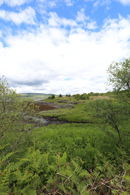
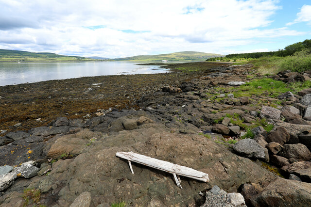
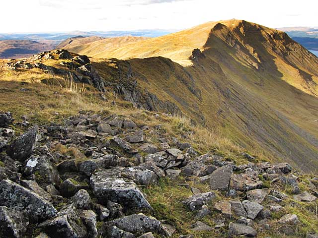
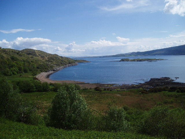
Situated on the western coast of Scotland, Sròn na Croiche is a striking headland that juts out into the Atlantic Ocean. Its dramatic cliffs, reaching heights of up to 200 meters, are a sight to behold and offer breathtaking panoramic views of the surrounding coastal scenery. The headland is characterized by rugged terrain, with rocky outcrops and steep slopes leading down to the sea.

The geological formation of Sròn na Croiche is primarily composed of Lewisian gneiss, a metamorphic rock that dates back over a billion years. This ancient rock provides a solid foundation for the headland and contributes to its impressive appearance.

In addition to its natural beauty, Sròn na Croiche holds historical significance. The name "Nose of the Gallows" refers to a gallows that was once located at the site, where public executions took place in the past. This dark history adds an intriguing layer to the headland's identity.

Today, Sròn na Croiche attracts visitors from near and far who come to appreciate its stunning landscapes, engage in coastal activities such as hiking and birdwatching, and explore the area's rich history. It stands as a testament to the awe-inspiring natural and cultural heritage of Argyllshire.

If you have any feedback on the listing, please let us know in the comments section below.

Sròn na Croiche Images

Images are sourced within 2km of 56.501093/-5.7923694 or Grid Reference NM6640. Thanks to Geograph Open Source API. All images are credited.

Trees of Salen Forest There's been clear-felling of the conifers of Salen Forest; the area in view is named on OS maps as  Doire Daraich
The hill in the distance is Beinn Mheadan.
Trees of Salen Forest
There's been clear-felling of the conifers of Salen Forest; the area in view is named on OS maps as Doire Daraich The hill in the distance is Beinn Mheadan.
Allt Airigh nan Stang Rising from the slopes of Beinn Chreagach
Allt Airigh nan Stang
Rising from the slopes of Beinn Chreagach
Fishnish ferry slip It was being used by another vessel while the ferry was over at Loch Aline.
Fishnish ferry slip
It was being used by another vessel while the ferry was over at Loch Aline.
Forest track, Cnoc nam Fòid
Time out waiting for the Mull ferry Whilst people in camper vans who just missed the ferry to Lochaline seemed mainly to sit in the queue, those in smaller cars seemed more drawn to the picnic area just along the forest track. Such places often have a height barrier to deter overnight camping, though I didn't notice one here - the restriction to small vehicles seemed entirely voluntary in the middle of the day.
Time out waiting for the Mull ferry
Whilst people in camper vans who just missed the ferry to Lochaline seemed mainly to sit in the queue, those in smaller cars seemed more drawn to the picnic area just along the forest track. Such places often have a height barrier to deter overnight camping, though I didn't notice one here - the restriction to small vehicles seemed entirely voluntary in the middle of the day.
Looking across Sgeir Mhòr to the Sound of Mull
Fishnish Ferry Terminal Across the Sound of Mull to Lochaline
Fishnish Ferry Terminal
Across the Sound of Mull to Lochaline
Allt Achadh na Moine View from burn facing towards Garmony Point
Allt Achadh na Moine
View from burn facing towards Garmony Point
Waterfall on Allt Achadh na Mòine Small Waterfall on the Allt Achadh na Mòine, where it enters the forestry plantation
Waterfall on Allt Achadh na Mòine
Small Waterfall on the Allt Achadh na Mòine, where it enters the forestry plantation
Allt Achadh na Mòine The Allt Achadh na Mòine immediately downstream of the forestry track bridge
Allt Achadh na Mòine
The Allt Achadh na Mòine immediately downstream of the forestry track bridge
Forestry clearing at Allt Achadh na Mòine A clearing in the forestry plantation at the Allt Achadh na Mòine, with the Sound of Mull and Loch Aline visible in the background
Forestry clearing at Allt Achadh na Mòine
A clearing in the forestry plantation at the Allt Achadh na Mòine, with the Sound of Mull and Loch Aline visible in the background
Port an t-Sluic From Fishnish ferry. The end of this part of the Stevenson Way.
Port an t-Sluic
From Fishnish ferry. The end of this part of the Stevenson Way.
MV Lochinvar departing Fishnish
Craignure left, Salen right
Mull rugby club
Mull rugby club
Trig point at Rubha Leth Thorcaill Fishnish
House at Balmeanach, Mull
Car park entrance at Dun Earba
Show me another place!

Sròn na Croiche is located at Grid Ref: NM6640 (Lat: 56.501093, Lng: -5.7923694)

Unitary Authority: Argyll and Bute

Police Authority: Argyll and West Dunbartonshire

What 3 Words

///overnight.soaps.goodness. Near Lochaline, Highland

Nearby Locations

Sròn na Croiche

Related Wikis

Fishnish

Fishnish (Scottish Gaelic: Finnsinis) is a ferry terminal on the Isle of Mull, roughly halfway between Tobermory and Craignure. It is owned and operated...

Ardtornish Castle

Ardtornish Castle is situated in the grounds of the Ardtornish estate in Morvern, on the west coast of Scotland. It stands at the seaward end of a promontory...

Ardtornish Bay

Ardtornish Bay is coastal embayment, on a chord of 0.89 miles, on a 161° orientation, in the Morvern peninsula in Lochaber, in the western coast of Scotland...

Lochaline

Lochaline (Scottish Gaelic: Loch Àlainn) is the main village in the Morvern area of Highland, Scotland. The coastal village is situated at the mouth of...

Dùn da Ghaoithe

Dùn da Ghaoithe (Scottish Gaelic: Dùn da Ghaoithe, meaning "fort of the two winds") is the second highest mountain on the Isle of Mull, western Scotland...

Lochaline Mine

Lochaline Mine is a mine on the Morvern peninsula of the Highland area of Scotland. The mine works a white cretaceous sandstone to produce high grade silica...

Mull and Iona Community Hospital

Mull and Iona Community Hospital is a community hospital in Java Road, Craignure, Scotland. It is managed by NHS Highland. == History == The facility was...

Inninmore Bay

Inninmore Bay is a small shallow coastal embayment, on a chord of 1.74 miles, on a 215° orientation, in the Morvern peninsula in Lochaber, in the western...

Nearby Amenities

Located within 500m of 56.501093,-5.7923694
Garmony
Place: locality
Source: OpenData Streetview
Lat/Long: 56.4975927/-5.7881801
Power: pole
Lat/Long: 56.5049254/-5.7914391
Power: pole
Lat/Long: 56.5038937/-5.7889286
Power: pole
Lat/Long: 56.5035029/-5.7872602
Power: pole
Lat/Long: 56.5028901/-5.7857394
Power: pole
Lat/Long: 56.5051741/-5.7926676
Power: pole
Lat/Long: 56.5052303/-5.795103
The data included in this document is from www.openstreetmap.org. The data is made available under ODbL.

Have you been to Sròn na Croiche?

Leave your review of Sròn na Croiche below (or comments, questions and feedback).