Àird Thorr Innse

Landscape Feature in Argyllshire

Scotland

Àird Thorr Innse

Heading north on Gigha A view of the 'main road' heading north on Gigha, from a small hillock by Tarbert Farm.

This photograph was taken during the Coronavirus (COVID-19) pandemic of 2020/21.
Heading north on Gigha Credit: James T M Towill

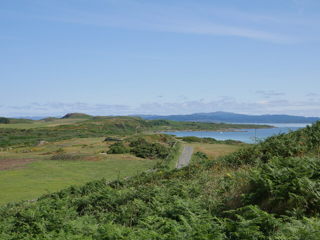
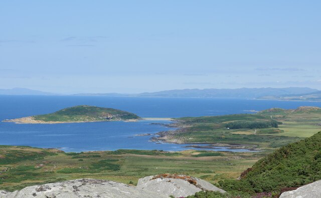
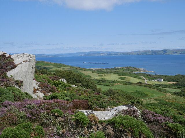
Àird Thorr Innse, located in Argyllshire, is a prominent landscape feature that showcases the natural beauty of the region. Situated on the western coast of Scotland, this scenic headland offers breathtaking views of the surrounding area.

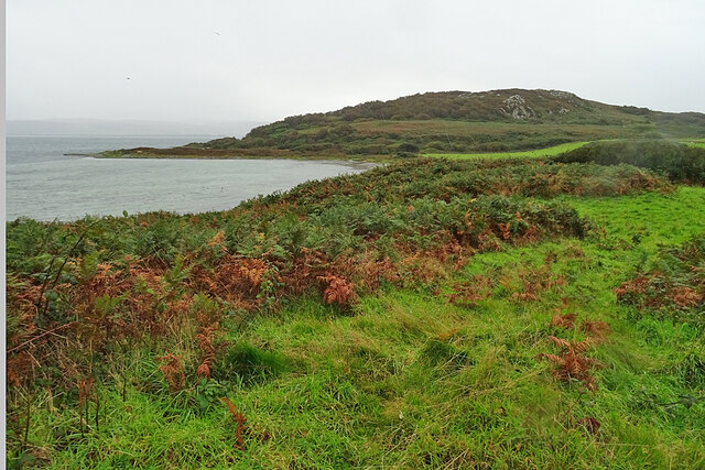
At Àird Thorr Innse, visitors are greeted by towering cliffs that overlook the sea, providing a dramatic backdrop to the landscape. These cliffs are composed of ancient rock formations, displaying intricate layers that tell the story of the area's geological history.

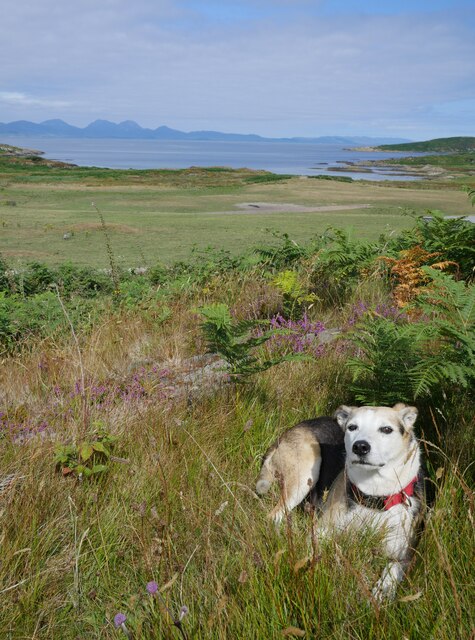
The headland is also home to a diverse range of flora and fauna, making it an ideal spot for nature enthusiasts. Seabirds can be seen nesting among the cliffs, including guillemots, puffins, and kittiwakes. The surrounding waters are teeming with marine life, with seals and dolphins often spotted swimming offshore.

The rugged coastline of Àird Thorr Innse is dotted with small, secluded beaches, offering visitors the chance to relax and enjoy the tranquility of the area. The sandy shores provide a stark contrast to the imposing cliffs, creating a picturesque and serene atmosphere.

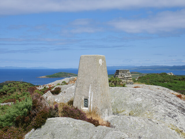
For those seeking adventure, Àird Thorr Innse also offers excellent opportunities for hiking and exploring. There are several walking trails that wind through the headland, providing breathtaking views and glimpses of the area's unique flora and fauna.

Overall, Àird Thorr Innse in Argyllshire is a stunning landscape feature that showcases the raw beauty of Scotland's western coast. With its towering cliffs, diverse wildlife, and peaceful beaches, it is a must-visit destination for nature lovers and outdoor enthusiasts alike.

If you have any feedback on the listing, please let us know in the comments section below.

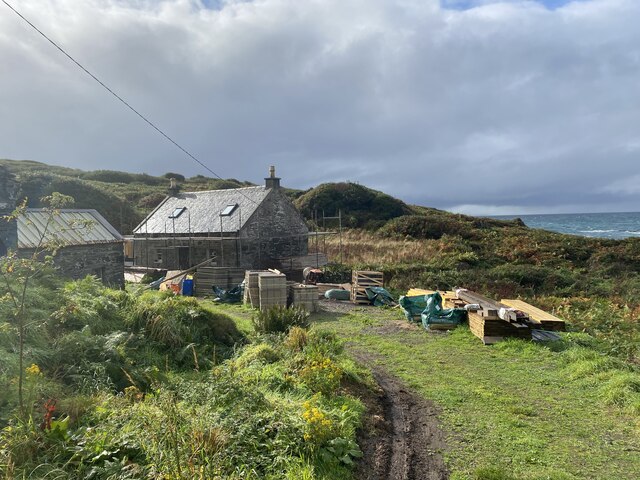
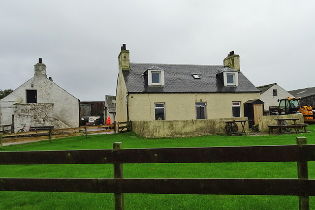
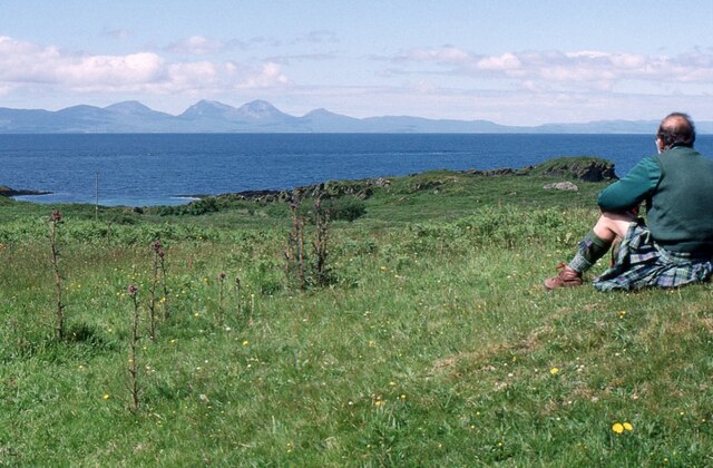
Àird Thorr Innse Images

Images are sourced within 2km of 55.708161/-5.7456064 or Grid Reference NR6452. Thanks to Geograph Open Source API. All images are credited.

Heading north on Gigha A view of the 'main road' heading north on Gigha, from a small hillock by Tarbert Farm.

This photograph was taken during the Coronavirus (COVID-19) pandemic of 2020/21.
Heading north on Gigha
A view of the 'main road' heading north on Gigha, from a small hillock by Tarbert Farm. This photograph was taken during the Coronavirus (COVID-19) pandemic of 2020/21.
'Bennie' near Tarbert Farm Upon cycling past Tarbert Farm, 'Bennie' came rushing out of the yard and followed us to where we sat overlooking the north of the island and Jura from a nearby rocky hillock.  Quite content, 'Bennie' spent about an hour with us, seemingly benefiting from the shade as he sat at our feet!  Tarbert Farm, trading as 'Wee Isle Dairy', produces wonderful whole milk and artisan ice cream - see <span class="nowrap"><a title="http://www.gigha.org.uk/Wee-Isle-Dairy" rel="nofollow ugc noopener" href="http://www.gigha.org.uk/Wee-Isle-Dairy">Link</a><img style="margin-left:2px;" alt="External link" title="External link - shift click to open in new window" src="https://s1.geograph.org.uk/img/external.png" width="10" height="10"/></span> for further information.

This photograph was taken during the Coronavirus (COVID-19) pandemic of 2020/21.
'Bennie' near Tarbert Farm
Upon cycling past Tarbert Farm, 'Bennie' came rushing out of the yard and followed us to where we sat overlooking the north of the island and Jura from a nearby rocky hillock. Quite content, 'Bennie' spent about an hour with us, seemingly benefiting from the shade as he sat at our feet! Tarbert Farm, trading as 'Wee Isle Dairy', produces wonderful whole milk and artisan ice cream - see LinkExternal link for further information. This photograph was taken during the Coronavirus (COVID-19) pandemic of 2020/21.
Triangulation pillar and toposcope on Creag Bhàn The trig pillar on Creag Bhàn, the highest point on the Isle of Gigha, sits at 100 metres above sea level, with the summit being just one metre higher.  A toposcope can be seen to the right in the background.  Ben Cruachan could be noted far to the north, and the County Antrim coastline of Northern Ireland, to the south-west.  See <span class="nowrap"><a title="http://trigpointing.uk/trig/2555" rel="nofollow ugc noopener" href="http://trigpointing.uk/trig/2555">Link</a><img style="margin-left:2px;" alt="External link" title="External link - shift click to open in new window" src="https://s1.geograph.org.uk/img/external.png" width="10" height="10"/></span> for further details about this trig point.

This photograph was taken during the Coronavirus (COVID-19) pandemic of 2020/21.
Triangulation pillar and toposcope on Creag Bhàn
The trig pillar on Creag Bhàn, the highest point on the Isle of Gigha, sits at 100 metres above sea level, with the summit being just one metre higher. A toposcope can be seen to the right in the background. Ben Cruachan could be noted far to the north, and the County Antrim coastline of Northern Ireland, to the south-west. See LinkExternal link for further details about this trig point. This photograph was taken during the Coronavirus (COVID-19) pandemic of 2020/21.
Eilean Garbh from Creag Bhàn A telephoto shot of Eilean Garbh and its sandy tombolo as viewed from the summit of Creag Bhàn on a glorious early August afternoon.

This photograph was taken during the Coronavirus (COVID-19) pandemic of 2020/21.
Eilean Garbh from Creag Bhàn
A telephoto shot of Eilean Garbh and its sandy tombolo as viewed from the summit of Creag Bhàn on a glorious early August afternoon. This photograph was taken during the Coronavirus (COVID-19) pandemic of 2020/21.
Highfield and the eastern coastline of Gigha from Creag Bhàn A view of the eastern coastline of the Isle of Gigha as seen during the descent from Creag Bhàn.  Highfield is the small house to the right of shot.

This photograph was taken during the Coronavirus (COVID-19) pandemic of 2020/21.
Highfield and the eastern coastline of Gigha from Creag Bhàn
A view of the eastern coastline of the Isle of Gigha as seen during the descent from Creag Bhàn. Highfield is the small house to the right of shot. This photograph was taken during the Coronavirus (COVID-19) pandemic of 2020/21.
Descending Creag Bhàn The descent of Creag Bhàn offers a fine view over the south and west of the Isle of Gigha, and a distant Islay.  In this view, Ardailly can be noted, with the covered Gigha service reservoir below.  Mill Loch and High Loch can be noted to the left in the near and far distance, respectively.

This photograph was taken during the Coronavirus (COVID-19) pandemic of 2020/21.
Descending Creag Bhàn
The descent of Creag Bhàn offers a fine view over the south and west of the Isle of Gigha, and a distant Islay. In this view, Ardailly can be noted, with the covered Gigha service reservoir below. Mill Loch and High Loch can be noted to the left in the near and far distance, respectively. This photograph was taken during the Coronavirus (COVID-19) pandemic of 2020/21.
Ardailly Mill and miller's cottage At the far end of a long and winding track on the Isle of Gigha stands Ardailly  Mill. It's in an idyllic spot on Gigha's remote west shore, looking out to the neighbouring islands of Islay and Jura. In this photograph it is seen with building works under way, transforming the old millers cottage into someone's dream house.....
Ardailly Mill and miller's cottage
At the far end of a long and winding track on the Isle of Gigha stands Ardailly Mill. It's in an idyllic spot on Gigha's remote west shore, looking out to the neighbouring islands of Islay and Jura. In this photograph it is seen with building works under way, transforming the old millers cottage into someone's dream house.....
Roadside Dyke On a pleasant day it would be tempting to take a walk to the shore of Bàgh Rubha Ruaidh, of which there is just a glimpse over the top of the dyke.
Roadside Dyke
On a pleasant day it would be tempting to take a walk to the shore of Bàgh Rubha Ruaidh, of which there is just a glimpse over the top of the dyke.
Access Road in the Rain You can tell how wet it is by the drops on the lens, and the drips on the gate. It looks as if the old buildings here have been replaced by a new house, named Balmore.
Access Road in the Rain
You can tell how wet it is by the drops on the lens, and the drips on the gate. It looks as if the old buildings here have been replaced by a new house, named Balmore.
Carragh an Tarbert A distinctive standing stone beside the road at Tarbert on the Isle of Gigha. It is also known as the Druids' Stone, and A Thom, author of 'The standing stones in Argyllshire' and 'Megalithic lunar observatories', considers it to be a lunar obervatory dating from the 1st millennium BC.
Carragh an Tarbert
A distinctive standing stone beside the road at Tarbert on the Isle of Gigha. It is also known as the Druids' Stone, and A Thom, author of 'The standing stones in Argyllshire' and 'Megalithic lunar observatories', considers it to be a lunar obervatory dating from the 1st millennium BC.
East Tarbert Bay In the bay are an offshore fish farm. The ship seems to have been there for at least several days.
East Tarbert Bay
In the bay are an offshore fish farm. The ship seems to have been there for at least several days.
Looking over Tràigh Bhàn If the tide were not so high, the white sand that gives the beach its name would be visible here. The hummock is Cnoc Largie, in the next square.
Looking over Tràigh Bhàn
If the tide were not so high, the white sand that gives the beach its name would be visible here. The hummock is Cnoc Largie, in the next square.
Tarbert Farm The farm houses and steading are set back a little from the road.
Tarbert Farm
The farm houses and steading are set back a little from the road.
Grassland near Ardailly Looking towards the west coast of Gigha and beyond to the Paps of Jura. Just visible (towards the left) are the gables of the ruined old water mill at Port An Duin, which dates from the 18th century.
Grassland near Ardailly
Looking towards the west coast of Gigha and beyond to the Paps of Jura. Just visible (towards the left) are the gables of the ruined old water mill at Port An Duin, which dates from the 18th century.
Looking towards the Paps of Jura From near Ardailly on the west coast of Gigha.
Looking towards the Paps of Jura
From near Ardailly on the west coast of Gigha.
Approaching Rain at Creag Bhan, Gigha
Gigha trig point at Creag Bhan
North east view from Gigha trig point
Show me another place!

Àird Thorr Innse is located at Grid Ref: NR6452 (Lat: 55.708161, Lng: -5.7456064)

Unitary Authority: Argyll and Bute

Police Authority: Argyll and West Dunbartonshire

What 3 Words

///compliant.invented.stocks. Near Craighouse, Argyll & Bute

Related Wikis

Gigha

Gigha (; Scottish Gaelic: Giogha; Scots: Gigha) or the Isle of Gigha (and formerly Gigha Island) is an island off the west coast of Kintyre in Scotland...

Sound of Gigha

The Sound of Gigha is a sound between the Inner Hebridean Isle of Gigha and Kintyre. It forms part of the Atlantic Ocean. == External links ==

Kilchattan Chapel

Kilchattan Chapel (St Cathan's Chapel) is a ruined medieval chapel near Ardminish, Isle of Gigha, Argyll and Bute, Scotland. Built in the 13th century...

Achamore House

Achamore House is a mansion on the Isle of Gigha, Scotland. It was built in 1884 for Lt-Col William James Scarlett, and the extensive gardens were laid...

Ardminish

Ardminish (Scottish Gaelic: Aird Mhèanais) is the sole village on the Isle of Gigha in the Inner Hebrides, in Argyll and Bute, Scotland, and considered...

Battle of Rhunahaorine Moss

The Battle of Rhunahaorine Moss was a battle between Covenanters led by General David Leslie and Royalist forces led by Alasdair Mac Colla Chiotaich (Sir...

Largie Castle, Rhunahaorine

Largie Castle is a ruined castle at Rhunahaorine, Argyll and Bute, Scotland. == History == The castle was built by Clan MacDonald of Largie.After the battle...

Tayinloan

Tayinloan (Scottish Gaelic: Taigh an Lòin, pronounced [t̪ɤj ə ˈl̪ˠɔːɲ]) is a village situated on the west coast of the Kintyre peninsula in Argyll and...

Nearby Amenities

Located within 500m of 55.708161,-5.7456064
Created By: dmgroom_coastlines
Lat/Long: 55.7042694/-5.7470234
Created By: dmgroom_coastlines
Lat/Long: 55.704841/-5.746586
Created By: dmgroom_coastlines
Lat/Long: 55.705096/-5.746604
Created By: dmgroom_coastlines
Lat/Long: 55.705183/-5.748425
Created By: dmgroom_coastlines
Lat/Long: 55.705306/-5.748662
Created By: dmgroom_coastlines
Lat/Long: 55.705818/-5.748698
Created By: dmgroom_coastlines
Lat/Long: 55.706596/-5.748298
Created By: dmgroom_coastlines
Lat/Long: 55.707373/-5.747899
Created By: dmgroom_coastlines
Lat/Long: 55.707639/-5.747464
Created By: dmgroom_coastlines
Lat/Long: 55.707905/-5.747029
Created By: dmgroom_coastlines
Lat/Long: 55.708171/-5.746594
Created By: dmgroom_coastlines
Lat/Long: 55.708437/-5.746159
Created By: dmgroom_coastlines
Lat/Long: 55.708954/-5.745968
Created By: dmgroom_coastlines
Lat/Long: 55.7093188/-5.7457101
Created By: dmgroom_coastlines
Lat/Long: 55.709229/-5.745079
Created By: dmgroom_coastlines
Lat/Long: 55.7088206/-5.7446716
Created By: dmgroom_coastlines
Lat/Long: 55.7083522/-5.7442802
Created By: dmgroom_coastlines
Lat/Long: 55.7079103/-5.7439521
Created By: dmgroom_coastlines
Lat/Long: 55.707898/-5.7437423
Created By: dmgroom_coastlines
Lat/Long: 55.7079212/-5.742689
Created By: dmgroom_coastlines
Lat/Long: 55.706722/-5.742635
Created By: dmgroom_coastlines
Lat/Long: 55.70686/-5.742191
Created By: dmgroom_coastlines
Lat/Long: 55.707126/-5.741756
Created By: dmgroom_coastlines
Lat/Long: 55.707136/-5.741303
Created By: dmgroom_coastlines
Lat/Long: 55.707166/-5.739944
Created By: dmgroom_coastlines
Lat/Long: 55.707442/-5.739055
Created By: dmgroom_coastlines
Lat/Long: 55.7074265/-5.7377291
Created By: dmgroom_coastlines
Lat/Long: 55.7076087/-5.7378885
Created By: dmgroom_coastlines
Lat/Long: 55.707837/-5.738629
Created By: dmgroom_coastlines
Lat/Long: 55.708906/-5.7385355
Created By: dmgroom_coastlines
Lat/Long: 55.7093907/-5.7389357
Created By: dmgroom_coastlines
Lat/Long: 55.7094126/-5.7393162
Created By: dmgroom_coastlines
Lat/Long: 55.709612/-5.739435
Created By: dmgroom_coastlines
Lat/Long: 55.709868/-5.739453
Created By: dmgroom_coastlines
Lat/Long: 55.710645/-5.739054
The data included in this document is from www.openstreetmap.org. The data is made available under ODbL.

Have you been to Àird Thorr Innse?

Leave your review of Àird Thorr Innse below (or comments, questions and feedback).