Àird Mholach

Landscape Feature in Ross-shire

Scotland

Àird Mholach

Fence above Loch Ealaidh, Isle of Lewis The fence doesn't currently show on the OS 1:25,000 map (as viewed on OS Maps 26/06/16).

Part of the loch lies within the grid square.
Fence above Loch Ealaidh, Isle of Lewis Credit: Claire Pegrum

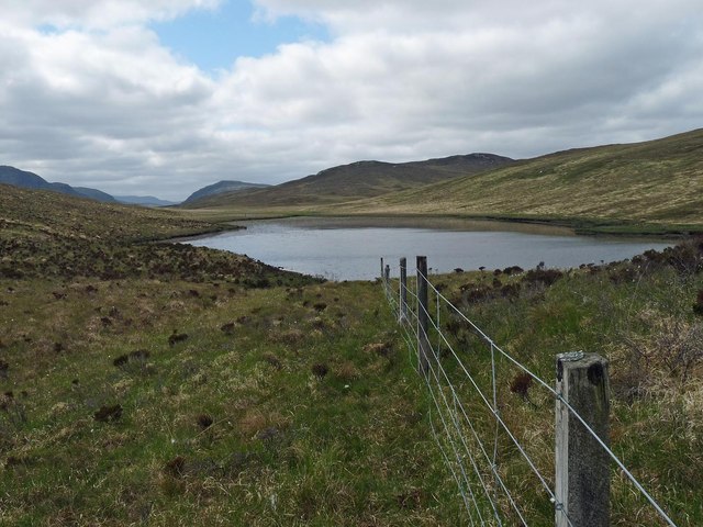
Àird Mholach is a prominent landscape feature located in Ross-shire, Scotland. Situated on the west coast of the country, it is a stunning and picturesque area that attracts nature enthusiasts and hikers alike.

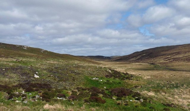
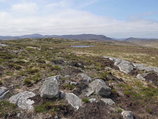
The landscape of Àird Mholach is characterized by its rugged and mountainous terrain. The area is dominated by the imposing Ben Wyvis, a Munro, standing at a height of 1,046 meters. This mountain provides a dramatic backdrop to the surrounding landscape and offers breathtaking views from its summit.

The region is also known for its diverse wildlife and natural beauty. It is home to a variety of plant and animal species, including red deer, buzzards, and golden eagles. The hills and moorlands are covered with heather, creating a vibrant purple hue during the summer months.

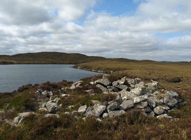
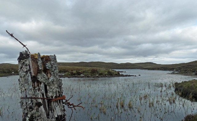
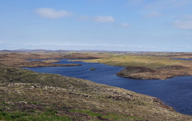
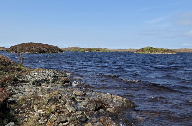
Àird Mholach is also intersected by rivers and lochs, adding to its scenic charm. The River Glass and River Meig flow through the area, providing opportunities for fishing and leisurely walks along their banks. Loch Glass and Loch Luichart are popular spots for boating and wildlife observation.

In addition to its natural attractions, Àird Mholach has historical significance. The area is dotted with archaeological sites, including ancient burial grounds and standing stones, which offer insight into the region's past.

Overall, Àird Mholach is a captivating landscape feature in Ross-shire. Its rugged mountains, diverse wildlife, and historical sites make it an ideal destination for those seeking to immerse themselves in Scotland's natural and cultural heritage.

If you have any feedback on the listing, please let us know in the comments section below.

Àird Mholach Images

Images are sourced within 2km of 58.063598/-6.4961667 or Grid Reference NB3417. Thanks to Geograph Open Source API. All images are credited.

Fence above Loch Ealaidh, Isle of Lewis The fence doesn't currently show on the OS 1:25,000 map (as viewed on OS Maps 26/06/16).

Part of the loch lies within the grid square.
Fence above Loch Ealaidh, Isle of Lewis
The fence doesn't currently show on the OS 1:25,000 map (as viewed on OS Maps 26/06/16). Part of the loch lies within the grid square.
View from Beinn Bhuidhe, Isle of Lewis Left is Loch na h-Inghinn, the section of which in the photo lies within the grid square.  Right is Loch na Cartach, all of which is within the grid square.  Beyond is Loch na h-Àirigh Meadhonach. Loch Odhairn on the coast can be seen in the gap on the horizon.
View from Beinn Bhuidhe, Isle of Lewis
Left is Loch na h-Inghinn, the section of which in the photo lies within the grid square. Right is Loch na Cartach, all of which is within the grid square. Beyond is Loch na h-Àirigh Meadhonach. Loch Odhairn on the coast can be seen in the gap on the horizon.
Fence above Loch na h-Àirigh Meadhonach, Isle of Lewis The loch straddles this grid square and the one to the north.
Fence above Loch na h-Àirigh Meadhonach, Isle of Lewis
The loch straddles this grid square and the one to the north.
Remains of possible farmstead, Glen Uirn, Isle of Lewis From <span class="nowrap"><a title="https://canmore.org.uk/site/134037" rel="nofollow ugc noopener" href="https://canmore.org.uk/site/134037">Link</a><img style="margin-left:2px;" alt="External link" title="External link - shift click to open in new window" src="https://s1.geograph.org.uk/img/external.png" width="10" height="10"/></span> : "What may be a farmstead comprising three unroofed buildings, which are annotated as Ruins, and a head-dyke are depicted on the 1st edition of the OS 6-inch map (Ross-shire, Island of Lewis 1854, sheet 37)."
Remains of possible farmstead, Glen Uirn, Isle of Lewis
From LinkExternal link : "What may be a farmstead comprising three unroofed buildings, which are annotated as Ruins, and a head-dyke are depicted on the 1st edition of the OS 6-inch map (Ross-shire, Island of Lewis 1854, sheet 37)."
Shieling by Loch Sgeireach, Isle of Lewis Looking towards Sidhean nan Caorach.
Shieling by Loch Sgeireach, Isle of Lewis
Looking towards Sidhean nan Caorach.
Fence post by Loch Leathain, Isle of Lewis
Possible remains of cairn, Sidhean Dubha, Isle of Lewis OS maps with a scale of 1:25,000 and larger show a cairn to the north-east of the highest point of Sidhean Dubha.  There didn't appear to be one on the ground.  The only thing I could find was this rough ring of stones which may previously have been the base of a cairn.
Possible remains of cairn, Sidhean Dubha, Isle of Lewis
OS maps with a scale of 1:25,000 and larger show a cairn to the north-east of the highest point of Sidhean Dubha. There didn't appear to be one on the ground. The only thing I could find was this rough ring of stones which may previously have been the base of a cairn.
Small island in Loch Tobhtaichean Amhlaidh, Isle of Lewis According to the OS Name Book of 1848-1852, the meaning of the loch's name, which at that time was spelled Totaichean Aulaidh, is Loch of Aulay's Roofless Walls.
Small island in Loch Tobhtaichean Amhlaidh, Isle of Lewis
According to the OS Name Book of 1848-1852, the meaning of the loch's name, which at that time was spelled Totaichean Aulaidh, is Loch of Aulay's Roofless Walls.
Loch nan Eilean, Isle of Lewis The OS Name Book of 1848-1852, describes the loch as, "a large crooked fresh water loch in which are a number of small heathy islands.  Signifies Islands Loch".
Loch nan Eilean, Isle of Lewis
The OS Name Book of 1848-1852, describes the loch as, "a large crooked fresh water loch in which are a number of small heathy islands. Signifies Islands Loch".
Fence, Cleite Mòr, Isle of Lewis The fence runs between improved land used as sheep pasture and moorland.
Fence, Cleite Mòr, Isle of Lewis
The fence runs between improved land used as sheep pasture and moorland.
Loch nan Eilean, Isle of Lewis The OS Name Book of 1848-1852, describes the loch as, "a large crooked fresh water loch in which are a number of small heathy islands. Signifies Islands Loch".
Loch nan Eilean, Isle of Lewis
The OS Name Book of 1848-1852, describes the loch as, "a large crooked fresh water loch in which are a number of small heathy islands. Signifies Islands Loch".
Ruined fence, Taobh a' Ghlinne, Isle of Lewis The fence is a continuation of the one which bounds the rear of the crofts in Glenside/Taobh a' Ghlinne.
Ruined fence, Taobh a' Ghlinne, Isle of Lewis
The fence is a continuation of the one which bounds the rear of the crofts in Glenside/Taobh a' Ghlinne.
Old Fence This old and ruined fence is just above the village of Taobh a' Ghlinne in the Pairc district of South Lochs.
Old Fence
This old and ruined fence is just above the village of Taobh a' Ghlinne in the Pairc district of South Lochs.
Show me another place!

Àird Mholach is located at Grid Ref: NB3417 (Lat: 58.063598, Lng: -6.4961667)

Unitary Authority: Na h-Eileanan an Iar

Police Authority: Highlands and Islands

What 3 Words

///mentioned.woods.lizard. Near Leurbost, Na h-Eileanan Siar

Related Wikis

Gravir

Gravir (Scottish Gaelic: Grabhair), is a village on the shore of Loch Odhairn (a sea loch) in the Park district of the Isle of Lewis. Gravir is within...

Cabharstadh

Cabharstadh or Caversta (Scottish Gaelic: Cabharstaigh) is a village on the Isle of Lewis in the Outer Hebrides, Scotland. Caversta is situated in the...

Loch Erisort

Loch Erisort (Scottish Gaelic: Èireasort) is an 8-mile-long narrow sea inlet on the east coast of the Isle of Lewis in the Outer Hebrides off the west...

Stiomrabhaig

Stiomrabhaig is an abandoned crofter's village on the Isle of Lewis in the Outer Hebrides. == History == The United Kingdom Census 1851 shows that the...

Have you been to Àird Mholach?

Leave your review of Àird Mholach below (or comments, questions and feedback).