Àird Mhic Neacail

Landscape Feature in Inverness-shire

Scotland

Àird Mhic Neacail

Sgealtrabhal stone row The stone row includes four stones set in a 79m long line (Scale 1m). 
<span class="nowrap"><a title="https://stonerows.wordpress.com/gazetteer/region/western-isles/skeal-traval/" rel="nofollow ugc noopener" href="https://stonerows.wordpress.com/gazetteer/region/western-isles/skeal-traval/">Link</a><img style="margin-left:2px;" alt="External link" title="External link - shift click to open in new window" src="https://s1.geograph.org.uk/img/external.png" width="10" height="10"/></span>
Sgealtrabhal stone row Credit: Sandy Gerrard

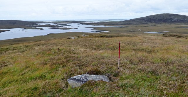
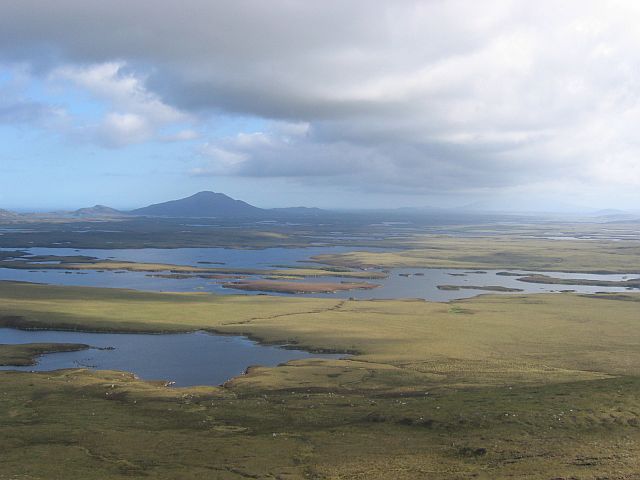
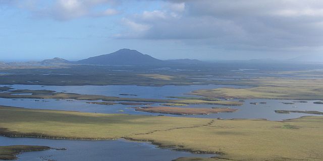
Àird Mhic Neacail, also known as Ardnamurchan Point, is a prominent landscape feature located in Inverness-shire, Scotland. It is situated on the westernmost point of the Ardnamurchan Peninsula, jutting out into the Atlantic Ocean.

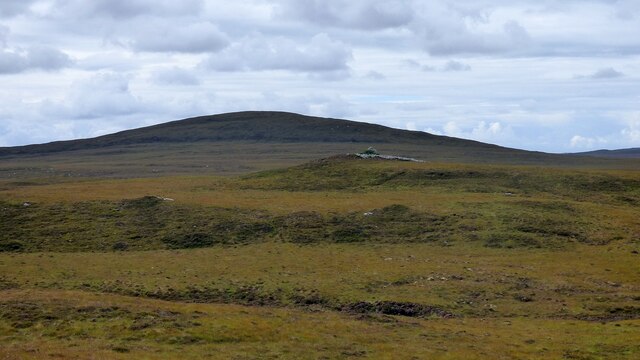
This stunning headland boasts a rugged and dramatic coastline, characterized by towering cliffs that plunge into the sea below. The area is renowned for its natural beauty and is a popular destination for nature enthusiasts and photographers.

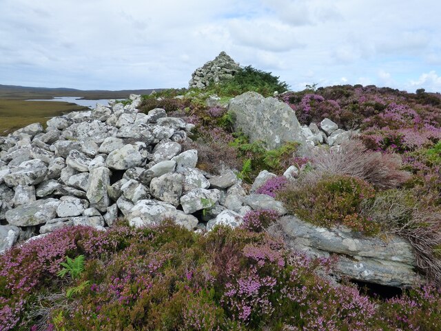
Àird Mhic Neacail is home to a diverse range of flora and fauna, making it an important site for conservation. The heathland and grassy slopes are adorned with colorful wildflowers during the summer months, providing a picturesque backdrop to the stunning sea views. Visitors may also spot a variety of bird species, including seabirds such as fulmars, kittiwakes, and razorbills.

At the tip of Àird Mhic Neacail stands a lighthouse, built in 1849. This iconic structure not only serves as a navigational aid for ships but also adds to the charm of the landscape. The lighthouse offers breathtaking panoramic views of the surrounding area, with glimpses of the Small Isles and the Isle of Skye on clear days.

In addition to its natural beauty, Àird Mhic Neacail also holds historical significance. The area is believed to have been inhabited by humans for thousands of years, and remnants of ancient settlements can still be found. The ruins of Castle Tioram, a medieval fortress, can be seen from the headland, adding a touch of mystery and intrigue to the landscape.

Overall, Àird Mhic Neacail is a captivating landscape feature that showcases the wild beauty and rich history of Inverness-shire.

If you have any feedback on the listing, please let us know in the comments section below.

Àird Mhic Neacail Images

Images are sourced within 2km of 57.615512/-7.2501451 or Grid Reference NF8670. Thanks to Geograph Open Source API. All images are credited.

Sgealtrabhal stone row The stone row includes four stones set in a 79m long line (Scale 1m). 
<span class="nowrap"><a title="https://stonerows.wordpress.com/gazetteer/region/western-isles/skeal-traval/" rel="nofollow ugc noopener" href="https://stonerows.wordpress.com/gazetteer/region/western-isles/skeal-traval/">Link</a><img style="margin-left:2px;" alt="External link" title="External link - shift click to open in new window" src="https://s1.geograph.org.uk/img/external.png" width="10" height="10"/></span>
Sgealtrabhal stone row
The stone row includes four stones set in a 79m long line (Scale 1m). LinkExternal link
Barpa nam Feannag Chambered Long Cairn View of the chamber at the eastern end of the mound <span class="nowrap"><a title="https://www.megalithic.co.uk/article.php?sid=48278" rel="nofollow ugc noopener" href="https://www.megalithic.co.uk/article.php?sid=48278">Link</a><img style="margin-left:2px;" alt="External link" title="External link - shift click to open in new window" src="https://s1.geograph.org.uk/img/external.png" width="10" height="10"/></span>
Barpa nam Feannag Chambered Long Cairn
View of the chamber at the eastern end of the mound LinkExternal link
Barpa nam Feannag Chambered Long Cairn The hill beyond the cairn is Sgealtrabhal <span class="nowrap"><a title="https://www.megalithic.co.uk/article.php?sid=48278" rel="nofollow ugc noopener" href="https://www.megalithic.co.uk/article.php?sid=48278">Link</a><img style="margin-left:2px;" alt="External link" title="External link - shift click to open in new window" src="https://s1.geograph.org.uk/img/external.png" width="10" height="10"/></span>
Barpa nam Feannag Chambered Long Cairn
The hill beyond the cairn is Sgealtrabhal LinkExternal link
South from Crògearraidh Mòr The confused, half loch, half bog interior of North Uist, with a view southwards from Crògearraidh Mòr. The nearby loch is Loch Hungabhat and the large Loch Fada is behind it.
South from Crògearraidh Mòr
The confused, half loch, half bog interior of North Uist, with a view southwards from Crògearraidh Mòr. The nearby loch is Loch Hungabhat and the large Loch Fada is behind it.
Loch Fada The water in the centre of the photo is Loch Fada, a very complicated loch. This low lying gneiss plain is a very confused mix of fresh, salt and bog water (There may even be some dry land!) and really needs to host a canoe orienteering event sometime.
Loch Fada
The water in the centre of the photo is Loch Fada, a very complicated loch. This low lying gneiss plain is a very confused mix of fresh, salt and bog water (There may even be some dry land!) and really needs to host a canoe orienteering event sometime.
Island, Loch Scadabhagh There are many unmarked islands on this convoluted loch, with its many bays, inlets and peninsulas.  A hard loch to navigate and well worth the exploration for its many hidden corners.
Island, Loch Scadabhagh
There are many unmarked islands on this convoluted loch, with its many bays, inlets and peninsulas. A hard loch to navigate and well worth the exploration for its many hidden corners.
Lochs below Crogary Mor and Maari Loch Hungabhat and Loch Bhereagbhat lie below Grogearraidh Mor and Maari and are well seen from the slopes of Blashaval.
Lochs below Crogary Mor and Maari
Loch Hungabhat and Loch Bhereagbhat lie below Grogearraidh Mor and Maari and are well seen from the slopes of Blashaval.
Show me another place!

Àird Mhic Neacail is located at Grid Ref: NF8670 (Lat: 57.615512, Lng: -7.2501451)

Unitary Authority: Na h-Eileanan an Iar

Police Authority: Highlands and Islands

What 3 Words

///warbler.loafing.launch. Near Lochmaddy, Na h-Eileanan Siar

Nearby Locations

Àird Mhic Neacail

Related Wikis

Loch Sgadabhagh

Loch Sgadabhagh or Loch Scadavay is a body of water on the island of North Uist, Scotland. The name may be of Old Norse derivation meaning "lake of tax...

Na Fir Bhrèige

Na Fir Bhrèige (pronounced [nə fiɾʲ ˈvɾʲeːkʲə]; can be translated from Gaelic into English as "The False Men") is a set of three standing stones on the...

Ceallasaigh Mòr

Ceallasaigh Mòr (or Keallasay More) is a low-lying island in Loch Maddy off North Uist in the Outer Hebrides of Scotland. This an area of shallow lagoons...

North Uist

North Uist (Scottish Gaelic: Uibhist a Tuath; Scots: North Uise) is an island and community in the Outer Hebrides of Scotland. == Etymology == In Donald...

Have you been to Àird Mhic Neacail?

Leave your review of Àird Mhic Neacail below (or comments, questions and feedback).