Aird nam Fiadh

Landscape Feature in Inverness-shire

Scotland

Aird nam Fiadh

The road to the Benbecula dump This is the approach to the island's recycling centre and municipal waste.

Ruabhal, 124 metres high and Benbecula's highest peak, lies ahead.
The road to the Benbecula dump Credit: Gordon Brown

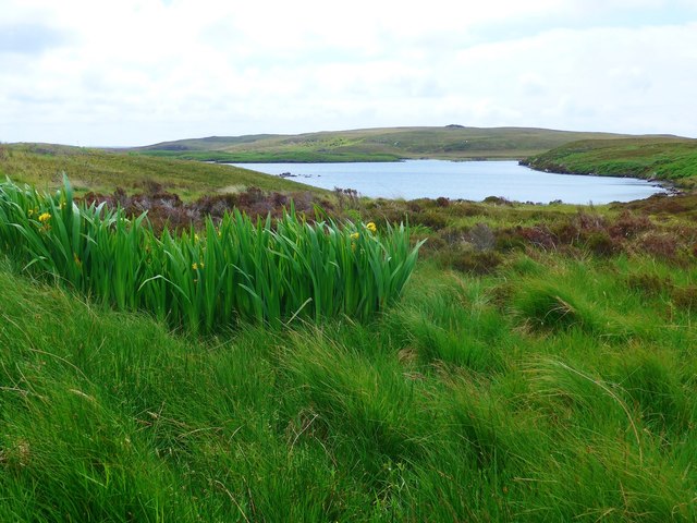
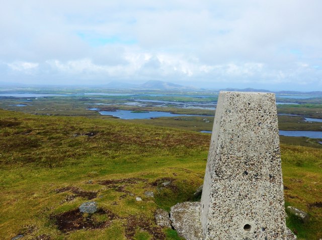
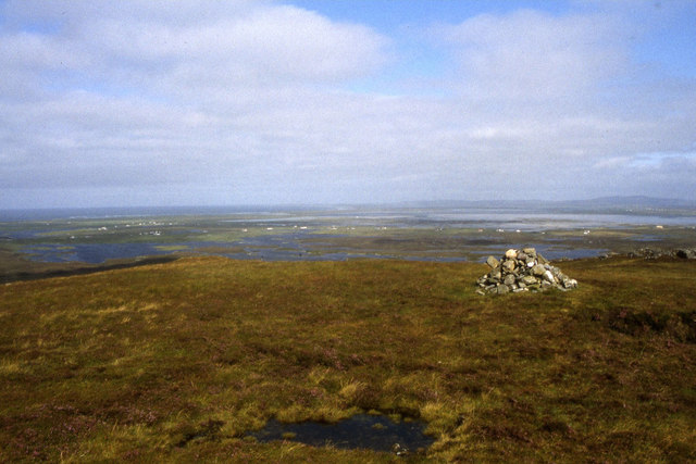
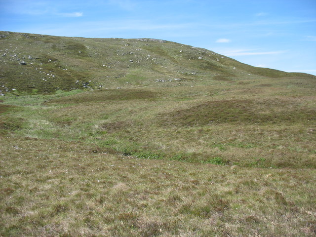
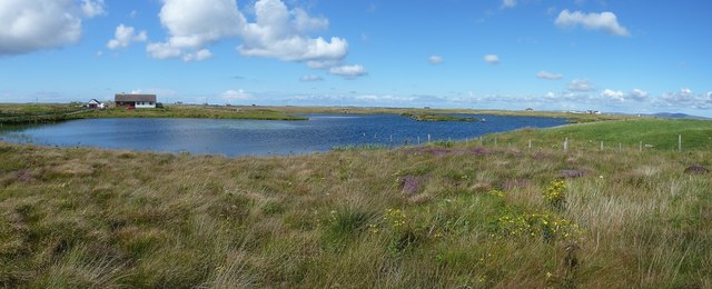
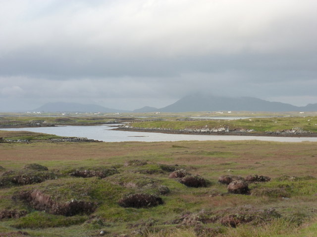
Aird nam Fiadh is a prominent landscape feature located in Inverness-shire, Scotland. This geographical formation is a large, elevated headland that extends into the sea, providing spectacular views of the surrounding area. The name "Aird nam Fiadh" translates to "Headland of the Deer" in Gaelic, which reflects the abundance of wildlife that can be found in this area.

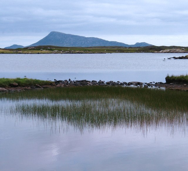
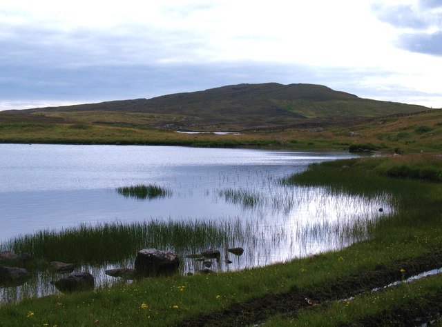
The headland is characterized by its rugged terrain, consisting of cliffs, rocky outcrops, and moorland. Its elevated position offers breathtaking panoramic vistas of the surrounding coastline, the sea, and the distant mountains. Aird nam Fiadh is a popular spot for outdoor enthusiasts, including hikers and bird watchers, who are drawn to the stunning natural beauty and diverse wildlife.

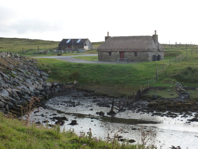
The headland is also steeped in history and has archaeological significance. There are remnants of Iron Age settlements and fortifications, indicating that the area has been inhabited for centuries. These historical artifacts add to the allure of Aird nam Fiadh, attracting history enthusiasts and researchers.

Visitors to Aird nam Fiadh can access the headland via well-maintained paths and trails, providing opportunities for exploration and discovery. It is recommended to come prepared with appropriate outdoor gear and to be mindful of the challenging terrain.

In conclusion, Aird nam Fiadh is a captivating landscape feature in Inverness-shire, offering stunning views, rich wildlife, and a glimpse into the area's historical past. It is a must-visit destination for nature lovers, hikers, and history enthusiasts alike.

If you have any feedback on the listing, please let us know in the comments section below.

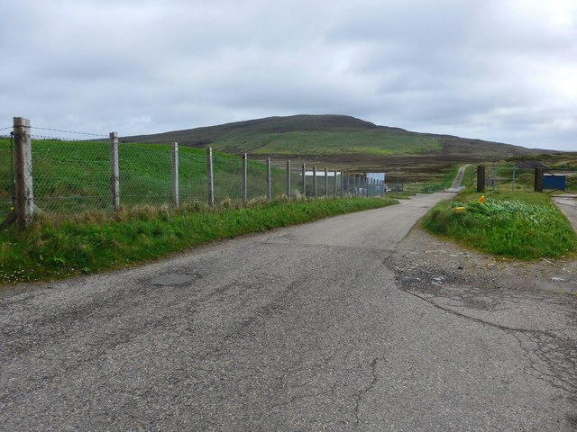
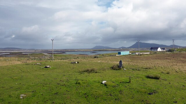
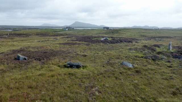
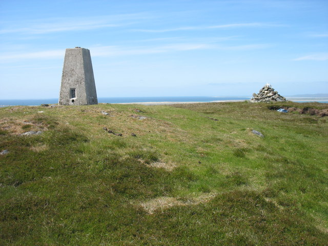
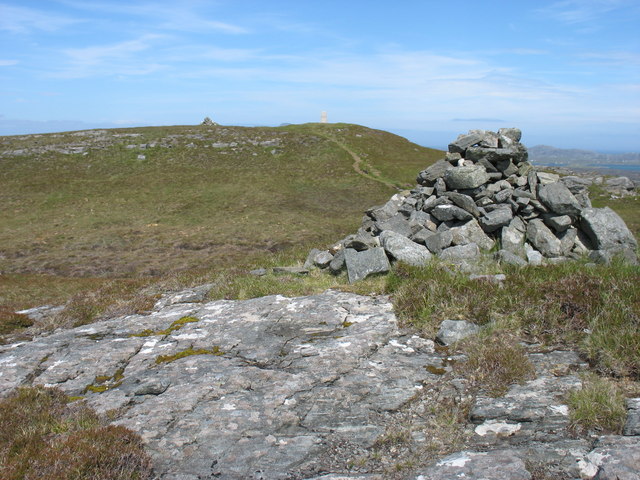
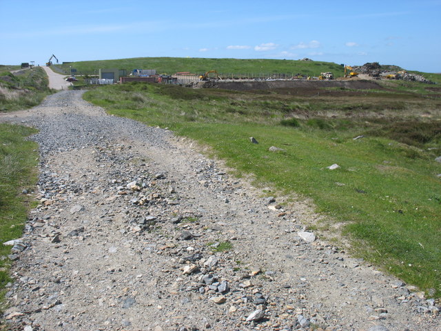
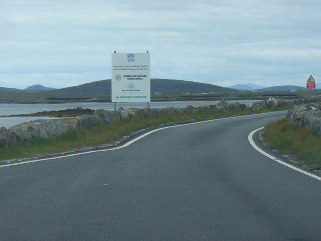
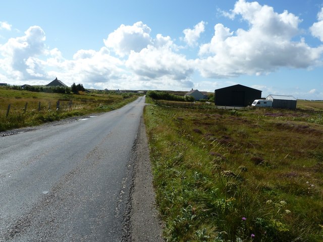
Aird nam Fiadh Images

Images are sourced within 2km of 57.473233/-7.3130154 or Grid Reference NF8155. Thanks to Geograph Open Source API. All images are credited.

The road to the Benbecula dump This is the approach to the island's recycling centre and municipal waste.

Ruabhal, 124 metres high and Benbecula's highest peak, lies ahead.
The road to the Benbecula dump
This is the approach to the island's recycling centre and municipal waste. Ruabhal, 124 metres high and Benbecula's highest peak, lies ahead.
Flag irises and Loch Ba Una By the track to Sgaraileod.
Flag irises and Loch Ba Una
By the track to Sgaraileod.
Summit trig on Ruabhal Looking towards Grimsay and North Uist.
Summit trig on Ruabhal
Looking towards Grimsay and North Uist.
Summit of Ruabhal, Benbecula
Gramisdale stone circle Rather mutilated prehistoric stone circle. <span class="nowrap"><a title="https://canmore.org.uk/site/10186/benbecula-gramisdale" rel="nofollow ugc noopener" href="https://canmore.org.uk/site/10186/benbecula-gramisdale">Link</a><img style="margin-left:2px;" alt="External link" title="External link - shift click to open in new window" src="https://s1.geograph.org.uk/img/external.png" width="10" height="10"/></span>
Gramisdale stone circle
Rather mutilated prehistoric stone circle. LinkExternal link
Suidheachadh Beag stone circle and chambered cairn Two large stones inside the stone circle may represent the remains of a chambered cairn. <span class="nowrap"><a title="https://canmore.org.uk/site/10187/benbecula-suidheachadh-beag" rel="nofollow ugc noopener" href="https://canmore.org.uk/site/10187/benbecula-suidheachadh-beag">Link</a><img style="margin-left:2px;" alt="External link" title="External link - shift click to open in new window" src="https://s1.geograph.org.uk/img/external.png" width="10" height="10"/></span>
Suidheachadh Beag stone circle and chambered cairn
Two large stones inside the stone circle may represent the remains of a chambered cairn. LinkExternal link
Ruaval (Ruabhal) summit Near the summit of Ruaval are a trig point and two fairly large cairns. This photo suggests, though it does not prove, that the trig point is at the true highest point. Taken in conjunction with <a href="https://www.geograph.org.uk/photo/2537593">NF8253 : Ruaval (Ruabhal) from the lower cairn</a>, I think that the supremacy of the trig point is beyond doubt.
Ruaval is the highest point of Benbecula. As this island is mostly low-lying, it gives excellent views in all directions.
Ruaval (Ruabhal) summit
Near the summit of Ruaval are a trig point and two fairly large cairns. This photo suggests, though it does not prove, that the trig point is at the true highest point. Taken in conjunction with NF8253 : Ruaval (Ruabhal) from the lower cairn, I think that the supremacy of the trig point is beyond doubt. Ruaval is the highest point of Benbecula. As this island is mostly low-lying, it gives excellent views in all directions.
Ruaval (Ruabhal) from the lower cairn I think that this image, in conjunction with <a href="https://www.geograph.org.uk/photo/2537563">NF8253 : Ruaval (Ruabhal) summit</a>, is conclusive evidence that the trig point is at the summit of the hill.
Cairns, especially on hills which are not major attractions for hillwalkers, are often in locations prominent from below rather than at true summits. This may explain the position of these two cairns.
Ruaval (Ruabhal) from the lower cairn
I think that this image, in conjunction with NF8253 : Ruaval (Ruabhal) summit, is conclusive evidence that the trig point is at the summit of the hill. Cairns, especially on hills which are not major attractions for hillwalkers, are often in locations prominent from below rather than at true summits. This may explain the position of these two cairns.
The eastern slopes of Ruaval (Ruabhal) I have submitted this because, though there are many photos in this square, none appears to show the less often visited east side of Ruaval.
The eastern slopes of Ruaval (Ruabhal)
I have submitted this because, though there are many photos in this square, none appears to show the less often visited east side of Ruaval.
The end of the walk from Ruaval (Ruabhal) ! Even in the Outer Hebrides, rubbish has to go somewhere. This site is, from most perspectives, quite unobtrusive: and, importantly, it does not obstruct access to Ruaval, the highest point of Benbecula.
The end of the walk from Ruaval (Ruabhal) !
Even in the Outer Hebrides, rubbish has to go somewhere. This site is, from most perspectives, quite unobtrusive: and, importantly, it does not obstruct access to Ruaval, the highest point of Benbecula.
North Ford Causeway On the north edge of Benbecula, the modern causeway leads across the Oitir Mhor to Grimsay and North Uist.
<span class="nowrap"><a title="http://www.isle-of-benbecula.co.uk/" rel="nofollow ugc noopener" href="http://www.isle-of-benbecula.co.uk/">Link</a><img style="margin-left:2px;" alt="External link" title="External link - shift click to open in new window" src="https://s1.geograph.org.uk/img/external.png" width="10" height="10"/></span>
North Ford Causeway
On the north edge of Benbecula, the modern causeway leads across the Oitir Mhor to Grimsay and North Uist. LinkExternal link
A865 south of Loch na Smalaig, Benbecula The A865 runs through the centre of the loch-laced flat isle of Benbecula. The large dark green shed or barn seen on the right is just beyond the track to Ardgarbh, and must be quite recent as it does not appear on Google's Streetview (see <span class="nowrap"><a title="http://maps.google.com/maps?q=Gramsdale,+Benbecula&hl=en&ll=57.47317,-7.32846&spn=0.000023,0.027788&sll=41.890062,12.492549&sspn=0.004394,0.006947&vpsrc=6&hnear=Gramsdale,+Isle+Of+Benbecula,+Eilean+Siar,+United+Kingdom&t=h&z=16&layer=c&cbll=57.473554,-7.3282&panoid=nm1zCQ5DOfBW2LblAN-U4g&cbp=12,203.83,,0,13.56" rel="nofollow ugc noopener" href="http://maps.google.com/maps?q=Gramsdale,+Benbecula&hl=en&ll=57.47317,-7.32846&spn=0.000023,0.027788&sll=41.890062,12.492549&sspn=0.004394,0.006947&vpsrc=6&hnear=Gramsdale,+Isle+Of+Benbecula,+Eilean+Siar,+United+Kingdom&t=h&z=16&layer=c&cbll=57.473554,-7.3282&panoid=nm1zCQ5DOfBW2LblAN-U4g&cbp=12,203.83,,0,13.56">Link</a><img style="margin-left:2px;" alt="External link" title="External link - shift click to open in new window" src="https://s1.geograph.org.uk/img/external.png" width="10" height="10"/></span> ) 
Note: The maps show "Shieling" just south of this point, but that simply means roughly constructed hut or pasture for cattle, and is not a placename.
A865 south of Loch na Smalaig, Benbecula
The A865 runs through the centre of the loch-laced flat isle of Benbecula. The large dark green shed or barn seen on the right is just beyond the track to Ardgarbh, and must be quite recent as it does not appear on Google's Streetview (see LinkExternal link ) Note: The maps show "Shieling" just south of this point, but that simply means roughly constructed hut or pasture for cattle, and is not a placename.
Loch na Smalaig Benbecula doesn't get rave reviews in most of the guidebooks, which generally urge the visitor on to the delights of the Uists to north and south. But on a beautiful sunny day like this, the inky blue lochs and lochans have a distinct charm.
The house on the left is Ardgarbh with its track forming the southern border of the loch.
Loch na Smalaig
Benbecula doesn't get rave reviews in most of the guidebooks, which generally urge the visitor on to the delights of the Uists to north and south. But on a beautiful sunny day like this, the inky blue lochs and lochans have a distinct charm. The house on the left is Ardgarbh with its track forming the southern border of the loch.
Loch Olabhat A shallow loch, almost at sea level and with numerous small islands. Looking towards the distinctive profile of Eabhal on North Uist.
Loch Olabhat
A shallow loch, almost at sea level and with numerous small islands. Looking towards the distinctive profile of Eabhal on North Uist.
Loch Olabhat An unpleasantly wet track leads from the road down to this reedy loch.
Loch Olabhat
An unpleasantly wet track leads from the road down to this reedy loch.
Gramsdale: postbox № HS6 40 and phone One of several postboxes which seem to have a prefix misnomer - being on Benbecula, this box is actually in the HS7, not HS6, postcode district. It stands alongside a red telephone box and this may be evidence that the post office, which opened in the summer of 1935 and closed on 5 October 1974, was in the adjacent house.
Gramsdale: postbox № HS6 40 and phone
One of several postboxes which seem to have a prefix misnomer - being on Benbecula, this box is actually in the HS7, not HS6, postcode district. It stands alongside a red telephone box and this may be evidence that the post office, which opened in the summer of 1935 and closed on 5 October 1974, was in the adjacent house.
Gramsdale: view across Grimsay towards North Uist The hills of the southeast corner of the ise of North Uist, Eaval being the highest, are viewed across a narrow inlet at the northern end of the isle of Benbecula. Grimsay is sandwiched between the two islands.
Gramsdale: view across Grimsay towards North Uist
The hills of the southeast corner of the ise of North Uist, Eaval being the highest, are viewed across a narrow inlet at the northern end of the isle of Benbecula. Grimsay is sandwiched between the two islands.
Kyles Flodda: a thatched croft An attractive little building by the head of an inlet, across which we look, on the north coast of Benbecula.
Kyles Flodda: a thatched croft
An attractive little building by the head of an inlet, across which we look, on the north coast of Benbecula.
Show me another place!

Aird nam Fiadh is located at Grid Ref: NF8155 (Lat: 57.473233, Lng: -7.3130154)

Unitary Authority: Na h-Eileanan an Iar

Police Authority: Highlands and Islands

What 3 Words

///deny.space.sharpened. Near Balivanich, Na h-Eileanan Siar

Related Wikis

Uachdar

Uachdar (Scottish Gaelic: An t-Uachdar [ən̪ˠ ˈt̪ʰuəxkəɾ]) is a settlement on the Outer Hebridean Island of Benbecula. Uachdar is within the parish of South...

Uist

Uist is a group of six islands that are part of the Outer Hebridean Archipelago, which is part of the Outer Hebrides of Scotland. North Uist and South...

Benbecula

Benbecula ( ; Scottish Gaelic: Beinn nam Fadhla or Beinn na Faoghla) is an island of the Outer Hebrides in the Atlantic Ocean off the west coast of Scotland...

Flodaigh

Flodaigh is a tidal island lying to the north of Benbecula and south of Grimsay in the Outer Hebrides, Scotland. It is connected to Benbecula by a causeway...

Nearby Amenities

Located within 500m of 57.473233,-7.3130154
Power: pole
Lat/Long: 57.477691/-7.3132521
Power: pole
Lat/Long: 57.4775021/-7.3147461
Power: pole
Lat/Long: 57.4773103/-7.3162401
The data included in this document is from www.openstreetmap.org. The data is made available under ODbL.

Have you been to Aird nam Fiadh?

Leave your review of Aird nam Fiadh below (or comments, questions and feedback).