Lochan Uaine

Lake, Pool, Pond, Freshwater Marsh in Dunbartonshire

Scotland

Lochan Uaine

Inverbeg Inn Loch Lomond
Inverbeg Inn Loch Lomond Credit: John Ferguson

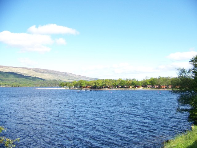
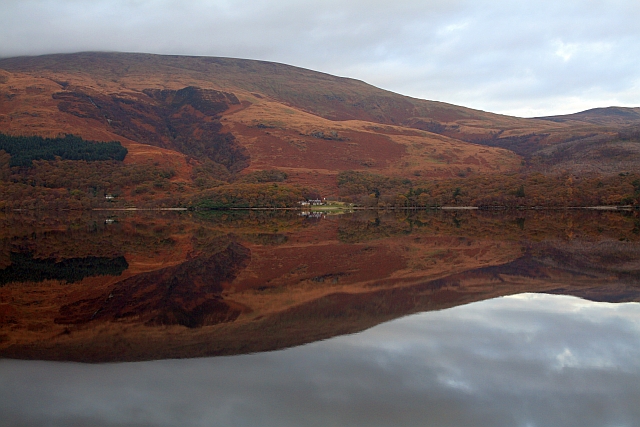
Lochan Uaine, also known as the Green Loch, is a small freshwater lake located in Dunbartonshire, Scotland. Nestled amidst the picturesque surrounding landscapes, it is situated within the Loch Lomond and The Trossachs National Park.

Covering an area of approximately 3.5 acres, Lochan Uaine is a tranquil oasis renowned for its stunning emerald-green waters. The unique color of the lake is attributed to the presence of fine particles of glacial clay, which refract light and give the water its vivid green hue. This captivating feature never fails to mesmerize visitors.

Surrounded by dense woodlands and rolling hills, Lochan Uaine offers an idyllic setting for nature enthusiasts and hikers. The area is abundant in flora and fauna, with various species of birds, including herons and ducks, often spotted on the lake. The lush vegetation around the lake includes birch, oak, and pine trees, providing a habitat for diverse wildlife.

Visitors can explore the lake by following a well-maintained walking trail that encircles its shore. The path offers breathtaking views of the tranquil waters and allows for peaceful moments of reflection. Additionally, fishing is permitted in Lochan Uaine, making it a popular spot for anglers seeking to catch trout or perch.

The Green Loch is a haven for those seeking tranquility and natural beauty. Its stunning green waters, surrounded by verdant forests and rolling hills, create a serene and captivating atmosphere that leaves a lasting impression on all who visit.

If you have any feedback on the listing, please let us know in the comments section below.

Lochan Uaine Images

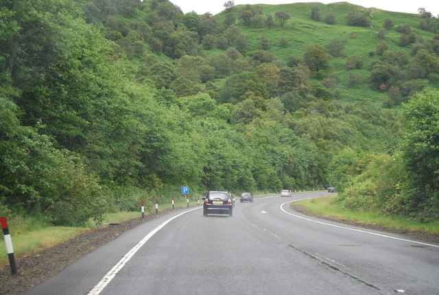
Images are sourced within 2km of 56.158117/-4.6768746 or Grid Reference NS3399. Thanks to Geograph Open Source API. All images are credited.

Inverbeg Inn Loch Lomond
Looking towards Inverbeg jetty from Loch Lomond lakeside
Inverbeg Inn
Inverbeg Inn
Glen Douglas turn off, A82 The A82 is a trunk road in Scotland. It is the principal route from Lowland Scotland to the western Scottish Highlands, running from Glasgow to Inverness, going by Loch Lomond, Glen Coe, Fort William and the Great Glen. It is 167 miles long.
<span class="nowrap"><a title="https://www.sabre-roads.org.uk/wiki/index.php?title=A82" rel="nofollow ugc noopener" href="https://www.sabre-roads.org.uk/wiki/index.php?title=A82">Link</a><img style="margin-left:2px;" alt="External link" title="External link - shift click to open in new window" src="https://s1.geograph.org.uk/img/external.png" width="10" height="10"/></span>
Glen Douglas turn off, A82
The A82 is a trunk road in Scotland. It is the principal route from Lowland Scotland to the western Scottish Highlands, running from Glasgow to Inverness, going by Loch Lomond, Glen Coe, Fort William and the Great Glen. It is 167 miles long. LinkExternal link
A82 north The A82 is a trunk road in Scotland. It is the principal route from Lowland Scotland to the western Scottish Highlands, running from Glasgow to Inverness, going by Loch Lomond, Glen Coe, Fort William and the Great Glen. It is 167 miles long.
<span class="nowrap"><a title="https://www.sabre-roads.org.uk/wiki/index.php?title=A82" rel="nofollow ugc noopener" href="https://www.sabre-roads.org.uk/wiki/index.php?title=A82">Link</a><img style="margin-left:2px;" alt="External link" title="External link - shift click to open in new window" src="https://s1.geograph.org.uk/img/external.png" width="10" height="10"/></span>
A82 north
The A82 is a trunk road in Scotland. It is the principal route from Lowland Scotland to the western Scottish Highlands, running from Glasgow to Inverness, going by Loch Lomond, Glen Coe, Fort William and the Great Glen. It is 167 miles long. LinkExternal link
A82 northwards The A82 is a trunk road in Scotland. It is the principal route from Lowland Scotland to the western Scottish Highlands, running from Glasgow to Inverness, going by Loch Lomond, Glen Coe, Fort William and the Great Glen. It is 167 miles long.
<span class="nowrap"><a title="https://www.sabre-roads.org.uk/wiki/index.php?title=A82" rel="nofollow ugc noopener" href="https://www.sabre-roads.org.uk/wiki/index.php?title=A82">Link</a><img style="margin-left:2px;" alt="External link" title="External link - shift click to open in new window" src="https://s1.geograph.org.uk/img/external.png" width="10" height="10"/></span>
A82 northwards
The A82 is a trunk road in Scotland. It is the principal route from Lowland Scotland to the western Scottish Highlands, running from Glasgow to Inverness, going by Loch Lomond, Glen Coe, Fort William and the Great Glen. It is 167 miles long. LinkExternal link
A82 at Rubha Mor The A82 is a trunk road in Scotland. It is the principal route from Lowland Scotland to the western Scottish Highlands, running from Glasgow to Inverness, going by Loch Lomond, Glen Coe, Fort William and the Great Glen. It is 167 miles long.
<span class="nowrap"><a title="https://www.sabre-roads.org.uk/wiki/index.php?title=A82" rel="nofollow ugc noopener" href="https://www.sabre-roads.org.uk/wiki/index.php?title=A82">Link</a><img style="margin-left:2px;" alt="External link" title="External link - shift click to open in new window" src="https://s1.geograph.org.uk/img/external.png" width="10" height="10"/></span>
A82 at Rubha Mor
The A82 is a trunk road in Scotland. It is the principal route from Lowland Scotland to the western Scottish Highlands, running from Glasgow to Inverness, going by Loch Lomond, Glen Coe, Fort William and the Great Glen. It is 167 miles long. LinkExternal link
Start of estate road in Glen Douglas
A82 approaching Inverbeg from Luss
Inverbeg Inn turning from A82
Turn off for Glen Douglas at Inverbeg From A82
Turn off for Glen Douglas at Inverbeg
From A82
A82 just north of Inverbeg
A82 northwards south of Rubha Mor The A82 is a three lane carriageway here
A82 northwards south of Rubha Mor
The A82 is a three lane carriageway here
Loch Lomond
Loch Lomond
Inverbeg Jetty Disused ferry jetty.
Inverbeg Jetty
Disused ferry jetty.
Single track road in Glen Douglas Looking towards Doune Hill.
Single track road in Glen Douglas
Looking towards Doune Hill.
Inverbeg caravan site.
Loch Lomond from Rowardennan Lodge Youth House
Show me another place!

Lochan Uaine is located at Grid Ref: NS3399 (Lat: 56.158117, Lng: -4.6768746)

Unitary Authority: Argyll and Bute

Police Authority: Argyll and West Dunbartonshire

Also known as: Fairy Loch

What 3 Words

///apples.incorrect.eager. Near Garelochhead, Argyll & Bute

Nearby Locations

Fairy Loch Lochan Uaine

Related Wikis

Inverbeg

Inverbeg is a settlement in Argyll and Bute, Scotland. Its Ordnance Survey grid reference is NS3497.It is on the western shore of Loch Lomond. There has...

Beinn Bhreac (Arrochar)

Beinn Bhreac (681 m) is a mountain in Argyll and Bute, Scotland. It is part of the Luss Hills, a southern subrange of the Grampian Mountains. Rising from...

Eilean nan Deargannan

Eilean nan Deargannan (sometimes written as Eilean Deargannan) is a small island in Loch Lomond, in west central Scotland. It lies between Rowardennan...

Rowardennan

Rowardennan (Gaelic: Rubha Aird EĆ²nain) is a small rural community on the eastern shore of Loch Lomond in Stirling council, Scotland. It is mainly known...

Nearby Amenities

Located within 500m of 56.158117,-4.6768746
Parking
Parking: lane
Source: survey
Lat/Long: 56.1581633/-4.6716563
Power: pole
Lat/Long: 56.154906/-4.6715873
Power: pole
Lat/Long: 56.1556141/-4.6722441
Power: pole
Lat/Long: 56.1564331/-4.672986
Power: pole
Lat/Long: 56.1580693/-4.6735285
Power: pole
Lat/Long: 56.1586271/-4.6736837
Power: pole
Lat/Long: 56.1589766/-4.6732213
Power: pole
Lat/Long: 56.1595153/-4.6725105
Power: pole
Lat/Long: 56.1603379/-4.6714206
Power: pole
Lat/Long: 56.160781/-4.6708176
The data included in this document is from www.openstreetmap.org. The data is made available under ODbL.

Have you been to Lochan Uaine?

Leave your review of Lochan Uaine below (or comments, questions and feedback).