Loch nam Blar-loch

Lake, Pool, Pond, Freshwater Marsh in Sutherland

Scotland

Loch nam Blar-loch

Corrie floor enclosed by slopes and ridge of Arkle The corrie is a massive hollow on the north-eastern side of the curving summit ridge of the mountain, Arkle.
Foinaven is the lengthy mountain beyond.
Corrie floor enclosed by slopes and ridge of Arkle Credit: Trevor Littlewood

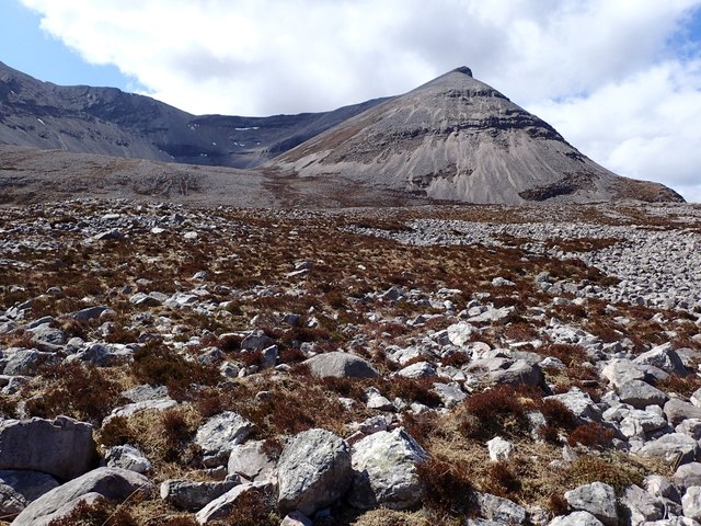
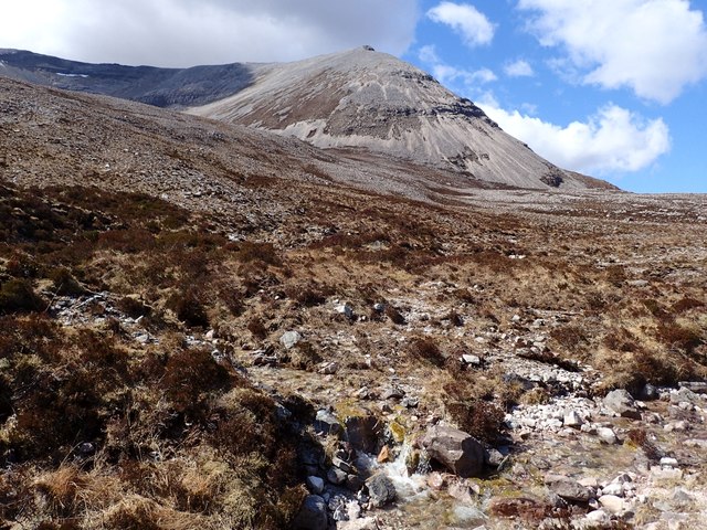
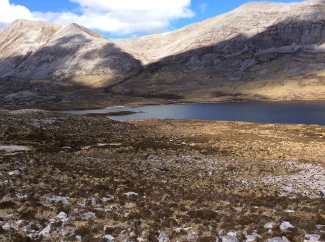
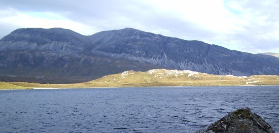
Loch nam Blar-loch, located in Sutherland, Scotland, is a picturesque freshwater loch surrounded by breathtaking natural beauty. Nestled amidst rolling hills and verdant landscapes, this tranquil water body offers a serene escape for visitors seeking solace and a connection with nature.

With a surface area of approximately 0.5 hectares, Loch nam Blar-loch is relatively small compared to other Scottish lochs, but its charm lies in its intimate and secluded setting. The loch is fed by both surface runoff and small streams, ensuring a constant flow of fresh water throughout the year.

The surrounding area is rich in diverse flora and fauna, making it an ideal habitat for a variety of wildlife species. Visitors can spot a range of bird species, including ducks, swans, and herons, as they gracefully glide across the calm waters of the loch. The marshy edges of the loch provide a haven for amphibians such as frogs and newts.

Fishing enthusiasts are drawn to Loch nam Blar-loch, as it is home to a healthy population of brown trout. Anglers can enjoy the peaceful surroundings while trying their luck at catching these elusive fish. However, fishing permits are required and can be obtained from local authorities.

Surrounded by unspoiled natural beauty, Loch nam Blar-loch offers a perfect setting for leisurely walks, picnics, and photography. The tranquil atmosphere and stunning vistas make it an ideal destination for those seeking a peaceful retreat in the heart of Scotland's wilderness.

If you have any feedback on the listing, please let us know in the comments section below.

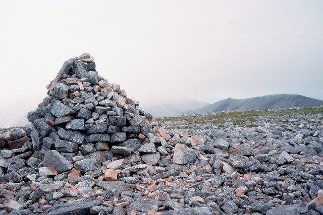
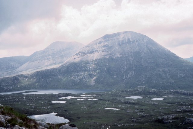
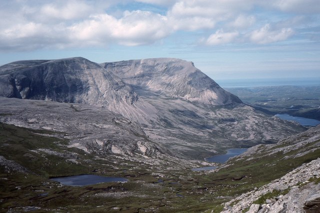
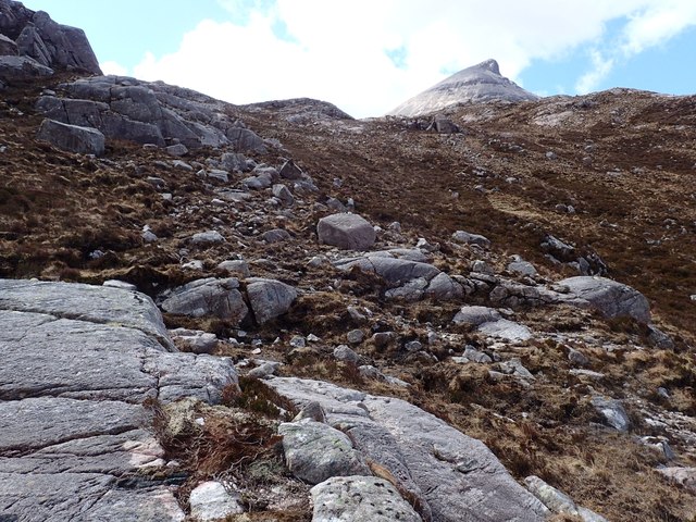
Loch nam Blar-loch Images

Images are sourced within 2km of 58.380688/-4.8912472 or Grid Reference NC3147. Thanks to Geograph Open Source API. All images are credited.

Corrie floor enclosed by slopes and ridge of Arkle The corrie is a massive hollow on the north-eastern side of the curving summit ridge of the mountain, Arkle.
Foinaven is the lengthy mountain beyond.
Corrie floor enclosed by slopes and ridge of Arkle
The corrie is a massive hollow on the north-eastern side of the curving summit ridge of the mountain, Arkle. Foinaven is the lengthy mountain beyond.
Arkle from the west
Arkle from the west
Quartzite screes, Arkle The sweep of scree slope on the west side of Arkle, looking down to Loch Stack with the lochans near Rubh' Aird a' Chuilinn in view (centre).
Quartzite screes, Arkle
The sweep of scree slope on the west side of Arkle, looking down to Loch Stack with the lochans near Rubh' Aird a' Chuilinn in view (centre).
Am Bathaich, Arkle The lower end of the corrie to the east of the ridge with part of Foinaven (Fionne Bhein) in the background with cloud base at about 750m.
Am Bathaich, Arkle
The lower end of the corrie to the east of the ridge with part of Foinaven (Fionne Bhein) in the background with cloud base at about 750m.
Rock structure near Arkle's summit The Cambrian quartzite showing a folded structure on the slope SE of the summit.
Rock structure near Arkle's summit
The Cambrian quartzite showing a folded structure on the slope SE of the summit.
Ridge south of the summit, Arkle Looking back along the quartzite 'pavement' with Loch Stack to the right. The tongue of land projecting into the loch is Rubh Aird a' Mhadaidh.
Ridge south of the summit, Arkle
Looking back along the quartzite 'pavement' with Loch Stack to the right. The tongue of land projecting into the loch is Rubh Aird a' Mhadaidh.
Summit cairn, Arkle The cairn at the 787m spot height of the northern, highest summit of this fine mountain, overshadowed only by the even greater and more complex bulk of its neighbour Foinaven.
Summit cairn, Arkle
The cairn at the 787m spot height of the northern, highest summit of this fine mountain, overshadowed only by the even greater and more complex bulk of its neighbour Foinaven.
Arkle from the north Looking across the lochan-strewn hinterland between Arkle and Foinaven. Nearest on the left is Lochan na Pollan Dhughaill and in the middle distance is Loch nam Blar-loch or Loch na Tuadh.
Arkle from the north
Looking across the lochan-strewn hinterland between Arkle and Foinaven. Nearest on the left is Lochan na Pollan Dhughaill and in the middle distance is Loch nam Blar-loch or Loch na Tuadh.
Arkle from Meall Horn The two great spurs of this quartzite mountain seen from the col NW of Meall Horn.
Arkle from Meall Horn
The two great spurs of this quartzite mountain seen from the col NW of Meall Horn.
Looking up Towards Arkle Rock and boulder strewn moorland on lower slopes of Arkle. End of Creag nam Blar-Loch on the right.
Looking up Towards Arkle
Rock and boulder strewn moorland on lower slopes of Arkle. End of Creag nam Blar-Loch on the right.
Looking up Am Bathaich Boulder strewn lower slopes of Arkle.
Looking up Am Bathaich
Boulder strewn lower slopes of Arkle.
Allt a' Bhathaich Junction of streams in boulder strewn moorland. Arkle in the distance. Lovely clear water.
Allt a' Bhathaich
Junction of streams in boulder strewn moorland. Arkle in the distance. Lovely clear water.
E End of Loch nam Blar-Loch Also known as Loch na Tuadh. Foinaven in the distance. Boggy moorland with rocks.
E End of Loch nam Blar-Loch
Also known as Loch na Tuadh. Foinaven in the distance. Boggy moorland with rocks.
Clach-pholl Huge boulders sitting on shelf. Boulder strewn moorland all around. The name seems to mean "bog stone".
Clach-pholl
Huge boulders sitting on shelf. Boulder strewn moorland all around. The name seems to mean "bog stone".
Loch an Easain Uaine Allt Coir' a' Chruiteir and ridge of Foinaven in the distance.
Loch an Easain Uaine
Allt Coir' a' Chruiteir and ridge of Foinaven in the distance.
Uidh na Tuaidh At the outflow of Loch an Easain Uaine. Very short river, which we crossed further downstream.
Uidh na Tuaidh
At the outflow of Loch an Easain Uaine. Very short river, which we crossed further downstream.
Looking towards Allt Coir' a' Chruiteir Moorland with tussocky grass and heather. Occasional rocks.
Looking towards Allt Coir' a' Chruiteir
Moorland with tussocky grass and heather. Occasional rocks.
Arkle across Loch Stack A hill that, more than many, changes its appearance in differing lights, mainly owing to its ridge of quartzite.
Arkle across Loch Stack
A hill that, more than many, changes its appearance in differing lights, mainly owing to its ridge of quartzite.
Show me another place!

Loch nam Blar-loch is located at Grid Ref: NC3147 (Lat: 58.380688, Lng: -4.8912472)

Unitary Authority: Highland

Police Authority: Highlands and Islands

Also known as: Loch na Tuadh

What 3 Words

///padding.signal.though. Near Oldshoremore, Highland

Related Wikis

North West Sutherland National Scenic Area

North West Sutherland is a national scenic area (NSA) covering the mountains and coastal scenery of the northwestern part of the county of Sutherland...

Arkle (Sutherland)

Arkle (Scottish Gaelic: Airceil) is a mountain in Sutherland, in the far north-west corner of the Scottish Highlands. Like its sister Foinaven, the mountain...

Foinaven

Foinaven (Scottish Gaelic: Foinne Bheinn) is a mountain in Scotland, situated in the far northwest corner of the Scottish Highlands. Like many of the monolithic...

Loch Dionard

Loch Dionard is a medium-sized loch in the Durness Parish, in Sutherland, Highland Council Area, Northern Scotland. It is in the North-Western Highlands...

Have you been to Loch nam Blar-loch?

Leave your review of Loch nam Blar-loch below (or comments, questions and feedback).