Brook Stream
Lake, Pool, Pond, Freshwater Marsh in Kent Dover
England
Brook Stream
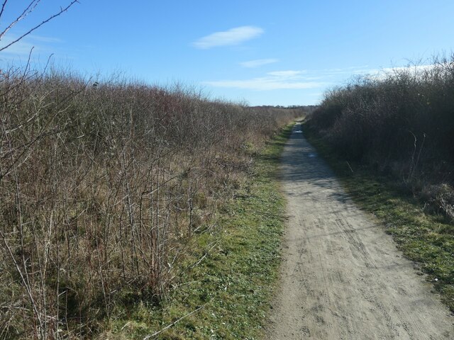
![Colliers Gate The access between South Wall and Betteshanger [Country] Park. This site was originally Foulmead Marsh, and then the spoil heap for Betteshanger Colliery. The pit opened in the late 1920s and closed in 1989. Fowlmead Park and nature reserve opened here in May 2007. When it was taken over by the Hadlow Group in May 2015, it was renamed Betteshanger Country Park. More recently the 'Country' has been dropped.](https://s3.geograph.org.uk/geophotos/07/10/80/7108035_0cca653b.jpg)
Brook Stream is a picturesque freshwater marsh located in Kent, England. Spanning over a sprawling area, it offers a variety of aquatic habitats including a lake, pool, pond, and marshland. The stream itself is fed by several smaller tributaries, ensuring a constant flow of freshwater throughout the year.
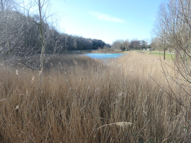
The centerpiece of Brook Stream is its stunning lake, which serves as a focal point for both the local wildlife and visitors alike. The crystal-clear waters of the lake are home to an array of fish species, such as trout and carp, making it a popular spot for anglers. In addition, the lake provides a serene and tranquil environment for recreational activities like boating and kayaking.
Surrounding the lake are lush marshlands, acting as a natural filtration system and providing a vital ecosystem for a diverse range of plant and animal species. The marshes are brimming with life, supporting a vast array of bird species, including herons, swans, and ducks. Birdwatchers flock to this area to catch a glimpse of these magnificent creatures as they go about their daily routines.
The pool and pond within Brook Stream offer a more secluded and intimate setting. These smaller bodies of water are home to a variety of aquatic plants, creating a vibrant and colorful display throughout the year. They provide a haven for amphibians, such as frogs and newts, as well as a wide range of insects and invertebrates.
Overall, Brook Stream in Kent is a haven for nature enthusiasts, offering a diverse range of aquatic habitats that support a rich and thriving ecosystem. Whether it is fishing, birdwatching, or simply immersing oneself in the beauty of nature, this freshwater marsh has something to offer for everyone.
If you have any feedback on the listing, please let us know in the comments section below.
Brook Stream Images
Images are sourced within 2km of 51.240122/1.3556401 or Grid Reference TR3454. Thanks to Geograph Open Source API. All images are credited.
![Path and trail junction, Betteshanger [Country] Park This site was originally Foulmead Marsh, and then the spoil heap for Betteshanger Colliery. The pit opened in the late 1920s and closed in 1989. Fowlmead Park and nature reserve opened here in May 2007. When it was taken over by the Hadlow Group in May 2015, it was renamed Betteshanger Country Park. More recently the 'Country' has been dropped. The wide path is a 'leisure path' for pedestrians. The narrow trail is a mountain bike trail. Blue trails are entry level, red ones advanced.](https://s3.geograph.org.uk/geophotos/07/10/80/7108039_cf790219.jpg)
![Blue Lake, Betteshanger [Country] Park This site was originally Foulmead Marsh, and then the spoil heap for Betteshanger Colliery. The pit opened in the late 1920s and closed in 1989. Fowlmead Park and nature reserve opened here in May 2007. When it was taken over by the Hadlow Group in May 2015, it was renamed Betteshanger Country Park. More recently the 'Country' has been dropped. The 'Blue Lake' is designed to filter contaminants coming from the former spoil heap.](https://s1.geograph.org.uk/geophotos/07/10/80/7108049_86a53ebe.jpg)
![Changing the landscape at Betteshanger [Country] Park This site was originally Foulmead Marsh, and then the spoil heap for Betteshanger Colliery. The pit opened in the late 1920s and closed in 1989. Fowlmead Park and nature reserve opened here in May 2007. When it was taken over by the Hadlow Group in May 2015, it was renamed Betteshanger Country Park. More recently the 'Country' has been dropped. The purpose of this civil engineering is unclear.](https://s3.geograph.org.uk/geophotos/07/10/80/7108051_7778c807.jpg)
![Leisure path, Betteshanger [Country] Park This site was originally Foulmead Marsh, and then the spoil heap for Betteshanger Colliery. The pit opened in the late 1920s and closed in 1989. Fowlmead Park and nature reserve opened here in May 2007. When it was taken over by the Hadlow Group in May 2015, it was renamed Betteshanger Country Park. More recently the 'Country' has been dropped. The leisure paths are open to walkers and cyclists.](https://s1.geograph.org.uk/geophotos/07/10/80/7108053_10547af2.jpg)
![Signage, Betteshanger [Country] Park This site was originally Foulmead Marsh, and then the spoil heap for Betteshanger Colliery. The pit opened in the late 1920s and closed in 1989. Fowlmead Park and nature reserve opened here in May 2007. When it was taken over by the Hadlow Group in May 2015, it was renamed Betteshanger Country Park. More recently the 'Country' has been dropped. All the signs say 'Betteshanger Country Park'.](https://s2.geograph.org.uk/geophotos/07/10/80/7108054_ca388146.jpg)
![Steps to the new visitor centre, Betteshanger [Country] Park This site was originally Foulmead Marsh, and then the spoil heap for Betteshanger Colliery. The pit opened in the late 1920s and closed in 1989. Fowlmead Park and nature reserve opened here in May 2007. When it was taken over by the Hadlow Group in May 2015, it was renamed Betteshanger Country Park. More recently the 'Country' has been dropped. The old visitor centre was demolished in November 2018. The replacement is still incomplete [February 2022].](https://s3.geograph.org.uk/geophotos/07/10/80/7108055_3299d489.jpg)
![Leisure path, Betteshanger [Country] Park This site was originally Foulmead Marsh, and then the spoil heap for Betteshanger Colliery. The pit opened in the late 1920s and closed in 1989. Fowlmead Park and nature reserve opened here in May 2007. When it was taken over by the Hadlow Group in May 2015, it was renamed Betteshanger Country Park. More recently the 'Country' has been dropped. Leisure paths are for walkers and cyclists. This one follows the perimeter of 'The Meadow'.](https://s1.geograph.org.uk/geophotos/07/10/80/7108057_889eda3d.jpg)
![Earthmoving at Betteshanger [Country] Park This site was originally Foulmead Marsh, and then the spoil heap for Betteshanger Colliery. The pit opened in the late 1920s and closed in 1989. Fowlmead Park and nature reserve opened here in May 2007. When it was taken over by the Hadlow Group in May 2015, it was renamed Betteshanger Country Park. More recently the 'Country' has been dropped. Presumably colliery spoil makes the earth so dark.](https://s2.geograph.org.uk/geophotos/07/10/80/7108090_1edff50e.jpg)
![You are here, Betteshanger [Country] Park This site was originally Foulmead Marsh, and then the spoil heap for Betteshanger Colliery. The pit opened in the late 1920s and closed in 1989. Fowlmead Park and nature reserve opened here in May 2007. When it was taken over by the Hadlow Group in May 2015, it was renamed Betteshanger Country Park. More recently the 'Country' has been dropped. All these signs say Betteshanger Country Park.](https://s0.geograph.org.uk/geophotos/07/10/80/7108096_51b75c99.jpg)

!['The Meadow', Betteshanger [Country] Park This site was originally Foulmead Marsh, and then the spoil heap for Betteshanger Colliery. The pit opened in the late 1920s and closed in 1989. Fowlmead Park and nature reserve opened here in May 2007. When it was taken over by the Hadlow Group in May 2015, it was renamed Betteshanger Country Park. More recently the 'Country' has been dropped. Most of the eastern side of the park is wooded, most of this western side is not.](https://s1.geograph.org.uk/geophotos/07/10/81/7108101_0f893eed.jpg)
![Dried-up pond, Betteshanger [Country] Park Not much need for the lifebelt. This site was originally Foulmead Marsh, and then the spoil heap for Betteshanger Colliery. The pit opened in the late 1920s and closed in 1989. Fowlmead Park and nature reserve opened here in May 2007. When it was taken over by the Hadlow Group in May 2015, it was renamed Betteshanger Country Park. More recently the 'Country' has been dropped.](https://s3.geograph.org.uk/geophotos/07/10/81/7108103_4a28bcf3.jpg)
Brook Stream is located at Grid Ref: TR3454 (Lat: 51.240122, Lng: 1.3556401)
Administrative County: Kent
District: Dover
Police Authority: Kent
What 3 Words
///awoke.wasp.tightrope. Near Eastry, Kent
Nearby Locations
Related Wikis

Hacklinge
Hacklinge is a village near Deal in Kent, England. The population of the village is included in the civil parish of Northbourne. It lies next to the A258...

Betteshanger Park
Betteshanger Park (formerly Fowlmead Country Park and Betteshanger Country Park) is a park near Deal, in Kent, England. It covers the site of a former...

Finglesham Anglo-Saxon cemetery
Finglesham Anglo-Saxon cemetery is a place of burial that was used from the sixth to the eighth centuries CE. It is located adjacent to the village of...

Finglesham
Finglesham is a village in the civil parish of Northbourne, and near Deal in Kent, England, which was the location of the Finglesham Anglo-Saxon cemetery...
Nearby Amenities
Located within 500m of 51.240122,1.3556401Have you been to Brook Stream?
Leave your review of Brook Stream below (or comments, questions and feedback).