Black Pond
Lake, Pool, Pond, Freshwater Marsh in Kent Dover
England
Black Pond

Black Pond is a picturesque body of water located in the county of Kent, England. Situated within the Black Pond Wood Nature Reserve, it encompasses an area of approximately 2.5 acres. Despite its name, Black Pond is not actually a pond, but rather a small lake or pool.
The water in Black Pond is of freshwater origin, making it a valuable habitat for a diverse range of flora and fauna. The surrounding landscape consists of a mixture of woodland and marshland, creating an ideal environment for various species of plants and animals to thrive.
The pond itself is relatively shallow, with an average depth of around 3 meters. It is fed by rainfall and small streams, ensuring a continuous supply of fresh water. The water is generally clear and tranquil, reflecting the verdant greenery that surrounds it.
Black Pond is home to an array of aquatic life, including various species of fish, frogs, and water insects. This makes it a popular destination for local wildlife enthusiasts and birdwatchers, who gather to observe the diverse bird species that frequent the area.
The surrounding woodland provides a haven for woodland creatures, such as deer, badgers, and foxes. It also offers numerous walking trails for visitors to explore, allowing them to immerse themselves in the beauty of nature.
Overall, Black Pond is a serene and ecologically important freshwater body that serves as a vital habitat for a wide range of plants and animals. Its idyllic location within the Black Pond Wood Nature Reserve makes it a popular destination for nature lovers and wildlife enthusiasts alike.
If you have any feedback on the listing, please let us know in the comments section below.
Black Pond Images
Images are sourced within 2km of 51.265005/1.2839438 or Grid Reference TR2956. Thanks to Geograph Open Source API. All images are credited.


Black Pond is located at Grid Ref: TR2956 (Lat: 51.265005, Lng: 1.2839438)
Administrative County: Kent
District: Dover
Police Authority: Kent
What 3 Words
///abundance.hotspots.deny. Near Ash, Kent
Nearby Locations
Related Wikis
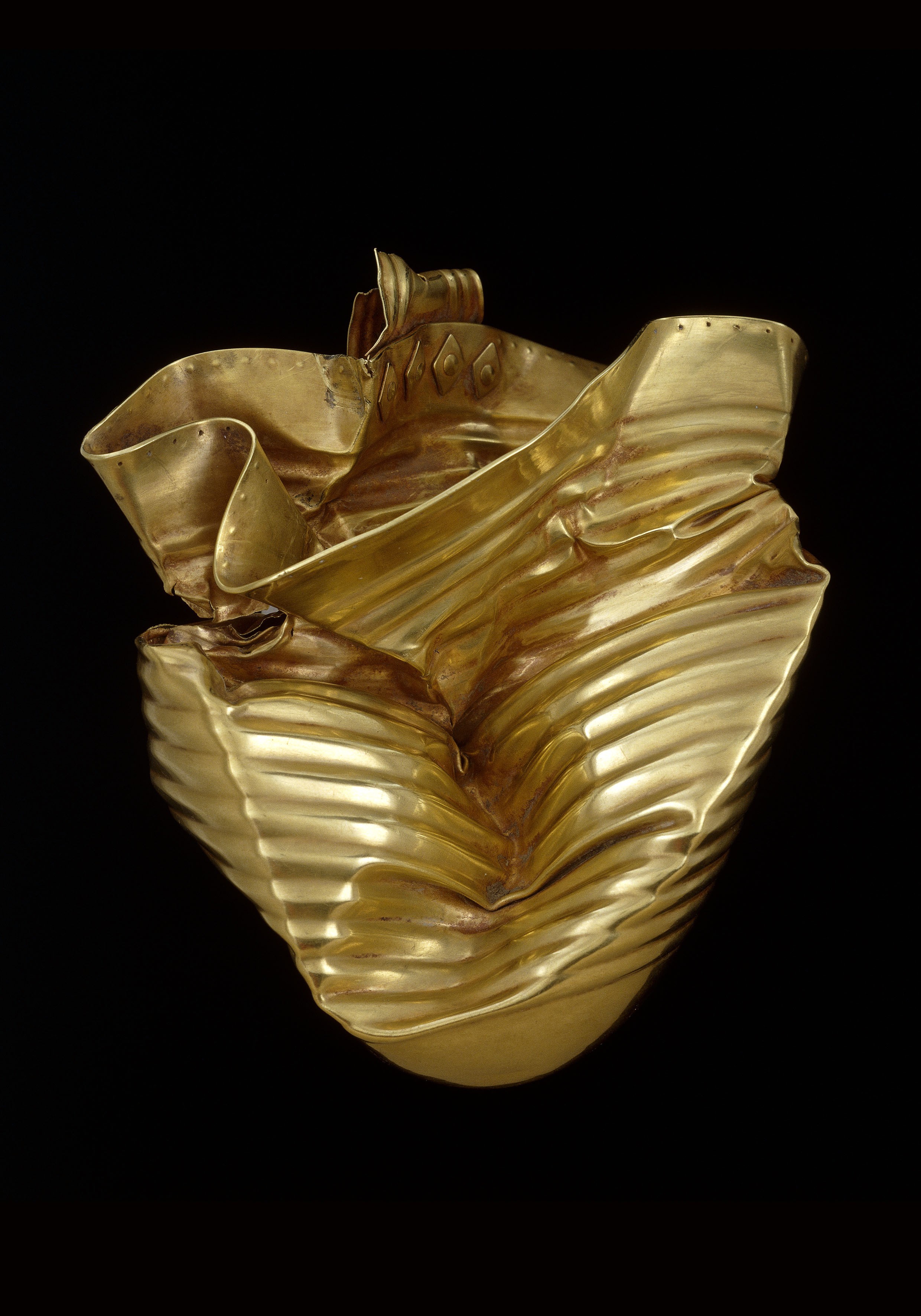
Ringlemere Cup
The Ringlemere Gold Cup is a Bronze Age vessel found in the Ringlemere barrow near Sandwich in the English county of Kent in 2001. == Description == The...

Ringlemere barrow
The Ringlemere barrow is an archaeological site near Sandwich in the English county of Kent most famous as being the find site of the Ringlemere gold cup...

Woodnesborough railway station
Woodnesborough railway station was a railway station on the East Kent Light Railway. It opened on 16 October 1916 and closed to passenger traffic after...

RAF Ash
Royal Air Force Ash or more simply RAF Ash (formerly RAF Sandwich) was a Royal Air Force underground control centre and radar station situated near the...
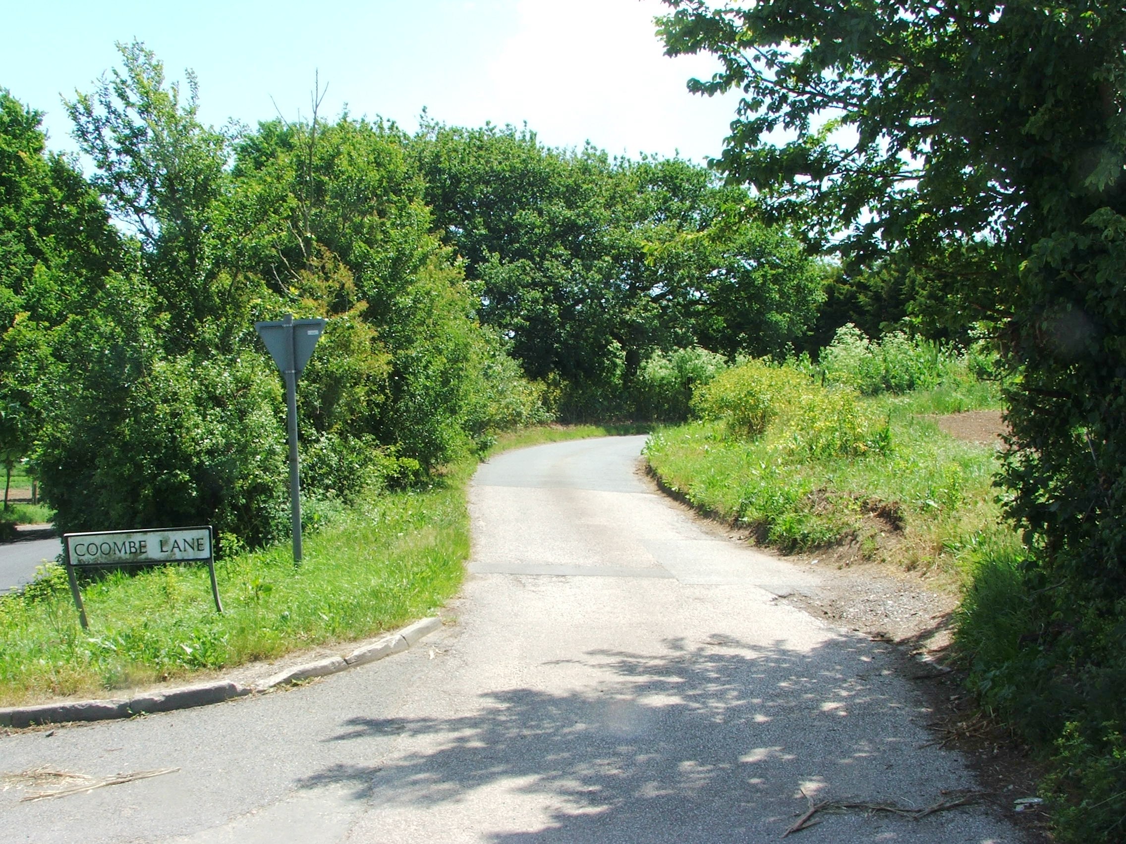
Coombe, Kent
Coombe is a settlement in the English county of Kent. It lies between Ash-next-Sandwich and Woodnesborough. According to Edward Hasted in 1800, it was...
Eastry Rural District
Eastry Rural District was a rural district in the county of Kent, England, from 1894 to 1974. It was subject to a significant boundary reform in 1935 when...
Marshborough
Marshborough is a small hamlet immediately adjacent to Woodnesborough in East Kent, England. == Listed buildings == === Parsonage Farm === The farmhouse...
Ash Town railway station
Ash Town railway station was a railway station on the East Kent Light Railway. The station served the village of Ash. == History == Opened by the East...
Nearby Amenities
Located within 500m of 51.265005,1.2839438Have you been to Black Pond?
Leave your review of Black Pond below (or comments, questions and feedback).