Bayfield Lake

Lake, Pool, Pond, Freshwater Marsh in Norfolk North Norfolk

England

Bayfield Lake

The Church of St Andrew, Letheringsett One of a small number of churches in Britain with a round tower.  Most of the round towers do however occur in Norfolk.
The Church of St Andrew, Letheringsett Credit: Bill Henderson

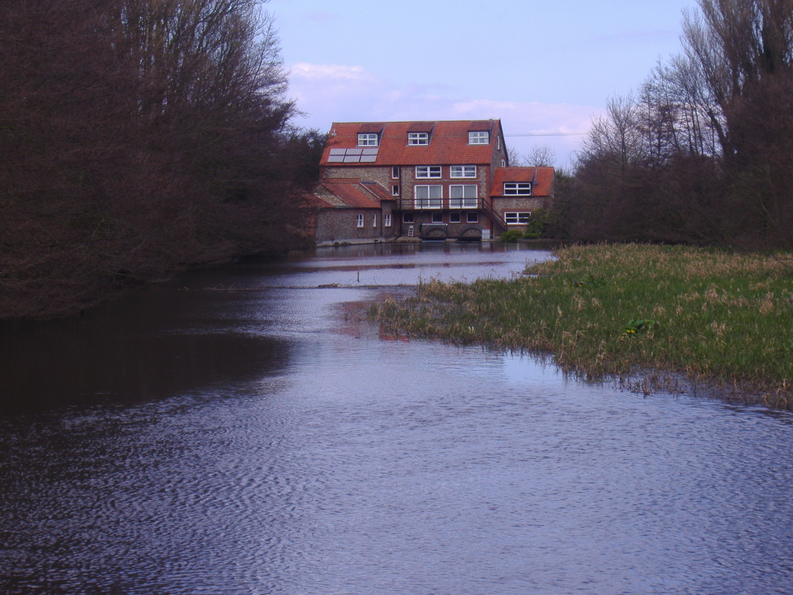
Bayfield Lake, located in Norfolk, is a picturesque freshwater marsh nestled in a serene natural setting. Spanning over an area of about 10 acres, it serves as a prominent recreational spot for both locals and tourists. The lake boasts a diverse ecosystem and is home to a wide array of flora and fauna, making it an ideal destination for nature enthusiasts.

The crystal-clear waters of Bayfield Lake are supplied by natural springs, ensuring a constant flow throughout the year. The lake is surrounded by lush greenery, including tall reeds, water lilies, and cattails that thrive in the marshy environment. These plants provide a habitat for various species of birds, amphibians, and insects.

The lake's tranquil ambiance makes it suitable for a range of activities such as fishing, birdwatching, and boating. Fishing enthusiasts can expect to catch species like perch, pike, and roach, among others. With its calm waters, it is a preferred spot for kayaking and canoeing, allowing visitors to explore the lake's nooks and crannies.

Bayfield Lake offers a scenic walking trail that encircles the perimeter, providing stunning views of the surrounding landscape. The area is also equipped with picnic spots, allowing visitors to enjoy a leisurely lunch amidst nature's beauty.

Overall, Bayfield Lake is a serene freshwater marsh that offers a diverse range of recreational activities. Whether one wishes to indulge in fishing, birdwatching, or simply relax in the tranquil surroundings, this enchanting lake has something to offer for everyone.

If you have any feedback on the listing, please let us know in the comments section below.

Bayfield Lake Images

Images are sourced within 2km of 52.920166/1.048261 or Grid Reference TG0540. Thanks to Geograph Open Source API. All images are credited.

The Church of St Andrew, Letheringsett One of a small number of churches in Britain with a round tower.  Most of the round towers do however occur in Norfolk.
The Church of St Andrew, Letheringsett
One of a small number of churches in Britain with a round tower. Most of the round towers do however occur in Norfolk.
St. Andrew, Letheringsett Much of the tower dates from the eleventh century. Most of the rest of the church is of fourteenth century origin.
St. Andrew, Letheringsett
Much of the tower dates from the eleventh century. Most of the rest of the church is of fourteenth century origin.
The grounds of Hall Farm, Letheringsett
House on Blakeney Road, Letheringsett If my memory serves me correctly this was once the home of Noel Cusa, naturalist and illustrator. He was a cousin of my father and we occasionally visited (though the house has been much extended since then). Noel gave me a bird book and a year's subscription to the RSPB when I was about 8. His influence still lives!
House on Blakeney Road, Letheringsett
If my memory serves me correctly this was once the home of Noel Cusa, naturalist and illustrator. He was a cousin of my father and we occasionally visited (though the house has been much extended since then). Noel gave me a bird book and a year's subscription to the RSPB when I was about 8. His influence still lives!
"Back to the Garden" farm shop At Breck Farm, Weybourne, on the A148.
"Back to the Garden" farm shop
At Breck Farm, Weybourne, on the A148.
Rolling roadworks on Blakeney Road Still trying to get the tar and stone chippings out of the tyres.
Rolling roadworks on Blakeney Road
Still trying to get the tar and stone chippings out of the tyres.
At last! After crawling along Blakeney Road for about 15 minutes due to rolling roadworks, we finally get permission to GO.
At last!
After crawling along Blakeney Road for about 15 minutes due to rolling roadworks, we finally get permission to GO.
A148 westbound near Meadow Farm
Back To The Garden Farm shop, restaurant and cafe.
Named after a lyric from "Woodstock" written by Joni Mitchell.
Back To The Garden
Farm shop, restaurant and cafe. Named after a lyric from "Woodstock" written by Joni Mitchell.
Entrance to Back To The Garden Looking across to the A148 Holt road.
Entrance to Back To The Garden
Looking across to the A148 Holt road.
A148, Breck Farm The A148 runs 44 miles from King's Lynn to Cromer. It is entirely within Norfolk. <span class="nowrap"><a title="http://www.sabre-roads.org.uk/wiki/index.php?title=A148" rel="nofollow ugc noopener" href="http://www.sabre-roads.org.uk/wiki/index.php?title=A148">Link</a><img style="margin-left:2px;" alt="External link" title="External link - shift click to open in new window" src="https://s1.geograph.org.uk/img/external.png" width="10" height="10"/></span>
A148, Breck Farm
The A148 runs 44 miles from King's Lynn to Cromer. It is entirely within Norfolk. LinkExternal link
A148 The A148 runs 44 miles from King's Lynn to Cromer. It is entirely within Norfolk. <span class="nowrap"><a title="http://www.sabre-roads.org.uk/wiki/index.php?title=A148" rel="nofollow ugc noopener" href="http://www.sabre-roads.org.uk/wiki/index.php?title=A148">Link</a><img style="margin-left:2px;" alt="External link" title="External link - shift click to open in new window" src="https://s1.geograph.org.uk/img/external.png" width="10" height="10"/></span>
A148
The A148 runs 44 miles from King's Lynn to Cromer. It is entirely within Norfolk. LinkExternal link
A148, Letheringsett The A148 runs 44 miles from King's Lynn to Cromer. It is entirely within Norfolk. <span class="nowrap"><a title="http://www.sabre-roads.org.uk/wiki/index.php?title=A148" rel="nofollow ugc noopener" href="http://www.sabre-roads.org.uk/wiki/index.php?title=A148">Link</a><img style="margin-left:2px;" alt="External link" title="External link - shift click to open in new window" src="https://s1.geograph.org.uk/img/external.png" width="10" height="10"/></span>
A148, Letheringsett
The A148 runs 44 miles from King's Lynn to Cromer. It is entirely within Norfolk. LinkExternal link
Malthouse, Letheringsett Grade II listed <span class="nowrap"><a title="http://list.english-heritage.org.uk/resultsingle.aspx?uid=1049837" rel="nofollow ugc noopener" href="http://list.english-heritage.org.uk/resultsingle.aspx?uid=1049837">Link</a><img style="margin-left:2px;" alt="External link" title="External link - shift click to open in new window" src="https://s1.geograph.org.uk/img/external.png" width="10" height="10"/></span>
Malthouse, Letheringsett
Grade II listed LinkExternal link
Road near Sand Hill
Road near Sand Hill
Unnamed road joins the B1156
Flint and brick cottages in Blakeney Road
Show me another place!

Bayfield Lake is located at Grid Ref: TG0540 (Lat: 52.920166, Lng: 1.048261)

Administrative County: Norfolk

District: North Norfolk

Police Authority: Norfolk

What 3 Words

///confident.grading.worker. Near Briston, Norfolk

Related Wikis

Glandford (Letheringsett Road)

Glandford (Letheringsett Road) is a 1.1-hectare (2.7-acre) geological Site of Special Scientific Interest west of Sheringham in Norfolk. It is a Geological...

Glandford (Hurdle Lane)

Glandford (Hurdle Lane) is a 9.4-hectare (23-acre) geological Site of Special Scientific Interest west of Sheringham in Norfolk. It is a Geological Conservation...

The Shell Museum

The Shell Museum in Glandford, Norfolk is the oldest museum in the county and holds one of the country's largest collections of sea shells. It was founded...

Glandford Watermill

Glandford watermill is situated on the River Glaven a little north of the village of Glandford within the English county of Norfolk. Glandford is in the...

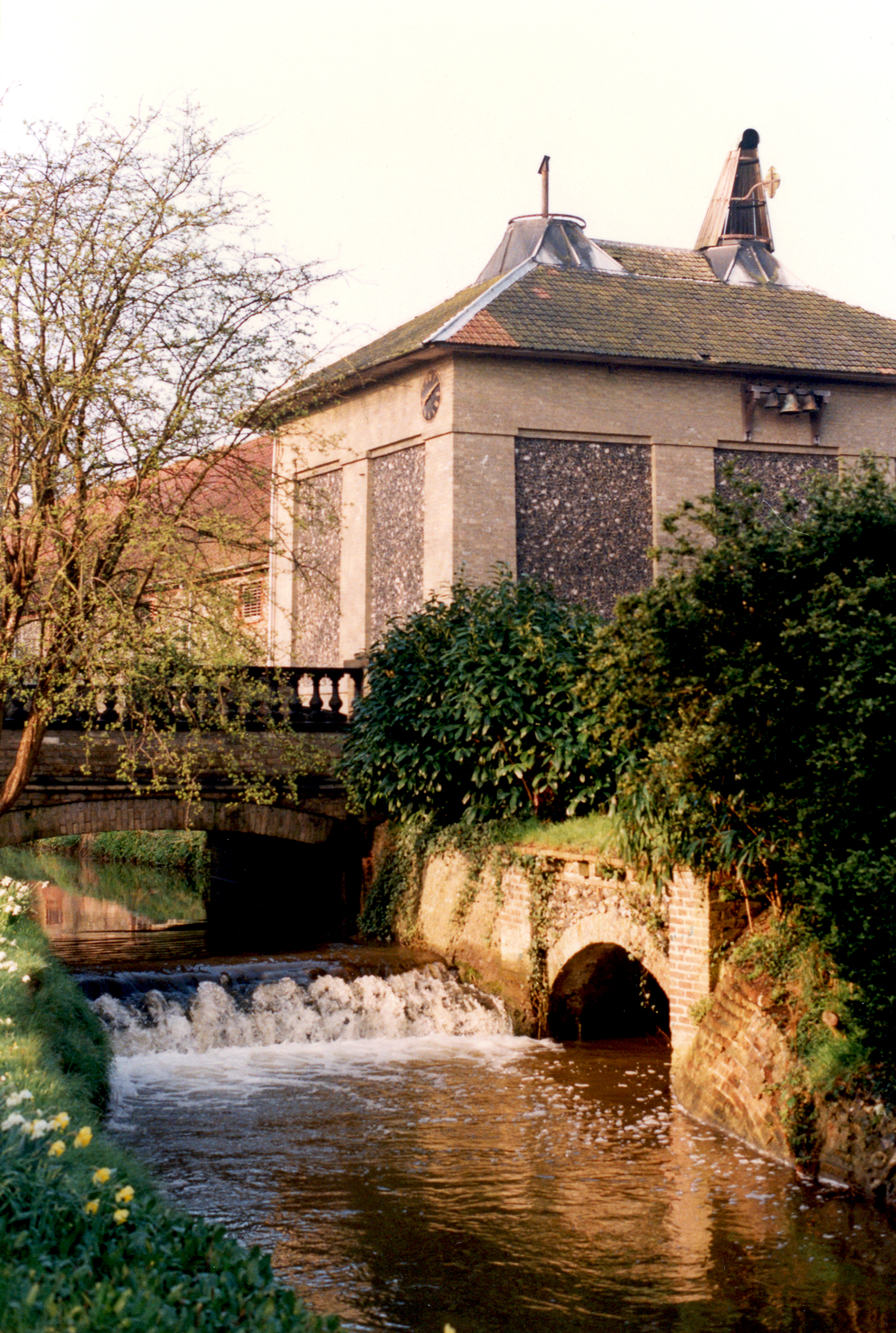
Letheringsett Brewery watermill

The remains of Letheringsett Brewery Watermill are located in the centre of the village of Letheringsett in the county of Norfolk. The watermill of 1784...

Letheringsett with Glandford

Letheringsett with Glandford is a civil parish in the English county of Norfolk. It includes the village of Letheringsett, along with the hamlet of Glandford...

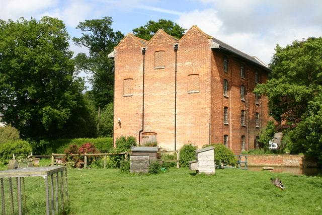
Letheringsett Watermill

Letheringsett watermill is situated on the River Glaven in the village of Letheringsett within the English county of Norfolk. Letheringsett is in the district...

Saxlingham

Saxlingham is a village and former civil parish, now in the parish of Field Dalling, in the North Norfolk district, in the county of Norfolk, England....

Nearby Amenities

Located within 500m of 52.920166,1.048261
The data included in this document is from www.openstreetmap.org. The data is made available under ODbL.

Have you been to Bayfield Lake?

Leave your review of Bayfield Lake below (or comments, questions and feedback).