Green Street

Settlement in Hertfordshire Hertsmere

England

Green Street

Lake in Aberford Park Aberford Park was purchased in stages starting in 1888. The lake was formed by the damming of the Borehamwood Brook. On some maps this is known as Tykes Water.

More information can be found at <span class="nowrap"><a title="https://www.greenflagaward.org//park-summary/?park=576" rel="nofollow ugc noopener" href="https://www.greenflagaward.org//park-summary/?park=576">Link</a><img style="margin-left:2px;" alt="External link" title="External link - shift click to open in new window" src="https://s1.geograph.org.uk/img/external.png" width="10" height="10"/></span>  and <span class="nowrap"><a title="https://www.parksherts.co.uk/parks/view/aberford-park" rel="nofollow ugc noopener" href="https://www.parksherts.co.uk/parks/view/aberford-park">Link</a><img style="margin-left:2px;" alt="External link" title="External link - shift click to open in new window" src="https://s1.geograph.org.uk/img/external.png" width="10" height="10"/></span>
Lake in Aberford Park Credit: Marathon

Green Street is a charming village located in Hertfordshire, England. Situated approximately 20 miles north of London, it forms part of the district of Broxbourne. The village is known for its picturesque countryside, idyllic setting, and historical significance.

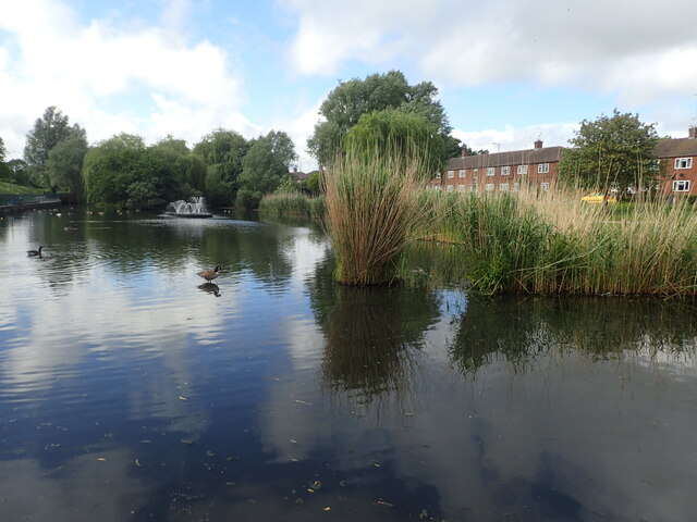
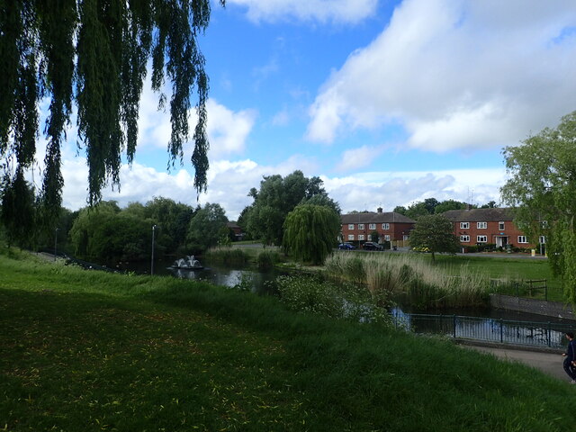
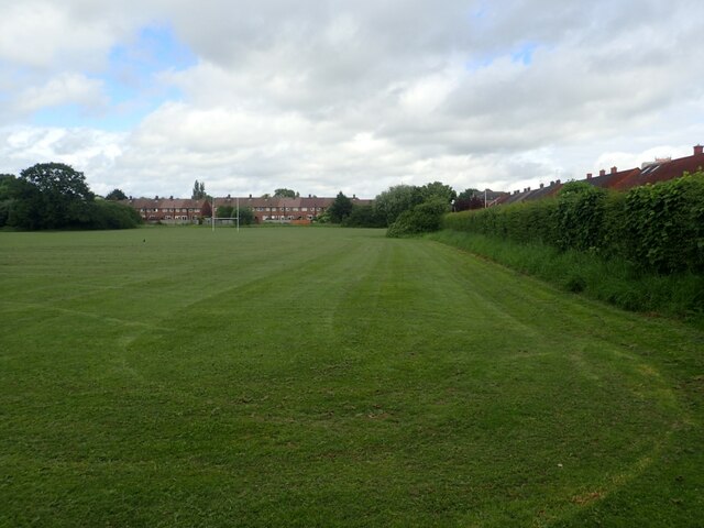
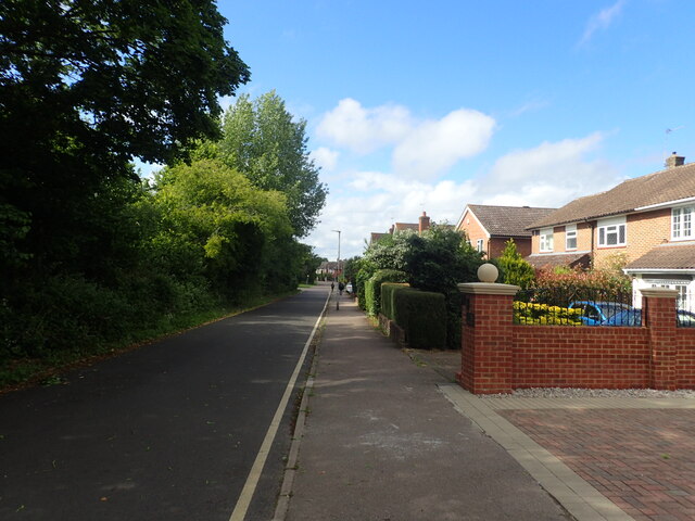
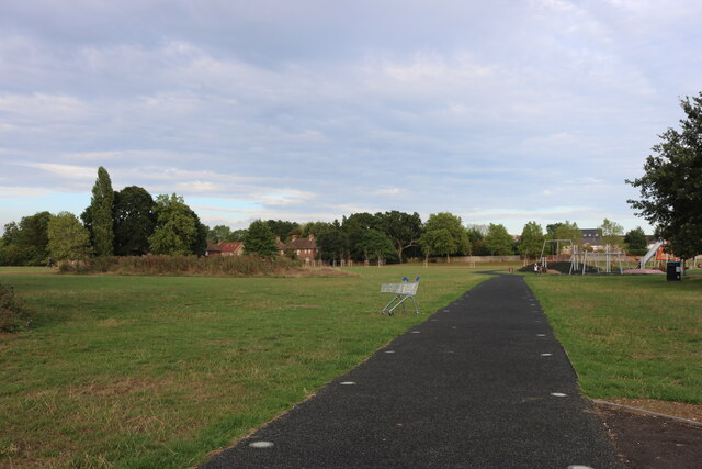
Green Street is characterized by its quaint, traditional English architecture, with many buildings dating back to the 17th and 18th centuries. The village is surrounded by lush green fields and rolling hills, offering residents and visitors a peaceful and scenic environment. The area is also home to several nature reserves and parks, providing ample opportunities for outdoor activities and exploration.

Despite its rural setting, Green Street benefits from excellent transport links, making it an ideal location for commuters. The village is well-connected to nearby towns and cities through a network of well-maintained roads, and there are regular bus services providing convenient access to surrounding areas. Additionally, the nearby Broxbourne railway station offers frequent train services to London Liverpool Street, making it easily accessible for those working in the capital.

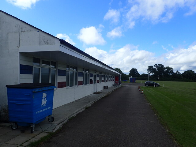
Green Street boasts a friendly and close-knit community, with a range of amenities and services available to residents. The village has a local primary school, a village hall, and a few shops and pubs, catering to the everyday needs of its inhabitants. For further amenities, the nearby town of Hoddesdon offers a wider range of shops, supermarkets, and leisure facilities.

Overall, Green Street is a peaceful and picturesque village, offering a delightful blend of countryside living and convenient access to nearby urban centers. Its rich history, natural beauty, and community spirit make it an attractive place to live or visit in Hertfordshire.

If you have any feedback on the listing, please let us know in the comments section below.
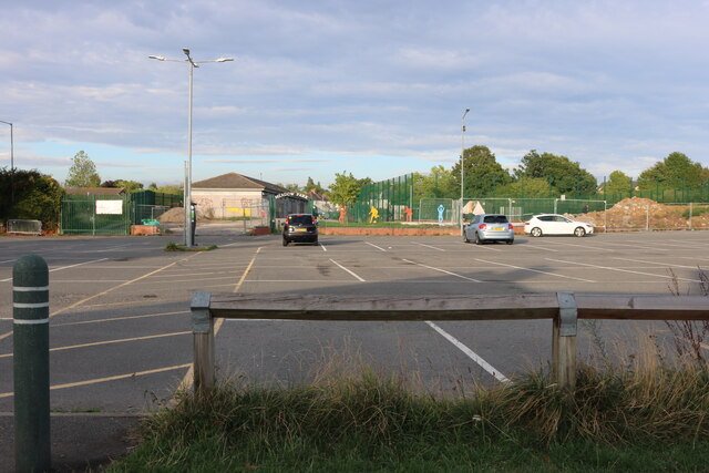
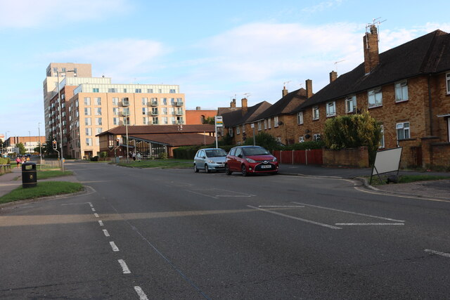
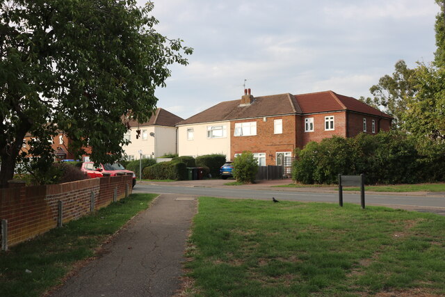
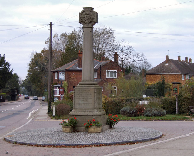
Green Street Images

Images are sourced within 2km of 51.67549/-0.274006 or Grid Reference TQ1998. Thanks to Geograph Open Source API. All images are credited.

Lake in Aberford Park Aberford Park was purchased in stages starting in 1888. The lake was formed by the damming of the Borehamwood Brook. On some maps this is known as Tykes Water.

More information can be found at <span class="nowrap"><a title="https://www.greenflagaward.org//park-summary/?park=576" rel="nofollow ugc noopener" href="https://www.greenflagaward.org//park-summary/?park=576">Link</a><img style="margin-left:2px;" alt="External link" title="External link - shift click to open in new window" src="https://s1.geograph.org.uk/img/external.png" width="10" height="10"/></span>  and <span class="nowrap"><a title="https://www.parksherts.co.uk/parks/view/aberford-park" rel="nofollow ugc noopener" href="https://www.parksherts.co.uk/parks/view/aberford-park">Link</a><img style="margin-left:2px;" alt="External link" title="External link - shift click to open in new window" src="https://s1.geograph.org.uk/img/external.png" width="10" height="10"/></span>
Lake in Aberford Park
Aberford Park was purchased in stages starting in 1888. The lake was formed by the damming of the Borehamwood Brook. On some maps this is known as Tykes Water. More information can be found at LinkExternal link and LinkExternal link
Aberford Park Aberford Park was purchased in stages starting in 1888. The lake was formed by the damming of the Borehamwood Brook. On some maps this is known as Tykes Water.

More information can be found at <span class="nowrap"><a title="https://www.greenflagaward.org//park-summary/?park=576" rel="nofollow ugc noopener" href="https://www.greenflagaward.org//park-summary/?park=576">Link</a><img style="margin-left:2px;" alt="External link" title="External link - shift click to open in new window" src="https://s1.geograph.org.uk/img/external.png" width="10" height="10"/></span>  and <span class="nowrap"><a title="https://www.parksherts.co.uk/parks/view/aberford-park" rel="nofollow ugc noopener" href="https://www.parksherts.co.uk/parks/view/aberford-park">Link</a><img style="margin-left:2px;" alt="External link" title="External link - shift click to open in new window" src="https://s1.geograph.org.uk/img/external.png" width="10" height="10"/></span>

See also <a title="https://www.geograph.org.uk/photo/7182331" href="https://www.geograph.org.uk/photo/7182331">Link</a>
Aberford Park
Aberford Park was purchased in stages starting in 1888. The lake was formed by the damming of the Borehamwood Brook. On some maps this is known as Tykes Water. More information can be found at LinkExternal link and LinkExternal link See also Link
Rugby and cricket ground alongside Croxdale Road This is the Old Haberdashers Sports Ground.
Rugby and cricket ground alongside Croxdale Road
This is the Old Haberdashers Sports Ground.
Rugby and cricket ground alongside Croxdale Road This is the Old Haberdashers Sports Ground - see also <a title="https://www.geograph.org.uk/photo/7182342" href="https://www.geograph.org.uk/photo/7182342">Link</a>
Rugby and cricket ground alongside Croxdale Road
This is the Old Haberdashers Sports Ground - see also Link
Theobald Street, Borehamwood The main part of Theobald Street runs parallel to this service road on the other side of the trees on the left
Theobald Street, Borehamwood
The main part of Theobald Street runs parallel to this service road on the other side of the trees on the left
The entrance to Borehamwood FC The ground is currently being rebuilt and this is the road entrance which is not yet in use, the pedestrian entrance runs parallel to the left.
The entrance to Borehamwood FC
The ground is currently being rebuilt and this is the road entrance which is not yet in use, the pedestrian entrance runs parallel to the left.
Meadow Park Stadium, Borehamwood Currently being rebuilt, this is the home of Borehamwood FC.
Meadow Park Stadium, Borehamwood
Currently being rebuilt, this is the home of Borehamwood FC.
Meadow Park, Borehamwood
Construction work at Borehamwood FC The whole stadium is being rebuilt.
Construction work at Borehamwood FC
The whole stadium is being rebuilt.
The pedestrian entrance to Borehamwood FC This is all in the process of construction.
The pedestrian entrance to Borehamwood FC
This is all in the process of construction.
Meadow Park, Borehamwood Looking towards Broughinge Road.
Meadow Park, Borehamwood
Looking towards Broughinge Road.
Liberty Court, Borehamwood
Fairbrook Medical Centre, Borehamwood
Meadow Park car park, Borehamwood
Brook Road, Borehamwood
Broughinge Road, Borehamwood
Shops on Aycliffe Road, Borehamwood
A street of houses beyond a gate This is in Borehamwood and the BBC Elstree Centre is on the other side of the gate. The houses are part of the set of Eastenders.
A street of houses beyond a gate
This is in Borehamwood and the BBC Elstree Centre is on the other side of the gate. The houses are part of the set of Eastenders.
Show me another place!

Green Street is located at Grid Ref: TQ1998 (Lat: 51.67549, Lng: -0.274006)

Administrative County: Hertfordshire

District: Hertsmere

Police Authority: Hertfordshire

What 3 Words

///softly.cafe.surely. Near Shenley, Hertfordshire

Nearby Locations

Green Street Silver Hill

Related Wikis

Hertsmere (UK Parliament constituency)

Hertsmere is a constituency in Hertfordshire, England, represented in the House of Commons since 2015 by Oliver Dowden, who currently serves as deputy...

Hertswood Academy

Hertswood Academy (formerly Hertswood School) is a coeducational secondary school in Borehamwood, Hertfordshire which gained academy status in January...

Boreham Wood F.C.

Boreham Wood Football Club is a professional football club based in Borehamwood, Hertfordshire, England. They are currently members of the National League...

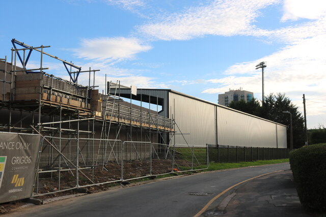
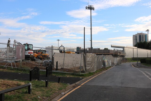
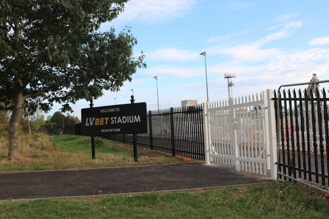
Meadow Park (Borehamwood)

Meadow Park, currently known as the Mangata Pay UK Stadium, Meadow Park for sponsorship purposes, is a football ground in Borehamwood, Hertfordshire, England...

Hertsmere

Hertsmere is a local government district with borough status in Hertfordshire, England. Its council is based in Borehamwood. Other settlements in the borough...

BBC Elstree Centre

The BBC Elstree Centre, sometimes referred to as the BBC Elstree Studios, is a television production facility, currently owned by the BBC. The complex...

Elstree Screen Arts Academy

Elstree Screen Arts Academy (formerly Elstree University Technical College) is a university technical college (UTC) located in Borehamwood, Hertfordshire...

Shenley

Shenley is a village and civil parish in Hertfordshire, England, between Barnet and St Albans. The village is located 14 miles from Central London. As...

Nearby Amenities

Located within 500m of 51.67549,-0.274006
Power: tower
Lat/Long: 51.6759765/-0.2799839
Power: tower
Lat/Long: 51.6772581/-0.2759686
Power: tower
Lat/Long: 51.6795059/-0.2729185
Bus Stop
Stapleton Road
Bus: yes
Naptan AtcoCode: 210021002600
Naptan Bearing: SE
Naptan CommonName: Stapleton Road
Naptan Indicator: opp
Naptan Landmark: Unknown
Naptan NaptanCode: hrtgpjdp
Naptan PlusbusZoneRef: ELTR
Naptan ShortCommonName: NA
Naptan Street: Green Street
Naptan Verified: no
Public Transport: platform
Source: naptan_import
Lat/Long: 51.676129/-0.2741739
Bus Stop
Champions Close
Naptan AtcoCode: 210021002610
Naptan Bearing: SE
Naptan CommonName: Champions Close
Naptan Crossing: Green Street
Naptan Indicator: opp
Naptan Landmark: Green Street
Naptan NaptanCode: hrtgpjdt
Naptan PlusbusZoneRef: ELTR
Naptan ShortCommonName: NA
Naptan Street: Cowley Hill
Naptan Verified: no
Public Transport: platform
Source: naptan_import
Lat/Long: 51.6741501/-0.2722966
Bus Stop
Stanborough Avenue
Bus: yes
Naptan AtcoCode: 210021002790
Naptan Bearing: SW
Naptan CommonName: Stanborough Avenue
Naptan Indicator: adj
Naptan Landmark: Unknown
Naptan NaptanCode: hrtgpgmp
Naptan PlusbusZoneRef: ELTR
Naptan ShortCommonName: NA
Naptan Street: Stapleton Road
Naptan Verified: no
Public Transport: platform
Shelter: no
Source: naptan_import
Lat/Long: 51.6748554/-0.2757474
Bus Stop
Ayot Path
Bus: yes
Naptan AtcoCode: 210021002795
Naptan Bearing: S
Naptan CommonName: Ayot Path
Naptan Indicator: adj
Naptan Landmark: Unknown
Naptan NaptanCode: hrtgpgmt
Naptan PlusbusZoneRef: ELTR
Naptan ShortCommonName: NA
Naptan Street: Stapleton Road
Naptan Verified: no
Public Transport: platform
Source: naptan_import
Lat/Long: 51.6732314/-0.2777182
Bus Stop
Stilton Path
Bus: yes
Naptan AtcoCode: 210021002800
Naptan Bearing: S
Naptan CommonName: Stilton Path
Naptan Indicator: nr
Naptan Landmark: Unknown
Naptan NaptanCode: hrtgpgmw
Naptan PlusbusZoneRef: ELTR
Naptan ShortCommonName: NA
Naptan Street: Stapleton Road
Naptan Verified: no
Public Transport: platform
Shelter: no
Source: naptan_import
Lat/Long: 51.6721034/-0.2782425
Bus Stop
Thirsk Road footpath
Bus: yes
Naptan AtcoCode: 210021002833
Naptan Bearing: NW
Naptan CommonName: Thirsk Road footpath
Naptan Indicator: adj
Naptan Landmark: Unknown
Naptan NaptanCode: hrtgpgpt
Naptan PlusbusZoneRef: ELTR
Naptan ShortCommonName: NA
Naptan Street: Stanborough Avenue
Naptan Verified: no
Public Transport: platform
Source: naptan_import
Lat/Long: 51.6711386/-0.2727305
Bus Stop
Redwood Rise
Bus: yes
Naptan AtcoCode: 210021002835
Naptan Bearing: N
Naptan CommonName: Redwood Rise
Naptan Indicator: opp
Naptan Landmark: Unknown
Naptan NaptanCode: hrtgpgpw
Naptan PlusbusZoneRef: ELTR
Naptan ShortCommonName: NA
Naptan Street: Stanborough Avenue
Naptan Verified: no
Public Transport: platform
Shelter: yes
Source: naptan_import
Lat/Long: 51.6725279/-0.2737787
Bus Stop
Ayot Path
Bus: yes
Naptan AtcoCode: 210021003996
Naptan Bearing: N
Naptan CommonName: Ayot Path
Naptan Indicator: opp
Naptan Landmark: Unknown
Naptan NaptanCode: hrtgpdgw
Naptan PlusbusZoneRef: ELTR
Naptan ShortCommonName: NA
Naptan Street: Stapleton Road
Naptan Verified: no
Public Transport: platform
Shelter: yes
Source: naptan_import
Lat/Long: 51.6736263/-0.2775594
Bus Stop
Stanborough Avenue
Bus: yes
Naptan AtcoCode: 210021003997
Naptan Bearing: NE
Naptan CommonName: Stanborough Avenue
Naptan Indicator: opp
Naptan Landmark: Unknown
Naptan NaptanCode: hrtgpdja
Naptan PlusbusZoneRef: ELTR
Naptan ShortCommonName: NA
Naptan Street: Stapleton Road
Naptan Verified: no
Public Transport: platform
Shelter: no
Source: naptan_import
Lat/Long: 51.6752209/-0.2749791
Bus Stop
Champions Close
Naptan AtcoCode: 210021004090
Naptan Bearing: NW
Naptan CommonName: Champions Close
Naptan Crossing: Stapleton Road
Naptan Indicator: adj
Naptan Landmark: Stapleton Road
Naptan NaptanCode: hrtgpawp
Naptan PlusbusZoneRef: ELTR
Naptan ShortCommonName: NA
Naptan Street: Cowley Hill
Naptan Verified: no
Public Transport: platform
Source: naptan_import
Lat/Long: 51.6747092/-0.2730129
Bus Stop
Stapleton Road
Bus: yes
Local Ref: NR
Naptan AtcoCode: 210021004105
Naptan Bearing: NW
Naptan CommonName: Stapleton Road
Naptan Indicator: nr
Naptan Landmark: Unknown
Naptan NaptanCode: hrtgpdad
Naptan PlusbusZoneRef: ELTR
Naptan ShortCommonName: NA
Naptan Street: Green Street
Naptan Verified: no
Public Transport: platform
Source: naptan_import
Lat/Long: 51.6763323/-0.2745422
Bus Stop
Stanborough Avenue
Bus: yes
Naptan AtcoCode: 210021004145
Naptan Bearing: SE
Naptan CommonName: Stanborough Avenue
Naptan Indicator: SE-bound
Naptan Landmark: Unknown
Naptan NaptanCode: hrtgpdap
Naptan PlusbusZoneRef: ELTR
Naptan ShortCommonName: NA
Naptan Street: Stanborough Avenue
Naptan Verified: no
Public Transport: platform
Shelter: no
Source: naptan_import
Lat/Long: 51.6746304/-0.2749798
Bus Stop
Redwood Rise
Bus: yes
Naptan AtcoCode: 210021004150
Naptan Bearing: S
Naptan CommonName: Redwood Rise
Naptan Indicator: nr
Naptan Landmark: Unknown
Naptan NaptanCode: hrtgpapt
Naptan PlusbusZoneRef: ELTR
Naptan ShortCommonName: NA
Naptan Street: Stanborough Avenue
Naptan Verified: no
Public Transport: platform
Shelter: yes
Source: naptan_import
Lat/Long: 51.6736177/-0.274042
Bus Stop
Thirsk Road footpath
Bus: yes
Naptan AtcoCode: 210021004160
Naptan Bearing: SE
Naptan CommonName: Thirsk Road footpath
Naptan Indicator: opp
Naptan Landmark: Unknown
Naptan NaptanCode: hrtgpapw
Naptan PlusbusZoneRef: ELTR
Naptan ShortCommonName: NA
Naptan Street: Stanborough Avenue
Naptan Verified: no
Public Transport: platform
Shelter: no
Source: naptan_import
Lat/Long: 51.6714451/-0.272899
Noexit: yes
Lat/Long: 51.6715296/-0.2720512
Noexit: yes
Lat/Long: 51.6731688/-0.2718782
Direction: 120
Fixme: survey for panel count
Generator Method: photovoltaic
Generator Output Electricity: yes
Generator Solar Modules: 14
Generator Source: solar
Generator Type: solar_photovoltaic_panel
Location: roof
Power: generator
Lat/Long: 51.6736643/-0.2763807
Direction: 160
Generator Method: photovoltaic
Generator Output Electricity: yes
Generator Solar Modules: 10
Generator Source: solar
Generator Type: solar_photovoltaic_panel
Location: roof
Power: generator
Lat/Long: 51.6732354/-0.272216
Direction: 165
Generator Method: photovoltaic
Generator Output Electricity: yes
Generator Solar Modules: 12
Generator Source: solar
Generator Type: solar_photovoltaic_panel
Location: roof
Power: generator
Lat/Long: 51.6731603/-0.2734947
Direction: 165
Generator Method: photovoltaic
Generator Output Electricity: yes
Generator Solar Modules: 12
Generator Source: solar
Generator Type: solar_photovoltaic_panel
Location: roof
Power: generator
Lat/Long: 51.6732095/-0.2732777
Crossing
Crossing: unmarked
Crossing Island: no
Crossing Markings: no
Lat/Long: 51.6726835/-0.273504
Direction: 215
Generator Method: photovoltaic
Generator Output Electricity: yes
Generator Solar Modules: 3
Generator Source: solar
Generator Type: solar_photovoltaic_panel
Location: roof
Power: generator
Lat/Long: 51.6746785/-0.2735273
Barrier: cycle_barrier
Foot: yes
Lat/Long: 51.6735202/-0.2719034
Power: pole
Lat/Long: 51.6734555/-0.2698053
Power: pole
Lat/Long: 51.6731409/-0.2713193
Traffic Calming: island
Lat/Long: 51.6762359/-0.274317
The data included in this document is from www.openstreetmap.org. The data is made available under ODbL.

Have you been to Green Street?

Leave your review of Green Street below (or comments, questions and feedback).