Ardleigh Reservoir

Lake, Pool, Pond, Freshwater Marsh in Essex Tendring

England

Ardleigh Reservoir

Crockleford Heath, Essex A field of Borage near Crockleford Heath.
Crockleford Heath, Essex Credit: Rebecca A Wills

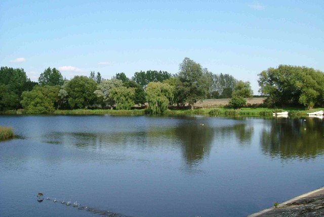
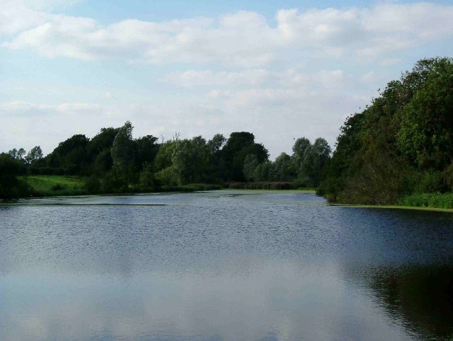
Ardleigh Reservoir, located in Essex, England, is a picturesque freshwater body encompassing an area of approximately 125 acres. With its tranquil surroundings and diverse wildlife, the reservoir is a popular destination for both locals and tourists seeking a peaceful retreat.

The reservoir primarily serves as a water supply source, providing clean and fresh water to the surrounding areas. It is fed by several small streams and natural springs, ensuring a consistent water level throughout the year. The water quality is closely monitored to maintain its purity and suitability for consumption.

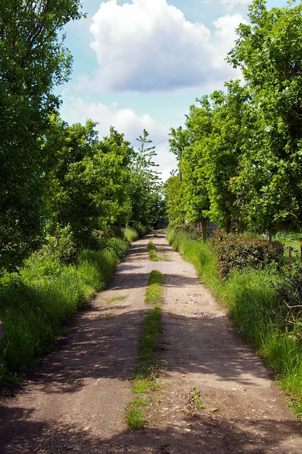
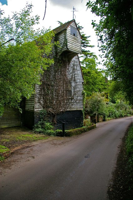
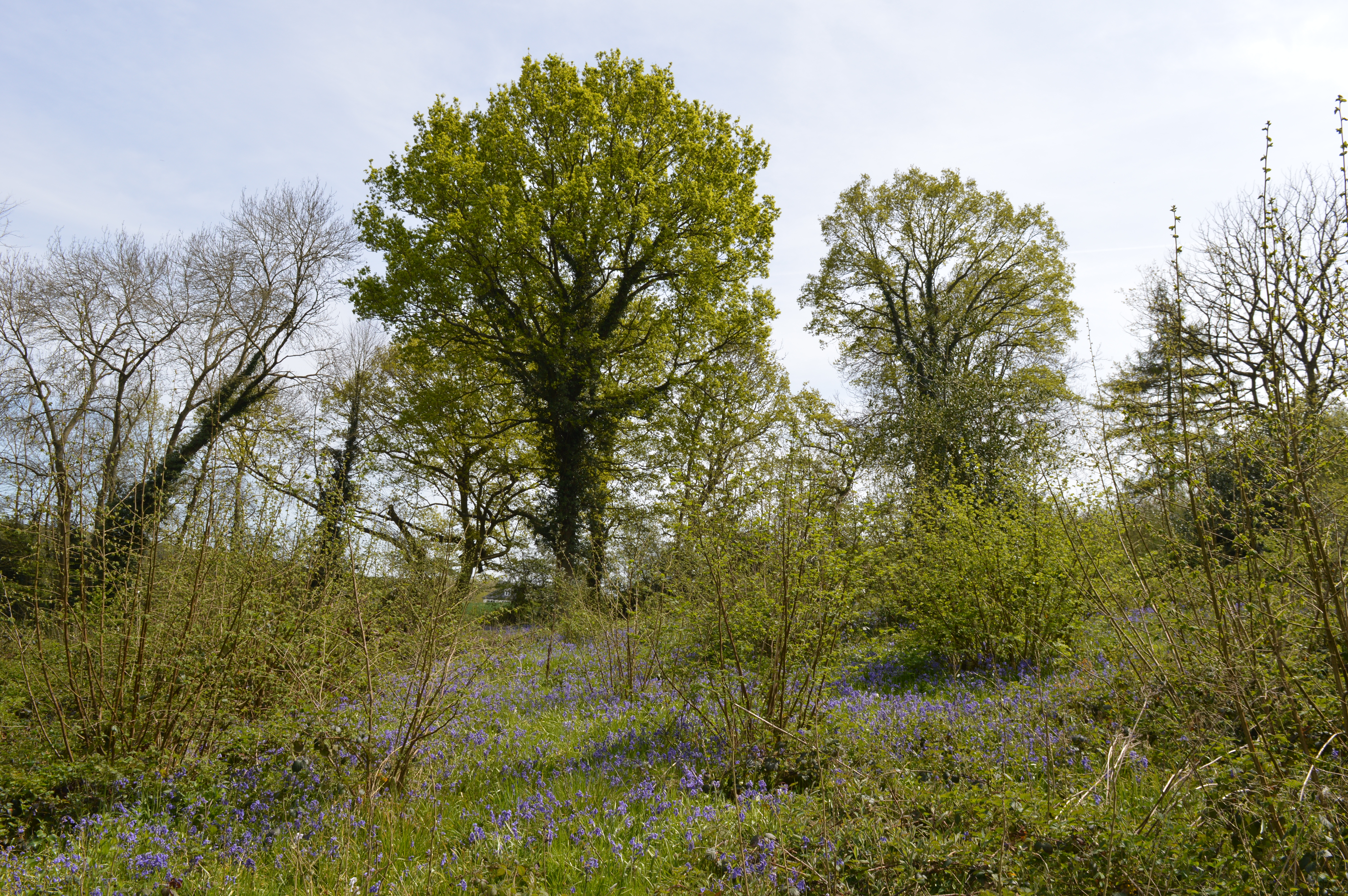
Surrounded by lush greenery and wooded areas, Ardleigh Reservoir boasts a rich biodiversity. The diverse ecosystem supports a wide range of flora and fauna, making it a haven for nature enthusiasts. Visitors can expect to encounter various species of birds, including herons, grebes, and ducks, as well as small mammals like water voles and otters.

The reservoir also offers recreational activities such as fishing and boating. Anglers can find a variety of fish species, including pike, carp, and roach, making it an ideal spot for fishing enthusiasts. Additionally, the calm waters provide an excellent opportunity for boating and sailing, allowing visitors to explore the reservoir at their own leisure.

Ardleigh Reservoir is a cherished natural asset in Essex, providing a serene environment for relaxation, wildlife observation, and outdoor activities. Whether visitors are seeking a peaceful walk along the shore or an exciting fishing expedition, the reservoir offers a tranquil setting immersed in natural beauty.

If you have any feedback on the listing, please let us know in the comments section below.

Ardleigh Reservoir Images

Images are sourced within 2km of 51.916175/0.95291523 or Grid Reference TM0328. Thanks to Geograph Open Source API. All images are credited.

Crockleford Heath, Essex A field of Borage near Crockleford Heath.
Crockleford Heath, Essex
A field of Borage near Crockleford Heath.
Crockleford Heath, Essex Borage flowers in a field near Crockleford Heath, Essex.
Crockleford Heath, Essex
Borage flowers in a field near Crockleford Heath, Essex.
Aggregate Works, Martells Pit
Farmland near Colchester
Old Milestone, Old Ipswich Road (Was A12), 240m South of Harts Lane Junction The milestone is located in front of  the PRM Commercials garage on the east side of road. Parish of Ardleigh (Tendring District). Carved stone post, erected by the Chelmsford (Division of Essex First District) turnpike trust in the 19th century. 

Inscription is now largely eroded but the following is discernible on the front face:- Ardleigh

Listed grade II, list entry number:1147792  <span class="nowrap"><a title="https://historicengland.org.uk/listing/the-list/list-entry/1147792" rel="nofollow ugc noopener" href="https://historicengland.org.uk/listing/the-list/list-entry/1147792">Link</a><img style="margin-left:2px;" alt="External link" title="External link - shift click to open in new window" src="https://s1.geograph.org.uk/img/external.png" width="10" height="10"/></span>
Essex HER listed. SMR Number: 15743 <span class="nowrap"><a title="https://www.heritagegateway.org.uk/Gateway/Results_Single.aspx?uid=MEX1009948&resourceID=1001" rel="nofollow ugc noopener" href="https://www.heritagegateway.org.uk/Gateway/Results_Single.aspx?uid=MEX1009948&resourceID=1001">Link</a><img style="margin-left:2px;" alt="External link" title="External link - shift click to open in new window" src="https://s1.geograph.org.uk/img/external.png" width="10" height="10"/></span>

The milestone was found by a Milestone Society member fallen, probably following local flooding, and was re-erected by a working party from the Society for the Protection of Ancient Buildings in August 2021.

Milestone Society National ID: EX_COIP55
Old Milestone, Old Ipswich Road (Was A12), 240m South of Harts Lane Junction
The milestone is located in front of the PRM Commercials garage on the east side of road. Parish of Ardleigh (Tendring District). Carved stone post, erected by the Chelmsford (Division of Essex First District) turnpike trust in the 19th century. Inscription is now largely eroded but the following is discernible on the front face:- Ardleigh Listed grade II, list entry number:1147792 LinkExternal link Essex HER listed. SMR Number: 15743 LinkExternal link The milestone was found by a Milestone Society member fallen, probably following local flooding, and was re-erected by a working party from the Society for the Protection of Ancient Buildings in August 2021. Milestone Society National ID: EX_COIP55
Ardleigh Reservoir from Wick Lane This is a shot of Ardleigh Reservoir north of Colchester taken from near Fountain Farm. The Reservoir was created in the 1970’s when Colchester’s traditional water source at Lexden Springs became inadequate for the expanding town. The picture was taken from a causeway on Wick Lane looking north east(ish).
Ardleigh Reservoir from Wick Lane
This is a shot of Ardleigh Reservoir north of Colchester taken from near Fountain Farm. The Reservoir was created in the 1970’s when Colchester’s traditional water source at Lexden Springs became inadequate for the expanding town. The picture was taken from a causeway on Wick Lane looking north east(ish).
Ardleigh Reservoir near Hillhouse Farm This is a shot of Ardleigh Reservoir north of Colchester taken from near Hillhouse Farm on Lodge Lane this picture is looking north west. See also <a href="https://www.geograph.org.uk/gridref/TM0429">TM0429</a>
Ardleigh Reservoir near Hillhouse Farm
This is a shot of Ardleigh Reservoir north of Colchester taken from near Hillhouse Farm on Lodge Lane this picture is looking north west. See also TM0429
Ardleigh Reservoir This is a shot of Ardleigh Reservoir north of Colchester taken from the end of Lodge Lane. The picture looks west across the water. See also <a href="https://www.geograph.org.uk/gridref/TM0429">TM0429</a> & <a href="https://www.geograph.org.uk/gridref/TM0329">TM0329</a>
Ardleigh Reservoir
This is a shot of Ardleigh Reservoir north of Colchester taken from the end of Lodge Lane. The picture looks west across the water. See also TM0429 & TM0329
The Crown Inn On Old Ipswich Road near Ardleigh
The Crown Inn
On Old Ipswich Road near Ardleigh
Brunel Way This is Brunel Way part of a large business park to the north of Colchester. The mainly service industries based here have to some degree helped alleviate the unemployment caused by the closure of Colchester’s traditional engineering employers such as the lathe company.
Brunel Way
This is Brunel Way part of a large business park to the north of Colchester. The mainly service industries based here have to some degree helped alleviate the unemployment caused by the closure of Colchester’s traditional engineering employers such as the lathe company.
Fen Farm footpath This footpath/private Road  near Fen Farm,  Fox Street runs from the A137 to A12/A120 Junction at TM019289
Fen Farm footpath
This footpath/private Road near Fen Farm, Fox Street runs from the A137 to A12/A120 Junction at TM019289
Henless Huts These abandoned chicken sheds are on Fen Farm, Fox Street north of Colchester.
Henless Huts
These abandoned chicken sheds are on Fen Farm, Fox Street north of Colchester.
Springvalley Lane Mill This mill near Ardleigh north of Colchester looks to be at the start of an extensive restoration it is a tad dilapidated at the moment.
Springvalley Lane Mill
This mill near Ardleigh north of Colchester looks to be at the start of an extensive restoration it is a tad dilapidated at the moment.
A120 This is the A120 looking coast bound from the flyover on Springvalley Lane near Ardleigh.
A120
This is the A120 looking coast bound from the flyover on Springvalley Lane near Ardleigh.
Springvalley Lane This is Springvalley Lane and the mill near Ardleigh north of Colchester.
Springvalley Lane
This is Springvalley Lane and the mill near Ardleigh north of Colchester.
Bumblebee This bumblebee was feasting on the rhododendrons near the mill in <a href="https://www.geograph.org.uk/photo/176756">TM0327 : Springvalley Lane</a>
Bumblebee
This bumblebee was feasting on the rhododendrons near the mill in TM0327 : Springvalley Lane
Langham Trig This triangulation point is near Langham Lodge farm. If satellite imaging had not rendered triangulation points obsolete some lumberjacking would be required before this one could be used again!
Langham Trig
This triangulation point is near Langham Lodge farm. If satellite imaging had not rendered triangulation points obsolete some lumberjacking would be required before this one could be used again!
Milepost Milepost outside Lodge Farm near Ardleigh
Milepost
Milepost outside Lodge Farm near Ardleigh
Show me another place!

Ardleigh Reservoir is located at Grid Ref: TM0328 (Lat: 51.916175, Lng: 0.95291523)

Administrative County: Essex

District: Tendring

Police Authority: Essex

What 3 Words

///stir.slate.cooks. Near Colchester, Essex

Related Wikis

Ardleigh Reservoir

Ardleigh Reservoir is a 49-hectare (120-acre) lake near Colchester in Essex, England constructed in the valley of the Salary Brook. It supplies water both...

Bullock Wood

Bullock Wood is a 23.3-hectare (58-acre) biological Site of Special Scientific Interest on the northern outskirts of Colchester in Essex.The site is mature...

Welsh Wood

Welsh Wood is a 3.2 hectare Local Nature Reserve in Colchester in Essex. It is owned and managed by Colchester Borough Council.Trees in this site are managed...

Ardleigh railway station

Ardleigh railway station served the village of Ardleigh in Essex, England. The station was situated on the Great Eastern Main Line. == History == Opened...

Ardleigh Gravel Pit

Ardleigh Gravel Pit is a 1.2-hectare (3.0-acre) geological Site of Special Scientific Interest south of Ardleigh in Essex. It is a Geological Conservation...

Crockleford Heath

Crockleford Heath is part of the village and civil parish of Ardleigh in Essex. It is located 2+1⁄2 miles south-west of the village centre.Crockleford...

Ardleigh

Ardleigh is a village and civil parish in Essex, England. It is situated approximately 4 miles (6 km) northeast from the centre of Colchester and 26 miles...

The Gilberd School

The Gilberd School is a coeducational secondary school with academy status, in Colchester, Essex, England. == History == The school originally opened on...

Nearby Amenities

Located within 500m of 51.916175,0.95291523
Milestone
Note: London 54, Harwich 18, Colchester 3
Lat/Long: 51.9121338/0.951448
Parking
Parking: street_side
Lat/Long: 51.9131748/0.9506438
Parking
Parking: street_side
Lat/Long: 51.9147367/0.9482057
Hyundai Garage
Naptan AtcoCode: 15001012002
Naptan BusStopType: CUS
Naptan NaptanCode: esxjmjpa
Naptan Verified: no
Public Transport: platform
Lat/Long: 51.912132/0.9517482
The data included in this document is from www.openstreetmap.org. The data is made available under ODbL.

Have you been to Ardleigh Reservoir?

Leave your review of Ardleigh Reservoir below (or comments, questions and feedback).