Doctor's Pond

Lake, Pool, Pond, Freshwater Marsh in Essex Uttlesford

England

Doctor's Pond

TESCO Great Dunmow
TESCO Great Dunmow Credit: Andrew Tatlow

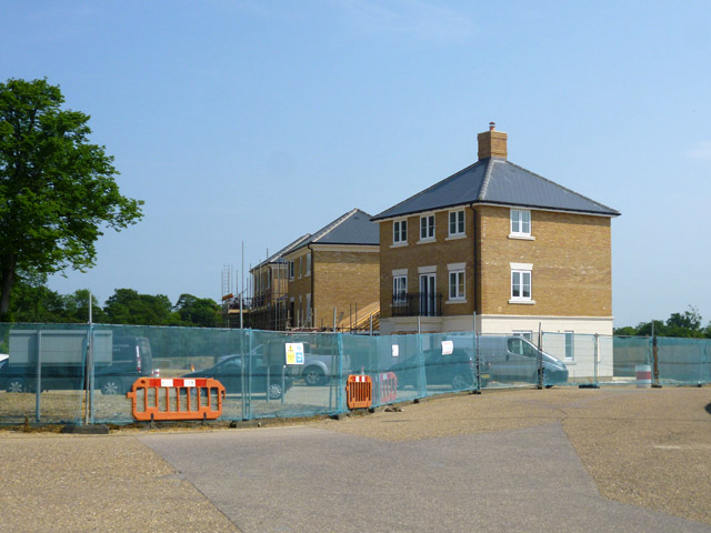
Doctor's Pond is a picturesque freshwater pond situated in Great Dunmow, Essex, England. Spanning an area of approximately 1.4 hectares, it is often referred to as a pond, although its size and features could also classify it as a small lake. The pond is located in a tranquil and idyllic setting, surrounded by lush greenery and a diverse range of flora and fauna.

The origins of the name "Doctor's Pond" are uncertain, but it is believed to be named after a local doctor who owned the land. The pond has been a popular recreational spot for locals and visitors alike for many years, offering opportunities for fishing, boating, and picnicking.

The water at Doctor's Pond is fresh and clear, fed by natural springs and rainwater runoff. It is home to a variety of fish species, including carp, perch, and roach, making it a popular destination for anglers. The abundant aquatic vegetation, such as water lilies and reeds, provides a habitat for a diverse range of bird species, including swans, ducks, and herons, attracting birdwatchers throughout the year.

Surrounding the pond is a well-maintained footpath, allowing visitors to take leisurely walks and enjoy the serene atmosphere. There are also benches strategically placed around the pond, providing a peaceful spot to rest and take in the scenic beauty.

Overall, Doctor's Pond offers a tranquil escape from the hustle and bustle of daily life, providing a haven for wildlife enthusiasts, anglers, and those seeking a peaceful retreat in the heart of Essex.

If you have any feedback on the listing, please let us know in the comments section below.

Doctor's Pond Images

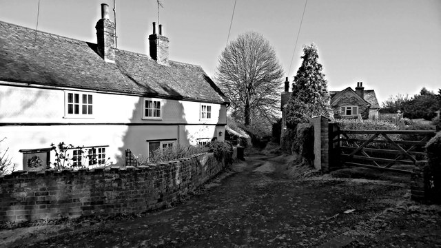
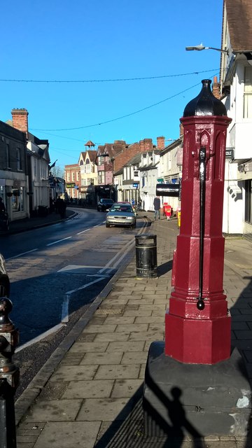
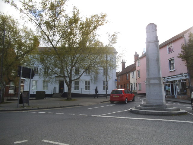
Images are sourced within 2km of 51.874522/0.36209852 or Grid Reference TL6222. Thanks to Geograph Open Source API. All images are credited.

TESCO Great Dunmow
TESCO Great Dunmow
TESCO car park Great Dunmow
Footbridge, A120 The A120 is a trunk road that runs east-west across East Anglia from Harwich to Puckeridge, 63 miles in length. It follows the route of the Roman Road, Stane Street. <span class="nowrap"><a title="http://www.sabre-roads.org.uk/wiki/index.php?title=A120" rel="nofollow ugc noopener" href="http://www.sabre-roads.org.uk/wiki/index.php?title=A120">Link</a><img style="margin-left:2px;" alt="External link" title="External link - shift click to open in new window" src="https://s1.geograph.org.uk/img/external.png" width="10" height="10"/></span>
Footbridge, A120
The A120 is a trunk road that runs east-west across East Anglia from Harwich to Puckeridge, 63 miles in length. It follows the route of the Roman Road, Stane Street. LinkExternal link
Ongar Road Bridge, A120 The A120 is a trunk road that runs east-west across East Anglia from Harwich to Puckeridge, 63 miles in length. It follows the route of the Roman Road, Stane Street. <span class="nowrap"><a title="http://www.sabre-roads.org.uk/wiki/index.php?title=A120" rel="nofollow ugc noopener" href="http://www.sabre-roads.org.uk/wiki/index.php?title=A120">Link</a><img style="margin-left:2px;" alt="External link" title="External link - shift click to open in new window" src="https://s1.geograph.org.uk/img/external.png" width="10" height="10"/></span>
Ongar Road Bridge, A120
The A120 is a trunk road that runs east-west across East Anglia from Harwich to Puckeridge, 63 miles in length. It follows the route of the Roman Road, Stane Street. LinkExternal link
New houses, Great Dunmow The recent residential enlargement of Great Dunmow to the north-west spreads further north.
New houses, Great Dunmow
The recent residential enlargement of Great Dunmow to the north-west spreads further north.
Frosty lane, Great Dunmow
Pump, High Street, Great Dunmow
Resting on thin ice, or taking a cold bath!
Rosemary Lane, Great Dunmow
New Street at the junction of Great Dunmow High Street
Houses on High Street, Great Dunmow
Junction on Braintree Road, Great Dunmow
Houses on The Downs, Great Dunmow
Rosemary Close, Great Dunmow
The Broadway, Great Dunmow
The Broadway entering Dunmow
Roundabout on Ongar Road, Great Dunmow
Show me another place!

Doctor's Pond is located at Grid Ref: TL6222 (Lat: 51.874522, Lng: 0.36209852)

Administrative County: Essex

District: Uttlesford

Police Authority: Essex

What 3 Words

///accented.magnum.headlines. Near Great Dunmow, Essex

Nearby Locations

Doctor's Pond

Related Wikis

Old Town Hall, Great Dunmow

The Old Town Hall is a municipal building in the Market Place, Great Dunmow, Essex, England. The structure, which is now in retail use, is a Grade II listed...

Great Dunmow

Great Dunmow is a historic market town and civil parish in the Uttlesford district of Essex, England. It lies to the north of the A120 road, approximately...

Talliston House

Talliston House & Gardens is an ex-council house in Essex, England that has been transformed by owner John Trevillian into a miniature palace. The house...

Church End Mill, Great Dunmow

Church End Mill is a grade II listed Tower mill at Great Dunmow, Essex, England which has been converted to residential use. == History == Church End Mill...

Nearby Amenities

Located within 500m of 51.874522,0.36209852
Mini Roundabout
Direction: clockwise
Lat/Long: 51.8765024/0.3622107
Mini Roundabout
Direction: clockwise
Lat/Long: 51.8731503/0.3578368
Mini Roundabout
Direction: clockwise
Lat/Long: 51.8785543/0.3621492
Great Dunmow
Name Ru: Грейт-Данмоу
Place: town
Lat/Long: 51.8728198/0.3624014
Noexit: yes
Lat/Long: 51.8731122/0.3684542
Direction: both
Traffic Calming: table
Lat/Long: 51.8752541/0.3549502
Bus Stop
Stortford Road
Bus: yes
Naptan AtcoCode: 150018016003
Naptan Bearing: E
Naptan CommonName: Stortford Road
Naptan Crossing: Rosemary Lane
Naptan Indicator: E-bound
Naptan Landmark: Stortford Road
Naptan NaptanCode: esxdampd
Naptan Street: Stortford Road
Naptan Verified: no
Public Transport: platform
Source: naptan_import
Lat/Long: 51.8731513/0.3585887
Bus Stop
Stortford Road
Bus: yes
Naptan AtcoCode: 150018016004
Naptan Bearing: W
Naptan CommonName: Stortford Road
Naptan Crossing: Rosemary Lane
Naptan Indicator: W-bound
Naptan Landmark: Stortford Road
Naptan NaptanCode: esxdampg
Naptan Street: Stortford Road
Naptan Verified: no
Public Transport: platform
Source: naptan_import
Lat/Long: 51.8730742/0.3588462
Bus Stop
North Street
Bus: yes
Naptan AtcoCode: 150018016013
Naptan Bearing: S
Naptan CommonName: North Street
Naptan Crossing: The Maltings
Naptan Indicator: S-bound
Naptan Landmark: North Street
Naptan NaptanCode: esxdamtj
Naptan Street: North Street
Naptan Verified: no
Public Transport: platform
Source: naptan_import
Lat/Long: 51.8748029/0.3627723
Bus Stop
North Street
Bus: yes
Naptan AtcoCode: 150018016014
Naptan Bearing: N
Naptan CommonName: North Street
Naptan Crossing: The Maltings
Naptan Indicator: N-bound
Naptan Landmark: North Street
Naptan NaptanCode: esxdgapg
Naptan Street: North Street
Naptan Verified: no
Public Transport: platform
Source: naptan_import
Lat/Long: 51.8752832/0.3625941
Bus Stop
The Causeway
Bus: yes
Naptan AtcoCode: 150018016015
Naptan Bearing: S
Naptan CommonName: The Causeway
Naptan Crossing: Godfrey Way
Naptan Indicator: S-bound
Naptan Landmark: The Causeway
Naptan NaptanCode: esxdamtm
Naptan Street: The Causeway
Naptan Verified: no
Public Transport: platform
Source: naptan_import
Lat/Long: 51.8789053/0.3622705
Bus Stop
High Street
Bus: yes
Naptan AtcoCode: 1500IM180
Naptan Bearing: SE
Naptan CommonName: High Street
Naptan Crossing: New Street
Naptan Indicator: SE-bound
Naptan Landmark: High Street
Naptan NaptanCode: esxdampw
Naptan Street: High Street
Naptan Verified: no
Public Transport: platform
Source: naptan_import
Lat/Long: 51.8714859/0.363563
Bus Stop
High Street
Bus: yes
Naptan AtcoCode: 1500IM180B
Naptan Bearing: NW
Naptan CommonName: High Street
Naptan Crossing: New Street
Naptan Indicator: NW-bound
Naptan Landmark: High Street
Naptan NaptanCode: esxdampt
Naptan Street: High Street
Naptan Verified: no
Public Transport: platform
Source: naptan_import
Lat/Long: 51.8714601/0.3633962
Recycling
Lat/Long: 51.8726356/0.3645701
Traffic Signals
Traffic Signals: signal_box
Traffic Signals Direction: both
Lat/Long: 51.8709955/0.3640423
Place Of Worship
The Ark Baptist Chapel
Denomination: baptist
Religion: christian
Lat/Long: 51.871841/0.3625972
Dunmow Maltings
Tourism: museum
Website: https://www.greatdunmowmaltings.uk/
Wikidata: Q17534714
Lat/Long: 51.8730736/0.3644237
Barrier: bollard
Lat/Long: 51.8731178/0.3658611
Fast Food
Dunmow Fish and Chips
Cuisine: chinese
Lat/Long: 51.8706458/0.3652166
Bar
Traffic
Lat/Long: 51.8715106/0.3636566
Restaurant
The Starr
Lat/Long: 51.8735691/0.3620392
Fast Food
Jade Garden
Cuisine: chinese
Lat/Long: 51.873271/0.3622693
Restaurant
Balti Spice
Cuisine: pakistani
Lat/Long: 51.8713335/0.3638416
Restaurant
Rocco's
Cuisine: italian
Lat/Long: 51.8711382/0.3636216
Restaurant
Square One
Cuisine: Fusion
Lat/Long: 51.8725159/0.3629619
Pub;restaurant
Saracen's Head
Tourism: hotel
Lat/Long: 51.8726391/0.3622318
Fast Food
Bosphorus
Cuisine: Turkish/kebab
Lat/Long: 51.8705418/0.3649837
Pharmacy
Ropers
Healthcare: pharmacy
Lat/Long: 51.8727187/0.3625918
Taxi
Lat/Long: 51.8712553/0.3640155
Telephone
Booth: K6
Covered: booth
Phone: +44 1371 872617
Lat/Long: 51.8732014/0.3594885
Townhall
Lat/Long: 51.8728948/0.36236
Doctors
Angel Lane Surgery
Healthcare: doctor
Lat/Long: 51.8714998/0.3621304
Parking
Lat/Long: 51.8732784/0.359239
Post Office
Lat/Long: 51.8710422/0.363838
Atm
Brand: Barclays
Brand Wikidata: Q245343
Operator: Barclays
Operator Wikidata: Q245343
Lat/Long: 51.8723733/0.362822
Atm
Lloyds Bank
Brand: Lloyds Bank
Brand Wikidata: Q1152847
Brand Wikipedia: en:Lloyds Bank
Operator: Lloyds Bank
Operator Wikidata: Q1152847
Lat/Long: 51.872572/0.3628542
Atm
Operator: Co-op
Lat/Long: 51.8720487/0.3640236
Atm
Nationwide
Brand: Nationwide
Brand Wikidata: Q846735
Brand Wikipedia: en:Nationwide Building Society
Operator: Nationwide
Operator Wikidata: Q846735
Lat/Long: 51.8717904/0.3632619
Atm
HSBC
Brand: HSBC UK
Brand Wikidata: Q64767453
Brand Wikipedia: en:HSBC
Operator: HSBC UK
Operator Wikidata: Q64767453
Lat/Long: 51.8711809/0.3639807
Tourist Information
Tourism: information
Lat/Long: 51.8717988/0.3642077
Pharmacy
Yogi Pharmacy
Healthcare: pharmacy
Lat/Long: 51.8731717/0.3619816
Barrier: bollard
Lat/Long: 51.871858/0.3622744
Tourism: picnic_site
Lat/Long: 51.8773284/0.3674019
Toilets
Lat/Long: 51.8769128/0.3629543
Bench
Lat/Long: 51.8744176/0.3687613
Bench
Lat/Long: 51.874204/0.3690805
Tourism: picnic_site
Lat/Long: 51.8740169/0.3681766
Power: pole
Lat/Long: 51.8743573/0.3678073
Power: pole
Lat/Long: 51.8764794/0.3667814
Power: pole
Lat/Long: 51.8756257/0.366894
Power: pole
Lat/Long: 51.8752443/0.3671754
Power: pole
Lat/Long: 51.8749594/0.3673806
Power: pole
Lat/Long: 51.8773944/0.3666551
Power: pole
Lat/Long: 51.8738624/0.3688706
Power: pole
Lat/Long: 51.8752525/0.3678359
Power: pole
Lat/Long: 51.8752662/0.369279
Noexit: yes
Lat/Long: 51.8718789/0.3644333
Noexit: yes
Lat/Long: 51.8724649/0.3644222
Restaurant
Rhubarb
Source: Bing/Knowledge
Lat/Long: 51.872499/0.3625537
Historic: memorial
Memorial: war_memorial
Lat/Long: 51.8710948/0.363702
Leisure: firepit
Lat/Long: 51.8735433/0.367576
Advertising: board
Lat/Long: 51.8731214/0.3596519
Crossing
Lat/Long: 51.8742265/0.359212
Direction: both
Traffic Calming: bump
Lat/Long: 51.8755407/0.3554281
Direction: both
Traffic Calming: bump
Lat/Long: 51.8751123/0.355242
Crossing
Crossing: marked
Crossing Island: no
Crossing Ref: puffin
Tactile Paving: yes
Lat/Long: 51.870917/0.3642192
Crossing
Crossing: marked
Crossing Island: no
Crossing Ref: puffin
Tactile Paving: yes
Lat/Long: 51.8710401/0.3641205
Crossing
Crossing: marked
Crossing Island: no
Crossing Ref: puffin
Tactile Paving: yes
Lat/Long: 51.871072/0.3638971
Bench
Lat/Long: 51.8747354/0.361729
Bench
Lat/Long: 51.8747734/0.3618497
Bench
Lat/Long: 51.8748132/0.3619677
Bench
Lat/Long: 51.874838/0.3620991
Bench
Lat/Long: 51.8748645/0.3622359
Crossing
Crossing: marked
Crossing Island: no
Crossing Ref: zebra
Tactile Paving: yes
Lat/Long: 51.8747481/0.3599395
Crossing
Crossing: unmarked
Crossing Island: yes
Tactile Paving: yes
Lat/Long: 51.8766928/0.3621779
Crossing
Crossing: unmarked
Crossing Island: yes
Tactile Paving: yes
Lat/Long: 51.8789065/0.3621892
Direction: both
Traffic Calming: table
Lat/Long: 51.8783736/0.3602785
Direction: both
Traffic Calming: table
Lat/Long: 51.8783073/0.3592237
Crossing
Crossing: marked
Crossing Ref: zebra
Lat/Long: 51.8750375/0.3627115
Give Way
Direction: forward
Lat/Long: 51.8734297/0.3620185
Crossing
Crossing: unmarked
Crossing Island: yes
Tactile Paving: yes
Lat/Long: 51.8731232/0.3576008
Crossing
Crossing: marked
Crossing Island: no
Crossing Ref: puffin
Tactile Paving: yes
Lat/Long: 51.8730781/0.3594768
Crossing
Crossing: unmarked
Crossing Island: yes
Tactile Paving: yes
Lat/Long: 51.872846/0.3622295
Crossing
Crossing: marked
Crossing Island: no
Crossing Markings: yes
Crossing Ref: puffin
Tactile Paving: yes
Lat/Long: 51.8718757/0.3632764
Give Way
Direction: forward
Lat/Long: 51.8719297/0.367863
Give Way
Direction: forward
Lat/Long: 51.8721068/0.3678019
Noexit: yes
Lat/Long: 51.8731915/0.3672843
Noexit: yes
Lat/Long: 51.873129/0.3683303
Post Box
Operator: Royal Mail
Operator Wikidata: Q638098
Post Box Design: type_k
Post Box Type: pillar
Ref: CM6 208
Royal Cypher: EIIR
Lat/Long: 51.8729598/0.3623461
Bicycle Parking
Bicycle Parking: stands
Lat/Long: 51.8718661/0.364141
Information: guidepost
Tourism: information
Lat/Long: 51.872952/0.3623105
Colour: yellow
Marker: post
Material: concrete
Utility: gas
Lat/Long: 51.8726083/0.3647763
Colour: yellow
Marker: post
Material: concrete
Utility: gas
Lat/Long: 51.8725453/0.3648936
Colour: yellow
Marker: post
Material: concrete
Utility: gas
Lat/Long: 51.8725049/0.3648408
Colour: red
Marker: post
Material: concrete
Utility: gas
Lat/Long: 51.8728573/0.3648125
Colour: red
Marker: post
Material: concrete
Utility: gas
Lat/Long: 51.8728797/0.3647577
Marker: post
Material: concrete
Utility: gas
Lat/Long: 51.8728682/0.3647685
The data included in this document is from www.openstreetmap.org. The data is made available under ODbL.

Have you been to Doctor's Pond?

Leave your review of Doctor's Pond below (or comments, questions and feedback).