Green Hill

Settlement in Lincolnshire South Kesteven

England

Green Hill

Kelham Road, Great Gonerby From Gonerby Road
Kelham Road, Great Gonerby Credit: David Howard

Green Hill is a small village located in the county of Lincolnshire, in the East Midlands region of England. Situated approximately 4 miles west of the town of Horncastle, Green Hill is nestled in a picturesque rural landscape, characterized by rolling hills and lush green fields.

The village itself is home to a close-knit community, with a population of around 300 residents. The local economy is primarily supported by agriculture, with many residents engaged in farming activities or working in related industries. The village is dotted with traditional stone and brick houses, creating a charming and timeless atmosphere.

Green Hill boasts several amenities for its residents, including a primary school, a village hall, and a local pub. The primary school provides education for children up to the age of 11, fostering a nurturing and inclusive learning environment. The village hall serves as a social hub, hosting various community events and activities throughout the year. The local pub, known as The Green Hill Inn, offers a cozy and welcoming atmosphere where residents can gather for a pint or a delicious meal.

The surrounding countryside provides ample opportunities for outdoor activities such as hiking, cycling, and horse riding. The nearby Lincolnshire Wolds, an Area of Outstanding Natural Beauty, offers stunning views and a tranquil setting for nature enthusiasts. Additionally, Green Hill is well-connected to neighboring towns and cities, with good transport links enabling easy access to amenities and employment opportunities.

In summary, Green Hill is a charming and idyllic village in Lincolnshire, with a strong sense of community and a beautiful natural environment.

If you have any feedback on the listing, please let us know in the comments section below.
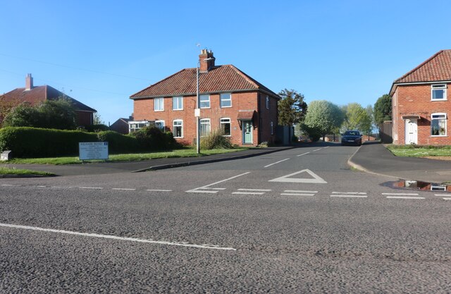
Green Hill Images

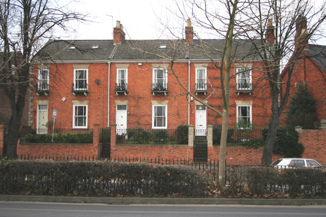
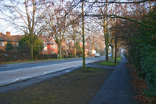
Images are sourced within 2km of 52.9157/-0.651 or Grid Reference SK9036. Thanks to Geograph Open Source API. All images are credited.

Kelham Road, Great Gonerby From Gonerby Road
Kelham Road, Great Gonerby
From Gonerby Road
Roundabout on Barrowby Road, Grantham
The A1, Grantham
The A1, Grantham
The A1, Grantham
The A1, Grantham
The A1, Grantham
The A1, Grantham
The A1, Grantham
The A1, Grantham
Morrisons carpark, Grantham This is the ground level of a multi storey carpark serving the Isaac Newton Shopping Centre
Morrisons carpark, Grantham
This is the ground level of a multi storey carpark serving the Isaac Newton Shopping Centre
Grantham View south down the A607.
Grantham
View south down the A607.
Disused malthouse Disused malthouse at Grantham
Disused malthouse
Disused malthouse at Grantham
On Barrowby Road, Grantham These Victorian terraced cottages are opposite ASDA
On Barrowby Road, Grantham
These Victorian terraced cottages are opposite ASDA
Grantham Station The station in Grantham is on the GNER main line that runs from London to Scotland. It's only 76 minutes from London on the express so this station gets very busy early weekday mornings and evenings.
Grantham Station
The station in Grantham is on the GNER main line that runs from London to Scotland. It's only 76 minutes from London on the express so this station gets very busy early weekday mornings and evenings.
Grantham Station Platform 1 at Grantham Station with the Hull to London train just arriving.
Grantham Station
Platform 1 at Grantham Station with the Hull to London train just arriving.
A vestige of a bygone age North Parade, Grantham, is a row of Georgian town houses.
A vestige of a bygone age
North Parade, Grantham, is a row of Georgian town houses.
Stevenson Avenue, Gonerby Hill Foot, Grantham In the Thatcher era there was a building boom in Grantham supposedly to house all the London commuters that had discovered the benefits of living in a Lincolnshire town only 76 minutes from King's Cross. Gonerby Hill Foot, not surprisingly at the bottom of Gonerby Hill, is mainly 70s and 80s housing.
Stevenson Avenue, Gonerby Hill Foot, Grantham
In the Thatcher era there was a building boom in Grantham supposedly to house all the London commuters that had discovered the benefits of living in a Lincolnshire town only 76 minutes from King's Cross. Gonerby Hill Foot, not surprisingly at the bottom of Gonerby Hill, is mainly 70s and 80s housing.
Green Hill, Grantham The street is called Barrowby Road and is the A52 to Nottingham. Looking towards Grantham town centre,
Green Hill, Grantham
The street is called Barrowby Road and is the A52 to Nottingham. Looking towards Grantham town centre,
St.John's church, Manthorpe, Lincs. In the pretty stone estate village of Manthorpe on the outskirts of Grantham, built 1847-8 by G.G.Place of Nottingham in a Early English gothic revival manner.
St.John's church, Manthorpe, Lincs.
In the pretty stone estate village of Manthorpe on the outskirts of Grantham, built 1847-8 by G.G.Place of Nottingham in a Early English gothic revival manner.
Low Road. Manthorpe
Low Road. Manthorpe
Harrowby Lane Methodist church The church was an old hut until recently when this new multi-purpose building was erected by its enthusiastic congregation <span class="nowrap"><a title="http://www.users.zetnet.co.uk/harrowbylane/" rel="nofollow ugc noopener" href="http://www.users.zetnet.co.uk/harrowbylane/">Link</a><img style="margin-left:2px;" alt="External link" title="External link - shift click to open in new window" src="https://s1.geograph.org.uk/img/external.png" width="10" height="10"/></span>
Harrowby Lane Methodist church
The church was an old hut until recently when this new multi-purpose building was erected by its enthusiastic congregation LinkExternal link
Show me another place!

Green Hill is located at Grid Ref: SK9036 (Lat: 52.9157, Lng: -0.651)

Division: Parts of Kesteven

Administrative County: Lincolnshire

District: South Kesteven

Police Authority: Lincolnshire

What 3 Words

///bunks.firm.nobody. Near Grantham, Lincolnshire

Nearby Locations

Green Hill

Related Wikis

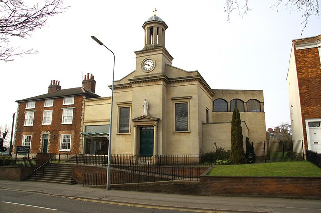
St Mary's Church, Grantham

St Mary's Church or St Mary the Immaculate Church is a Roman Catholic parish church in Grantham, Lincolnshire, England. It was built in phases from 1833...

Eden House Hotel, Grantham

The Eden House Hotel is a building of historical significance in Grantham, Lincolnshire, England. It was built as a mansion in about 1850 and for many...

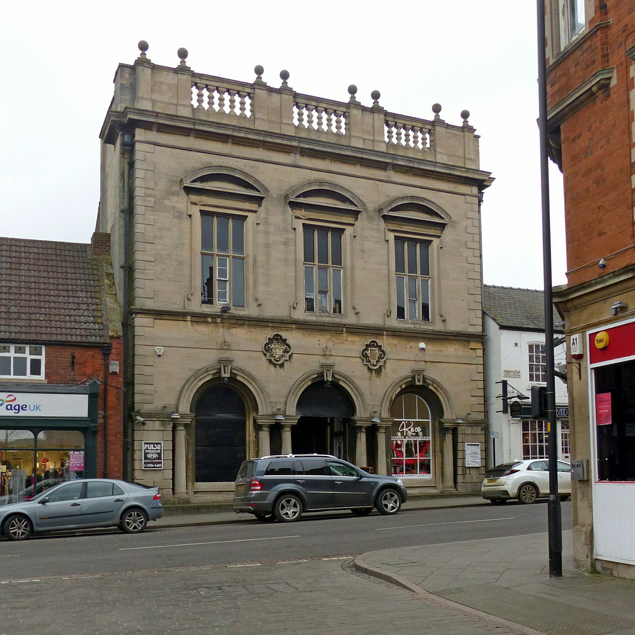
Westgate Hall, Grantham

Westgate Hall is a commercial building in Westgate, Grantham, Lincolnshire, England. The structure, which was last used as a nightclub, is a Grade II listed...

The King's School, Grantham

The King's School is an 11–18 boys grammar school with academy status, in the market town of Grantham, Lincolnshire, England. The school's history can...

Nearby Amenities

Located within 500m of 52.9157,-0.651
Crossing
Crossing: uncontrolled
Lat/Long: 52.9149913/-0.6454246
Bus Stop
Asda
Bus: yes
Naptan AtcoCode: 270000008539
Naptan Bearing: NE
Naptan CommonName: Asda
Naptan Landmark: Asda
Naptan NaptanCode: lingtgad
Naptan Street: Union Street
Naptan Verified: no
Public Transport: platform
Source: naptan_import
Lat/Long: 52.9146365/-0.6456486
Bus Stop
124 Barrowby Road
Bus: yes
Naptan AtcoCode: 270000010052
Naptan Bearing: E
Naptan CommonName: 124 Barrowby Road
Naptan Indicator: o/s
Naptan Landmark: Number 124
Naptan NaptanCode: linjgpwd
Naptan Street: Barrowby Road
Naptan Verified: no
Public Transport: platform
Source: naptan_import
Lat/Long: 52.9167531/-0.6562913
Bus Stop
123 Barrowby Road
Bus: yes
Naptan AtcoCode: 270000010053
Naptan Bearing: W
Naptan CommonName: 123 Barrowby Road
Naptan Indicator: o/s
Naptan Landmark: Number 123
Naptan NaptanCode: linjgpwg
Naptan Street: Barrowby Road
Naptan Verified: no
Public Transport: platform
Source: naptan_import
Lat/Long: 52.9166441/-0.6561906
Bus Stop
Premier Court
Bus: yes
Naptan AtcoCode: 270002701755
Naptan Bearing: NE
Naptan CommonName: Premier Court
Naptan Indicator: opp
Naptan Landmark: Premier Court
Naptan Street: Broad Street
Naptan Verified: no
Public Transport: platform
Source: naptan_import
Lat/Long: 52.9160535/-0.6445633
Bus Stop
Chelmsford Drive
Bus: yes
Naptan AtcoCode: 2700LGBG3256
Naptan Bearing: S
Naptan CommonName: Chelmsford Drive
Naptan Indicator: adj
Naptan Landmark: Chelmsford Drive
Naptan Street: Winchester Road
Naptan Verified: no
Public Transport: platform
Source: naptan_import
Lat/Long: 52.9138897/-0.6542979
Bus Stop
Chelmsford Drive
Bus: yes
Naptan AtcoCode: 2700LGWR1571
Naptan Bearing: N
Naptan CommonName: Chelmsford Drive
Naptan Indicator: opp
Naptan Landmark: Chelmsford Drive
Naptan NaptanCode: linamdam
Naptan Street: Winchester Road
Naptan Verified: no
Public Transport: platform
Source: naptan_import
Lat/Long: 52.9139002/-0.6544314
Social Club
Kontak Social Club
Ele: 52.9979248
Lat/Long: 52.9156404/-0.647875
Bench
Ele: 55.8819580
Lat/Long: 52.915525/-0.6488489
Post Box
Check Date: 2021-09-19
Ele: 58.5255127
Lat/Long: 52.9160228/-0.649617
Post Box
Brand: Royal Mail
Brand Wikidata: Q638098
Ele: 71.7435303
Operator: Royal Mail
Operator Wikidata: Q638098
Post Box Type: pillar
Lat/Long: 52.9144112/-0.6541291
Railway: switch
Lat/Long: 52.9161153/-0.6485534
Childcare
Serendipitys Day Nursery
Addr City: Grantham
Addr Housenumber: 18
Addr Postcode: NG31 8AN
Addr Street: North Parade
Fhrs Authority: South Kesteven
Fhrs Id: 421868
Fhrs Local Authority Id: 74126
Website: http://www.serendipitys.co.uk/grantham.php
Lat/Long: 52.9162457/-0.6451279
Turning Circle
Lat/Long: 52.9149369/-0.6557946
Turning Circle
Lat/Long: 52.9158167/-0.6574523
Turning Circle
Lat/Long: 52.9147784/-0.657868
Crossing
Crossing: uncontrolled
Lat/Long: 52.914974/-0.6463764
Crossing
Crossing: uncontrolled
Lat/Long: 52.9142867/-0.6460177
Addr City: Grantham
Addr Housenumber: 2
Addr Street: North Parade
Description: Birthplace of Margaret Thatcher
Historic Shop: grocer
Lat/Long: 52.9159219/-0.6450126
Green Hill
Place: neighbourhood
Source: Bing
Lat/Long: 52.917647/-0.6514839
Railway: switch
Lat/Long: 52.9153709/-0.6484064
Railway: switch
Lat/Long: 52.9189141/-0.6481028
Post Box
Brand: Royal Mail
Brand Wikidata: Q638098
Brand Wikipedia: en:Royal Mail
Collection Times: Mo-Fr 09:00; Sa 07:00
Operator: Royal Mail
Operator Wikidata: Q638098
Post Box Mounting: pier
Post Box Type: lamp
Ref: NG31 133D
Royal Cypher: EIIR
Royal Cypher Wikidata: Q33102113
Lat/Long: 52.9125022/-0.6459851
Barrier: height_restrictor
Maxheight: 2.3
Lat/Long: 52.912856/-0.6454699
Barrier: height_restrictor
Maxheight: 2.3
Lat/Long: 52.9129125/-0.6454291
Pharmacy
Asda
Brand: Asda
Brand Wikidata: Q297410
Brand Wikipedia: en:Asda
Contact Phone: +44 1476 581500
Contact Website: https://storelocator.asda.com/east-midlands/grantham/union-street/pharmacy
Healthcare: pharmacy
Note: Needs positioning
Opening Hours: Mo 08:00-22:00; Tu-Sa 07:00-22:00; Su 10:00-16:00
Opening Hours Covid19: Mo-Sa 08:00-22:00; Su 11:00-17:00
Operator: Asda Stores Ltd
Wheelchair: yes
Lat/Long: 52.9139779/-0.6468664
Asda Opticians
Brand: Asda
Brand Wikidata: Q297410
Brand Wikipedia: en:Asda
Contact Phone: +44 1476 581512
Contact Website: https://storelocator.asda.com/east-midlands/grantham/union-street/opticians
Note: Needs positioning
Opening Hours: Mo-Sa 09:00-20:00; Su 10:00-16:00
Opening Hours Covid19: Mo-Th,Sa 09:00-18:00; Su 10:00-16:00
Operator: Asda Stores Ltd
Shop: optician
Lat/Long: 52.9141636/-0.6467478
Post Box
Brand: Royal Mail
Brand Wikidata: Q638098
Brand Wikipedia: en:Royal Mail
Collection Times: Mo-Fr 16:30; Sa 11:30
Indoor: yes
Operator: Royal Mail
Operator Wikidata: Q638098
Post Box Type: pillar
Ref: NG31 134
Royal Cypher: EIIR
Royal Cypher Wikidata: Q33102113
Lat/Long: 52.9142694/-0.6464897
Crossing
Crossing: uncontrolled
Lat/Long: 52.9144722/-0.6464521
Traffic Signals
Lat/Long: 52.9151311/-0.6442547
Crossing
Crossing: traffic_signals
Crossing Ref: pelican
Tactile Paving: yes
Lat/Long: 52.9151488/-0.644288
Crossing
Crossing: traffic_signals
Crossing Ref: toucan
Tactile Paving: yes
Lat/Long: 52.9152049/-0.6440116
Traffic Signals
Lat/Long: 52.9152369/-0.6440014
Crossing
Crossing: traffic_signals
Crossing Ref: toucan
Tactile Paving: yes
Lat/Long: 52.9152743/-0.6442849
Traffic Signals
Lat/Long: 52.9152932/-0.6442335
Post Box
Brand: Royal Mail
Brand Wikidata: Q638098
Brand Wikipedia: en:Royal Mail
Collection Times: Mo-Fr 18:30; Sa 11:45
Operator: Royal Mail
Operator Wikidata: Q638098
Post Box Type: pillar
Ref: NG31 8
Royal Cypher: GVIR
Royal Cypher Wikidata: Q33102169
Lat/Long: 52.915374/-0.6438104
Traffic Signals
Lat/Long: 52.9155681/-0.6452105
Crossing
Crossing: traffic_signals
Crossing Ref: pelican
Tactile Paving: yes
Lat/Long: 52.9155692/-0.6452665
Crossing
Crossing: traffic_signals
Crossing Ref: pelican
Tactile Paving: yes
Lat/Long: 52.915691/-0.6451181
Crossing
Crossing: traffic_signals
Crossing Ref: pelican
Tactile Paving: yes
Lat/Long: 52.9157009/-0.645325
Cafe
Asda Café
Addr City: Grantham
Addr Postcode: NG31 6NZ
Addr Street: Union Street
Brand: Asda
Brand Wikidata: Q297410
Brand Wikipedia: en:Asda
Contact Phone: +44 1476 581500
Contact Website: https://storelocator.asda.com/east-midlands/grantham/union-street/cafe
Cuisine: coffee_shop
Drinking Water Refill: yes
Drinking Water Refill Network: Refill
Fhrs Authority: South Kesteven
Fhrs Id: 237789
Fhrs Local Authority Id: 6841
Internet Access: wlan
Internet Access Fee: no
Opening Hours Covid19: Mo-Su off
Operator: Asda Stores Ltd
Takeaway: yes
Lat/Long: 52.9141441/-0.6463828
Nottingham Branch Junction
Railway: junction
Lat/Long: 52.9153711/-0.648369
Grantham North Junction
Railway: junction
Lat/Long: 52.9189122/-0.6480713
Generator Method: photovoltaic
Generator Output Electricity: yes
Generator Source: solar
Generator Type: solar_photovoltaic_panel
Location: roof
Power: generator
Lat/Long: 52.9174756/-0.6567558
Generator Method: photovoltaic
Generator Output Electricity: yes
Generator Source: solar
Generator Type: solar_photovoltaic_panel
Location: roof
Power: generator
Lat/Long: 52.9169451/-0.6572252
Generator Method: photovoltaic
Generator Output Electricity: yes
Generator Source: solar
Generator Type: solar_photovoltaic_panel
Location: roof
Power: generator
Lat/Long: 52.9174433/-0.6548139
Generator Method: photovoltaic
Generator Output Electricity: yes
Generator Source: solar
Generator Type: solar_photovoltaic_panel
Location: roof
Power: generator
Lat/Long: 52.9174853/-0.6547254
Generator Method: photovoltaic
Generator Output Electricity: yes
Generator Source: solar
Generator Type: solar_photovoltaic_panel
Location: roof
Power: generator
Lat/Long: 52.9173899/-0.6548032
Generator Method: photovoltaic
Generator Output Electricity: yes
Generator Source: solar
Generator Type: solar_photovoltaic_panel
Location: roof
Power: generator
Lat/Long: 52.9173123/-0.6548193
Generator Method: photovoltaic
Generator Output Electricity: yes
Generator Source: solar
Generator Type: solar_photovoltaic_panel
Location: roof
Power: generator
Lat/Long: 52.9173996/-0.6543794
Generator Method: photovoltaic
Generator Output Electricity: yes
Generator Source: solar
Generator Type: solar_photovoltaic_panel
Location: roof
Power: generator
Lat/Long: 52.9183473/-0.6551116
Generator Method: photovoltaic
Generator Output Electricity: yes
Generator Source: solar
Generator Type: solar_photovoltaic_panel
Location: roof
Power: generator
Lat/Long: 52.9183279/-0.6550553
Generator Method: photovoltaic
Generator Output Electricity: yes
Generator Source: solar
Generator Type: solar_photovoltaic_panel
Location: roof
Power: generator
Lat/Long: 52.9189344/-0.6542211
Generator Method: photovoltaic
Generator Output Electricity: yes
Generator Source: solar
Generator Type: solar_photovoltaic_panel
Location: roof
Power: generator
Lat/Long: 52.9186934/-0.6550526
Generator Method: photovoltaic
Generator Output Electricity: yes
Generator Source: solar
Generator Type: solar_photovoltaic_panel
Location: roof
Power: generator
Lat/Long: 52.9159572/-0.6572559
Generator Method: photovoltaic
Generator Output Electricity: yes
Generator Source: solar
Generator Type: solar_photovoltaic_panel
Location: roof
Power: generator
Lat/Long: 52.9151212/-0.6559347
Generator Method: photovoltaic
Generator Output Electricity: yes
Generator Source: solar
Generator Type: solar_photovoltaic_panel
Location: roof
Power: generator
Lat/Long: 52.9152716/-0.6562778
Generator Method: photovoltaic
Generator Output Electricity: yes
Generator Source: solar
Generator Type: solar_photovoltaic_panel
Location: roof
Power: generator
Lat/Long: 52.9152785/-0.6563713
Generator Method: photovoltaic
Generator Output Electricity: yes
Generator Source: solar
Generator Type: solar_photovoltaic_panel
Location: roof
Power: generator
Lat/Long: 52.915128/-0.6543272
Generator Method: photovoltaic
Generator Output Electricity: yes
Generator Source: solar
Generator Type: solar_photovoltaic_panel
Location: roof
Power: generator
Lat/Long: 52.9156375/-0.6544916
Generator Method: photovoltaic
Generator Output Electricity: yes
Generator Source: solar
Generator Type: solar_photovoltaic_panel
Location: roof
Power: generator
Lat/Long: 52.9144698/-0.6518578
Generator Method: photovoltaic
Generator Output Electricity: yes
Generator Source: solar
Generator Type: solar_photovoltaic_panel
Location: roof
Power: generator
Lat/Long: 52.9133654/-0.6546079
Generator Method: photovoltaic
Generator Output Electricity: yes
Generator Source: solar
Generator Type: solar_photovoltaic_panel
Location: roof
Power: generator
Lat/Long: 52.9133261/-0.6547921
Generator Method: photovoltaic
Generator Output Electricity: yes
Generator Source: solar
Generator Type: solar_photovoltaic_panel
Location: roof
Power: generator
Lat/Long: 52.9138424/-0.6557845
Generator Method: photovoltaic
Generator Output Electricity: yes
Generator Source: solar
Generator Type: solar_photovoltaic_panel
Location: roof
Power: generator
Lat/Long: 52.9139518/-0.6577322
Generator Method: photovoltaic
Generator Output Electricity: yes
Generator Source: solar
Generator Type: solar_photovoltaic_panel
Location: roof
Power: generator
Lat/Long: 52.9163584/-0.6446148
Generator Method: photovoltaic
Generator Output Electricity: yes
Generator Source: solar
Generator Type: solar_photovoltaic_panel
Location: roof
Power: generator
Lat/Long: 52.9151243/-0.649448
Generator Method: photovoltaic
Generator Output Electricity: yes
Generator Source: solar
Generator Type: solar_photovoltaic_panel
Location: roof
Power: generator
Lat/Long: 52.9124711/-0.6500865
Generator Method: photovoltaic
Generator Output Electricity: yes
Generator Source: solar
Generator Type: solar_photovoltaic_panel
Location: roof
Power: generator
Lat/Long: 52.9139219/-0.6531415
Generator Method: photovoltaic
Generator Output Electricity: yes
Generator Source: solar
Generator Type: solar_photovoltaic_panel
Location: roof
Power: generator
Lat/Long: 52.9164159/-0.6542063
Generator Method: photovoltaic
Generator Output Electricity: yes
Generator Source: solar
Generator Type: solar_photovoltaic_panel
Location: roof
Power: generator
Lat/Long: 52.9164385/-0.6550124
Generator Method: photovoltaic
Generator Output Electricity: yes
Generator Source: solar
Generator Type: solar_photovoltaic_panel
Location: roof
Power: generator
Lat/Long: 52.9164442/-0.655184
Generator Method: photovoltaic
Generator Output Electricity: yes
Generator Source: solar
Generator Type: solar_photovoltaic_panel
Location: roof
Power: generator
Lat/Long: 52.9163957/-0.6583302
Generator Method: photovoltaic
Generator Output Electricity: yes
Generator Source: solar
Generator Type: solar_photovoltaic_panel
Location: roof
Power: generator
Lat/Long: 52.9158894/-0.6558975
Generator Method: photovoltaic
Generator Output Electricity: yes
Generator Source: solar
Generator Type: solar_photovoltaic_panel
Location: roof
Power: generator
Lat/Long: 52.9158919/-0.6559578
Generator Method: photovoltaic
Generator Output Electricity: yes
Generator Source: solar
Generator Type: solar_photovoltaic_panel
Location: roof
Power: generator
Lat/Long: 52.9156509/-0.6544424
Traffic Signals
Lat/Long: 52.9159566/-0.6453529
Traffic Signals
Lat/Long: 52.9156607/-0.6454213
Traffic Signals
Lat/Long: 52.9156429/-0.6450833
Tennis Courts
Public Transport: platform
Lat/Long: 52.9193214/-0.6472868
Tennis Courts
Public Transport: platform
Lat/Long: 52.9194588/-0.6475845
New Street
Public Transport: platform
Lat/Long: 52.9172497/-0.6464338
Barrowby Road
Public Transport: platform
Lat/Long: 52.9165251/-0.6528094
Camera Mount: pole
Camera Type: dome
Man Made: surveillance
Surveillance: public
Surveillance Type: camera
Surveillance Zone: town
Lat/Long: 52.9153903/-0.6471563
Camera Mount: pole
Camera Type: dome
Man Made: surveillance
Surveillance: public
Surveillance Type: camera
Surveillance Zone: town
Lat/Long: 52.9148564/-0.6438251
Bicycle Parking
Access: customers
Bicycle Parking: stands
Capacity: 14
Note: Good security in view of full checkouts
Operator: Lidl
Lat/Long: 52.914395/-0.6448109
Bicycle Parking
Access: customers
Bicycle Parking: stands
Capacity: 4
Covered: yes
Note: Poor security. No CCTV coverage.
Operator: Asda
Operator Type: business
Surveillance: no
Lat/Long: 52.9142398/-0.6461404
Bureau De Change
Asda Currency Exchange
Payment Cash: yes
Payment Coins: yes
Payment Credit Cards: yes
Payment Debit Cards: yes
Payment Mastercard: yes
Payment Visa: yes
Lat/Long: 52.9141506/-0.6465193
Carlisle Blinds
Addr City: Grantham
Addr Housenumber: 7
Addr Postcode: NG31 6NU
Addr Street: North Street
Shop: curtain
Website: https://www.carlisleblinds.com/
Lat/Long: 52.9151682/-0.644559
Clinic
Footsteps
Healthcare: clinic
Lat/Long: 52.9151504/-0.6445013
Gerard Hairdressing
Addr City: Grantham
Addr Housenumber: 3
Addr Postcode: NG31 6NU
Addr Street: North Street
Shop: hairdresser
Website: https://www.gerardhair.com/
Lat/Long: 52.9150655/-0.6443082
Fast Food
Pinocchio Italian Takeaway
Addr City: Grantham
Addr Housenumber: 1-2
Addr Postcode: NG31 6NU
Addr Street: North Street
Fhrs Authority: South Kesteven
Fhrs Id: 456625
Fhrs Local Authority Id: 72000
Lat/Long: 52.915/-0.6441969
Kwik Fit
Addr City: Grantham
Addr Street: Watergate
Brand: Kwik Fit
Brand Wikidata: Q958053
Shop: car_repair
Lat/Long: 52.9143619/-0.6438831
Purl a Row
Shop: fabric
Lat/Long: 52.9150768/-0.6438898
Close Inkounters
Shop: tattoo
Lat/Long: 52.9152264/-0.6438576
Kindergarten
My Nursery
Addr City: Grantham
Addr Postcode: NG31 6PB
Addr Street: Conduit Lane
Fhrs Authority: South Kesteven
Fhrs Id: 749757
Fhrs Local Authority Id: 86410
Lat/Long: 52.9133033/-0.6448084
Cafe
The Garden Yard
Addr City: Grantham
Addr Postcode: NG31 6NZ
Addr Street: Union Street
Fhrs Authority: South Kesteven
Fhrs Id: 1128458
Fhrs Local Authority Id: 88217
Lat/Long: 52.9141929/-0.6454495
The Antiques Store
Opening Hours: Mo-Sa 09:30-17:00; Su 10:00-16:00
Shop: antiques
Lat/Long: 52.9143158/-0.6455138
Bar
Hunter's Bar
Addr City: Grantham
Addr Postcode: NG31 6NZ
Addr Street: Union Street
Fhrs Authority: South Kesteven
Fhrs Id: 238896
Fhrs Local Authority Id: 1678
Lat/Long: 52.9150064/-0.6448621
DFS
Brand: DFS
Brand Wikidata: Q5204927
Shop: furniture
Lat/Long: 52.9196448/-0.6490946
The Range
Addr City: Grantham
Addr Housename: Grantham Retail Park
Addr Postcode: NG31 8HX
Addr Street: Gonerby Road
Addr Unit: Unit B
Brand: The Range
Brand Wikidata: Q7759409
Fhrs Authority: South Kesteven
Fhrs Id: 1220535
Fhrs Local Authority Id: 86872
Shop: houseware
Website: https://www.therange.co.uk/stores/grantham
Lat/Long: 52.9192534/-0.6487352
Eden House Hotel
Tourism: hotel
Lat/Long: 52.91931/-0.6466162
Social Facility
Belvoir House Care Home
Addr City: Grantham
Addr Postcode: NG31 8BE
Addr Street: Brownlow Street
Fhrs Authority: South Kesteven
Fhrs Id: 238695
Fhrs Local Authority Id: 200
Social Facility: nursing_home
Lat/Long: 52.9163084/-0.6439233
2nd Grantham (St Wulframs)
Club: scout
Lat/Long: 52.9161143/-0.6444088
Red House Guest House
Addr City: Grantham
Addr Housenumber: 74
Addr Postcode: NG31 8AN
Addr Street: North Parade
Fhrs Authority: South Kesteven
Fhrs Id: 238363
Fhrs Local Authority Id: 7161
Tourism: guest_house
Lat/Long: 52.9176637/-0.6463185
The data included in this document is from www.openstreetmap.org. The data is made available under ODbL.

Have you been to Green Hill?

Leave your review of Green Hill below (or comments, questions and feedback).