Stanker's Pond

Lake, Pool, Pond, Freshwater Marsh in Cambridgeshire East Cambridgeshire

England

Stanker's Pond

Mepal Road
Mepal Road Credit: David Howard

Stanker's Pond is a small freshwater body located in Cambridgeshire, England. It is situated near the village of Stanker and covers an area of approximately 2 hectares. The pond is surrounded by lush greenery and is known for its tranquil and picturesque setting.

The water in Stanker's Pond is sourced from natural springs and rainwater runoff. It is a freshwater ecosystem that supports a diverse range of flora and fauna. The pond is home to various aquatic plants such as water lilies, reeds, and submerged vegetation. These plants provide shelter and breeding grounds for a variety of insects, amphibians, and small fish.

The pond is also a popular spot for birdwatching enthusiasts, as it attracts a wide array of bird species throughout the year. Common sightings include ducks, swans, herons, and various songbirds. The surrounding marshland provides an ideal habitat for these birds, offering ample food sources and nesting sites.

Stanker's Pond is a designated nature reserve, managed by the local conservation authority. It is open to the public and offers several walking trails and picnic areas for visitors to enjoy. The serene environment and abundance of wildlife make it a popular destination for nature lovers and photographers.

The pond also plays a crucial role in the local ecosystem by acting as a natural filtration system, improving water quality and supporting a healthy balance of aquatic life. It serves as a valuable educational resource, with schools and environmental organizations often conducting field trips and research projects in the area.

Overall, Stanker's Pond is a beautiful and ecologically significant freshwater body that provides a haven for wildlife and offers a peaceful retreat for visitors.

If you have any feedback on the listing, please let us know in the comments section below.

Stanker's Pond Images

Images are sourced within 2km of 52.389178/0.1325571 or Grid Reference TL4578. Thanks to Geograph Open Source API. All images are credited.

Mepal Road
Mepal Road
Layby  on Witcham Road Where the footpath crosses the road.
Layby on Witcham Road
Where the footpath crosses the road.
Witcham Road Between Mepal and Witcham.
Witcham Road
Between Mepal and Witcham.
Ridge and furrow field Just north of Witcham Road. The ridges are from old ploughing patterns and the field is now left as grass to preserve the feature. Such fields provide interesting habitats for plants due to the long term grassland and the varying water supplies between the bottom of the furrows and the tops of the ridges.
Ridge and furrow field
Just north of Witcham Road. The ridges are from old ploughing patterns and the field is now left as grass to preserve the feature. Such fields provide interesting habitats for plants due to the long term grassland and the varying water supplies between the bottom of the furrows and the tops of the ridges.
The Rushway Footpath from Witcham Road to the Ouse Washes.
The Rushway
Footpath from Witcham Road to the Ouse Washes.
Witcham Road, Mepal, heading east
Farm buildings off Sutton Road, Mepal
Farm building, White Gate Farm
Mepal Road towards Witcham
White Gate Farm
White Gate Farm
Cemetery, Witcham
Cemetery, Witcham
Martins Lane heading south, Witcham
House on Martins Lane, Witcham
The church of St Martin in Witcham
Rolls of hay off Mepal Road Not far from Witcham Equestrian Centre
Rolls of hay off Mepal Road
Not far from Witcham Equestrian Centre
Sutton: a close-fought match Sutton, here batting, recovered from 71 for 8 to win an exciting low-scoring Cambridgeshire Cricket Association league game by one wicket.

Camden (Cambridge) 113 all out, Sutton 114 for 9.
Sutton: a close-fought match
Sutton, here batting, recovered from 71 for 8 to win an exciting low-scoring Cambridgeshire Cricket Association league game by one wicket. Camden (Cambridge) 113 all out, Sutton 114 for 9.
Sutton: four runs The visitors, Camden (Cambridge), here batting, were bowled out for only 113 and the home side won an exciting low-scoring match by one wicket, recovering with some lusty blows from 71 for 8.

St Andrew's Church is in the background of this telephoto shot - "a large church with an unforgettable tower, placed on a ridge and visible from far to the south" (Nikolaus Pevsner).
Sutton: four runs
The visitors, Camden (Cambridge), here batting, were bowled out for only 113 and the home side won an exciting low-scoring match by one wicket, recovering with some lusty blows from 71 for 8. St Andrew's Church is in the background of this telephoto shot - "a large church with an unforgettable tower, placed on a ridge and visible from far to the south" (Nikolaus Pevsner).
Sutton Cricket Club: the first ball of the match Sutton entertained Camden (Cambridge) and won a low-scoring Cambridgeshire Cricket Association league match by one wicket. There was no hint of the excitement to come as the first ball of the contest was bowled to the Camden opener. The houses behind and to the right of the pavilion are on Station Road. The fine tower of St Andrew's Church, on the top of the ridge, can be seen from miles away in this flat part of the world.
Sutton Cricket Club: the first ball of the match
Sutton entertained Camden (Cambridge) and won a low-scoring Cambridgeshire Cricket Association league match by one wicket. There was no hint of the excitement to come as the first ball of the contest was bowled to the Camden opener. The houses behind and to the right of the pavilion are on Station Road. The fine tower of St Andrew's Church, on the top of the ridge, can be seen from miles away in this flat part of the world.
Show me another place!

Stanker's Pond is located at Grid Ref: TL4578 (Lat: 52.389178, Lng: 0.1325571)

Division: Isle of Ely

Administrative County: Cambridgeshire

District: East Cambridgeshire

Police Authority: Cambridgeshire

What 3 Words

///contoured.meanwhile.press. Near Sutton, Cambridgeshire

Nearby Locations

Stanker's Pond

Related Wikis

Sutton railway station (Cambridgeshire)

Sutton railway station was a station in Sutton, Cambridgeshire on the Ely and St Ives Railway. The first station opened in 1866 but it became the goods...

Elean power station

Elean power station is a straw-fired biomass power station in Cambridgeshire, England. At a capacity of 38 MW, it was the largest straw-fired power plant...

Sutton-in-the-Isle

Sutton or Sutton-in-the-Isle is a village and civil parish in the county of Cambridgeshire in England, near the city of Ely. The "in-the-Isle" suffix refers...

Witcham

Witcham is a small village near Ely in Cambridgeshire, England. The village is surrounded by fenland farms and has a village hall and a 13th-century church...

Mepal

Mepal is a village in Cambridgeshire, England. Mepal is part of the East Cambridgeshire district, and is located just north of the A142 road between Ely...

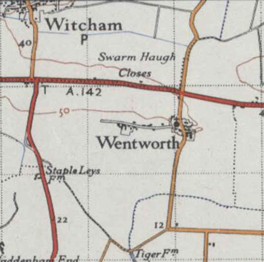
Wentworth, Cambridgeshire

Wentworth is a small village near Ely in Cambridgeshire, England. It is in the Isle of Ely, adjacent to Grunty Fen, Wentworth lies south of the A142...

Haddenham railway station (Cambridgeshire)

Haddenham railway station was a station in Haddenham, Cambridgeshire. It was first opened in 1866 by the Ely, Haddenham and Sutton Railway. It closed to...

Tracked Hovercraft

Tracked Hovercraft was an experimental high-speed train developed in the United Kingdom during the 1960s. It combined two British inventions, the hovercraft...

Nearby Amenities

Located within 500m of 52.389178,0.1325571
Barrier: kissing_gate
Lat/Long: 52.386678/0.1319673
Traffic Calming: island
Lat/Long: 52.3919366/0.1317276
Bus Stop
Park Road
Bus: yes
Naptan AtcoCode: 0500ESUTT001
Naptan Bearing: W
Naptan BusStopType: CUS
Naptan CommonName: Park Road
Naptan Indicator: opp
Naptan Landmark: Park Road
Naptan NaptanCode: cmbdjgma
Naptan ShortCommonName: Park Road
Naptan Street: Ely Road
Naptan Verified: no
Public Transport: platform
Source: naptan_import
Lat/Long: 52.3916801/0.128627
Bus Stop
Park Road
Naptan AtcoCode: 0500ESUTT003
Naptan Bearing: E
Naptan CommonName: Park Road
Naptan Indicator: near
Naptan Landmark: Park Road
Naptan NaptanCode: cmbdjgmg
Naptan ShortCommonName: Park Road
Naptan Street: Ely Road
Naptan Verified: no
Source: naptan_import
Lat/Long: 52.391806/0.1286286
Power: pole
Lat/Long: 52.3860351/0.1333808
Power: pole
Lat/Long: 52.3919215/0.1376697
Power: pole
Lat/Long: 52.3890406/0.1370581
Power: pole
Lat/Long: 52.3892043/0.1386728
Power: transformer
Lat/Long: 52.3869732/0.1324179
Power: pole
Lat/Long: 52.3883253/0.1360548
Power: pole
Lat/Long: 52.3876755/0.1351241
Power: pole
Lat/Long: 52.3873021/0.1337349
RAF Mepal Memorial
Historic: memorial
Lat/Long: 52.3927331/0.132726
Bench
Lat/Long: 52.3920647/0.1323335
Bench
Lat/Long: 52.3920426/0.1323657
Bicycle Repair Station
Check Date: 2023-11-06
Lastcheck Status: needs_repair
Lat/Long: 52.3920941/0.1324274
Bicycle Parking
Bicycle Parking: stands
Capacity: 12
Lat/Long: 52.3920409/0.1323214
Waste Basket
Lat/Long: 52.3919534/0.1325668
Defibrillator
Emergency: defibrillator
Ref GB The Circuit: 76FE0391-B58D-4984-914B-B07B00AA5306
Lat/Long: 52.3919781/0.1325579
Atm
Lat/Long: 52.3919303/0.1326255
Charging Station
Lat/Long: 52.3918593/0.1329973
Recycling
Recycling Clothes: yes
Recycling Type: container
Lat/Long: 52.3916612/0.1327586
Sutton
Historic Railway: station
Railway: site
Wikidata: Q7650356
Wikipedia: en:Sutton railway station (Cambridgeshire)
Lat/Long: 52.385722/0.1325779
The data included in this document is from www.openstreetmap.org. The data is made available under ODbL.

Have you been to Stanker's Pond?

Leave your review of Stanker's Pond below (or comments, questions and feedback).