Chapel Pond

Lake, Pool, Pond, Freshwater Marsh in Huntingdonshire Huntingdonshire

England

Chapel Pond

Hermitage Farm
Hermitage Farm Credit: Fractal Angel

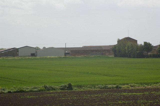
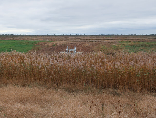
Chapel Pond, located in Huntingdonshire, is a picturesque freshwater pond nestled amidst a serene natural setting. With its tranquil atmosphere and stunning surroundings, it offers a perfect retreat for nature enthusiasts and outdoor enthusiasts alike.

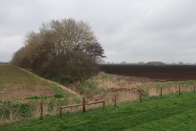
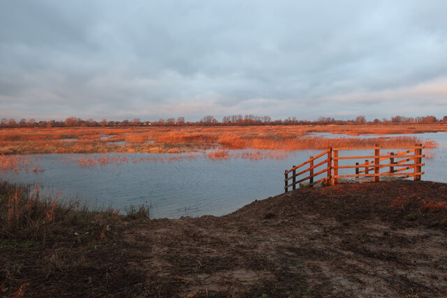
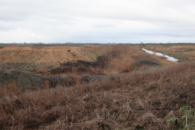
Spanning an area of approximately 10 acres, Chapel Pond is characterized by its crystal-clear waters and lush vegetation that borders its banks. The pond is surrounded by dense woodlands and green meadows, creating a harmonious blend of colors and textures that make it a visual delight.

The pond serves as a habitat for a diverse range of flora and fauna. Its clear waters provide a home for various species of fish, including carp, roach, and perch, making it a popular spot for anglers. The pond is also home to a variety of waterfowl, such as ducks and swans, adding to its natural beauty.

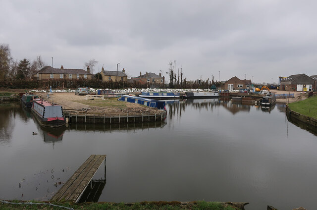
Chapel Pond offers plenty of recreational opportunities for visitors. Fishing is a popular activity, with many anglers enjoying the peaceful setting and the chance to catch a variety of fish species. The pond is also suitable for boating and kayaking, providing a unique perspective of the surrounding landscape.

For those who prefer to take a leisurely stroll, there are several walking trails that wind their way around Chapel Pond, offering breathtaking views and a chance to spot wildlife. The peaceful ambiance of the pond and its surroundings also makes it an idyllic spot for picnicking and simply enjoying the serenity of nature.

In conclusion, Chapel Pond in Huntingdonshire is a scenic freshwater pond that offers a peaceful retreat in the heart of nature. With its clear waters, diverse wildlife, and ample recreational opportunities, it is a true haven for outdoor enthusiasts and nature lovers.

If you have any feedback on the listing, please let us know in the comments section below.

Chapel Pond Images

Images are sourced within 2km of 52.354893/0.030945617 or Grid Reference TL3874. Thanks to Geograph Open Source API. All images are credited.

Hermitage Farm
Hermitage Farm
Excavator on river bank RB22 on the bank of the Hundred Foot river.
Excavator on river bank
RB22 on the bank of the Hundred Foot river.
From the bank of The Ouse Washes near Earith A row of trees near Hermitage Farm
From the bank of The Ouse Washes near Earith
A row of trees near Hermitage Farm
Cold and grey - The Ouse Washes near Earith ...
Cold and grey - The Ouse Washes near Earith
...
A strip of land - The Ouse Washes near Earith ...
A strip of land - The Ouse Washes near Earith
...
The Bulwark in flood - The Ouse Washes near Earith ...
The Bulwark in flood - The Ouse Washes near Earith
...
Hermitage Farm From Upper Delph Grove.
Hermitage Farm
From Upper Delph Grove.
St Mary, Bluntisham: late September 2021
Approaching the junction of the A1123 with Holliday's Road
Village sign, Colne
Village sign, Colne
St Helen, Colne: late September 2021
Looking north-east along the High Street
Ouse Fen RSPB car park A new car park off the B1050 near Earith, very soon before it opened.
Ouse Fen RSPB car park
A new car park off the B1050 near Earith, very soon before it opened.
New sluice at Ouse Fen Allowing water level control of the next phase of the wetland creation project that is following the sand and gravel quarry.
New sluice at Ouse Fen
Allowing water level control of the next phase of the wetland creation project that is following the sand and gravel quarry.
Fields by River Great Ouse With a flock of Whooper Swans.
Fields by River Great Ouse
With a flock of Whooper Swans.
Hermitage Marina
Hermitage Marina
Crane's Fen (Cell 8) flooded After a prolonged wait for the sluices, the northern end of Ouse Fen RSPB reserve is starting to be flooded to make more reedbeds.
Crane's Fen (Cell 8) flooded
After a prolonged wait for the sluices, the northern end of Ouse Fen RSPB reserve is starting to be flooded to make more reedbeds.
Gravel works by Ouse Fen The Hanson sand and gravel quarry is being turned into wetland habitat by the RSPB after each area is completed.
Gravel works by Ouse Fen
The Hanson sand and gravel quarry is being turned into wetland habitat by the RSPB after each area is completed.
Show me another place!

Chapel Pond is located at Grid Ref: TL3874 (Lat: 52.354893, Lng: 0.030945617)

Administrative County: Cambridgeshire

District: Huntingdonshire

Police Authority: Cambridgeshire

What 3 Words

///treat.clearcut.obvious. Near Earith, Cambridgeshire

Related Wikis

Berry Fen

Berry Fen is a 15.3-hectare (38-acre) biological Site of Special Scientific Interest on the western outskirts of Earith in Cambridgeshire.This neutral...

Earith

Earith is a village and civil parish in Cambridgeshire, England. Lying approximately 10 miles (16 km) east of Huntingdon, Earith is situated within Huntingdonshire...

Old Bedford River

The Old Bedford River is an artificial, partial diversion of the waters of the River Great Ouse in the Fens of Cambridgeshire, England. It was named after...

Bluntisham

Bluntisham is a village and civil parish in Cambridgeshire, England. The population of the civil parish at the 2011 census was 2,003. Bluntisham lies approximately...

Earith Bridge railway station

Earith Bridge railway station was a station in Earith, Cambridgeshire on the Ely and St Ives Railway. It was closed to regular passenger trains in 1931...

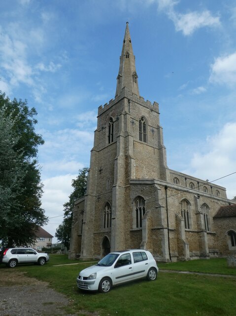
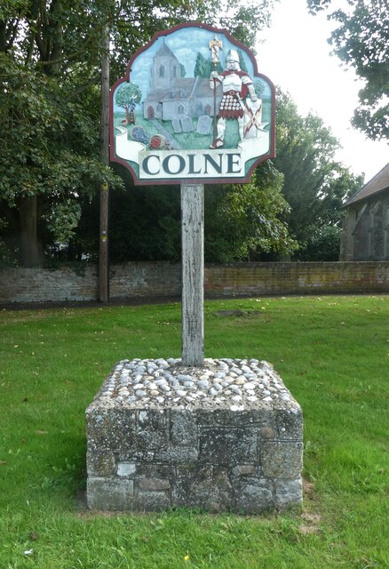
Colne, Cambridgeshire

Colne is a village and civil parish in Cambridgeshire, England. Colne lies about 9 miles (14 km) east of Huntingdon; the villages of Bluntisham, Woodhurst...

Bluntisham railway station

Bluntisham railway station was a station in Bluntisham, Cambridgeshire on the Ely and St Ives Railway. The station closed for regular passenger services...

New Bedford River

The New Bedford River, also known as the Hundred Foot Drain because of the distance between the tops of the two embankments on either side of the river...

Nearby Amenities

Located within 500m of 52.354893,0.030945617
Earith
Place: village
Lat/Long: 52.3566155/0.0321921
Crossing
Crossing: marked
Crossing Island: no
Crossing Markings: yes
Lat/Long: 52.3542566/0.0354832
Turning Circle
Lat/Long: 52.356454/0.0316264
Turning Circle
Lat/Long: 52.3563485/0.0357123
Turning Circle
Lat/Long: 52.3575151/0.0363766
Turning Circle
Lat/Long: 52.3573362/0.0349245
Post Office
Bridge End Stores
Opening Hours: Mo-Su 07:00-21:00
Shop: convenience
Lat/Long: 52.3541375/0.0357923
Telephone
Addr Street: High Street, Earith
Booth: K6
Covered: booth
Listed Status: Grade II
Operator: BT
Operator Wikidata: Q593786
Phone: +44 1487 841390
Wikidata: Q26423413
Lat/Long: 52.3537839/0.0316523
Bus Stop
Chapel Lane
Bus: yes
Naptan AtcoCode: 0500HEARI007
Naptan Bearing: W
Naptan CommonName: Chapel Lane
Naptan Indicator: opp
Naptan Landmark: Chapel Lane
Naptan NaptanCode: cmbdmwgw
Naptan ShortCommonName: Chapel Lane
Naptan Street: High Street
Naptan Verified: no
Note: 15A and 15 stop here.
Operator: Stagecoach
Public Transport: platform
Shelter: no
Source: survey;naptan_import
Lat/Long: 52.35377/0.0316119
Bus Stop
School Road
Bus: yes
Naptan AtcoCode: 0500HEARI001
Naptan Bearing: SW
Naptan BusStopType: CUS
Naptan CommonName: School Road
Naptan Indicator: near
Naptan Landmark: School Road
Naptan NaptanCode: cmbdmwga
Naptan ShortCommonName: School Road
Naptan Street: Greenfields
Naptan Verified: no
Public Transport: platform
Source: naptan_import
Lat/Long: 52.3565123/0.035277
Bus Stop
School Road
Bus: yes
Naptan AtcoCode: 0500HEARI003
Naptan Bearing: NE
Naptan CommonName: School Road
Naptan Indicator: opp
Naptan Landmark: School Road
Naptan NaptanCode: cmbdmwgj
Naptan ShortCommonName: School Road
Naptan Street: Greenfields
Naptan Verified: no
Public Transport: platform
Source: naptan_import
Lat/Long: 52.3565673/0.0352208
Bus Stop
Bridge End
Bus: yes
Naptan AtcoCode: 0500HEARI004
Naptan Bearing: E
Naptan CommonName: Bridge End
Naptan Indicator: near
Naptan Landmark: Bridge End
Naptan NaptanCode: cmbdmwgm
Naptan ShortCommonName: Bridge End
Naptan Street: High Street
Naptan Verified: no
Public Transport: platform
Source: naptan_import
Lat/Long: 52.3540883/0.0371481
Bus Stop
Whybrows Lane
Bus: yes
Naptan AtcoCode: 0500HEARI005
Naptan Bearing: N
Naptan CommonName: Whybrows Lane
Naptan Indicator: near
Naptan Landmark: Whybrows Lane
Naptan NaptanCode: cmbdmwgp
Naptan ShortCommonName: Whybrows Lane
Naptan Street: Colne Road
Naptan Verified: no
Public Transport: platform
Source: naptan_import
Lat/Long: 52.3556519/0.0309346
Bus Stop
Greenfields
Bus: yes
Naptan AtcoCode: 0500HEARI008
Naptan Bearing: S
Naptan BusStopType: CUS
Naptan CommonName: Greenfields
Naptan Indicator: opp No 146
Naptan Landmark: Greenfields
Naptan NaptanCode: cmbdmwja
Naptan ShortCommonName: Greenfields
Naptan Street: Greenfields
Naptan Verified: no
Public Transport: platform
Source: naptan_import
Lat/Long: 52.357776/0.0329119
Bus Stop
Greenfields
Bus: yes
Naptan AtcoCode: 0500HEARI009
Naptan Bearing: N
Naptan CommonName: Greenfields
Naptan Indicator: o/s No 146
Naptan Landmark: Greenfields
Naptan NaptanCode: cmbdmwjd
Naptan ShortCommonName: Greenfields
Naptan Street: Greenfields
Naptan Verified: no
Public Transport: platform
Source: naptan_import
Lat/Long: 52.3577687/0.0328087
Bus Stop
Bridge End
Bus: yes
Naptan AtcoCode: 0500HEARI010
Naptan Bearing: W
Naptan CommonName: Bridge End
Naptan Indicator: opp
Naptan Landmark: Bridge End
Naptan NaptanCode: cmbdmwjg
Naptan ShortCommonName: Bridge End
Naptan Street: High Street
Naptan Verified: no
Public Transport: platform
Source: naptan_import
Lat/Long: 52.3539802/0.0371578
Bus Stop
Whybrows Lane
Bus: yes
Naptan AtcoCode: 0500HEARI012
Naptan Bearing: S
Naptan BusStopType: CUS
Naptan CommonName: Whybrows Lane
Naptan Indicator: opp
Naptan Landmark: Whybrows Lane
Naptan NaptanCode: cmbdmwjp
Naptan ShortCommonName: Whybrows Lane
Naptan Street: Colne Road
Naptan Verified: no
Public Transport: platform
Source: naptan_import
Lat/Long: 52.3556496/0.0310667
Bus Stop
Marina
Bus: yes
Naptan AtcoCode: 0500HEARI013
Naptan Bearing: SW
Naptan BusStopType: CUS
Naptan CommonName: Marina
Naptan Indicator: near
Naptan Landmark: Marina
Naptan NaptanCode: cmbdmwjt
Naptan ShortCommonName: Marina
Naptan Street: High Street
Naptan Verified: no
Public Transport: platform
Source: naptan_import
Lat/Long: 52.3538512/0.0256828
Bus Stop
Marina
Bus: yes
Naptan AtcoCode: 0500HEARI014
Naptan Bearing: NE
Naptan CommonName: Marina
Naptan Indicator: opp
Naptan Landmark: Marina
Naptan NaptanCode: cmbdmwjw
Naptan ShortCommonName: Marina
Naptan Street: High Street
Naptan Verified: no
Public Transport: platform
Source: naptan_import
Lat/Long: 52.3539531/0.0256583
Bus Stop
Adelaide Walk
Bus: yes
Naptan AtcoCode: 0500HEARI015
Naptan Bearing: S
Naptan BusStopType: CUS
Naptan CommonName: Adelaide Walk
Naptan Indicator: near
Naptan Landmark: Adelaide Walk
Naptan NaptanCode: cmbdmwma
Naptan ShortCommonName: Adelaide Walk
Naptan Street: Cook's Drove
Naptan Verified: no
Public Transport: platform
Source: naptan_import
Lat/Long: 52.3563194/0.0376032
Bus Stop
Adelaide Walk
Bus: yes
Naptan AtcoCode: 0500HEARI016
Naptan Bearing: N
Naptan CommonName: Adelaide Walk
Naptan Indicator: opp
Naptan Landmark: Adelaide Walk
Naptan NaptanCode: cmbdmwmd
Naptan ShortCommonName: Adelaide Walk
Naptan Street: Cook's Drove
Naptan Verified: no
Public Transport: platform
Source: naptan_import
Lat/Long: 52.3564652/0.0374924
Barrier: kissing_gate
Lat/Long: 52.3531167/0.026631
Post Box
Brand: Royal Mail
Brand Wikidata: Q638098
Brand Wikipedia: en:Royal Mail
Collection Times: Mo-Fr 17:00; Sa 09:15
Operator: Royal Mail
Operator Wikidata: Q638098
Post Box Type: wall
Ref: PE28 91
Royal Cypher: GR
Royal Cypher Wikidata: Q33102273
Lat/Long: 52.3538811/0.0315344
Pub
The Crown
Lat/Long: 52.3538134/0.032478
Crossing
Crossing: marked
Crossing Island: no
Crossing Markings: yes
Lat/Long: 52.3538562/0.032236
Fast Food
Earith Tandoori
Lat/Long: 52.3539788/0.0322622
Post Box
Brand: Royal Mail
Brand Wikidata: Q638098
Brand Wikipedia: en:Royal Mail
Collection Times: Mo-Fr 09:00; Sa 07:00
Operator: Royal Mail
Operator Wikidata: Q638098
Post Box Type: lamp
Ref: PE28 108D
Royal Cypher: EIIR
Royal Cypher Wikidata: Q33102113
Lat/Long: 52.3574706/0.032907
Riverview Hotel
Tourism: hotel
Lat/Long: 52.3542292/0.0337165
Doctors
Church Street Helath Centre Earith Branch Surgery
Healthcare: doctor
Lat/Long: 52.3547008/0.0341098
Turning Circle
Lat/Long: 52.3582107/0.0338259
Earith Sluice
Waterway: sluice
Lat/Long: 52.3538505/0.0377655
Mooring: yes
Seamark Mooring Category: mooring
Seamark Type: berth
Lat/Long: 52.3527479/0.0289976
Power: pole
Lat/Long: 52.3557915/0.0300192
Power: pole
Lat/Long: 52.3558177/0.0285922
Power: pole
Lat/Long: 52.3569202/0.0263553
Power: pole
Lat/Long: 52.3557915/0.0271412
Power: pole
Lat/Long: 52.3575851/0.0258698
Fuel
Boat fueling point
Contact Phone: 01487 840089
Contact Website: 01487 840089 info@http://www.westviewmarina.co.uk/contact-us/
Note: Location may be inaccurate.
Seamark Small Craft Facility Category: fuel_station
Seamark Type: small_craft_facility
Waterway: fuel
Lat/Long: 52.3519565/0.0283258
Addr City: Earith
Addr Housenumber: 109
Addr Postcode: PE28 3QZ
Addr Street: Greenfields
Lat/Long: 52.3568351/0.033563
Post Box
Brand: Royal Mail
Brand Wikidata: Q638098
Brand Wikipedia: en:Royal Mail
Collection Times: Mo-Fr 17:00; Sa 10:00
Operator: Royal Mail
Operator Wikidata: Q638098
Post Box Type: pillar
Ref: PE28 86
Royal Cypher: EIIR
Royal Cypher Wikidata: Q33102113
Lat/Long: 52.3541592/0.0357891
Bench
Backrest: yes
Material: plastic
Lat/Long: 52.3538126/0.0370418
Public Bookcase
Public Bookcase Type: reading_box
Lat/Long: 52.354119/0.0346805
Advertising: board
Lat/Long: 52.3537658/0.0317043
Bench
Backrest: yes
Material: wood
Lat/Long: 52.3537728/0.0317616
Bench
Backrest: yes
Material: wood
Lat/Long: 52.3537604/0.0316483
Bench
Backrest: yes
Colour: brown
Inscription: Donated by Earith Parish Council to Commemorate 50th. Anniversary of VE / VJ Day
Material: wood
Lat/Long: 52.3538623/0.0309942
Bench
Backrest: yes
Colour: black
Inscription: In Memory Of RON HODGE For His Dedicated Commitment To The Earith Community 1930-2021
Material: metal
Openbenches Id: 22622
Lat/Long: 52.3539363/0.03101
Bench
Backrest: yes
Lat/Long: 52.3541844/0.0368667
Leisure: slipway
Lat/Long: 52.3530731/0.0320443
Crane: mobile
Man Made: crane
Lat/Long: 52.3530534/0.0273647
The data included in this document is from www.openstreetmap.org. The data is made available under ODbL.

Have you been to Chapel Pond?

Leave your review of Chapel Pond below (or comments, questions and feedback).