Westminster Pond
Lake, Pool, Pond, Freshwater Marsh in Hertfordshire East Hertfordshire
England
Westminster Pond
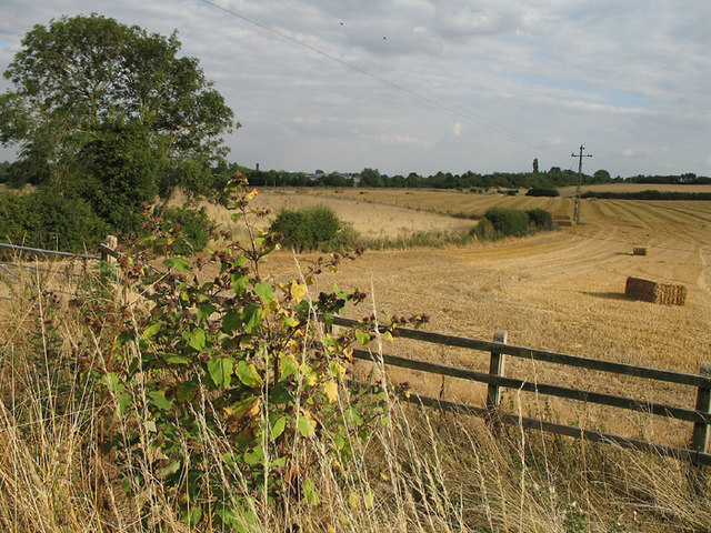
Westminster Pond is a picturesque freshwater marsh located in Hertfordshire, England. Spanning approximately 10 acres, it is a stunning natural habitat that offers a serene escape for nature enthusiasts and wildlife observers alike. The pond is surrounded by lush vegetation, including reeds, grasses, and water lilies, adding to its scenic beauty.
The water in Westminster Pond is crystal clear and teeming with various freshwater species. The pond is home to a diverse range of aquatic life, such as fish, frogs, newts, and water insects. It also serves as a haven for numerous bird species, including mallards, coots, herons, and kingfishers. These birds can often be seen gracefully gliding across the water or perched on the surrounding trees.
The pond itself is relatively shallow, with depths ranging from a few inches to a couple of feet. This makes it an ideal environment for water plants to thrive and for small aquatic creatures to find shelter. The calm and tranquil atmosphere of Westminster Pond makes it a popular spot for visitors to relax and enjoy the beauty of nature.
Surrounding the pond, there are well-maintained footpaths and observation points that provide visitors with excellent views of the wildlife and vegetation. These paths allow visitors to explore the area at their own pace while respecting the delicate ecosystem.
Westminster Pond is a true gem in Hertfordshire, offering a peaceful and idyllic setting for nature lovers and providing a vital habitat for a wide range of plant and animal species.
If you have any feedback on the listing, please let us know in the comments section below.
Westminster Pond Images
Images are sourced within 2km of 51.937623/-0.030783875 or Grid Reference TL3528. Thanks to Geograph Open Source API. All images are credited.


Westminster Pond is located at Grid Ref: TL3528 (Lat: 51.937623, Lng: -0.030783875)
Administrative County: Hertfordshire
District: East Hertfordshire
Police Authority: Hertfordshire
What 3 Words
///journey.earlobes.drop. Near Buntingford, Hertfordshire
Nearby Locations
Related Wikis
Aspenden
Aspenden is a village and civil parish in the East Hertfordshire district of Hertfordshire, England. It is just to the south of Buntingford. The Prime...

Buntingford railway station
Buntingford railway station is a former station in Buntingford, Hertfordshire, England. It served as the terminus of a branch from the Hertford East Branch...

Benson Memorial Church
The Benson Memorial Church, dedicated to St Richard of Chichester, is an English Roman Catholic church in the Hertfordshire town of Buntingford. Its name...
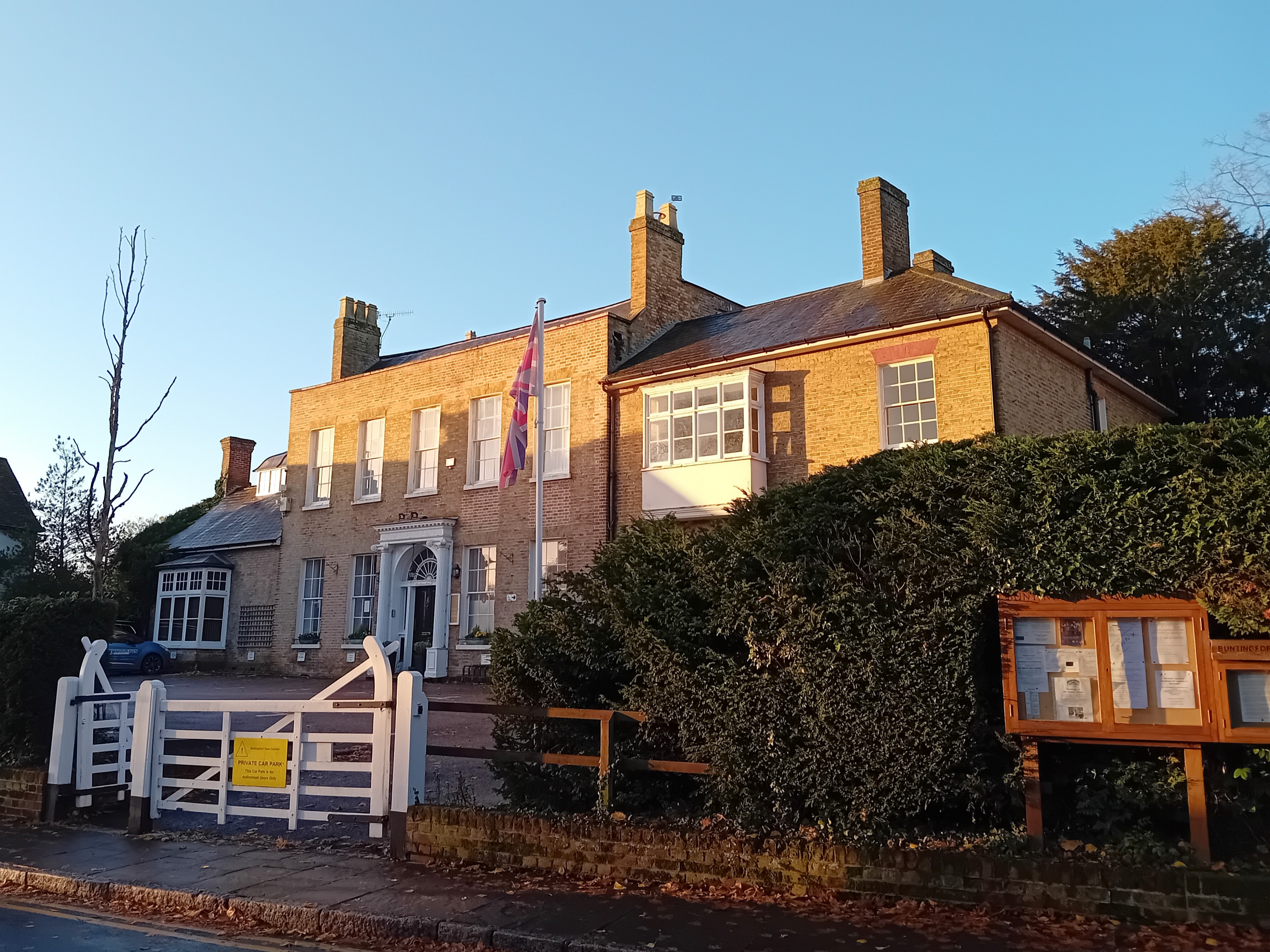
Buntingford Manor House
Buntingford Manor House is an 18th-century building in the town of Buntingford, in Hertfordshire, England. It is a Grade II listed building. == Usage... ==

Buntingford
Buntingford is a market town and civil parish in the district of East Hertfordshire and county of Hertfordshire in England. It lies next to the River Rib...
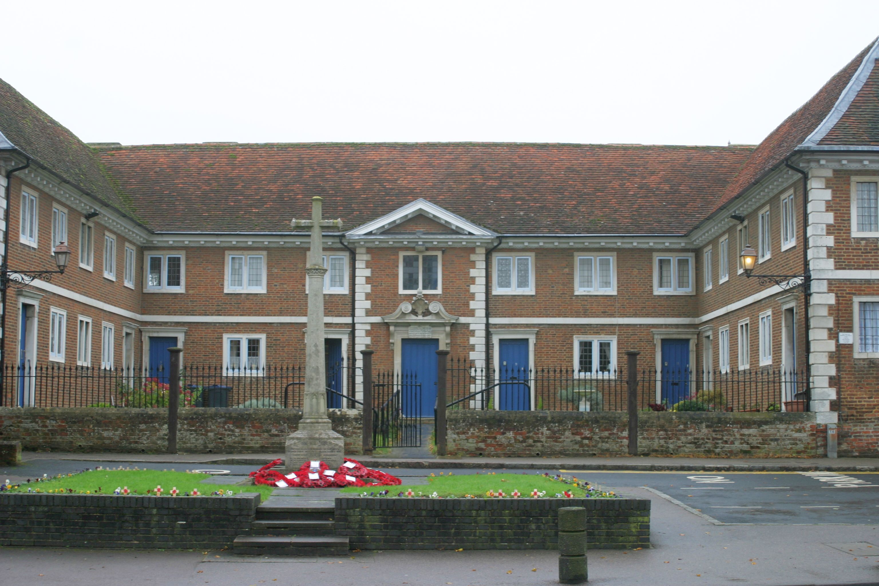
Buntingford almshouses
Buntingford Almshouses is a grade II* listed building on the High street of the Hertfordshire town of Buntingford. The building was erected in 1684 by...
Braughing Rural District
Braughing was a rural district in Hertfordshire, England from 1935 to 1974. == Creation == Braughing Rural District was created on 1 April 1935 under a...

Buntingford Rural District
Buntingford Rural District was a rural district in Hertfordshire, England from 1894 to 1935, covering the town of Buntingford and a number of surrounding...
Nearby Amenities
Located within 500m of 51.937623,-0.030783875Have you been to Westminster Pond?
Leave your review of Westminster Pond below (or comments, questions and feedback).