Bay Pond

Lake, Pool, Pond, Freshwater Marsh in Surrey Tandridge

England

Bay Pond

Footpath towards South Godstone A decrepit gateway marks the start of this path leading down from Tilburstowhill Common to the A22.
Footpath towards South Godstone Credit: Stephen McKay

Bay Pond is a picturesque freshwater marsh located in Surrey, England. It covers an area of approximately 12 hectares and is a popular destination for birdwatchers and nature enthusiasts. The pond is surrounded by lush vegetation and is home to a variety of plant and animal species.

The pond itself is relatively shallow, with an average depth of around 2 meters. It is fed by a combination of surface water runoff and groundwater, which helps to maintain a healthy ecosystem within the pond. The water is clear and clean, providing a habitat for a diverse range of aquatic plants and animals.

Visitors to Bay Pond can enjoy walking along the trails that surround the pond, taking in the sights and sounds of nature. Birdwatchers will be delighted by the numerous species of birds that call the pond home, including herons, kingfishers, and ducks.

Overall, Bay Pond is a tranquil and beautiful spot that offers a peaceful escape from the hustle and bustle of everyday life. It is a haven for wildlife and a place of natural beauty that is sure to captivate all who visit.

If you have any feedback on the listing, please let us know in the comments section below.
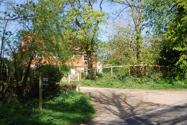
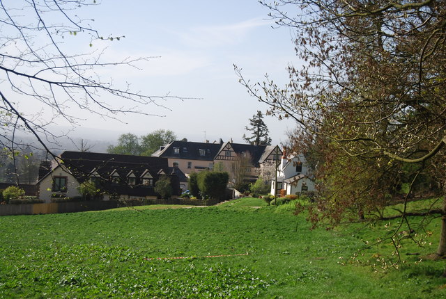
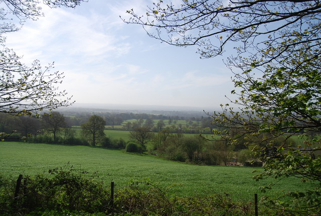
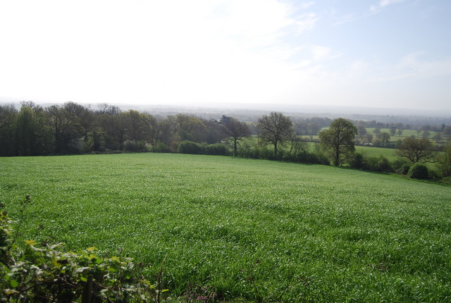
Bay Pond Images

Images are sourced within 2km of 51.247853/-0.063244076 or Grid Reference TQ3551. Thanks to Geograph Open Source API. All images are credited.

Footpath towards South Godstone A decrepit gateway marks the start of this path leading down from Tilburstowhill Common to the A22.
Footpath towards South Godstone
A decrepit gateway marks the start of this path leading down from Tilburstowhill Common to the A22.
Tilburstow Hill A wooded hill south of Godstone, part of the Lower Greensand ridge that runs pareallel and south of the North Downs.
Tilburstow Hill
A wooded hill south of Godstone, part of the Lower Greensand ridge that runs pareallel and south of the North Downs.
Tilburstow Hill Farmhouse Grade II listed. <span class="nowrap"><a title="http://www.britishlistedbuildings.co.uk/en-287781-tilburstow-hill-farm-house-godstone" rel="nofollow ugc noopener" href="http://www.britishlistedbuildings.co.uk/en-287781-tilburstow-hill-farm-house-godstone">Link</a><img style="margin-left:2px;" alt="External link" title="External link - shift click to open in new window" src="https://s1.geograph.org.uk/img/external.png" width="10" height="10"/></span>
Tilburstow Hill Farmhouse
Grade II listed. LinkExternal link
Climbing Tilburstow Hill
Road signs on Tilburstow Hill
Greensand Way off the road The Greensand Way is a long distance walk of 108 miles (174 km) in Southeast England, from Haslemere in Surrey to Hamstreet in Kent. It follows the Greensand Ridge along the Surrey Hills and Chart Hills. The route is mostly rural, passing through woods and alongside fruit orchards and hop farms in Kent. and links with the Stour Valley Walk near Pluckley in Kent.

See <span class="nowrap"><a title="http://www.kent.gov.uk/leisure_and_culture/countryside_and_coast/walking/greensand_way.aspx" rel="nofollow ugc noopener" href="http://www.kent.gov.uk/leisure_and_culture/countryside_and_coast/walking/greensand_way.aspx">Link</a><img style="margin-left:2px;" alt="External link" title="External link - shift click to open in new window" src="https://s1.geograph.org.uk/img/external.png" width="10" height="10"/></span> for more details. See also <span class="nowrap"><a title="http://www.walkingpages.co.uk/trails_paths/LDP_greensandway.htm" rel="nofollow ugc noopener" href="http://www.walkingpages.co.uk/trails_paths/LDP_greensandway.htm">Link</a><img style="margin-left:2px;" alt="External link" title="External link - shift click to open in new window" src="https://s1.geograph.org.uk/img/external.png" width="10" height="10"/></span> for more mapping details.
Greensand Way off the road
The Greensand Way is a long distance walk of 108 miles (174 km) in Southeast England, from Haslemere in Surrey to Hamstreet in Kent. It follows the Greensand Ridge along the Surrey Hills and Chart Hills. The route is mostly rural, passing through woods and alongside fruit orchards and hop farms in Kent. and links with the Stour Valley Walk near Pluckley in Kent. See LinkExternal link for more details. See also LinkExternal link for more mapping details.
Orme House
Orme House
View from the Greensand Ridge
Orme House and grounds
View south from the Greensand Way
Footpath leaves the Greensand Way through a gate The Greensand Way is a long distance walk of 108 miles (174 km) in Southeast England, from Haslemere in Surrey to Hamstreet in Kent. It follows the Greensand Ridge along the Surrey Hills and Chart Hills. The route is mostly rural, passing through woods and alongside fruit orchards and hop farms in Kent. and links with the Stour Valley Walk near Pluckley in Kent.

See <span class="nowrap"><a title="http://www.kent.gov.uk/leisure_and_culture/countryside_and_coast/walking/greensand_way.aspx" rel="nofollow ugc noopener" href="http://www.kent.gov.uk/leisure_and_culture/countryside_and_coast/walking/greensand_way.aspx">Link</a><img style="margin-left:2px;" alt="External link" title="External link - shift click to open in new window" src="https://s1.geograph.org.uk/img/external.png" width="10" height="10"/></span> for more details. See also <span class="nowrap"><a title="http://www.walkingpages.co.uk/trails_paths/LDP_greensandway.htm" rel="nofollow ugc noopener" href="http://www.walkingpages.co.uk/trails_paths/LDP_greensandway.htm">Link</a><img style="margin-left:2px;" alt="External link" title="External link - shift click to open in new window" src="https://s1.geograph.org.uk/img/external.png" width="10" height="10"/></span> for more mapping details.
Footpath leaves the Greensand Way through a gate
The Greensand Way is a long distance walk of 108 miles (174 km) in Southeast England, from Haslemere in Surrey to Hamstreet in Kent. It follows the Greensand Ridge along the Surrey Hills and Chart Hills. The route is mostly rural, passing through woods and alongside fruit orchards and hop farms in Kent. and links with the Stour Valley Walk near Pluckley in Kent. See LinkExternal link for more details. See also LinkExternal link for more mapping details.
South-west off the Greensand Way
South off the Greensand Way
South-west off the Greensand Way
The Greensand Way below Tilburstow Hill
South-east off the Greensand Way
Show me another place!

Bay Pond is located at Grid Ref: TQ3551 (Lat: 51.247853, Lng: -0.063244076)

Administrative County: Surrey

District: Tandridge

Police Authority: Surrey

What 3 Words

///motor.complains.goods. Near Godstone, Surrey

Related Wikis

Bay Pond

Bay Pond is a 7-hectare (17-acre) nature reserve in Godstone in Surrey. It is managed by the Surrey Wildlife Trust. It is part of Godstone Ponds Site...

Godstone

Godstone is a village and civil parish in the Tandridge District of Surrey, England. It is 6 miles (9.7 km) east of Reigate, 3 miles (4.8 km) west of Oxted...

1929 Luft Hansa Junkers G 24 crash

The 1929 Luft Hansa Junkers G.24 crash occurred on 6 November 1929 when a Junkers G 24 of Luft Hansa crashed at Godstone, Surrey, United Kingdom while...

A25 road

The A25 road is an east–west main road in the South-East of England. Its carries traffic east from Guildford, Surrey, eastward through Surrey and into...

Nearby Amenities

Located within 500m of 51.247853,-0.063244076
Godstone
Is In: Surrey, England
Place: village
Lat/Long: 51.2482776/-0.0673265
Crossing
Crossing: unmarked
Crossing Island: yes
Tactile Paving: yes
Lat/Long: 51.2519462/-0.064506
Post Office
Godstone Post Office
Addr City: Godstone
Addr Country: GB
Addr Postcode: RH9 8DT
Brand: Post Office
Brand Wikidata: Q1783168
Contact Website: https://www.postoffice.co.uk/branch-finder/0609404/godstone
Operator: Godstone News
Ref Pol Id: 306
Lat/Long: 51.2477228/-0.0667369
Pub
Hare & Hounds
Opening Hours: Mo-Sa 11:00-23:00; Su 12:00-22:30
Toilets: yes
Toilets Access: customers
Wikidata: Q26658087
Lat/Long: 51.2485354/-0.0681472
Post Box
Collection Times: Mo-Fr 09:00; Sa 07:00; Su off
Drive Through: no
Operator: Royal Mail
Post Box Type: wall
Ref: RH9 313D
Royal Cypher: EIIR
Royal Cypher Wikidata: Q33102113
Source: survey
Lat/Long: 51.2508966/-0.0644005
Bus Stop
Hare And Hounds
Bench: no
Bin: no
Bus: yes
Lit: no
Naptan AtcoCode: 40004410077A
Naptan Bearing: NE
Naptan CommonName: Hare And Hounds
Naptan Indicator: O/s
Naptan Landmark: Hare And Hounds
Naptan NaptanCode: surdmtdw
Naptan Street: Needles Bank
Naptan Verified: yes
Public Transport: platform
Shelter: no
Source: naptan_import
Tactile Paving: no
Wheelchair: yes
Wheelchair Description: Step-free to all nearby stops.
Lat/Long: 51.2484025/-0.0679415
Bus Stop
Godstone Green
Bench: yes
Bin: yes
Bus: yes
Lit: no
Naptan AtcoCode: 40004410077B
Naptan Bearing: W
Naptan CommonName: Godstone Green
Naptan Indicator: Opp
Naptan Landmark: Godstone Green
Naptan NaptanCode: surdmtga
Naptan Street: Bletchingley Road
Naptan Verified: yes
Public Transport: platform
Shelter: yes
Source: naptan_import
Tactile Paving: no
Wheelchair: yes
Wheelchair Description: Step-free to all nearby stops
Lat/Long: 51.2478954/-0.0689817
Bus Stop
Hare And Hounds
Bus: yes
Naptan AtcoCode: 40004410077D
Naptan Bearing: S
Naptan CommonName: Hare And Hounds
Naptan Indicator: Just after
Naptan Landmark: Godstone Green
Naptan NaptanCode: surdmtgj
Naptan Street: High Street
Naptan Verified: no
Public Transport: platform
Shelter: no
Source: naptan_import
Wheelchair: yes
Lat/Long: 51.2480539/-0.0668294
Bus Stop
High Street
Bench: yes
Bin: no
Bus: yes
Lit: no
Naptan AtcoCode: 40004410078A
Naptan Bearing: S
Naptan CommonName: High Street
Naptan Indicator: On
Naptan Landmark: Before One Way System
Naptan NaptanCode: surdmtgm
Naptan Street: High Street
Naptan Verified: yes
Public Transport: platform
Shelter: yes
Source: naptan_import
Tactile Paving: no
Wheelchair: yes
Wheelchair Description: Step-free to all nearby stops
Lat/Long: 51.2492014/-0.0668538
Bus Stop
Crowhurst Mead
Bench: no
Bin: yes
Naptan AtcoCode: 40004410079C
Naptan Bearing: E
Naptan CommonName: Crowhurst Mead
Naptan Indicator: adj
Naptan Landmark: Salisbury Road
Naptan NaptanCode: surdmtgw
Naptan Street: Oxted Road
Naptan Verified: yes
Public Transport: platform
Shelter: yes
Source: naptan_import
Tactile Paving: no
Wheelchair: yes
Lat/Long: 51.2521044/-0.0652065
Bus Stop
Crowhurst Mead
Bench: no
Naptan AtcoCode: 40004410079D
Naptan Bearing: W
Naptan CommonName: Crowhurst Mead
Naptan Indicator: Opp
Naptan Landmark: Salisbury Road
Naptan NaptanCode: surdmtja
Naptan Street: Oxted Road
Naptan Verified: yes
Public Transport: platform
Shelter: no
Source: naptan_import
Tactile Paving: no
Wheelchair: yes
Lat/Long: 51.2520146/-0.065312
Bus Stop
Tilburstow Hill Road
Bench: no
Bin: no
Lit: no
Naptan AtcoCode: 40004410214A
Naptan Bearing: N
Naptan CommonName: Tilburstow Hill Road
Naptan Indicator: Just after
Naptan Landmark: Village
Naptan NaptanCode: surdpmad
Naptan Street: High Street
Naptan Verified: yes
Public Transport: platform
Shelter: no
Source: naptan_import
Tactile Paving: no
Wheelchair: limited
Lat/Long: 51.2458518/-0.0654172
Bus Stop
Tilburstow Hill Road
Bench: no
Bin: yes
Lit: yes
Naptan AtcoCode: 40004410214B
Naptan Bearing: S
Naptan CommonName: Tilburstow Hill Road
Naptan Indicator: Opp
Naptan Landmark: Tilburstow Hill Road
Naptan NaptanCode: surdpmag
Naptan Street: Eastbourne Road
Naptan Verified: yes
Public Transport: platform
Shelter: no
Source: naptan_import
Tactile Paving: no
Wheelchair: limited
Lat/Long: 51.2452132/-0.0649155
Barrier: stile
Lat/Long: 51.2437587/-0.0624631
Pub
The Bell
Opening Hours: Fr,Sa 11:00-23:00; Su-Th 11:00-22:00
Lat/Long: 51.2462434/-0.0657772
Church Town
Is In: Godstone, Surrey
Place: hamlet
Lat/Long: 51.2464249/-0.0570682
Crossing
Crossing: uncontrolled
Crossing Ref: zebra
Kerb: lowered
Tactile Paving: yes
Lat/Long: 51.247598/-0.0669599
Crossing
Crossing: uncontrolled
Crossing Ref: zebra
Tactile Paving: yes
Lat/Long: 51.2474869/-0.0669317
Crossing
Crossing: uncontrolled
Crossing Ref: zebra
Kerb: lowered
Source: P143-0489
Tactile Paving: yes
Lat/Long: 51.2489665/-0.067021
Toilets
Check Date: 2023-09-02
Fee: no
Note: Toilets are built into the bus shelter.
Lat/Long: 51.248409/-0.0680015
Barrier: cycle_barrier
Cycle Barrier: double
Cycle Barrier Installation: openable
Lat/Long: 51.2471313/-0.0650849
Post Box
Collection Times: Mo-Fr 17:15; Sa 11:15; Su off
Drive Through: no
Operator: Royal Mail
Post Box Type: pillar
Ref: RH9 187
Royal Cypher: EIIR
Royal Cypher Wikidata: Q33102113
Source: survey
Lat/Long: 51.2483835/-0.0669727
Check Date: 2018-10-01
Disused Amenity: pharmacy
Old Name: Lloyds Pharmacy
Lat/Long: 51.2493111/-0.0669774
Community Centre
Godstone Town Hall
Check Date: 2023-09-02
Opening Hours: "for hire"
Wheelchair: yes
Lat/Long: 51.2471969/-0.0655543
Godstone
Check Date: 2023-09-02
Description: Includes historical notes on 44 buildings, Bay Ponds, and several earlier settlement names including Wolchestede
Hiking: yes
Information: map
Map Size: city
Map Type: street
Source: P143-0480
Tourism: information
Lat/Long: 51.2471657/-0.0667005
Community Centre
St Nicholas Youth Centre
Check Date: 2023-09-02
Opening Hours: "for hire"
Source: P143-0483
Lat/Long: 51.2469903/-0.0654367
Crossing
Crossing: uncontrolled
Crossing Ref: zebra
Kerb: lowered
Source: P143-0489
Tactile Paving: yes
Lat/Long: 51.2490371/-0.0669253
Barrier: bollard
Bicycle: no
Foot: yes
Lat/Long: 51.2484867/-0.0670294
Crossing
Crossing: unmarked
Kerb: lowered
Tactile Paving: no
Lat/Long: 51.2469009/-0.0663823
Crossing
Crossing: uncontrolled
Crossing Island: yes
Kerb: lowered
Tactile Paving: yes
Lat/Long: 51.2521042/-0.0653398
Crossing
Crossing: unmarked
Kerb: lowered
Tactile Paving: no
Lat/Long: 51.2470142/-0.0664978
Crossing
Crossing: unmarked
Crossing Island: no
Kerb: lowered
Tactile Paving: no
Lat/Long: 51.2454005/-0.0652575
Barrier: kissing_gate
Lat/Long: 51.2490952/-0.0689388
Crossing
Check Date Crossing: 2020-11-08
Crossing: unmarked
Crossing Island: no
Sloped Curb: both
Tactile Paving: yes
Lat/Long: 51.2519638/-0.0652542
Crossing
Crossing: unmarked
Crossing Island: no
Kerb: lowered
Tactile Paving: yes
Lat/Long: 51.2500956/-0.0671016
Crossing
Check Date Crossing: 2020-12-27
Check Date Tactile Paving: 2020-12-27
Crossing: unmarked
Crossing Island: no
Sloped Curb: both
Tactile Paving: yes
Lat/Long: 51.2517466/-0.0639197
Crossing
Crossing: unmarked
Kerb: flush
Tactile Paving: no
Lat/Long: 51.250749/-0.0580846
Crossing
Crossing: unmarked
Kerb: flush
Tactile Paving: no
Lat/Long: 51.2510154/-0.0593039
Barrier: kerb
Kerb: lowered
Lat/Long: 51.252016/-0.0648556
Addr City: Godstone
Addr Country: GB
Addr Housenumber: 75
Addr Street: High Street
Lat/Long: 51.2470315/-0.0658316
Crossing
Crossing: unmarked
Crossing Island: no
Kerb: lowered
Tactile Paving: yes
Lat/Long: 51.2481427/-0.0681776
Crossing: informal
Lat/Long: 51.2485482/-0.0676415
Crossing
Crossing: unmarked
Curb: lowered
Kerb: lowered
Tactile Paving: yes
Lat/Long: 51.2480538/-0.068123
Pub
The White Hart
Addr City: Godstone
Addr Country: GB
Addr Housenumber: 71
Addr Postcode: RH9 8DU
Addr Street: High Street
Opening Hours: Mo-Th 12:00-23:00; Fr,Sa 12:00-24:00; Su 12:00-22:30
Lat/Long: 51.2472412/-0.0663367
Cafe
Flower Farm Tea Room
Opening Hours: Mo-Su 09:00-16:00
Outdoor Seating: yes
Lat/Long: 51.2513508/-0.0587686
Place Of Worship
St Mary's Chapel
Architect: Gilbert Scott
Building: chapel
Historic: yes
Religion: christian
Start Date: 1872
Tourism: attraction
Wheelchair: no
Lat/Long: 51.2463661/-0.0572893
Bench
Backrest: yes
Lat/Long: 51.2472428/-0.0632398
Entrance: yes
Lat/Long: 51.2463267/-0.0572022
Give Way
Lat/Long: 51.2451165/-0.065035
Post Box
Collection Times: Mo-Fr 09:00; Sa 07:00; Su off
Drive Through: no
Operator: Royal Mail
Post Box Type: wall
Ref: RH9 246D
Royal Cypher: GVIR
Royal Cypher Wikidata: Q33102169
Source: survey
Lat/Long: 51.2453434/-0.0652475
Post Box
Collection Times: Mo-Fr 09:00; Sa 07:00; Su off
Drive Through: no
Operator: Royal Mail
Post Box Type: lamp
Ref: RH9 276D
Royal Cypher: GVIR
Royal Cypher Wikidata: Q33102169
Source: survey
Lat/Long: 51.2466494/-0.0573715
Bench
Backrest: yes
Lat/Long: 51.2467825/-0.0563783
Dentist
The White House Dental Practice
Email: enquiries@thewhitehouse.dental
Healthcare: dentist
Opening Hours: Mo-Fr 08:30-17:00
Phone: +44 1883 742549
Website: https://www.thewhitehouse.dental/
Wheelchair: yes
Lat/Long: 51.2477871/-0.0700334
Barrier: stile
Lat/Long: 51.2515442/-0.0619838
Give Way
Direction: forward
Lat/Long: 51.2481749/-0.0681308
Coughlans Bakery
Opening Hours: Mo-Fr 07:30-15:30; Sa 08:00-16:00; Su off
Shop: bakery
Lat/Long: 51.2469619/-0.0662479
Give Way
Lat/Long: 51.2489499/-0.066984
Shop: funeral_directors
Lat/Long: 51.2494903/-0.0667964
Male: yes
Shop: hairdresser
Lat/Long: 51.2497631/-0.0670861
Give Way
Lat/Long: 51.2454147/-0.0651978
Give Way
Lat/Long: 51.2478752/-0.0696865
Give Way
Lat/Long: 51.247518/-0.0669741
Bench
Backrest: yes
Seats: 4
Lat/Long: 51.2479147/-0.067872
Bench
Backrest: yes
Seats: 2
Lat/Long: 51.2478819/-0.067825
Bench
Backrest: yes
Seats: 3
Lat/Long: 51.2475407/-0.0672517
Bench
Backrest: yes
Seats: 3
Lat/Long: 51.2473573/-0.0671799
Bench
Backrest: yes
Seats: 4
Lat/Long: 51.2472423/-0.0672309
Bench
Backrest: yes
Seats: 4
Lat/Long: 51.2470475/-0.0672839
Bench
Backrest: yes
Seats: 3
Lat/Long: 51.2466907/-0.0676581
Bench
Backrest: yes
Seats: 3
Lat/Long: 51.24671/-0.0676554
Bench
Backrest: yes
Seats: 3
Lat/Long: 51.2467222/-0.0676433
Bench
Backrest: yes
Seats: 3
Lat/Long: 51.2464523/-0.0678813
Bench
Backrest: yes
Seats: 3
Lat/Long: 51.2462676/-0.0687316
Bench
Backrest: yes
Seats: 2
Lat/Long: 51.2461081/-0.0691688
Crossing
Crossing: uncontrolled
Crossing Ref: zebra
Kerb: lowered
Source: P143-0489
Tactile Paving: yes
Lat/Long: 51.2490344/-0.0670511
Bench
Backrest: yes
Seats: 6
Source: gps
Lat/Long: 51.2478727/-0.0688885
Elevator
Lat/Long: 51.2463871/-0.0673045
The data included in this document is from www.openstreetmap.org. The data is made available under ODbL.

Have you been to Bay Pond?

Leave your review of Bay Pond below (or comments, questions and feedback).