Trout Pond

Lake, Pool, Pond, Freshwater Marsh in Cambridgeshire South Cambridgeshire

England

Trout Pond

Path by the Great Ouse Along the northern edge of Ferry Lagoon, where water levels are still high after a recent wet spell. The bank is raised, but often overtopped when river levels are high and isn't part of the actual flood defences around the floodplain area, which most of the lakes are within.
Path by the Great Ouse Credit: Hugh Venables

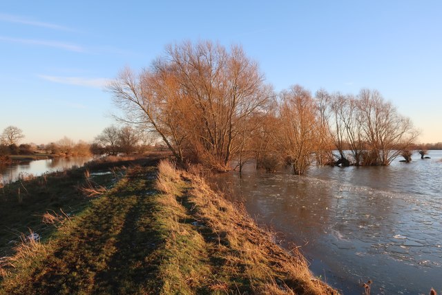
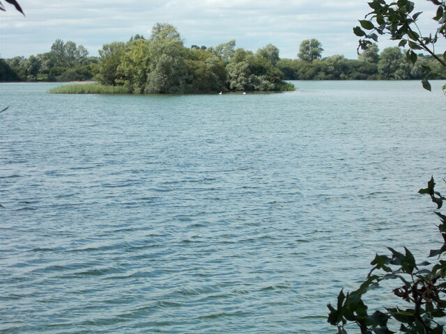
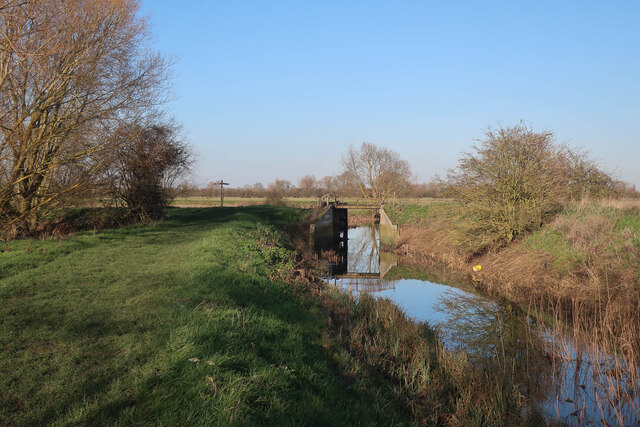
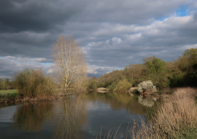
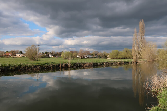
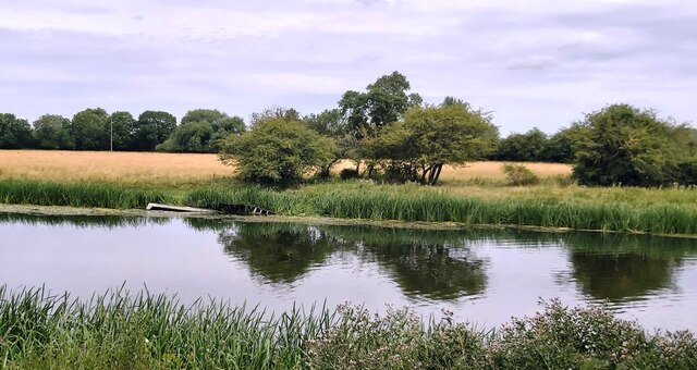
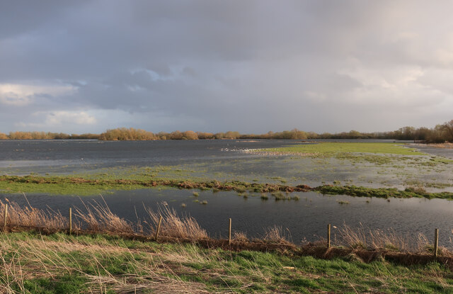
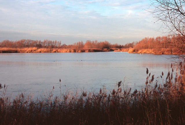
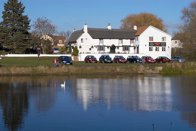
Trout Pond, located in Cambridgeshire, is a picturesque freshwater pond nestled amidst serene surroundings. Spanning a modest area, it is often referred to as a lake, pool, pond, or even a freshwater marsh. The pond is a natural water feature, formed by a combination of rainwater and underground springs.

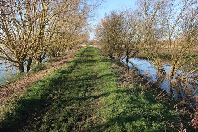
Surrounded by lush greenery and vibrant flora, Trout Pond offers a tranquil escape from the hustle and bustle of everyday life. The crystal-clear waters of the pond are home to a thriving population of trout, which gives the pond its name. Fishing enthusiasts are drawn to its shores, eager to cast their lines and try their luck in catching the prized fish.

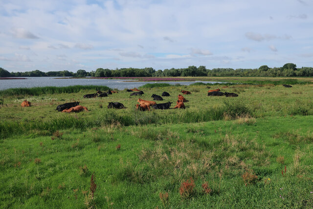
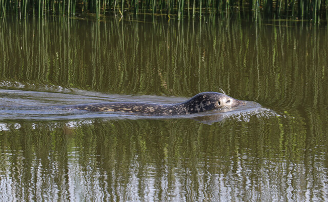
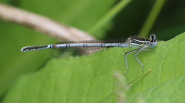
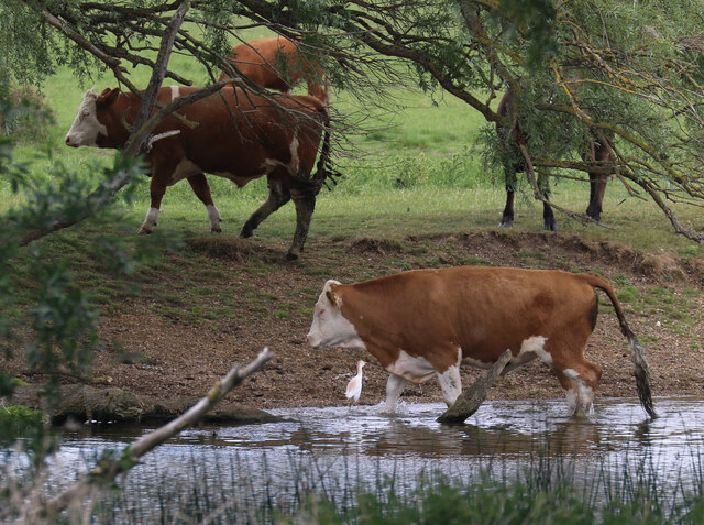
The pond's ecosystem is teeming with various aquatic plants and wildlife. The calm waters provide a habitat for a variety of waterfowl, such as ducks and swans, that gracefully glide across its surface. The surrounding vegetation provides a natural shelter for numerous species of birds, creating an ideal spot for birdwatchers to observe and enjoy their presence.

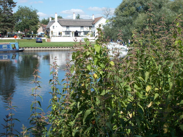
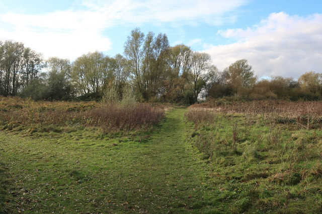
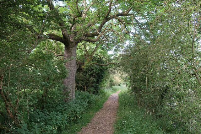
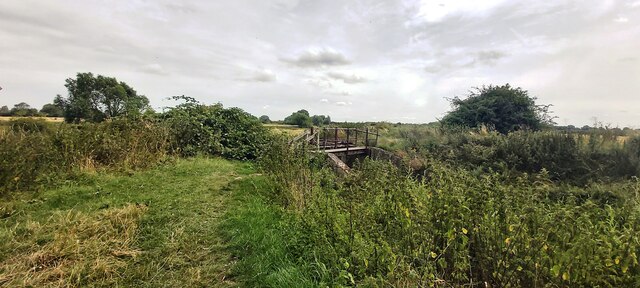
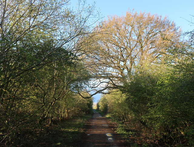
Trout Pond is a haven for nature lovers and avid photographers. Its serene ambiance and the stunning reflections of the surrounding landscape make it a popular spot for capturing the beauty of nature. Visitors can take leisurely walks along the pond's perimeter, immersing themselves in the peaceful atmosphere and taking in the scenic views.

Overall, Trout Pond in Cambridgeshire offers a delightful blend of natural beauty, tranquility, and outdoor recreational opportunities. Whether one seeks to fish, observe wildlife, or simply unwind in a serene environment, Trout Pond is a destination that promises to leave visitors refreshed and rejuvenated.

If you have any feedback on the listing, please let us know in the comments section below.

Trout Pond Images

Images are sourced within 2km of 52.306536/-0.020907524 or Grid Reference TL3569. Thanks to Geograph Open Source API. All images are credited.

Path by the Great Ouse Along the northern edge of Ferry Lagoon, where water levels are still high after a recent wet spell. The bank is raised, but often overtopped when river levels are high and isn't part of the actual flood defences around the floodplain area, which most of the lakes are within.
Path by the Great Ouse
Along the northern edge of Ferry Lagoon, where water levels are still high after a recent wet spell. The bank is raised, but often overtopped when river levels are high and isn't part of the actual flood defences around the floodplain area, which most of the lakes are within.
Ferryboat Inn seen across the River Great Ouse
Island view, Drayton Lagoon It was apparent that there was less bird life on this lake than on nearby Ferry Lagoon, however a couple of swans were in view near the island.
Island view, Drayton Lagoon
It was apparent that there was less bird life on this lake than on nearby Ferry Lagoon, however a couple of swans were in view near the island.
Path to Drayton Lagoon
Old flood gates at the end of Covell's Drain Well past being any use.
Old flood gates at the end of Covell's Drain
Well past being any use.
Path by the Great Ouse With high water levels in Ferry Lagoon to the left.
Path by the Great Ouse
With high water levels in Ferry Lagoon to the left.
Cattle north of Ferry Lagoon
Holywell, St John the Baptist
Common Seal in the Great Ouse It is not unusual to see common seals in the river between here and Earith, with animals coming inland from the Wash, with some spending considerable time in the area, including giving birth.
Common Seal in the Great Ouse
It is not unusual to see common seals in the river between here and Earith, with animals coming inland from the Wash, with some spending considerable time in the area, including giving birth.
White-legged Damselfly (Platycnemis pennipes) Present in small numbers at the northern edge of Fen Drayton Lakes RSPB reserve.
White-legged Damselfly (Platycnemis pennipes)
Present in small numbers at the northern edge of Fen Drayton Lakes RSPB reserve.
Cattle by the Great Ouse With a Cattle Egret in attendance, as is now unremarkable. Just three years ago it would have been quite a notable bird sighting.
Cattle by the Great Ouse
With a Cattle Egret in attendance, as is now unremarkable. Just three years ago it would have been quite a notable bird sighting.
River Great Ouse North of Fen Drayton lakes RSPB reserve.
River Great Ouse
North of Fen Drayton lakes RSPB reserve.
River Great Ouse North of Fen Drayton lakes RSPB reserve, looking towards Holywell village.
River Great Ouse
North of Fen Drayton lakes RSPB reserve, looking towards Holywell village.
Bridleway by the Great Ouse
Footbridge and Sluice Gate at Covell's Drain
River Great Ouse at Fen Drayton Lakes Nature Reserve:
Receding flood waters at Ferry Lagoon, Fen Drayton Lakes This area drains slowly after flooding, giving very good wet grassland habitat for species such as Black-tailed Godwit and Pintail that are displaced from the nearby Ouse Washes by the high water levels there.
Receding flood waters at Ferry Lagoon, Fen Drayton Lakes
This area drains slowly after flooding, giving very good wet grassland habitat for species such as Black-tailed Godwit and Pintail that are displaced from the nearby Ouse Washes by the high water levels there.
Holywell Ferry Road Path to the river from Fen Drayton Lakes car park.
Holywell Ferry Road
Path to the river from Fen Drayton Lakes car park.
Show me another place!

Trout Pond is located at Grid Ref: TL3569 (Lat: 52.306536, Lng: -0.020907524)

Administrative County: Cambridgeshire

District: South Cambridgeshire

Police Authority: Cambridgeshire

What 3 Words

///nods.secretly.ruling. Near Swavesey, Cambridgeshire

Related Wikis

Fen Drayton Lakes

Fen Drayton Lakes is a complex of lakes, lagoons, ponds and a river, situated close to Fen Drayton, Holywell and Swavesey in Cambridgeshire, England. The...

Swavesey railway station

Swavesey railway station was a station in Swavesey, Cambridgeshire on the line between Cambridge and St Ives which was closed for passenger services in...

The Old Ferry Boat Inn

The Old Ferry Boat Inn is a pub in Holywell, Huntingdonshire, Cambridgeshire, England. It is situated on the banks of the River Great Ouse.The Old Ferry...

Needingworth

Needingworth is a village in Cambridgeshire, England. Needingworth lies approximately 7 miles (11 km) east of Huntingdon and just west of the Prime Meridian...

Mare Fen

Mare Fen is a 16.3 hectare Local Nature Reserve north of Swavesey in Cambridgeshire, England. It is owned by Cambridgeshire County Council, and was formerly...

Swavesey Priory

Swavesey Priory was a medieval monastic house in the village of Swavesey, Cambridgeshire, England. A church existed in Swavesey at the time of the Norman...

Fen Drayton

Fen Drayton is a small village between Cambridge and St. Ives in Cambridgeshire, England, and between the villages of Fenstanton and Swavesey. The village...

Holywell, Cambridgeshire

Holywell is a village in Cambridgeshire, England, approximately 6 miles (10 km) east of Huntingdon, in the civil parish of Holywell-cum-Needingworth. It...

Nearby Amenities

Located within 500m of 52.306536,-0.020907524
Tourism: picnic_site
Lat/Long: 52.307991/-0.0250665
Direction: both
Surface: concrete
Traffic Calming: hump
Lat/Long: 52.3073458/-0.0174306
Parking
Fishermans Carpark
Access: private
Lat/Long: 52.3079016/-0.0276516
Bench
Lat/Long: 52.3079106/-0.0236776
Tourism: viewpoint
Lat/Long: 52.3084852/-0.0219245
Bench
Backrest: no
Material: wood
Lat/Long: 52.3065614/-0.017537
The data included in this document is from www.openstreetmap.org. The data is made available under ODbL.

Have you been to Trout Pond?

Leave your review of Trout Pond below (or comments, questions and feedback).