Valebridge Pond

Lake, Pool, Pond, Freshwater Marsh in Sussex Mid Sussex

England

Valebridge Pond

Little used BMX track, Burgess Hill, 2010 Not a circuit, but end to end with three banked corners.
Little used BMX track, Burgess Hill, 2010 Credit: Robin Webster

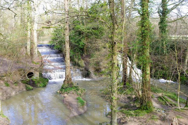
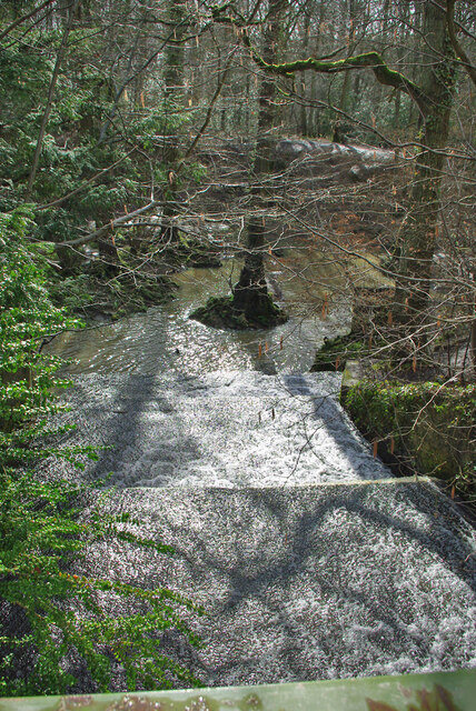
Valebridge Pond, located in Sussex, is a serene freshwater marsh encompassing an area of approximately 3 hectares. Nestled amidst the picturesque countryside, this pond offers a tranquil oasis for both nature enthusiasts and locals seeking a peaceful retreat. The site is easily accessible, situated just a short distance from the village of Lindfield.

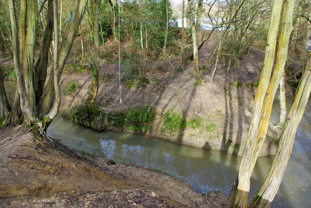
The pond itself is a haven for various species of wildlife, providing a diverse ecosystem for an array of plants and animals. Dense vegetation, including reeds and lilies, surrounds the water's edge, adding to the pond's natural beauty. The calm, still waters are home to a variety of freshwater fish, such as roach, perch, and carp, making it an appealing destination for anglers.

Valebridge Pond is not only a haven for wildlife but also a popular spot for recreational activities. Visitors can enjoy leisurely walks along the well-maintained footpaths that encircle the pond, offering breathtaking views of the surrounding countryside. Additionally, the pond provides opportunities for birdwatching, with a number of avian species, including ducks, swans, and herons, frequenting the area.

The pond's idyllic setting also makes it an ideal location for picnics and family outings. There are designated picnic areas with benches, allowing visitors to relax and enjoy the peaceful ambiance while appreciating the natural surroundings. Furthermore, the site features ample parking facilities and public toilets, ensuring convenience for all visitors.

Valebridge Pond serves as a valuable ecological resource and a cherished recreational space within the Sussex region, attracting both locals and tourists alike. Its harmonious blend of natural beauty and tranquility makes it a must-visit destination for anyone seeking a respite from the hustle and bustle of everyday life.

If you have any feedback on the listing, please let us know in the comments section below.

Valebridge Pond Images

Images are sourced within 2km of 50.975293/-0.12071647 or Grid Reference TQ3221. Thanks to Geograph Open Source API. All images are credited.

Little used BMX track, Burgess Hill, 2010 Not a circuit, but end to end with three banked corners.
Little used BMX track, Burgess Hill, 2010
Not a circuit, but end to end with three banked corners.
Little used BMX track, Burgess Hill, 2010 Not a circuit, but end to end with three banked corners. This view is from the first corner towards the start.
Little used BMX track, Burgess Hill, 2010
Not a circuit, but end to end with three banked corners. This view is from the first corner towards the start.
Green lane towards municipal dump, 2010 Not a public right-of-way now, not sure what it was then, but I used it.
Green lane towards municipal dump, 2010
Not a public right-of-way now, not sure what it was then, but I used it.
Path in Big Wood, Bedelands Farm A local nature reserve.
Path in Big Wood, Bedelands Farm
A local nature reserve.
Spillways, Valebridge Pond On the eastern branch of the River Adur.
Spillways, Valebridge Pond
On the eastern branch of the River Adur.
Blue rope hanging over River Adur Standard equipment for such places.
Blue rope hanging over River Adur
Standard equipment for such places.
Spillway, Valebridge Pond On the eastern branch of the River Adur.
Spillway, Valebridge Pond
On the eastern branch of the River Adur.
Path towards Bedelands Farm Local Nature Reserve
Path with footbridge, Leylands Wood Part of Bedelands Farm Local Nature Reserve.
Path with footbridge, Leylands Wood
Part of Bedelands Farm Local Nature Reserve.
Brook in Leylands Wood Part of Bedelands Farm Local Nature Reserve. The water emerges from a culvert under a built-up area and feeds into the River Adur, eastern branch.
Brook in Leylands Wood
Part of Bedelands Farm Local Nature Reserve. The water emerges from a culvert under a built-up area and feeds into the River Adur, eastern branch.
Path in Leylands Wood Part of Bedelands Farm Local Nature Reserve, although this route is a public footpath, 101CR, the CR probably being Cuckfield Rural.
Path in Leylands Wood
Part of Bedelands Farm Local Nature Reserve, although this route is a public footpath, 101CR, the CR probably being Cuckfield Rural.
Paths in Leylands Wood Part of Bedelands Farm Local Nature Reserve, although one route is a public footpath, 101CR, the CR probably being Cuckfield Rural. The helpful board on the right is one of several similar ones at key points, with a map of the nature reserve and its paths and where the local paths go. The reserve is an irregular patchwork of open fields and woods, quite easy to get lost in.
Paths in Leylands Wood
Part of Bedelands Farm Local Nature Reserve, although one route is a public footpath, 101CR, the CR probably being Cuckfield Rural. The helpful board on the right is one of several similar ones at key points, with a map of the nature reserve and its paths and where the local paths go. The reserve is an irregular patchwork of open fields and woods, quite easy to get lost in.
Brook in Leylands Wood Part of Bedelands Farm Local Nature Reserve. The water emerges from a culvert under a built-up area and feeds into the River Adur, eastern branch.
Brook in Leylands Wood
Part of Bedelands Farm Local Nature Reserve. The water emerges from a culvert under a built-up area and feeds into the River Adur, eastern branch.
Footbridge on footpath 46BH The footpath is a continuation into another parish of 101CR, it crosses here a drainage ditch down the side of a football field.
Footbridge on footpath 46BH
The footpath is a continuation into another parish of 101CR, it crosses here a drainage ditch down the side of a football field.
Woodland west of Bedelands Farm nature reserve Continuous with reserve woodland, but just outside its boundary.
Woodland west of Bedelands Farm nature reserve
Continuous with reserve woodland, but just outside its boundary.
Freek's Lane, Burgess Hill Public footpath 45BH.
Freek's Lane, Burgess Hill
Public footpath 45BH.
Show me another place!

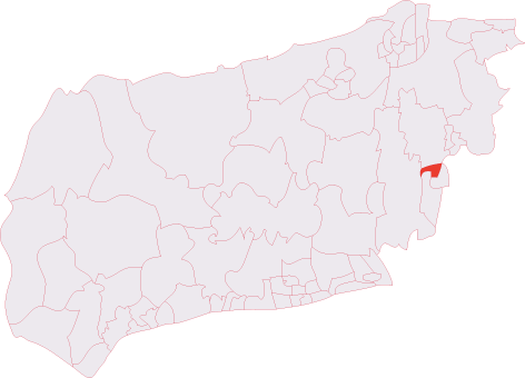
Valebridge Pond is located at Grid Ref: TQ3221 (Lat: 50.975293, Lng: -0.12071647)

Administrative County: West Sussex

District: Mid Sussex

Police Authority: Sussex

What 3 Words

///rate.settle.pits. Near Burgess Hill, West Sussex

Related Wikis

Bedelands Farm Nature Reserve

Bedelands Farm Nature Reserve is a 35.2-hectare (87-acre) Local Nature Reserve on the northern outskirts of Burgess Hill in West Sussex. It is owned and...

Burgess Hill Town F.C.

Burgess Hill Town Football Club is an English football club currently playing in the Isthmian League South East Division. The club plays its home games...

World's End, West Sussex

World's End is a neighbourhood located in Burgess Hill, West Sussex. It is thought that the name arrived with the railway – it was here that the 'up' line...

Wivelsfield railway station

Wivelsfield railway station is a railway station on the Brighton Main Line in West Sussex, England. Located in northern Burgess Hill, it primarily serves...

Ashenground and Bolnore Woods

Ashenground and Bolnore Woods is a 14.4-hectare (36-acre) Local Nature Reserve in Haywards Heath in West Sussex. It is owned and managed by Mid Sussex...

Burgess Hill Town (electoral division)

Burgess Hill Town is an electoral division of West Sussex in the United Kingdom, and returns one member to sit on West Sussex County Council. == Extent... ==

Providence Strict Baptist Chapel, Burgess Hill

Providence Strict Baptist Chapel is a former Strict Baptist place of worship in the town of Burgess Hill in Mid Sussex, one of seven local government districts...

Abbotsford, West Sussex

Abbotsford is a settlement in West Sussex, England. Although once of a distinct identity, the name is now rarely used to describe the area and it would...

Nearby Amenities

Located within 500m of 50.975293,-0.12071647
Power: tower
Lat/Long: 50.977842/-0.1161546
Power: tower
Lat/Long: 50.9765733/-0.1223128
Post Box
Operator: Royal Mail
Post Box Type: lamp
Ref: RH15 137
Royal Cypher: EIIR
Royal Cypher Wikidata: Q33102113
Lat/Long: 50.9746597/-0.1161703
Crossing
Lat/Long: 50.9768816/-0.1155019
Height: 3
Waterway: weir
Lat/Long: 50.974511/-0.1216652
Barrier: block
Bicycle: yes
Foot: yes
Horse: yes
Material: tree
Motor Vehicle: no
Lat/Long: 50.9786225/-0.1168172
Bench
Lat/Long: 50.9714092/-0.1182544
Bench
Lat/Long: 50.9717283/-0.1181566
Power: pole
Lat/Long: 50.9714412/-0.1242233
Power: pole
Lat/Long: 50.9724013/-0.1232197
Power: pole
Lat/Long: 50.9741974/-0.1213833
Bench
Lat/Long: 50.9744099/-0.1222589
Waterway: waterfall
Lat/Long: 50.9744489/-0.121442
Waterway: waterfall
Lat/Long: 50.9745433/-0.1215855
The data included in this document is from www.openstreetmap.org. The data is made available under ODbL.

Have you been to Valebridge Pond?

Leave your review of Valebridge Pond below (or comments, questions and feedback).