Round Pond
Lake, Pool, Pond, Freshwater Marsh in Middlesex
England
Round Pond
Round Pond is a picturesque body of water located in Middlesex County, Massachusetts. Situated in a serene and tranquil setting, it is a popular destination for nature enthusiasts and outdoor lovers. The pond covers an area of approximately 20 acres and is surrounded by lush greenery, providing a scenic backdrop for visitors.
Known for its crystal-clear waters, Round Pond offers a variety of recreational activities. Boating and fishing are popular pastimes, with anglers casting their lines in search of bass, trout, and sunfish that thrive in the pond's freshwater ecosystem. The calm and peaceful atmosphere makes it an ideal spot for kayaking and canoeing as well.
Round Pond is also home to a diverse range of wildlife, making it a haven for birdwatchers and nature photographers. Ducks, geese, herons, and various species of migratory birds can be spotted in and around the pond throughout the year. The pond is surrounded by a freshwater marsh, which provides a habitat for numerous aquatic plants and animals.
In addition to its natural beauty, Round Pond is equipped with amenities to enhance visitors' experiences. A small sandy beach area allows swimmers to cool off during the warm summer months, and picnic tables and grilling areas are available for those looking to enjoy a meal in the great outdoors.
Overall, Round Pond in Middlesex County offers a serene and picturesque environment for outdoor enthusiasts. With its diverse wildlife, recreational opportunities, and peaceful ambiance, it is an ideal destination for those seeking a getaway in nature.
If you have any feedback on the listing, please let us know in the comments section below.
Round Pond Images
Images are sourced within 2km of 51.505871/-0.1833075 or Grid Reference TQ2680. Thanks to Geograph Open Source API. All images are credited.


Round Pond is located at Grid Ref: TQ2680 (Lat: 51.505871, Lng: -0.1833075)
Unitary Authority: Westminster
Police Authority: Metropolitan
What 3 Words
///jumpy.handed.gold. Near Bayswater, London
Nearby Locations
Related Wikis
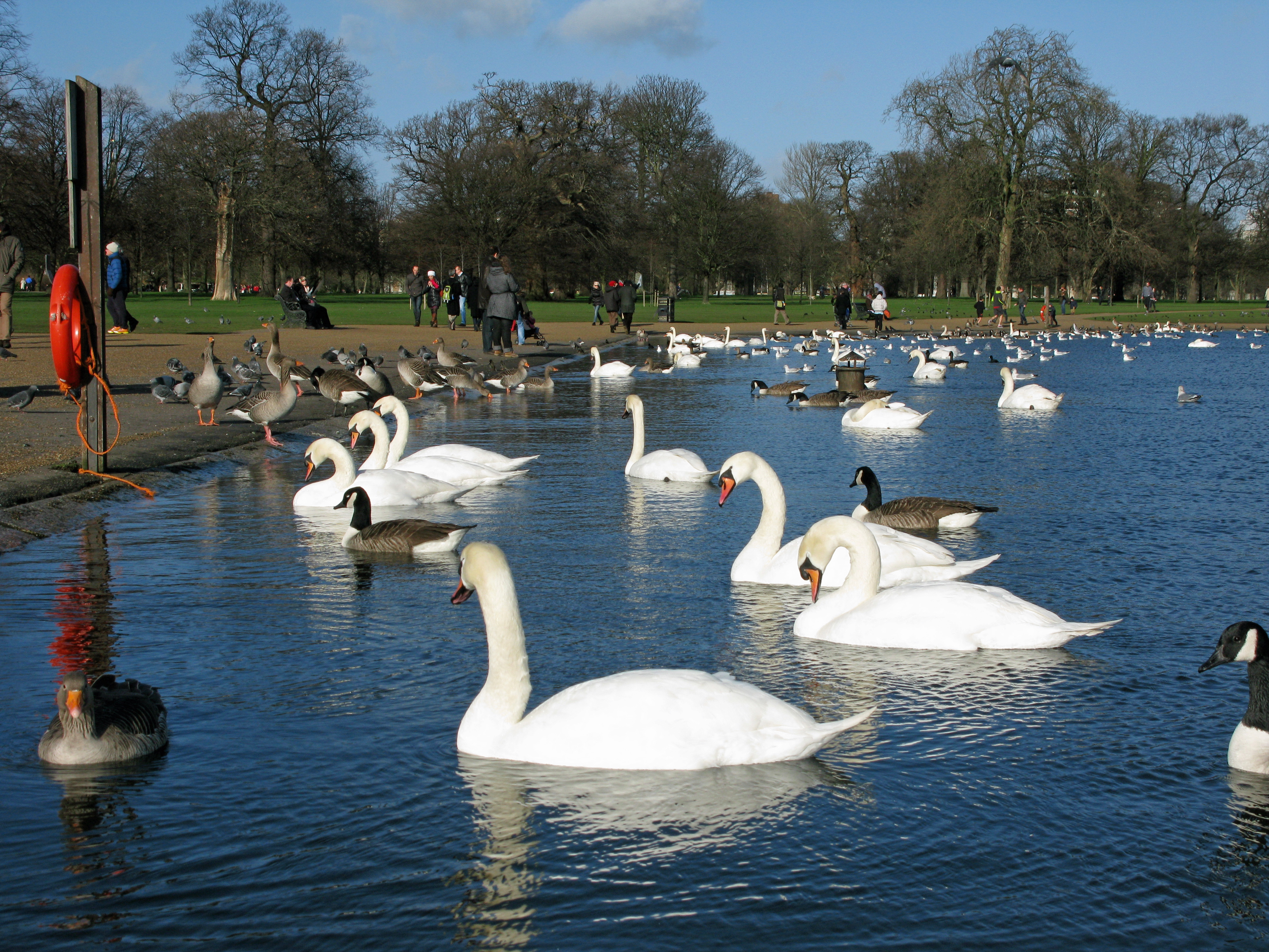
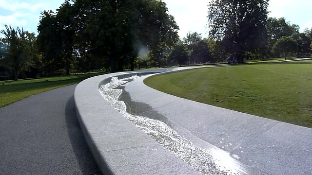
Round Pond (London)
The Round Pond is an ornamental lake in Kensington Gardens, London, in front of Kensington Palace. The pond was created in 1730 by George II. It is approximately...
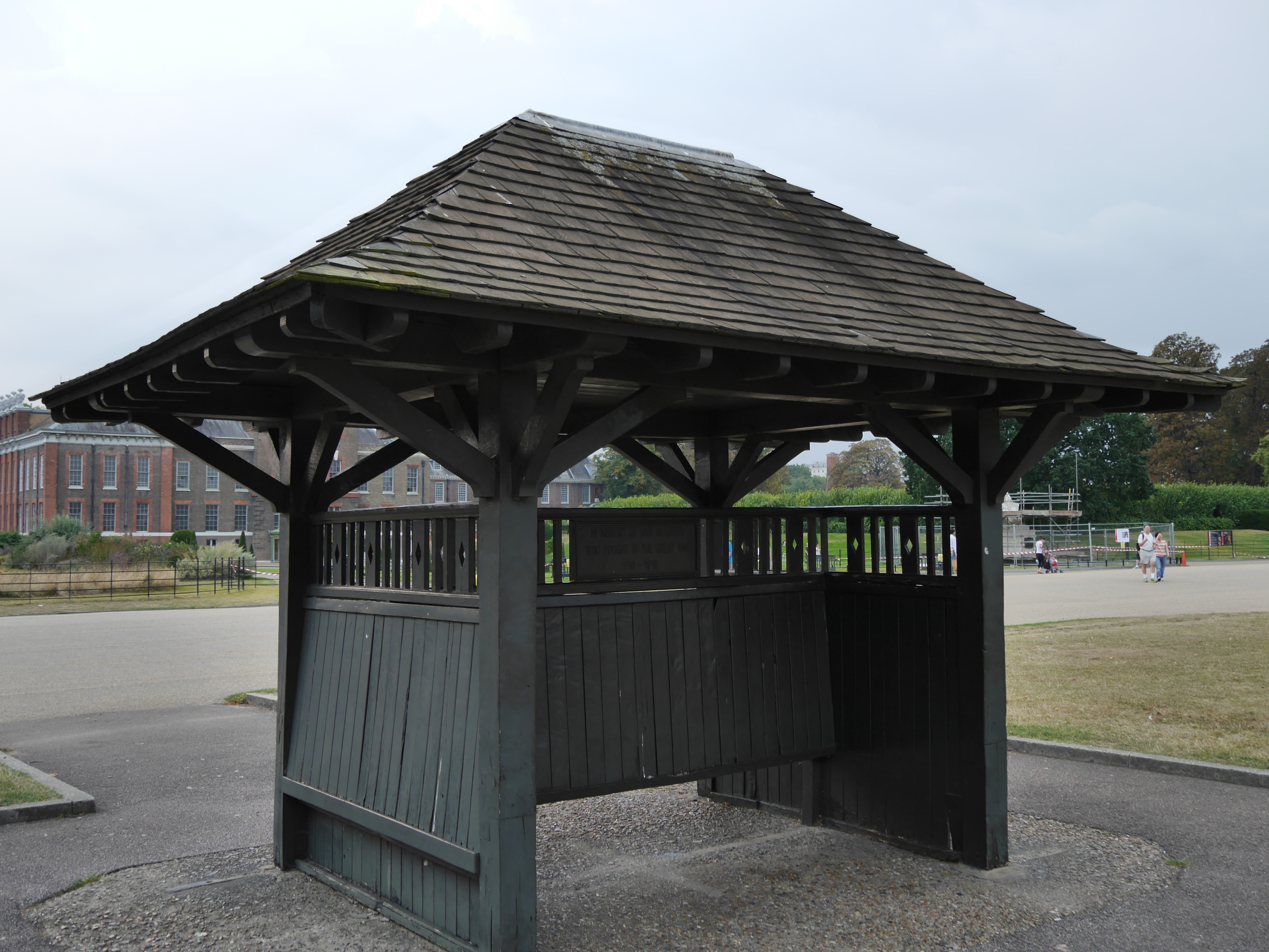
War Memorial Shelters
The War Memorial Shelters are two Grade II listed commemorative shelters in Kensington Gardens, London, about 100m apart, and about 140m east of Kensington...

Statue of Queen Victoria, Kensington Palace
A statue of Queen Victoria stands near Kensington Palace. It was sculpted by Victoria's fourth daughter Princess Louise, Duchess of Argyll and erected...

Statue of Diana, Princess of Wales
A statue of Diana, Princess of Wales is located in the Sunken Garden of London's Kensington Palace. Commissioned by Diana's two sons William and Harry...
Nearby Amenities
Located within 500m of 51.505871,-0.1833075Have you been to Round Pond?
Leave your review of Round Pond below (or comments, questions and feedback).