The Gull Pond

Lake, Pool, Pond, Freshwater Marsh in Lincolnshire South Holland

England

The Gull Pond

Stubble field Between the Welland Bank and Deeping St. Nicholas.
Stubble field Credit: Jonathan Thacker

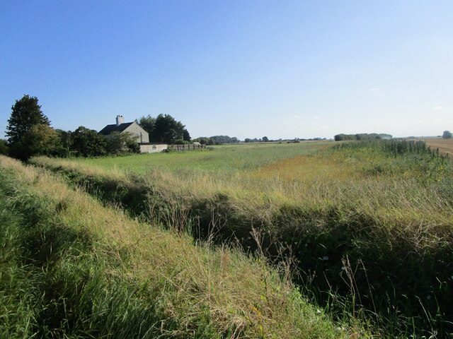
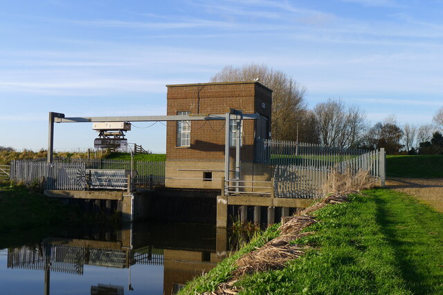
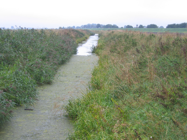
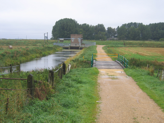
The Gull Pond, located in Lincolnshire, is a picturesque freshwater marsh that serves as a habitat for various bird species and other aquatic wildlife. Nestled in a peaceful setting, this natural body of water covers an area of approximately 10 acres, making it a popular destination for nature enthusiasts and birdwatchers.

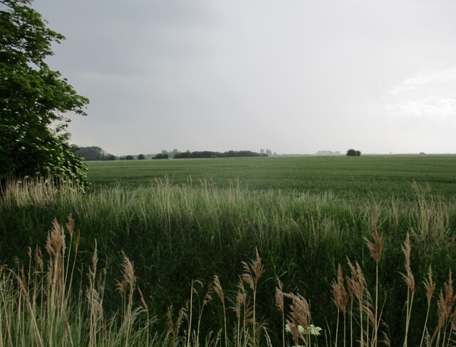
The pond is surrounded by lush vegetation, including reeds, grasses, and water lilies, creating a serene and tranquil atmosphere. The diverse flora and fauna found in and around the pond make it an important ecological site, providing a home for a wide range of species.

Bird enthusiasts will be delighted to spot a variety of avian inhabitants, including gulls (from which the pond derives its name), herons, ducks, and swans. These birds can be seen gracefully gliding across the water's surface or perched on the surrounding trees and bushes. Additionally, the pond attracts migratory birds during certain seasons, adding to the diversity of species that can be observed.

The Gull Pond also offers opportunities for recreational activities such as fishing and boating. Anglers can try their luck in catching fish species like perch, roach, and tench that inhabit the pond's depths. Visitors can also embark on leisurely boat rides, soaking in the natural beauty of the surroundings.

Overall, The Gull Pond in Lincolnshire is a haven for nature lovers, providing a serene and biodiverse environment that showcases the beauty of the region's freshwater ecosystems.

If you have any feedback on the listing, please let us know in the comments section below.

The Gull Pond Images

Images are sourced within 2km of 52.715631/-0.15412221 or Grid Reference TF2414. Thanks to Geograph Open Source API. All images are credited.

Stubble field Between the Welland Bank and Deeping St. Nicholas.
Stubble field
Between the Welland Bank and Deeping St. Nicholas.
Strip of grassland below the Welland Bank
Cowbit House Farm Cottage
New Road leading off Welland Bank New Road leads straight to Deeping St Nicholas
New Road leading off Welland Bank
New Road leads straight to Deeping St Nicholas
Cycle Route 12 on Welland Bank, alongside the River Welland
Congreaves Farm
Congreaves Farm
Four Mile Bar bridge Taking footpaths on the right bank of the Welland over to Welland Bank road. More useful, perhaps, the 1952 OS map shows an earlier bridge here connected to a pub called the Four Mile Bar on the other side.
Four Mile Bar bridge
Taking footpaths on the right bank of the Welland over to Welland Bank road. More useful, perhaps, the 1952 OS map shows an earlier bridge here connected to a pub called the Four Mile Bar on the other side.
Cradge Bank Road approaching Cowbit Cottage Following Cycle Route 12 along the left bank of the Welland north from Crowland. Initially the road ran along the river embankment, but now runs below the embankment (visible on the right), so the river is no longer visible.
Cradge Bank Road approaching Cowbit Cottage
Following Cycle Route 12 along the left bank of the Welland north from Crowland. Initially the road ran along the river embankment, but now runs below the embankment (visible on the right), so the river is no longer visible.
The Crowland and Cowbit Wash pumping station Two pumps with a combined capacity of 1.55 cubic metres per second <span class="nowrap"><a title="https://www.wellandidb.org.uk/about-us/pumping-stations/" rel="nofollow ugc noopener" href="https://www.wellandidb.org.uk/about-us/pumping-stations/">Link</a><img style="margin-left:2px;" alt="External link" title="External link - shift click to open in new window" src="https://s1.geograph.org.uk/img/external.png" width="10" height="10"/></span> pumping water from the New River into the River Welland
The Crowland and Cowbit Wash pumping station
Two pumps with a combined capacity of 1.55 cubic metres per second LinkExternal link pumping water from the New River into the River Welland
Wheat field off Bellingham's Drove
Wheat field and Greenlands Farm
Cowbit Wash Barrier Bank, Lincs View NE from Brotherhouse Bar along the A1074 towards Cowbit.
Cowbit Wash Barrier Bank, Lincs
View NE from Brotherhouse Bar along the A1074 towards Cowbit.
Queen's Bank and Great Postland, Crowland, Lincs
New River, Cowbit Wash, Lincs In the SE corner of the square; the small New River bounds the eastern side of the flood-relief wash and the raised River Welland the western side.
New River, Cowbit Wash, Lincs
In the SE corner of the square; the small New River bounds the eastern side of the flood-relief wash and the raised River Welland the western side.
Pumping Station, Cowbit Wash, Lincs Pumping from the low-level New River into the raised River Welland; view from Wash Bank.
Pumping Station, Cowbit Wash, Lincs
Pumping from the low-level New River into the raised River Welland; view from Wash Bank.
Winter wheat as far as the eye can see – view from Welland Bank in the SE corner of the square towards Deeping St Nicholas, Lincs.
Winter wheat as far as the eye can see
– view from Welland Bank in the SE corner of the square towards Deeping St Nicholas, Lincs.
Congreaves Farm, Deeping St Nicholas, Lincs – view from the Welland Bank.
Congreaves Farm, Deeping St Nicholas, Lincs
– view from the Welland Bank.
The Gull, River Welland, Deeping St Nicholas, Lincs The constructed semi-circular curve in the river bank, called a gull, contains a small fishery.
The Gull, River Welland, Deeping St Nicholas, Lincs
The constructed semi-circular curve in the river bank, called a gull, contains a small fishery.
Show me another place!

The Gull Pond is located at Grid Ref: TF2414 (Lat: 52.715631, Lng: -0.15412221)

Administrative County: Lincolnshire

District: South Holland

Police Authority: Lincolnshire

What 3 Words

///eminent.dimension.hosts. Near Cowbit, Lincolnshire

Nearby Locations

The Gull Pond

Related Wikis

Peak Hill, Lincolnshire

Peak Hill is a hamlet in the South Holland district of Lincolnshire, England. It is situated 4 miles (6 km) south from Spalding and 10 miles (16 km) north...

Fitton End

Fitton End is a hamlet in the civil parish of Newton-in-the-Isle, in the Fenland district, in the county of Cambridgeshire, England. It has a population...

Cowbit

Cowbit (locally pronounced Cubbit) is a village and civil parish in the South Holland district of Lincolnshire, England. The population of the civil parish...

Deeping Fen

Deeping Fen is a low-lying area in the South Holland district of Lincolnshire, England, which covers approximately 47 square miles (120 km2). It is bounded...

Deeping St Nicholas

Deeping St Nicholas is a village in Lincolnshire, England, on the A1175 road between The Deepings and Spalding. Unlike Market Deeping, which is in South...

Cowbit railway station

Cowbit railway station was a station in Cowbit, Lincolnshire, England. It was located on the route between Spalding and March. == History == The station...

South Holland District

South Holland is a local government district of Lincolnshire, England. The council is based in Spalding. Other notable towns and villages include Crowland...

Littleworth railway station

Littleworth railway station is a former railway station in Deeping St Nicholas, Lincolnshire, on the Peterborough to Lincoln Line. It opened in 1848 and...

Nearby Amenities

Located within 500m of 52.715631,-0.15412221
SPALDING1
Disused: yes
Man Made: petroleum_well
Ref GB Decc: LO/10-1
Source: DECC
Lat/Long: 52.7158333/-0.1588889
Crowland and Cowbit Pumping Station
Man Made: pumping_station
Operator: Welland and Deepings Internal Drainage Board
Lat/Long: 52.7169013/-0.1489311
Congreves Farm
Alt Name: Gull House Farm
Place: farm
Source: Bing
Lat/Long: 52.717484/-0.1520176
Gull House Farm
Place: farm
Source: Bing
Lat/Long: 52.7157726/-0.1572487
Victoria Farm
Place: farm
Source: Bing
Lat/Long: 52.7186726/-0.1496763
Cloot House
Place: isolated_dwelling
Source: Bing
Lat/Long: 52.7123624/-0.1537649
Crowland Fodder Lots
Place: locality
Source: Bing
Lat/Long: 52.7123823/-0.1575507
The data included in this document is from www.openstreetmap.org. The data is made available under ODbL.

Have you been to The Gull Pond?

Leave your review of The Gull Pond below (or comments, questions and feedback).