Bluegate Pond
Lake, Pool, Pond, Freshwater Marsh in Surrey
England
Bluegate Pond
Bluegate Pond is a serene freshwater body located in Surrey, England. Nestled amidst lush greenery, this picturesque pond offers a tranquil escape from the bustling city life. Spanning over an area of approximately 2 acres, Bluegate Pond is a popular destination for nature enthusiasts, anglers, and families alike.
The pond is surrounded by a diverse ecosystem, comprising of wetlands, marshes, and dense vegetation. This unique combination fosters a thriving habitat for a wide variety of flora and fauna. The surrounding marshland is home to several species of water-loving plants such as water lilies, reeds, and bulrushes, creating a vibrant and colorful backdrop.
Bluegate Pond is known to harbor a rich diversity of aquatic life. Anglers are drawn to the pond for its abundant fish population, including species such as carp, roach, and perch. The calm and clear waters also attract a variety of waterfowl, making it a popular spot for birdwatchers. Ducks, swans, and herons can often be observed gracefully gliding across the surface of the pond.
Visitors to Bluegate Pond can enjoy a range of recreational activities. The pond serves as an ideal location for leisurely walks, picnics, and photography, offering breathtaking views at every turn. Additionally, fishing enthusiasts can indulge in their hobby, while children can explore and engage with nature in a safe and peaceful environment.
Overall, Bluegate Pond in Surrey is a haven for nature lovers, providing a serene and idyllic setting where visitors can immerse themselves in the beauty of the surrounding landscape and appreciate the wonders of the natural world.
If you have any feedback on the listing, please let us know in the comments section below.
Bluegate Pond Images
Images are sourced within 2km of 51.431614/-0.22515492 or Grid Reference TQ2371. Thanks to Geograph Open Source API. All images are credited.


Bluegate Pond is located at Grid Ref: TQ2371 (Lat: 51.431614, Lng: -0.22515492)
Unitary Authority: Merton
Police Authority: Metropolitan
What 3 Words
///dating.bigger.flame. Near Earlsfield, London
Nearby Locations
Related Wikis
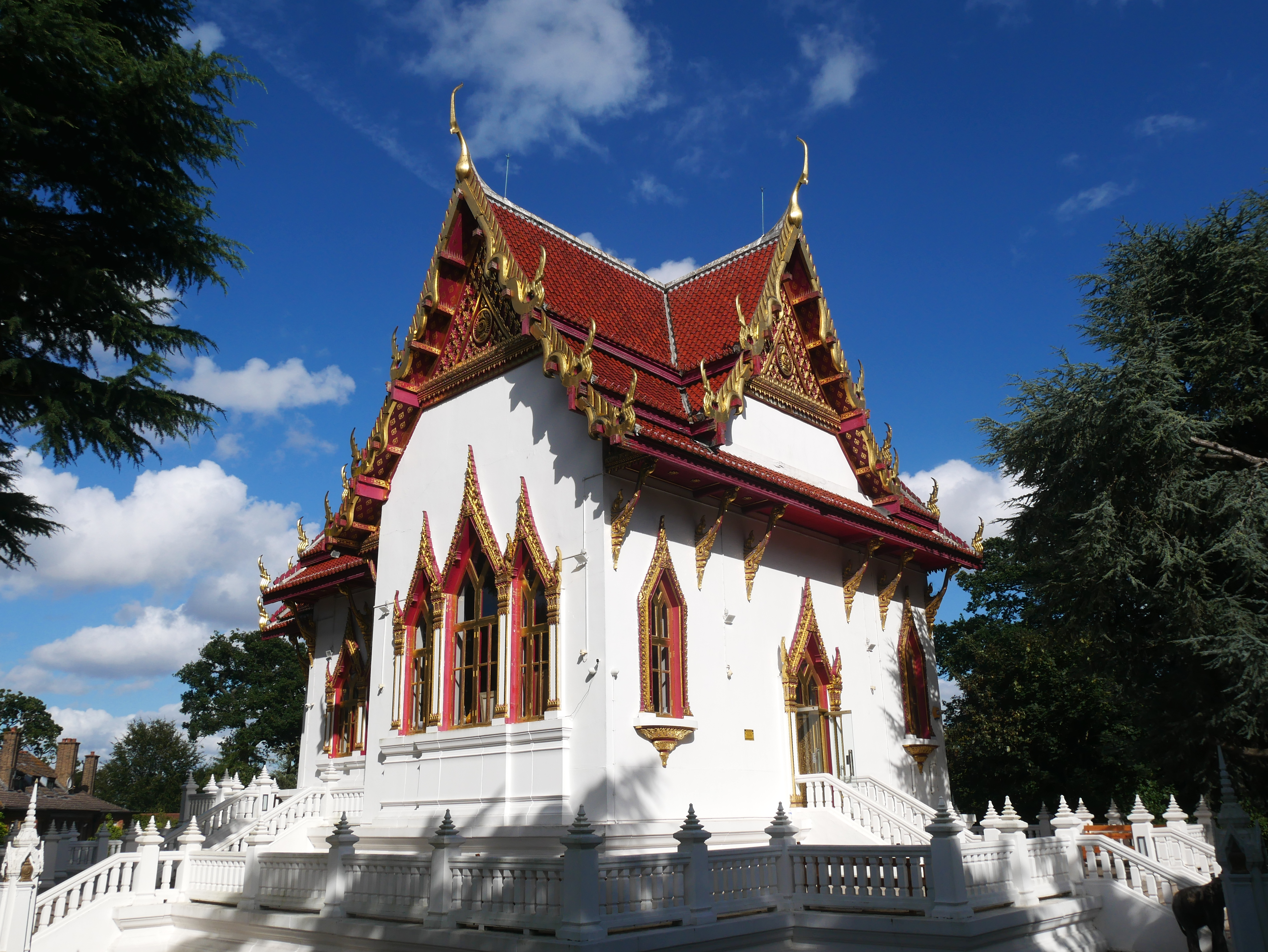
Wat Buddhapadipa
Wat Buddhapadipa or the Buddhapadipa Temple (Thai: วัดพุทธปทีป, pronounced [wát pʰút.tʰá.pà.tʰîːp]; RTGS: Wat Phutthapathip) is a Thai Buddhist temple...
Apostolic Nunciature to Great Britain
The Apostolic Nunciature to Great Britain is the diplomatic office of the Holy See in Great Britain. It is headed by the Apostolic Nuncio, who has the...
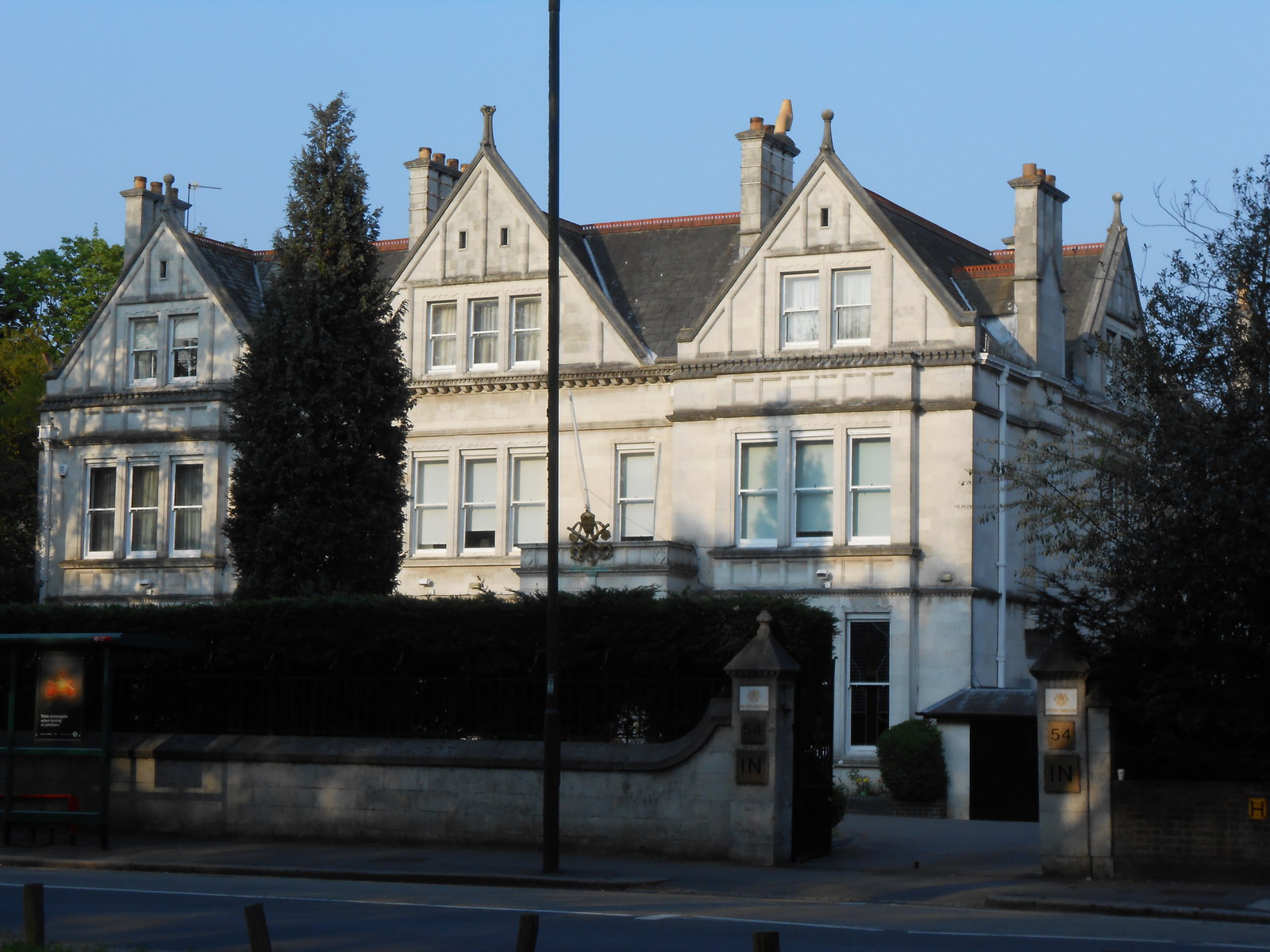
54 Parkside
54 Parkside (presently the Apostolic Nunciature to the United Kingdom) is a large, detached house in Wimbledon, London, SW19, overlooking Wimbledon Common...

22 Parkside
22 Parkside (also known as the Rogers House or Wimbledon House) is a residential property in Wimbledon, London, designed in 1967 by British architect Richard...
Nearby Amenities
Located within 500m of 51.431614,-0.22515492Have you been to Bluegate Pond?
Leave your review of Bluegate Pond below (or comments, questions and feedback).