Butt's Close Pond
Lake, Pool, Pond, Freshwater Marsh in Hertfordshire North Hertfordshire
England
Butt's Close Pond

Butt's Close Pond is a picturesque freshwater pond located in Hertfordshire, England. Nestled amidst lush greenery, the pond is a popular spot for leisure activities and nature enthusiasts. Covering an area of approximately one acre, it is classified as a pond due to its size and shallow depth.
The pond is surrounded by a diverse range of plant species, including water lilies, reeds, and rushes, creating a vibrant and colorful landscape throughout the year. These plants also provide a habitat for various wildlife, such as ducks, geese, and other water birds, which can often be seen gliding on the surface of the water or nesting nearby.
The water in Butt's Close Pond is sourced from natural springs and rainfall, ensuring a constant supply of freshwater. The pond is well-maintained by local authorities to preserve its ecological balance and aesthetic appeal. Visitors can enjoy a peaceful stroll around the pond, with well-maintained footpaths offering convenient access to different viewpoints.
In addition to its natural beauty, Butt's Close Pond also serves as a recreational area for locals and tourists alike. It is a popular spot for fishing, with a variety of fish species, including perch, roach, and carp, providing an opportunity for anglers to test their skills. The calm and serene atmosphere of the pond also makes it an ideal spot for picnics and relaxation.
Overall, Butt's Close Pond in Hertfordshire is a serene and idyllic freshwater pond, offering a peaceful retreat for nature lovers, anglers, and those seeking a tranquil escape from the hustle and bustle of city life.
If you have any feedback on the listing, please let us know in the comments section below.
Butt's Close Pond Images
Images are sourced within 2km of 51.951697/-0.28177571 or Grid Reference TL1829. Thanks to Geograph Open Source API. All images are credited.


Butt's Close Pond is located at Grid Ref: TL1829 (Lat: 51.951697, Lng: -0.28177571)
Administrative County: Hertfordshire
District: North Hertfordshire
Police Authority: Hertfordshire
What 3 Words
///shares.lung.fluid. Near Hitchin, Hertfordshire
Nearby Locations
Related Wikis
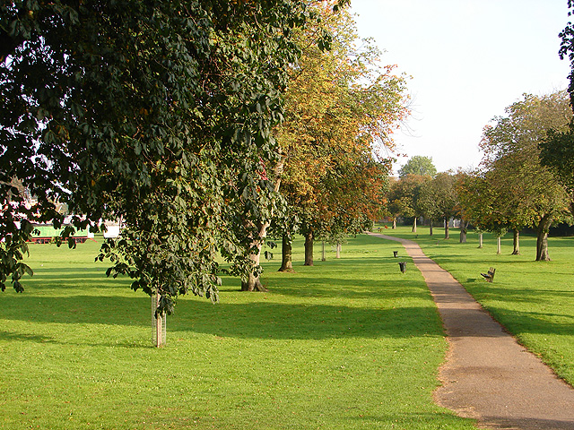
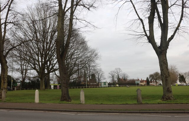
Butts Close
Butts Close is an 11-acre (45,000 m2) park in the town of Hitchin, Hertfordshire that used to once be a sporting ground for archery. The name refers to...

Hitchin Rural District
Hitchin Rural District was a rural district in Hertfordshire, England from 1894 to 1974, covering an area in the north of the county. == Evolution... ==

Hitchin Boys' School
Hitchin Boys' School (HBS) is an 11–18 boys academy-status secondary school, with sixth form, located in Hitchin, Hertfordshire, England. Founded in 1632...

Hitchin Town Hall
Hitchin Town Hall is a municipal structure in Brand Street, Hitchin, Hertfordshire, England. The town hall, which was the headquarters of Hitchin Urban...
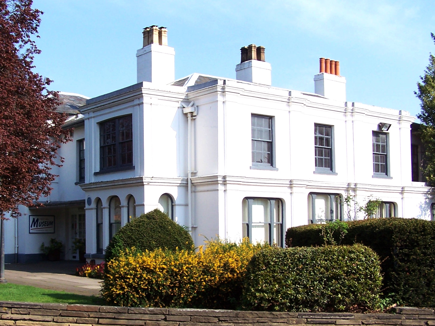
North Hertfordshire Museum
North Hertfordshire Museum, displays collections relating to local history and heritage. It is located adjacent to the refurbished Hitchin Town Hall on...
Hitchin Town F.C.
Hitchin Town Football Club is an English semi-professional football club based in Hitchin, Hertfordshire. They are currently members of the Southern League...
Hitchin Museum and Art Gallery
The Hitchin Museum and Art Gallery was a local history museum in Hitchin, Hertfordshire, England, with an extensive collection that told the story of the...
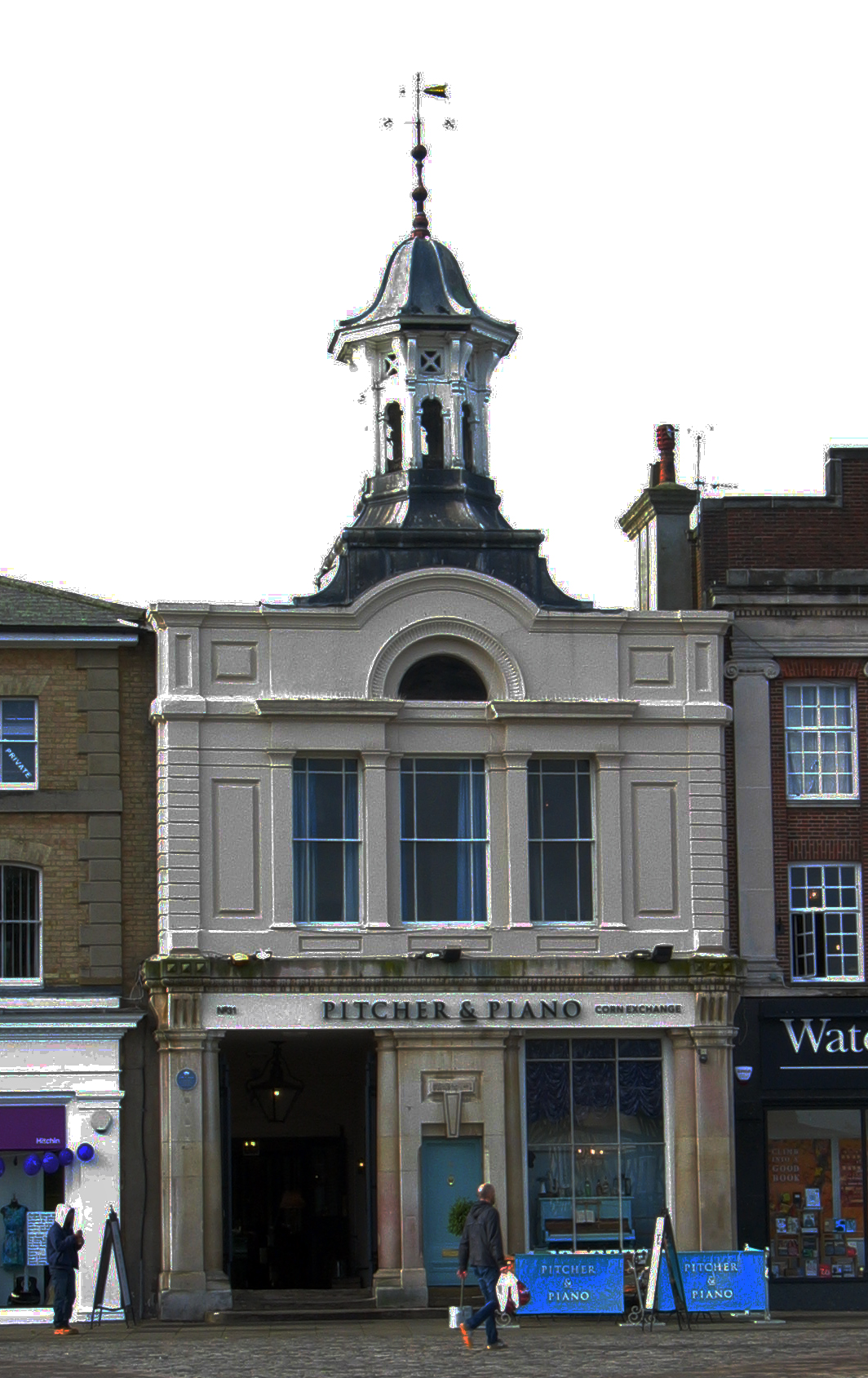
Corn Exchange, Hitchin
The Corn Exchange is a commercial building in the Market Place in Hitchin, Hertfordshire, England. The structure, which is currently used as a bar and...
Nearby Amenities
Located within 500m of 51.951697,-0.28177571Have you been to Butt's Close Pond?
Leave your review of Butt's Close Pond below (or comments, questions and feedback).