The Lake

Lake, Pool, Pond, Freshwater Marsh in Hertfordshire St. Albans

England

The Lake

Park Looking NE from TL138067 across the lake in the park, toward the abbey in TL1407
Park Credit: Rob Hinkley

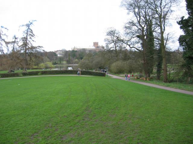
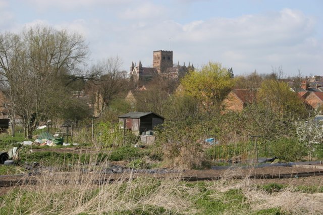
The Lake, located in Hertfordshire, is a natural body of water that encompasses various features such as a lake, pool, pond, and freshwater marsh. It is a picturesque destination that offers a serene and tranquil environment for visitors to enjoy.

The main attraction of The Lake is its expansive freshwater lake, which is surrounded by lush vegetation and scenic views. The lake offers opportunities for boating, fishing, and other water-based recreational activities. Its calm waters provide a perfect setting for sailing enthusiasts and nature lovers alike.

In addition to the lake, The Lake also boasts a smaller pool and pond, which are abundant with diverse aquatic life. These smaller bodies of water offer a chance for visitors to observe and appreciate the rich biodiversity that exists within the ecosystem.

Moreover, The Lake is home to a thriving freshwater marsh, which serves as a habitat for various plant and animal species. The marshland is characterized by its marsh grasses, reeds, and water lilies, creating a visually stunning landscape. It provides a sanctuary for a range of bird species, making it an ideal spot for birdwatching enthusiasts.

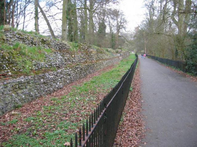
The surroundings of The Lake have been carefully preserved to maintain the natural beauty and ecological balance of the area. Visitors can explore the well-maintained walking trails that meander through the surrounding woodlands, offering an opportunity to immerse themselves in the natural surroundings.

Overall, The Lake in Hertfordshire offers a diverse range of features, including a lake, pool, pond, and freshwater marsh. With its tranquil ambiance, stunning scenery, and abundant wildlife, it is a must-visit destination for those seeking a peaceful retreat in nature.

If you have any feedback on the listing, please let us know in the comments section below.
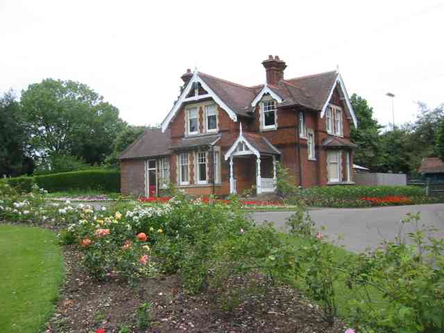
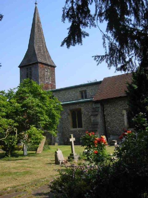
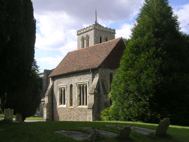
The Lake Images

Images are sourced within 2km of 51.750037/-0.34963247 or Grid Reference TL1406. Thanks to Geograph Open Source API. All images are credited.

Park Looking NE from TL138067 across the lake in the park, toward the abbey in TL1407
Park
Looking NE from TL138067 across the lake in the park, toward the abbey in TL1407
Roman city wall Looking NE from TL137066, with the old Roman city wall on the left.
Roman city wall
Looking NE from TL137066, with the old Roman city wall on the left.
Stone house House by the entrance to Verulamium Roman Theatre, on the left hand side coming into St Albans along the A4147 (TL135074).
Stone house
House by the entrance to Verulamium Roman Theatre, on the left hand side coming into St Albans along the A4147 (TL135074).
Roman theatre at Verulamium Remains of the theatre at the Roman city of Verulamium (Saint Albans), TL134074.
Roman theatre at Verulamium
Remains of the theatre at the Roman city of Verulamium (Saint Albans), TL134074.
M10, from bridge. Looking East from the bridge over the M10 at TL137055.
M10, from bridge.
Looking East from the bridge over the M10 at TL137055.
St Alban's cathedral The west front as rebuilt in the late C19 by a benefactor, Lord Grimthorpe, to his own specification. From TL143071, looking East
St Alban's cathedral
The west front as rebuilt in the late C19 by a benefactor, Lord Grimthorpe, to his own specification. From TL143071, looking East
St Albans cathedral Looking West from TL146070
St Albans cathedral
Looking West from TL146070
Cycleway bridge Looking East over the bridge over the Ver on the St Albans to Hatfield cycleway - an abandoned railway line - at TL153063.
Cycleway bridge
Looking East over the bridge over the Ver on the St Albans to Hatfield cycleway - an abandoned railway line - at TL153063.
Ruined nunnery The ruined nunnery at TL151064
Ruined nunnery
The ruined nunnery at TL151064
The Allotments Near the River Ver are the Allotments just off Cottonmill Lane.
The Allotments
Near the River Ver are the Allotments just off Cottonmill Lane.
Railway Bridge over the Alban Way Just near London Road is a pedestrian route from St.Albans to Hatfield.
Railway Bridge over the Alban Way
Just near London Road is a pedestrian route from St.Albans to Hatfield.
Where are we? St. Albans Railway Station is not shy in proclaiming its identity.  See Stacey Harris's photo <a href="https://www.geograph.org.uk/photo/788654">TL1507 : St Albans Station</a> for the context of this close-up.
Where are we?
St. Albans Railway Station is not shy in proclaiming its identity. See Stacey Harris's photo TL1507 : St Albans Station for the context of this close-up.
St Alban's R.C. Church at St Julians This church is almost at the southern edge of St Albans.
St Alban's R.C. Church at St Julians
This church is almost at the southern edge of St Albans.
Clarence Park Cafe  St Albans This cafe used to be the public lavatories until 
using a toilet went out of fashion.
Clarence Park Cafe St Albans
This cafe used to be the public lavatories until using a toilet went out of fashion.
The Lodge  Clarence Park St Albans A tied cottage provided for the Parks Superintendent. His office is the small room to the left
The Lodge Clarence Park St Albans
A tied cottage provided for the Parks Superintendent. His office is the small room to the left
St Stephen's Church  St Albans This church has sufficient land for car parking which is a boon as the road outside is always busy.
St Stephen's Church St Albans
This church has sufficient land for car parking which is a boon as the road outside is always busy.
The King Harry Pub St Albans This is an awkward junction with a double mini roundabout. Best avoided if possible. {see note re St Stephens Church}
The King Harry Pub St Albans
This is an awkward junction with a double mini roundabout. Best avoided if possible. {see note re St Stephens Church}
The Parish Church of St Michael, St Albans This church is on the edge of Verulamium park, close to the Roman museum. It was probably originally created to receive pilgrims on their way to the shrine of St Alban at the Abbey.
The Parish Church of St Michael, St Albans
This church is on the edge of Verulamium park, close to the Roman museum. It was probably originally created to receive pilgrims on their way to the shrine of St Alban at the Abbey.
Show me another place!

The Lake is located at Grid Ref: TL1406 (Lat: 51.750037, Lng: -0.34963247)

Administrative County: Hertfordshire

District: St. Albans

Police Authority: Hertfordshire

What 3 Words

///teeth.always.item. Near St Albans, Hertfordshire

Nearby Locations

Heron Island The Lake

Related Wikis

Verulamium Park

Verulamium Park is a park in St Albans, Hertfordshire. Set in over 100 acres (0.40 km2) of parkland, Verulamium Park was purchased from the Earl of Verulam...

Ye Olde Fighting Cocks

Ye Olde Fighting Cocks is a public house in St Albans, Hertfordshire, England. It is one of several pubs that lay claim to being the oldest in England...

The Lower Red Lion

The Lower Red Lion is a public house at 34 and 36 Fishpool Street in St Albans, Hertfordshire, England. The building is seventeenth century and is designated...
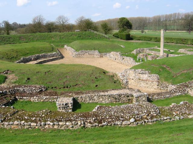
Verulamium

Verulamium was a town in Roman Britain. It was sited southwest of the modern city of St Albans in Hertfordshire, England. A large portion of the Roman...

Scheduled monuments in Hertfordshire

There are 225 scheduled monuments in the county of Hertfordshire, England. These protected sites date from the Neolithic period and include barrows, ruined...

St Albans School, Hertfordshire

St Albans School is a public school (traditional English fee-charging day and former boarding school) in the city of St Albans in Hertfordshire. Entry...

Abbey Gateway, St. Albans

The Abbey Gateway, St Albans was built in 1365 and is the last remaining building (except for the Abbey itself) of the Benedictine Monastery at St Albans...

The Blue Anchor, St Albans

The Blue Anchor was a public house in Fishpool Street, St Albans, Hertfordshire, England. The pub occupied an eighteenth century building which was listed...

Nearby Amenities

Located within 500m of 51.750037,-0.34963247
Toilets
Check Date: 2023-09-07
Fee: no
Opening Hours: Closed pending structural survey (RAAC)
Lat/Long: 51.7464791/-0.3489814
Recycling
Recycling Cans: yes
Recycling Clothes: yes
Recycling Glass Bottles: yes
Recycling Newspaper: yes
Lat/Long: 51.7523715/-0.355689
Pub
Lower Red Lion
Addr City: St Albans
Addr Housenumber: 36
Addr Postcode: AL3 4RX
Addr Street: Fishpool Street
Fhrs Authority: St Albans City
Fhrs Id: 305506
Wikidata: Q26397206
Lat/Long: 51.751726/-0.3464959
St Michael's Manor
Note: also a restaurant
Restaurant: yes
Tourism: hotel
Wikidata: Q17555415
Lat/Long: 51.75337/-0.3495819
Post Box
Brand: Royal Mail
Brand Wikidata: Q638098
Brand Wikipedia: en:Royal Mail
Operator: Royal Mail
Operator Wikidata: Q638098
Post Box Type: pillar
Ref: AL3 295D
Royal Cypher: EIIR
Royal Cypher Wikidata: Q33102113
Lat/Long: 51.7540976/-0.3479843
Pub
The Portland Arms
Addr City: St Albans
Addr Housenumber: 63
Addr Postcode: AL3 4RA
Addr Street: Portland Street
Brand: Fuller's
Brand Wikidata: Q5253950
Fhrs Authority: St Albans City
Fhrs Id: 305844
Website: https://www.portlandarmsstalbans.co.uk/
Wikidata: Q83558978
Lat/Long: 51.7541347/-0.3476336
Abbey Gateway
Created By: Potlatch 0.6
Tourism: attraction
Lat/Long: 51.7509735/-0.344153
Crossing
Kerb: flush
Lat/Long: 51.7488656/-0.3468766
Bus Stop
Prae Close
Bench: no
Bus: yes
Naptan AtcoCode: 210021508820
Naptan Bearing: SW
Naptan CommonName: Prae Close
Naptan Crossing: opp Kingsbury Water Mill Museum
Naptan Indicator: opp
Naptan Landmark: opp Kingsbury Water Mill Museum
Naptan NaptanCode: hrtatwam
Naptan PlusbusZoneRef: STALBCY
Naptan ShortCommonName: NA
Naptan Street: St Michaels Street
Naptan Verified: no
Public Transport: platform
Shelter: no
Source: naptan_import
Lat/Long: 51.7539869/-0.3530727
Crossing
Crossing: marked
Crossing Island: no
Crossing Markings: zebra
Tactile Paving: yes
Lat/Long: 51.7461571/-0.3470668
Crossing
Crossing: marked
Crossing Island: no
Crossing Markings: zebra
Tactile Paving: yes
Lat/Long: 51.746001/-0.3464987
Addr Housename: Abbey Gate House
Lat/Long: 51.750623/-0.3449523
Barrier: yes
Lat/Long: 51.7523644/-0.3548244
Addr Housenumber: 51
Addr Street: Fishpool Street
Lat/Long: 51.7515334/-0.3475273
Addr Housenumber: 46
Addr Street: Fishpool Street
Lat/Long: 51.7516605/-0.3469185
Addr Housenumber: 30
Addr Street: Fishpool Street
Lat/Long: 51.7517136/-0.3462278
Addr Housenumber: 16
Addr Street: Fishpool Street
Lat/Long: 51.7517708/-0.3454084
Addr Housenumber: 60
Addr Street: Fishpool Street
Lat/Long: 51.7517003/-0.3476708
Addr Housenumber: 4
Lat/Long: 51.7518646/-0.3446353
Addr Housenumber: 5
Lat/Long: 51.7527235/-0.3479263
Addr Housename: Kings Court
Lat/Long: 51.753782/-0.3480321
Addr Housenumber: 4
Lat/Long: 51.7531827/-0.3470062
Addr Housenumber: 12
Addr Street: Offa Road
Lat/Long: 51.753225/-0.3479691
Addr Housenumber: 1
Lat/Long: 51.7526497/-0.3478685
Addr Housenumber: 5
Lat/Long: 51.7529859/-0.3468198
Addr Housenumber: 1
Lat/Long: 51.7531204/-0.3466494
Addr Housenumber: 23
Addr Street: Offa Road
Lat/Long: 51.7531387/-0.3483205
Addr Housenumber: 23
Addr Street: Mount Pleasant
Lat/Long: 51.7534807/-0.347147
Addr Housenumber: 29
Lat/Long: 51.7536338/-0.3477383
Addr Housenumber: 56
Lat/Long: 51.7537098/-0.3470289
Addr Housenumber: 12
Addr Street: Mount Pleasant
Lat/Long: 51.753713/-0.3473521
Addr Housenumber: 57
Lat/Long: 51.7543182/-0.347623
Addr Housenumber: 52
Lat/Long: 51.7542296/-0.3479575
Addr Housenumber: 58
Lat/Long: 51.753748/-0.3485307
Addr Housenumber: 67
Lat/Long: 51.7538833/-0.348296
Addr Housenumber: 18
Lat/Long: 51.7544637/-0.3498423
Post Box
Brand: Royal Mail
Brand Wikidata: Q638098
Brand Wikipedia: en:Royal Mail
Collection Times: Mo-Fr 09:00
Operator: Royal Mail
Operator Wikidata: Q638098
Post Box Type: wall
Ref: AL3 60D
Royal Cypher: EIIR
Royal Cypher Wikidata: Q33102113
Lat/Long: 51.7519398/-0.3480015
Bicycle Parking
Museum bike racks
Bicycle Parking: stands
Capacity: 6
Covered: no
Lat/Long: 51.7524667/-0.354905
Basillica
Historic: ruins
Historic Civilization: ancient_roman
Ruins: building
Lat/Long: 51.752823/-0.3552905
Toilets
St Albans Cathedral toilets
Access: yes
Fee: no
Toilets Disposal: flush
Wheelchair: yes
Lat/Long: 51.7501066/-0.3424929
Board Type: wildlife
Information: board
Tourism: information
Lat/Long: 51.7489933/-0.3478368
Check Date: 2021-12-26
Information: map
Tourism: information
Lat/Long: 51.7489924/-0.3475721
Board Type: wildlife
Check Date: 2022-04-16
Information: board
Tourism: information
Lat/Long: 51.7484215/-0.3498561
Board Type: nature
Information: board
Tourism: information
Lat/Long: 51.7489086/-0.3480385
Board Type: history
Check Date: 2022-04-16
Information: board
Tourism: information
Lat/Long: 51.7486885/-0.3509619
Board Type: history
Check Date: 2022-05-26
Information: board
Tourism: information
Lat/Long: 51.7527403/-0.3508876
Information: board
Tourism: information
Lat/Long: 51.7493711/-0.3559175
Toilets
Access: yes
Female: yes
Male: yes
Operator: St Albans City & District Council
Lat/Long: 51.7526394/-0.3549078
Post Box
Brand: Royal Mail
Brand Wikidata: Q638098
Brand Wikipedia: en:Royal Mail
Collection Times: Mo-Fr 18:30; Sa 12:00
Description: Very large wall box; might be a Ludlow 05/04/23 Box is blocked up and collection plate has been removed. Is this permanent?
Operator: Royal Mail
Operator Wikidata: Q638098
Post Box Type: wall
Ref: AL3 21
Royal Cypher: EVIIR
Royal Cypher Wikidata: Q33102324
Lat/Long: 51.7516872/-0.3429514
Crossing
Crossing: uncontrolled
Crossing Ref: zebra
Lat/Long: 51.7526403/-0.3552613
The Abbey Gateway
Description: This is a Talking Building
Historic: gate
Lat/Long: 51.7510184/-0.3441856
Defibrillator
Emergency: defibrillator
Operator: St Albans Park Run
Lat/Long: 51.7526308/-0.3550541
Toilets
Access: opening_hours
Male: yes
Operator: St Albans City & District Council
Lat/Long: 51.7525962/-0.3548517
Bench
Backrest: yes
Lat/Long: 51.7499741/-0.3532076
Bench
Backrest: yes
Lat/Long: 51.7498193/-0.3535563
Bench
Backrest: yes
Lat/Long: 51.7468858/-0.3492502
Bench
Backrest: yes
Lat/Long: 51.7499629/-0.3435567
Waste Basket
Waste: trash
Lat/Long: 51.7498944/-0.3434735
Bench
Backrest: yes
Lat/Long: 51.749792/-0.3438133
Bench
Backrest: no
Lat/Long: 51.748948/-0.3470888
Bench
Backrest: yes
Lat/Long: 51.7491287/-0.3480905
Bench
Backrest: yes
Lat/Long: 51.7492791/-0.3482563
Bench
Backrest: yes
Lat/Long: 51.749905/-0.3487361
Bench
Backrest: yes
Lat/Long: 51.7501992/-0.3490397
Bench
Backrest: yes
Lat/Long: 51.7504348/-0.3492358
Bench
Backrest: yes
Lat/Long: 51.7505765/-0.3493421
Bench
Backrest: yes
Lat/Long: 51.7509733/-0.3496608
Bench
Backrest: yes
Lat/Long: 51.7513593/-0.349913
Bench
Backrest: yes
Lat/Long: 51.7515689/-0.3500939
Bench
Backrest: yes
Lat/Long: 51.7517647/-0.3502702
Bench
Backrest: yes
Lat/Long: 51.7521471/-0.3505446
Bench
Backrest: yes
Lat/Long: 51.7526393/-0.350833
Bench
Backrest: yes
Lat/Long: 51.7527925/-0.3510711
Bench
Backrest: yes
Lat/Long: 51.7521138/-0.3514926
Bench
Backrest: yes
Lat/Long: 51.7518301/-0.3511184
Bench
Backrest: yes
Lat/Long: 51.751596/-0.3508858
Bench
Backrest: yes
Lat/Long: 51.7509585/-0.3503774
Bench
Backrest: yes
Lat/Long: 51.7504578/-0.3503581
Bench
Backrest: yes
Lat/Long: 51.7496848/-0.3503312
Bench
Backrest: yes
Lat/Long: 51.7493786/-0.3503435
Bench
Backrest: yes
Lat/Long: 51.7491473/-0.3502865
Bench
Backrest: yes
Lat/Long: 51.7484859/-0.3499329
Leisure: picnic_table
Lat/Long: 51.7526019/-0.3550723
Leisure: picnic_table
Lat/Long: 51.7525552/-0.3550115
Leisure: picnic_table
Lat/Long: 51.7525037/-0.3549429
Leisure: picnic_table
Lat/Long: 51.7524331/-0.3548505
Waste Basket
Waste: trash
Lat/Long: 51.7524856/-0.3549175
Waste Basket
Waste: trash
Lat/Long: 51.7517133/-0.3532211
Bench
Backrest: yes
Lat/Long: 51.7479719/-0.3511258
Direction: 220
Generator Method: photovoltaic
Generator Output Electricity: yes
Generator Solar Modules: 14
Generator Source: solar
Generator Type: solar_photovoltaic_panel
Location: roof
Power: generator
Lat/Long: 51.7529135/-0.3474815
Direction: 155
Generator Method: photovoltaic
Generator Output Electricity: yes
Generator Solar Modules: 8
Generator Source: solar
Generator Type: solar_photovoltaic_panel
Location: roof
Power: generator
Lat/Long: 51.7523455/-0.3479289
Site of St Mary Magdalene's Chapel
Archaeological Site: church
Historic: archaeological_site
Historic Civilization: medieval
Source: https://maps.nls.uk/view-full/102343343#zoom=7&lat=4926&lon=10357&layers=BT
Lat/Long: 51.7482036/-0.3505601
Site of St Germanus' Chapel
Archaeological Site: church
Historic: archaeological_site
Historic Civilization: medieval
Source: https://maps.nls.uk/view-full/102343343#zoom=7&lat=5351&lon=10083&layers=BT
Lat/Long: 51.7507738/-0.3514668
Cafe
Café Ver
Indoor Seating: no
Outdoor Seating: yes
Payment Cash: no
Payment Credit Cards: yes
Payment Debit Cards: yes
Lat/Long: 51.749074/-0.3471652
The data included in this document is from www.openstreetmap.org. The data is made available under ODbL.

Have you been to The Lake?

Leave your review of The Lake below (or comments, questions and feedback).