New Ballast Pit

Lake, Pool, Pond, Freshwater Marsh in Lincolnshire North Kesteven

England

New Ballast Pit

The A17, East of Kirkby la Thorpe The A17 is the major route for HGV's accessing Norfolk from Northern England and the Midlands and also a major holiday route in the summer months for cars and caravans making their way to the seaside resorts of Hunstanton, Wells-next-the-Sea, Sheringham, Cromer and Great Yarmouth and is one of only two direct routes that links Norfolk with the A1, the other being the A47. It runs for almost 60 miles from Winthorpe, near Newark-on-Trent to King's Lynn across the flat landscape of the Lincolnshire fens with only four stretches of dual carriageway. 
<span class="nowrap"><a title="http://www.sabre-roads.org.uk/wiki/index.php?title=A17" rel="nofollow ugc noopener" href="http://www.sabre-roads.org.uk/wiki/index.php?title=A17">Link</a><img style="margin-left:2px;" alt="External link" title="External link - shift click to open in new window" src="https://s1.geograph.org.uk/img/external.png" width="10" height="10"/></span>  SABRE
<span class="nowrap"><a title="https://en.wikipedia.org/wiki/A17_road_(England)" rel="nofollow ugc noopener" href="https://en.wikipedia.org/wiki/A17_road_(England)">Link</a><img style="margin-left:2px;" alt="External link" title="External link - shift click to open in new window" src="https://s1.geograph.org.uk/img/external.png" width="10" height="10"/></span>  Wikipedia
The A17, East of Kirkby la Thorpe Credit: David Dixon

The requested URL returned error: 429 Too Many Requests

If you have any feedback on the listing, please let us know in the comments section below.

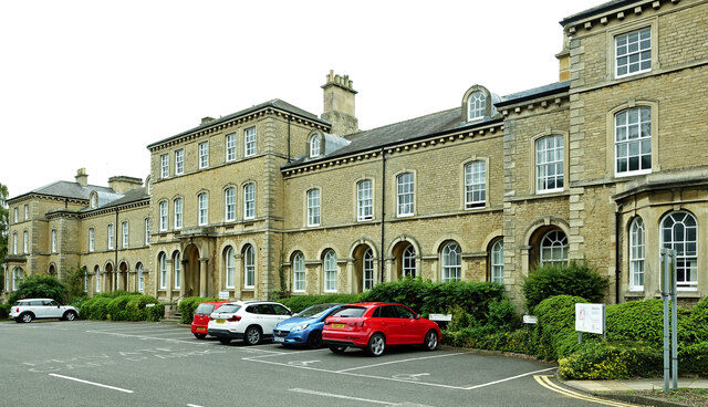
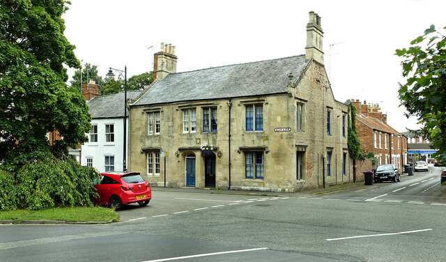
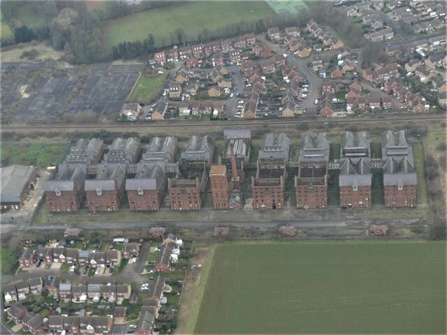
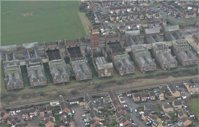
New Ballast Pit Images

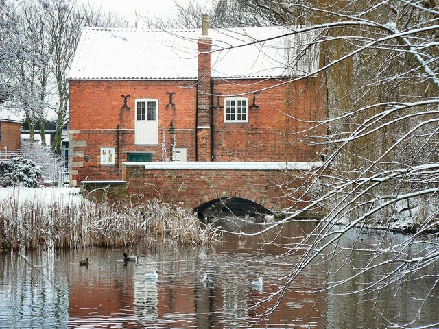
Images are sourced within 2km of 52.991548/-0.38605656 or Grid Reference TF0845. Thanks to Geograph Open Source API. All images are credited.

The A17, East of Kirkby la Thorpe The A17 is the major route for HGV's accessing Norfolk from Northern England and the Midlands and also a major holiday route in the summer months for cars and caravans making their way to the seaside resorts of Hunstanton, Wells-next-the-Sea, Sheringham, Cromer and Great Yarmouth and is one of only two direct routes that links Norfolk with the A1, the other being the A47. It runs for almost 60 miles from Winthorpe, near Newark-on-Trent to King's Lynn across the flat landscape of the Lincolnshire fens with only four stretches of dual carriageway. 
<span class="nowrap"><a title="http://www.sabre-roads.org.uk/wiki/index.php?title=A17" rel="nofollow ugc noopener" href="http://www.sabre-roads.org.uk/wiki/index.php?title=A17">Link</a><img style="margin-left:2px;" alt="External link" title="External link - shift click to open in new window" src="https://s1.geograph.org.uk/img/external.png" width="10" height="10"/></span>  SABRE
<span class="nowrap"><a title="https://en.wikipedia.org/wiki/A17_road_(England)" rel="nofollow ugc noopener" href="https://en.wikipedia.org/wiki/A17_road_(England)">Link</a><img style="margin-left:2px;" alt="External link" title="External link - shift click to open in new window" src="https://s1.geograph.org.uk/img/external.png" width="10" height="10"/></span>  Wikipedia
The A17, East of Kirkby la Thorpe
The A17 is the major route for HGV's accessing Norfolk from Northern England and the Midlands and also a major holiday route in the summer months for cars and caravans making their way to the seaside resorts of Hunstanton, Wells-next-the-Sea, Sheringham, Cromer and Great Yarmouth and is one of only two direct routes that links Norfolk with the A1, the other being the A47. It runs for almost 60 miles from Winthorpe, near Newark-on-Trent to King's Lynn across the flat landscape of the Lincolnshire fens with only four stretches of dual carriageway. LinkExternal link SABRE LinkExternal link Wikipedia
Track to Sardeson's Farm The embankment on the right is that of a reservoir.
Track to Sardeson's Farm
The embankment on the right is that of a reservoir.
A17 eastbound
A17 eastbound
Mount Lane turns the corner Leading towards Sardesons Farm.  Compare with a view two years earlier <a href="https://www.geograph.org.uk/photo/6189879">TF1044 : Track to Sardeson's Farm</a>.
Mount Lane turns the corner
Leading towards Sardesons Farm. Compare with a view two years earlier TF1044 : Track to Sardeson's Farm.
Looking the other way A different view of the pleasant tree-lined path <a href="https://www.geograph.org.uk/photo/2726401">TF1043 : Tree lined route</a>.
Looking the other way
A different view of the pleasant tree-lined path TF1043 : Tree lined route.
Buildings in the market place, Sleaford An awkward situation where buildings face a pay-and-display car park.
Buildings in the market place, Sleaford
An awkward situation where buildings face a pay-and-display car park.
Window, St Denys, Sleaford This is one of the windows with "flowing tracery" that Nikolaus Pevsner remembered the church for. It is similar in style to the east window of the chancel of Boston church.
Window, St Denys, Sleaford
This is one of the windows with "flowing tracery" that Nikolaus Pevsner remembered the church for. It is similar in style to the east window of the chancel of Boston church.
Café, shops and war memorial, Market Place, Sleaford
The River Slea Viewed on a disappointingly dull summer day.
The River Slea
Viewed on a disappointingly dull summer day.
Council offices at Lafford Terrace See <a href="https://www.geograph.org.uk/photo/5574532">TF0745 : Lafford Terrace</a> for information about this lovely old building.
Council offices at Lafford Terrace
See TF0745 : Lafford Terrace for information about this lovely old building.
East Gate, Sleaford Viewed on the edge of the square on a disappointingly dull summer day.
East Gate, Sleaford
Viewed on the edge of the square on a disappointingly dull summer day.
High Noon New Years Day 2021 in a less-often-photographed square.  Walking around in my t-shirt too!
High Noon
New Years Day 2021 in a less-often-photographed square. Walking around in my t-shirt too!
Where's the path? There is supposed to be a footpath from this point towards the right hand corner of the wooded area in the distance known as Kirkby Mount.  Today there was no sign whatsoever of any path so I took the farm track route which cuts across the photo on the other side of the ditch instead.
Where's the path?
There is supposed to be a footpath from this point towards the right hand corner of the wooded area in the distance known as Kirkby Mount. Today there was no sign whatsoever of any path so I took the farm track route which cuts across the photo on the other side of the ditch instead.
Track to Mount Plantation After crossing over the railway bridge from the north.
Track to Mount Plantation
After crossing over the railway bridge from the north.
Bridge over the railway at Beacon Hill View from the farm track.
Bridge over the railway at Beacon Hill
View from the farm track.
Clear view Compare today's photo with one from nine years earlier <a href="https://www.geograph.org.uk/photo/3160042">TF0944 : Railway lines towards Sleaford</a>.  
Somebody has been cutting the trees!  
In the distance to the left can be seen the Bass Maltings and to the right the relatively new power station
Clear view
Compare today's photo with one from nine years earlier TF0944 : Railway lines towards Sleaford. Somebody has been cutting the trees! In the distance to the left can be seen the Bass Maltings and to the right the relatively new power station
Fire-damaged Maltings, Sleaford: aerial 2022 (1)
Fire-damaged Maltings, Sleaford: aerial 2022 (2)
Show me another place!

New Ballast Pit is located at Grid Ref: TF0845 (Lat: 52.991548, Lng: -0.38605656)

Administrative County: Lincolnshire

District: North Kesteven

Police Authority: Lincolnshire

What 3 Words

///burns.swift.effort. Near Sleaford, Lincolnshire

Nearby Locations

New Ballast Pit

Related Wikis

Sleaford Town F.C.

Sleaford Town F.C. is a football club based in Sleaford, Lincolnshire, England. The club plays in the United Counties League Premier Division North....

Bass Maltings, Sleaford

The Bass Maltings in Sleaford, England are a large group of eight disused malt houses originally owned by the Bass Brewery of Burton upon Trent. Constructed...

Cogglesford Mill

Cogglesford Mill (sometimes referred to as Coggesford) is a Grade II listed working watermill in Sleaford, Lincolnshire. It is possibly the last working...

London Road, Sleaford

London Road is a cricket ground in Sleaford, Lincolnshire. It is the home of Sleaford Cricket Club and an occasional venue for Lincolnshire County Cricket...

Nearby Amenities

Located within 500m of 52.991548,-0.38605656
Railway: switch
Lat/Long: 52.9913959/-0.3834785
Railway: switch
Lat/Long: 52.9915807/-0.3839679
Railway: switch
Lat/Long: 52.9917522/-0.3843561
Railway: level_crossing
Source: Bing
Lat/Long: 52.9935439/-0.3812193
Power: pole
Lat/Long: 52.9896067/-0.379961
Power: pole
Lat/Long: 52.9897584/-0.3803067
Power: pole
Lat/Long: 52.9898382/-0.3805135
Power: pole
Lat/Long: 52.9901764/-0.3800191
Power: pole
Lat/Long: 52.9902008/-0.3802146
Power: pole
Lat/Long: 52.9910381/-0.3794415
Power: pole
Lat/Long: 52.9920134/-0.3786865
Power: pole
Lat/Long: 52.9885329/-0.3858788
Power: pole
Lat/Long: 52.9887582/-0.3867863
Power: pole
Lat/Long: 52.9889335/-0.3875526
Power: pole
Lat/Long: 52.9890296/-0.3861374
Power: pole
Lat/Long: 52.9891426/-0.3884467
Power: pole
Lat/Long: 52.9891591/-0.3860343
Power: pole
Lat/Long: 52.9893463/-0.3893093
Power: pole
Lat/Long: 52.9893668/-0.3868903
Power: pole
Lat/Long: 52.9895499/-0.3901563
Power: pole
Lat/Long: 52.9897442/-0.3910526
Power: pole
Lat/Long: 52.9897833/-0.3920811
Power: pole
Lat/Long: 52.9899009/-0.3884319
Power: pole
Lat/Long: 52.9904606/-0.390119
Power: pole
Lat/Long: 52.9910168/-0.3917553
Power: pole
Lat/Long: 52.9910512/-0.393232
Sleaford South Junction
Railway: junction
Lat/Long: 52.9917655/-0.3843407
Generator Method: photovoltaic
Generator Output Electricity: yes
Generator Source: solar
Generator Type: solar_photovoltaic_panel
Location: roof
Power: generator
Lat/Long: 52.9940898/-0.3896391
Generator Method: photovoltaic
Generator Output Electricity: yes
Generator Source: solar
Generator Type: solar_photovoltaic_panel
Location: roof
Power: generator
Lat/Long: 52.9946565/-0.3897813
Generator Method: photovoltaic
Generator Output Electricity: yes
Generator Source: solar
Generator Type: solar_photovoltaic_panel
Location: roof
Power: generator
Lat/Long: 52.9944127/-0.3906879
The data included in this document is from www.openstreetmap.org. The data is made available under ODbL.

Have you been to New Ballast Pit?

Leave your review of New Ballast Pit below (or comments, questions and feedback).