Mill Stream

Lake, Pool, Pond, Freshwater Marsh in Hertfordshire Dacorum

England

Mill Stream

Frogmore Paper Mill 2015 Unfortunately the River Gade is starting to get choked by plants.
Frogmore Paper Mill 2015 Credit: Paul Woolley

Mill Stream is a picturesque freshwater marsh located in Hertfordshire, England. It is a small body of water that can be classified as a combination of a lake, pool, and pond. The stream is fed by several natural springs, which ensures a constant flow of freshwater.

Surrounded by lush greenery and tall reeds, Mill Stream is a haven for a diverse range of plant and animal species. The marsh area provides an ideal habitat for various aquatic plants such as water lilies, duckweed, and reed mace. These plants not only add beauty to the landscape but also serve as a vital food source and shelter for numerous animal species.

The marsh is home to a rich variety of wildlife, including amphibians like frogs and newts, as well as an array of bird species. Visitors to the area can often spot mallards, coots, and herons gracefully gliding across the water or perched on the surrounding vegetation.

The tranquil setting of Mill Stream makes it a popular spot for nature enthusiasts, bird watchers, and photographers. Its serene and calming ambiance also attracts visitors seeking a moment of solitude and relaxation. The stream's clear and calm waters provide an excellent opportunity for fishing, particularly for anglers looking to catch small freshwater fish.

Overall, Mill Stream in Hertfordshire is a small but vibrant freshwater marsh that offers a delightful blend of natural beauty and wildlife. Its serene atmosphere and diverse ecosystem make it a cherished destination for both locals and tourists alike.

If you have any feedback on the listing, please let us know in the comments section below.

Mill Stream Images

Images are sourced within 2km of 51.727488/-0.45221685 or Grid Reference TL0604. Thanks to Geograph Open Source API. All images are credited.

Frogmore Paper Mill 2015 Unfortunately the River Gade is starting to get choked by plants.
Frogmore Paper Mill 2015
Unfortunately the River Gade is starting to get choked by plants.
Frogmore Paper Mill under snow Frogmore Paper Mill in Winter
Frogmore Paper Mill under snow
Frogmore Paper Mill in Winter
Frogmore Paper Mill The sluice is partly opened to show visitors the water flowing through. The wheel will be rebuilt at a future date.
Frogmore Paper Mill
The sluice is partly opened to show visitors the water flowing through. The wheel will be rebuilt at a future date.
Evans Wharf, Apsley Close to Apsley Basin on the Grand Union Canal, hence the name.
Evans Wharf, Apsley
Close to Apsley Basin on the Grand Union Canal, hence the name.
Dickinson Quay, Apsley Looking towards Belswains Lane from Evans Wharf.
Dickinson Quay, Apsley
Looking towards Belswains Lane from Evans Wharf.
Gate and footpath at Kings Langley
Chipperfield Road, Kings Langley Chipperfield Road in Kings Langley, in western Hertfordshire.
Chipperfield Road, Kings Langley
Chipperfield Road in Kings Langley, in western Hertfordshire.
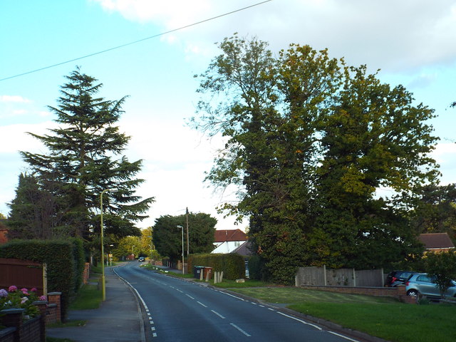
Vicarage Lane, Kings Langley This image was taken in late September.  The leaves on the trees are starting to turn golden.
Vicarage Lane, Kings Langley
This image was taken in late September. The leaves on the trees are starting to turn golden.
Vicarage Lane, Kings Langley A view down Vicarage Lane in Kings Langley.
Vicarage Lane, Kings Langley
A view down Vicarage Lane in Kings Langley.
The Nap, Kings Langley The Nap in Kings Langley, in Hertfordshire.
The Nap, Kings Langley
The Nap in Kings Langley, in Hertfordshire.
Public footpath, Kings Langley A public footpath in Kings Langley, Hertfordshire.  Concrete bollards prevent cars from attempting to use the path.
Public footpath, Kings Langley
A public footpath in Kings Langley, Hertfordshire. Concrete bollards prevent cars from attempting to use the path.
Hempstead Road, Kings Langley The electronic sign warns an approaching motorist to slow down as the road enters Kings Langley.
Hempstead Road, Kings Langley
The electronic sign warns an approaching motorist to slow down as the road enters Kings Langley.
Grand Union Canal at Kings Langley A lock on the Grand Union Canal as it passes through Kings Langley.
Grand Union Canal at Kings Langley
A lock on the Grand Union Canal as it passes through Kings Langley.
Railway bridge over Toms Lane, Kings Langley This bridge carries the West Coast Main Line over Toms Lane.
Railway bridge over Toms Lane, Kings Langley
This bridge carries the West Coast Main Line over Toms Lane.
Toms Lane, Kings Langley
Toms Lane, Kings Langley A view north-eastwards along Toms Lane, heading out of Kings Langley.
Toms Lane, Kings Langley
A view north-eastwards along Toms Lane, heading out of Kings Langley.
Toms Lane, Kings Langley Toms Lane approaching a double-bend, as it heads out of Kings Langley.
Toms Lane, Kings Langley
Toms Lane approaching a double-bend, as it heads out of Kings Langley.
Show me another place!

Mill Stream is located at Grid Ref: TL0604 (Lat: 51.727488, Lng: -0.45221685)

Administrative County: Hertfordshire

District: Dacorum

Police Authority: Hertfordshire

What 3 Words

///darker.paused.hurray. Near Kings Langley, Hertfordshire

Nearby Locations

Mill Stream Rucklers Lane

Related Wikis

Nash Mill

Nash Mill was a paper mill near Hemel Hempstead, Hertfordshire, United Kingdom. The local residential area (Nash Mills) takes its name from the mill....

Nash Mills

Nash Mills is a civil parish within Hemel Hempstead and Dacorum Borough Council on the northern side of the Grand Union Canal, formerly the River Gade...

Kings Langley F.C.

Kings Langley Football Club are a semi-professional association football club in the village and civil parish of Kings Langley, Hertfordshire, England...

Felden

Felden is a semi-rural neighbourhood of Hemel Hempstead, Hertfordshire, situated to the south west of the town, close to the railway station. At the 2011...

Nearby Amenities

Located within 500m of 51.727488,-0.45221685
Traffic Signals
Lat/Long: 51.7272411/-0.454249
Traffic Signals
Lat/Long: 51.7270373/-0.4542195
Seamark Type: gate
Waterway: lock_gate
Lat/Long: 51.7276957/-0.4525512
Bridge Ref: 156
Lat/Long: 51.7271935/-0.4518028
Pub
The Three Tuns
Lat/Long: 51.7314881/-0.4529353
Mini Roundabout
Direction: clockwise
Source: local knowledge
Lat/Long: 51.7310258/-0.4526028
Traffic Calming: table
Lat/Long: 51.731125/-0.455641
Nash Mills Recreation Centre
Leisure: sports_centre
Lat/Long: 51.7269958/-0.4526567
Bus Stop
Doolittle Meadows
Bus: yes
Naptan AtcoCode: 210021403490
Naptan Bearing: NW
Naptan CommonName: Doolittle Meadows
Naptan Crossing: Shendish Manor
Naptan Indicator: opp
Naptan Landmark: Shendish Manor
Naptan NaptanCode: hrtgwmtd
Naptan PlusbusZoneRef: HEMLHMP
Naptan ShortCommonName: NA
Naptan Street: London Road
Naptan Verified: no
Public Transport: platform
Source: naptan_import
Lat/Long: 51.7295323/-0.456944
Bus Stop
Rucklers Lane
Bus: yes
Local Ref: NR
Naptan AtcoCode: 210021403540
Naptan Bearing: N
Naptan CommonName: Rucklers Lane
Naptan Crossing: Abbots Rise
Naptan Indicator: nr
Naptan Landmark: Abbots Rise
Naptan NaptanCode: hrtdjpgm
Naptan ShortCommonName: NA
Naptan Street: Hempstead Road
Naptan Verified: no
Public Transport: platform
Shelter: yes
Source: naptan_import
Lat/Long: 51.7263698/-0.45405
Bus Stop
Red Lion Lane
Bench: no
Bin: no
Bus: yes
Naptan AtcoCode: 210021403550
Naptan Bearing: NE
Naptan CommonName: Red Lion Lane
Naptan Crossing: Grand Union Canal
Naptan Indicator: E-bound
Naptan Landmark: Grand Union Canal
Naptan NaptanCode: hrtdjpgt
Naptan ShortCommonName: NA
Naptan Street: Nash Mills Lane
Naptan Verified: no
Public Transport: platform
Shelter: no
Source: naptan_import
Lat/Long: 51.7275629/-0.4528264
Bus Stop
Mill Close
Bus: yes
Naptan AtcoCode: 210021406660
Naptan Bearing: NW
Naptan CommonName: Mill Close
Naptan Crossing: Kingfisher Drive
Naptan Indicator: opp
Naptan Landmark: Kingfisher Drive
Naptan NaptanCode: hrtdjdpj
Naptan PlusbusZoneRef: HEMLHMP
Naptan ShortCommonName: NA
Naptan Street: Belswains Lane
Naptan Verified: no
Public Transport: platform
Shelter: no
Source: naptan_import
Lat/Long: 51.7307615/-0.4522412
Bus Stop
Doolittle Meadows
Bus: yes
Naptan AtcoCode: 210021409250
Naptan Bearing: SE
Naptan CommonName: Doolittle Meadows
Naptan Crossing: opp Ridgeway Close
Naptan Indicator: adj
Naptan Landmark: opp Ridgeway Close
Naptan NaptanCode: hrtgwmtg
Naptan PlusbusZoneRef: HEMLHMP
Naptan ShortCommonName: NA
Naptan Street: London Road
Naptan Verified: no
Public Transport: platform
Source: naptan_import
Lat/Long: 51.7295735/-0.456653
Bus Stop
Rucklers Lane
Bus: yes
Naptan AtcoCode: 210021409260
Naptan Bearing: S
Naptan CommonName: Rucklers Lane
Naptan Crossing: Red Lion PH
Naptan Indicator: opp
Naptan Landmark: Red Lion PH
Naptan NaptanCode: hrtdgwgw
Naptan ShortCommonName: NA
Naptan Street: London Road
Naptan Verified: no
Public Transport: platform
Shelter: yes
Source: naptan_import
Lat/Long: 51.7278493/-0.4546092
Abbots Rise
Local Ref: NR
Naptan AtcoCode: 210021409270
Naptan Bearing: NE
Naptan BusStopType: CUS
Naptan CommonName: Abbots Rise
Naptan Crossing: Abbots Rise
Naptan Indicator: nr
Naptan Landmark: Abbots Rise
Naptan NaptanCode: hrtdgwja
Naptan ShortCommonName: NA
Naptan Street: Barnes Rise
Naptan Verified: no
Source: naptan_import
Lat/Long: 51.7241362/-0.4548256
Bus Stop
Red Lion Lane
Bench: no
Bin: no
Bus: yes
Naptan AtcoCode: 210021409275
Naptan Bearing: SW
Naptan CommonName: Red Lion Lane
Naptan Crossing: Grand Union Canal
Naptan Indicator: W-bound
Naptan Landmark: Grand Union Canal
Naptan NaptanCode: hrtdgwjd
Naptan ShortCommonName: NA
Naptan Street: Nash Mills Lane
Naptan Verified: no
Public Transport: platform
Shelter: no
Source: naptan_import
Lat/Long: 51.7273347/-0.4532541
Bus Stop
Mill Close
Bus: yes
Naptan AtcoCode: 210021409950
Naptan Bearing: SE
Naptan CommonName: Mill Close
Naptan Crossing: Bunkers Lane
Naptan Indicator: adj
Naptan Landmark: Bunkers Lane
Naptan NaptanCode: hrtdgtpm
Naptan PlusbusZoneRef: HEMLHMP
Naptan ShortCommonName: NA
Naptan Street: Belswains Lane
Naptan Verified: no
Public Transport: platform
Shelter: no
Source: naptan_import
Lat/Long: 51.730533/-0.4516678
Bus Stop
The George PH
Bus: yes
Local Ref: NR
Naptan AtcoCode: 210021409970
Naptan Bearing: SE
Naptan CommonName: The George PH
Naptan Crossing: Nash Mills School
Naptan Indicator: nr
Naptan Landmark: Nash Mills School
Naptan NaptanCode: hrtdgtgt
Naptan PlusbusZoneRef: HEMLHMP
Naptan ShortCommonName: NA
Naptan Street: Belswains Lane
Naptan Verified: no
Public Transport: platform
Source: naptan_import
Lat/Long: 51.7317214/-0.4538284
Bus Stop
Hyde Lane
Local Ref: NR
Naptan AtcoCode: 210021800080
Naptan Bearing: S
Naptan CommonName: Hyde Lane
Naptan Indicator: nr
Naptan Landmark: Unknown
Naptan NaptanCode: hrtajtpj
Naptan ShortCommonName: NA
Naptan Street: Lower Road
Naptan Verified: no
Public Transport: platform
Source: naptan_import
Lat/Long: 51.7240358/-0.4478937
Bus Stop
Hyde Lane
Naptan AtcoCode: 210021806640
Naptan Bearing: N
Naptan CommonName: Hyde Lane
Naptan Crossing: Railway Bridge
Naptan Indicator: opp
Naptan Landmark: Railway Bridge
Naptan NaptanCode: hrtagjwp
Naptan ShortCommonName: NA
Naptan Street: Lower Road
Naptan Verified: no
Public Transport: platform
Source: naptan_import
Lat/Long: 51.7243818/-0.4482148
Post Box
Collection Times: Mo-Fr 09:00; Sa 07:00
Operator: Royal Mail
Post Box Type: lamp
Ref: HP3 163
Royal Cypher: EIIR
Royal Cypher Wikidata: Q33102113
Source: survey
Survey Date: 2015-05-09
Lat/Long: 51.7302676/-0.4578448
Post Box
Brand: Royal Mail
Brand Wikidata: Q638098
Brand Wikipedia: en:Royal Mail
Collection Times: Mo-Fr 16:30; Sa 10:30
Operator: Royal Mail
Operator Wikidata: Q638098
Post Box Type: pillar
Ref: WD4 120
Royal Cypher: EIIR
Royal Cypher Wikidata: Q33102113
Source: survey
Survey Date: 2015-05-09
Lat/Long: 51.727057/-0.4545121
Seamark Type: gate
Waterway: lock_gate
Lat/Long: 51.7279167/-0.4527058
Cafe
Inspired Cafe
Addr City: Kings Langley
Addr Housenumber: 127
Addr Postcode: WD4 8AJ
Addr Street: Hempstead Road
Cuisine: coffee_shop
Opening Hours: 08:00-15:00
Smoking: no
Lat/Long: 51.7254747/-0.4534731
Inspired Fitness Centre
Addr City: Kings Langley
Addr Housenumber: 127
Addr Postcode: WD4 8AJ
Addr Street: Hempstead Road
Leisure: sports_centre
Sport: fitness
Lat/Long: 51.7253484/-0.4534409
Seamark Type: gate
Waterway: lock_gate
Lat/Long: 51.7296022/-0.4537407
Seamark Type: gate
Waterway: lock_gate
Lat/Long: 51.7298168/-0.4538917
Building: yes
Lat/Long: 51.72678/-0.4528555
Hemel Hempstead Cycling Club
Addr Housename: Hemel Cycling Club House
Addr Housenumber: Nash Mills Recreation Centre
Addr Postcode: HP3 9TE
Addr Street: Nash Mills Lane
Building: yes
Source: local_knowledge
Lat/Long: 51.7269086/-0.4528942
Fuel
Texaco
Brand: Texaco
Brand Wikidata: Q775060
Website: https://locations.valero.com/en-gb/LocationDetails/Index/HEMPSTEAD-ROAD/0000251132
Lat/Long: 51.7259007/-0.4531709
Atm
Lat/Long: 51.7258972/-0.4529078
Shop: convenience
Lat/Long: 51.7259637/-0.4529722
Post Box
Brand: Royal Mail
Brand Wikidata: Q638098
Brand Wikipedia: en:Royal Mail
Collection Times: Mo-Fr 09:00; Sa 07:00
Operator: Royal Mail
Operator Wikidata: Q638098
Post Box Type: lamp
Ref: WD4 352
Royal Cypher: EIIR
Royal Cypher Wikidata: Q33102113
Source: survey
Survey Date: 2015-05-09
Lat/Long: 51.725069/-0.4554801
Water Point
Nash Mills Top Lock Water Point
Access: permissive
Drinking Water: yes
Man Made: water_tap
Operator: Canal and River Trust
Waterway: water_point
Lat/Long: 51.729757/-0.454031
Waterway: boatyard
Lat/Long: 51.7270241/-0.4517926
Water Point
Waterway Experiences Water Point
Access: private
Addr City: Hemel Hempstead
Addr Country: GB
Addr County: Hertfordshire
Addr Housename: Nash Mills Recreation Centre
Addr Postcode: HP3 9TE
Addr Street: Red Lion Lane
Drinking Water: yes
Email: bookings@wexp.org.uk
Man Made: water_tap
Operator: Waterway Experiences
Phone: +44 1923 723 819
Waterway: water_point
Website: https://wexp.org.uk/
Lat/Long: 51.7269827/-0.4516621
Direction: 155
Generator Method: photovoltaic
Generator Output Electricity: yes
Generator Solar Modules: 8
Generator Source: solar
Generator Type: solar_photovoltaic_panel
Location: roof
Power: generator
Lat/Long: 51.7258412/-0.456849
Traffic Calming: island
Lat/Long: 51.7270285/-0.4544106
Crossing
Crossing: unmarked
Lat/Long: 51.726897/-0.4542055
Direction: 155
Generator Method: photovoltaic
Generator Output Electricity: yes
Generator Solar Modules: 16
Generator Source: solar
Generator Type: solar_photovoltaic_panel
Location: roof
Power: generator
Lat/Long: 51.726793/-0.4544266
Direction: 155
Generator Method: photovoltaic
Generator Output Electricity: yes
Generator Solar Modules: 4
Generator Source: solar
Generator Type: solar_photovoltaic_panel
Location: roof
Power: generator
Lat/Long: 51.7247571/-0.4561273
Direction: 225
Generator Method: photovoltaic
Generator Output Electricity: yes
Generator Solar Modules: 10
Generator Source: solar
Generator Type: solar_photovoltaic_panel
Location: roof
Power: generator
Lat/Long: 51.7305725/-0.4520771
Direction: 220
Generator Method: photovoltaic
Generator Output Electricity: yes
Generator Solar Modules: 12
Generator Source: solar
Generator Type: solar_photovoltaic_panel
Location: roof
Power: generator
Lat/Long: 51.7304305/-0.4543884
Direction: 220
Generator Method: photovoltaic
Generator Output Electricity: yes
Generator Solar Modules: 12
Generator Source: solar
Generator Type: solar_photovoltaic_panel
Location: roof
Power: generator
Lat/Long: 51.7313533/-0.4547417
Direction: 230
Generator Method: photovoltaic
Generator Output Electricity: yes
Generator Solar Modules: 9
Generator Source: solar
Generator Type: solar_photovoltaic_panel
Location: roof
Power: generator
Lat/Long: 51.7290387/-0.457106
Traffic Calming: island
Lat/Long: 51.729863/-0.4571042
Fixme: solar panels?
Lat/Long: 51.7295014/-0.4574518
Mothercare Global HQ
Brand: Mothercare
Brand Wikidata: Q136738
Brand Wikipedia: en:Mothercare
Office: company
Lat/Long: 51.7289155/-0.4551494
Fast Food
Union Sourdough Pizza & Sassy Bird
Addr City: Hemel Hempstead
Addr Housenumber: 27
Addr Postcode: HP3 9DQ
Addr Street: Swan Mead
Cuisine: pizza;chicken
Website: https://one-delivery.co.uk/unionsourdoughpizza/
Lat/Long: 51.7310007/-0.4560784
John Dickenson & Co War Memorial
Historic: memorial
Lat/Long: 51.7286831/-0.4503075
Barrier: bollard
Lat/Long: 51.729775/-0.4512043
Colour: white
Marker: post
Material: concrete
Utility: gas
Lat/Long: 51.7265404/-0.4480815
Power: pole
Lat/Long: 51.7264986/-0.4480604
Colour: white
Marker: post
Material: concrete
Utility: gas
Lat/Long: 51.7265425/-0.4480826
Colour: white
Marker: post
Material: concrete
Utility: gas
Lat/Long: 51.7265381/-0.4480805
Colour: white
Marker: post
Material: concrete
Utility: gas
Lat/Long: 51.7266102/-0.4478668
Colour: white
Marker: post
Material: concrete
Utility: gas
Lat/Long: 51.7266124/-0.4478678
Colour: white
Marker: post
Material: concrete
Utility: gas
Lat/Long: 51.7266145/-0.4478689
The data included in this document is from www.openstreetmap.org. The data is made available under ODbL.

Have you been to Mill Stream?

Leave your review of Mill Stream below (or comments, questions and feedback).