Ring Beck

Lake, Pool, Pond, Freshwater Marsh in Yorkshire

England

Ring Beck

Old milestone A newer photograph of this 18/19C milestone in front of 37 Bevereley Road in South Cave.  More erosion of the surface has taken place.  There is an OS bench mark on the left hand side.
Old milestone Credit: Chris Minto

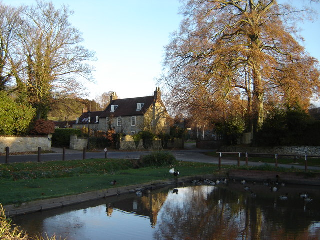
Ring Beck is a small freshwater marsh located in the county of Yorkshire, England. Nestled amidst the picturesque surroundings of the Yorkshire Dales, it is a serene and idyllic spot for nature enthusiasts and visitors seeking tranquility.

The beck, or stream, originates from the nearby hills and meanders through the marsh, giving it a unique and mesmerizing charm. The water in the beck is crystal clear and supports a diverse ecosystem of aquatic plants and animals. The marshland surrounding the beck is lush, with an abundance of reeds, grasses, and sedges. These provide shelter and nesting grounds for a variety of bird species, making it a haven for birdwatchers.

The beck widens into a small lake as it flows through the marsh, creating a scenic and peaceful setting. The lake offers opportunities for fishing, with a range of freshwater fish species such as trout and perch thriving in its waters. Anglers can be seen casting their lines, hoping for a successful catch.

In addition to the lake, the marsh features several smaller pools and ponds scattered throughout its landscape. These smaller bodies of water are home to amphibians like frogs and newts, as well as insects and other invertebrates. Exploring these pools and ponds can be a fascinating experience for those interested in studying the intricate web of life within a marsh ecosystem.

Overall, Ring Beck is a hidden gem in Yorkshire, offering visitors a chance to connect with nature and enjoy the tranquility of a freshwater marsh.

If you have any feedback on the listing, please let us know in the comments section below.
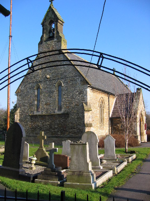
Ring Beck Images

Images are sourced within 2km of 53.755809/-0.59208415 or Grid Reference SE9229. Thanks to Geograph Open Source API. All images are credited.

Old milestone A newer photograph of this 18/19C milestone in front of 37 Bevereley Road in South Cave.  More erosion of the surface has taken place.  There is an OS bench mark on the left hand side.
Old milestone
A newer photograph of this 18/19C milestone in front of 37 Bevereley Road in South Cave. More erosion of the surface has taken place. There is an OS bench mark on the left hand side.
All Saints Church Brantingham This church has 12th Century origins but was largely rebuilt in 1872.
All Saints Church Brantingham
This church has 12th Century origins but was largely rebuilt in 1872.
All Saints Church Brantingham A picturesque church situated by the Wolds Way. It has 12th Century origins but was largely rebuilt in 1872.
All Saints Church Brantingham
A picturesque church situated by the Wolds Way. It has 12th Century origins but was largely rebuilt in 1872.
All Saints Church Brantingham This church has 12th Century origins but was largely rebuilt in 1872. It is situated to the north of the village beside the Wolds Way.
All Saints Church Brantingham
This church has 12th Century origins but was largely rebuilt in 1872. It is situated to the north of the village beside the Wolds Way.
Two Wooden Crosses at All Saints Church Brantingham These two wooden crosses each have the signature mouse by Robert Thompson of Kilburn. One cross is inscribed
          
                   To the glory of God
                   And in loving memory of 
                   Watson Arton Massey
                   Born 23rd September 1877
                   At rest 27th January 1944
Two Wooden Crosses at All Saints Church Brantingham
These two wooden crosses each have the signature mouse by Robert Thompson of Kilburn. One cross is inscribed To the glory of God And in loving memory of Watson Arton Massey Born 23rd September 1877 At rest 27th January 1944
South of the A63 at Willow Flats
South Cave Interchange
All Saints Church, Brantingham
In Brantingham Dale Here The Yorkshire Wolds Way climbs out of Brantingham Dale in the direction of South Cave.
In Brantingham Dale
Here The Yorkshire Wolds Way climbs out of Brantingham Dale in the direction of South Cave.
Geldart  Avenue  from  Little  Wold  Lane A new development by Bellway, still building at the far end
Geldart Avenue from Little Wold Lane
A new development by Bellway, still building at the far end
Sales  Centre  and  showhouse  for  Bellway  development At the corner of Geldart Ave and Little Wold Lane
Sales Centre and showhouse for Bellway development
At the corner of Geldart Ave and Little Wold Lane
Little  Wold  Lane  South  Cave Route of the Yorkshire Wolds Way
Little Wold Lane South Cave
Route of the Yorkshire Wolds Way
Track  between  houses  to  fields  South  Cave A footpath rises through the field to the access road to Mount Airey Farm
Track between houses to fields South Cave
A footpath rises through the field to the access road to Mount Airey Farm
View from  Service  Station  to  South  Cave  Interchange  A63
View from Service Station to South Cave Interchange A63
Fuelling  area  at  South  Cave  Service  Station
Fuelling area at South Cave Service Station
Campers  and  Motorhome  sales  Wandahome near South Cave
Campers and Motorhome sales Wandahome
near South Cave
Ellerker Wold Lane Looking along Ellerker Wold Lane from Brantingham Road.
Ellerker Wold Lane
Looking along Ellerker Wold Lane from Brantingham Road.
Fields beside Ellerker Wold Lane Looking across farmland from the junction of Brantingham Road with Ellerker Wold Lane.
Fields beside Ellerker Wold Lane
Looking across farmland from the junction of Brantingham Road with Ellerker Wold Lane.
Show me another place!

Ring Beck is located at Grid Ref: SE9229 (Lat: 53.755809, Lng: -0.59208415)

Division: East Riding

Unitary Authority: East Riding of Yorkshire

Police Authority: Humberside

What 3 Words

///outcasts.detect.means. Near Ellerker, East Yorkshire

Nearby Locations

Ring Beck Ellerker

Related Wikis

Ellerker

Ellerker is a village and civil parish in the East Riding of Yorkshire, England. It is situated approximately 10 miles (16 km) west of Hull city centre...

Brantingham Roman villa

Brantingham Roman villa is a Roman villa, now a scheduled monument, near Brantingham, East Riding of Yorkshire, England. == Villa == The villa would have...

Brantingham

Brantingham is a village and civil parish in the East Riding of Yorkshire, England, about 2 miles (3 km) north of Brough, 12 miles (19 km) west of Hull...

South Cave

South Cave is a village and civil parish in the East Riding of Yorkshire, England. It is situated approximately 14 miles (23 km) to the west of Hull city...

Nearby Amenities

Located within 500m of 53.755809,-0.59208415
Post Box
Ref: HU15 178
Source: survey
Lat/Long: 53.7552431/-0.5927179
Bench
Lat/Long: 53.7537235/-0.5980794
Ellerker Brantingham Road
Naptan AtcoCode: 2200YEA00852
Naptan Bearing: N
Naptan CommonName: Ellerker Brantingham Road
Naptan ShortCommonName: Brantingham Road Ellerker
Naptan Street: Ring Beck Lane
Physically Present: no
Source: naptan + survey
Lat/Long: 53.7551106/-0.5908609
Bus Stop
Ellerker South Cave Road
Layby: yes
Naptan AtcoCode: 2200YEA00853
Naptan Bearing: NW
Naptan CommonName: Ellerker South Cave Road
Naptan ShortCommonName: South Cave Road Ellerker
Naptan Street: Ring Beck Lane
Note: no code on sign
Shelter: no
Source: naptan + survey
Lat/Long: 53.7559617/-0.5913785
Bus Stop
Ellerker Howden Croft Hill
Naptan AtcoCode: 2200YEA00856
Naptan Bearing: NE
Naptan CommonName: Ellerker Howden Croft Hill
Naptan Street: Howden Croft Hill
Note: no sign but stop looks used
Shelter: yes
Source: naptan + survey
Lat/Long: 53.7536499/-0.5981448
Bus Stop
Ellerker Ring Beck Lane
Naptan AtcoCode: 2200YEA01534
Naptan Bearing: NE
Naptan CommonName: Ellerker Ring Beck Lane
Naptan Landmark: Outside Green Garden Centre
Naptan ShortCommonName: Ring Beck Lane Ellerker
Naptan Street: Ring Beck Lane
Note: bearing should be SW
Shelter: no
Source: naptan + survey
Lat/Long: 53.7554709/-0.5916831
Bus Stop
Ellerker Ring Beck Lane
Naptan AtcoCode: 2200YEA01635
Naptan Bearing: NE
Naptan CommonName: Ellerker Ring Beck Lane
Naptan Street: Ring Beck Lane
Note: no code on sign
Shelter: no
Source: naptan + survey
Lat/Long: 53.7563646/-0.5897117
Motorway Junction
South Cave Interchange
Lat/Long: 53.7599431/-0.5924719
Shop: garden_centre
Lat/Long: 53.7551581/-0.5917584
Wandahome
Tourism: caravan_site
Lat/Long: 53.7594766/-0.5946542
Charging Station
Operator: Sewell On The Go
Output: 7kW
Lat/Long: 53.760166/-0.5938101
The data included in this document is from www.openstreetmap.org. The data is made available under ODbL.

Have you been to Ring Beck?

Leave your review of Ring Beck below (or comments, questions and feedback).