Startopsend Reservoir

Lake, Pool, Pond, Freshwater Marsh in Hertfordshire Dacorum

England

Startopsend Reservoir

The Red Lion, Marsworth
The Red Lion, Marsworth Credit: Mark Percy

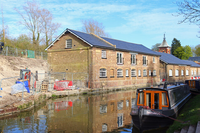
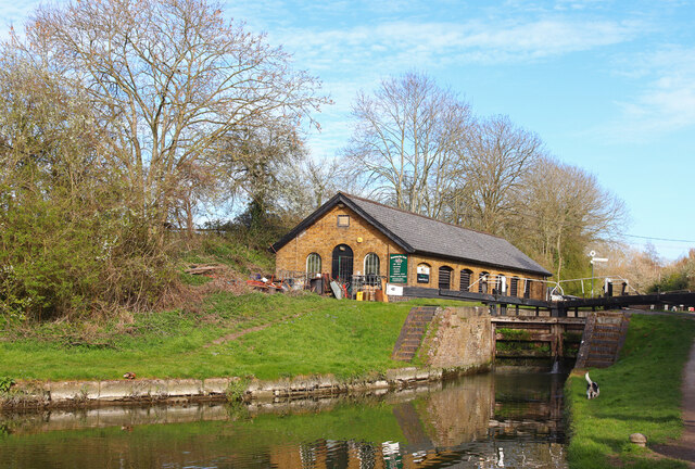
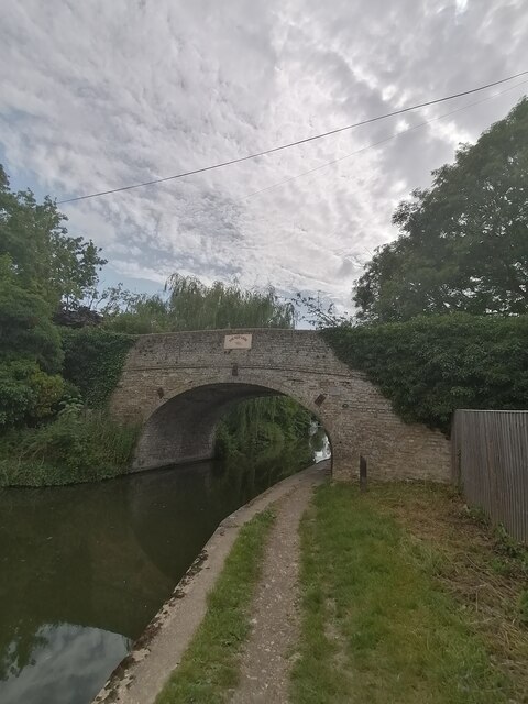
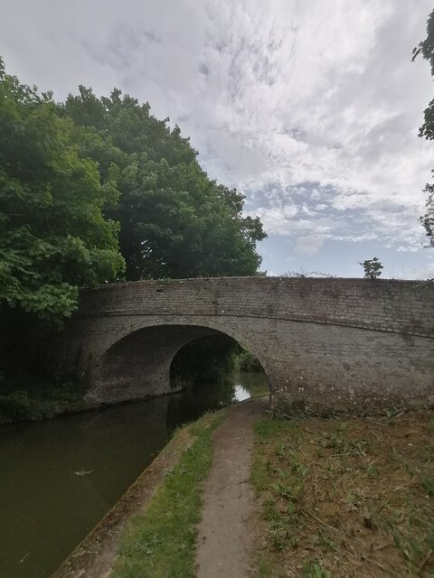
Startopsend Reservoir is a freshwater body located in the county of Hertfordshire, England. It is situated in the Chiltern Hills, near to the village of Marsworth. Also known as Startops End Reservoir, it was constructed in the 19th century as part of the Grand Union Canal system.

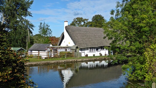
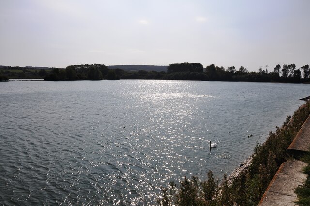
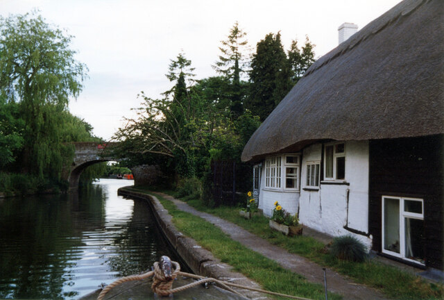
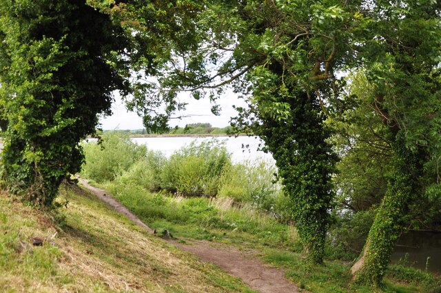
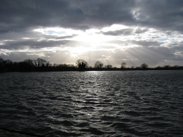
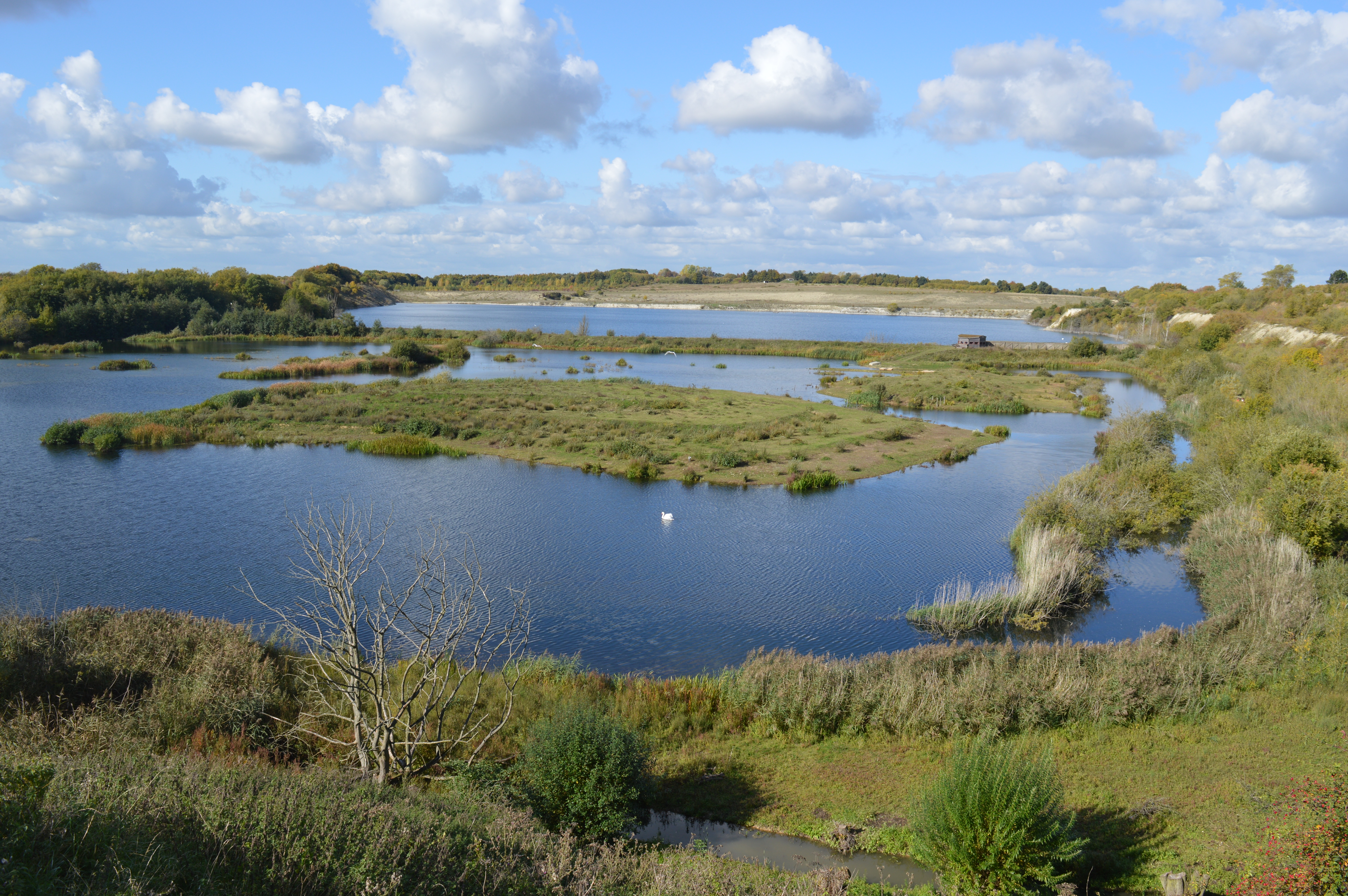
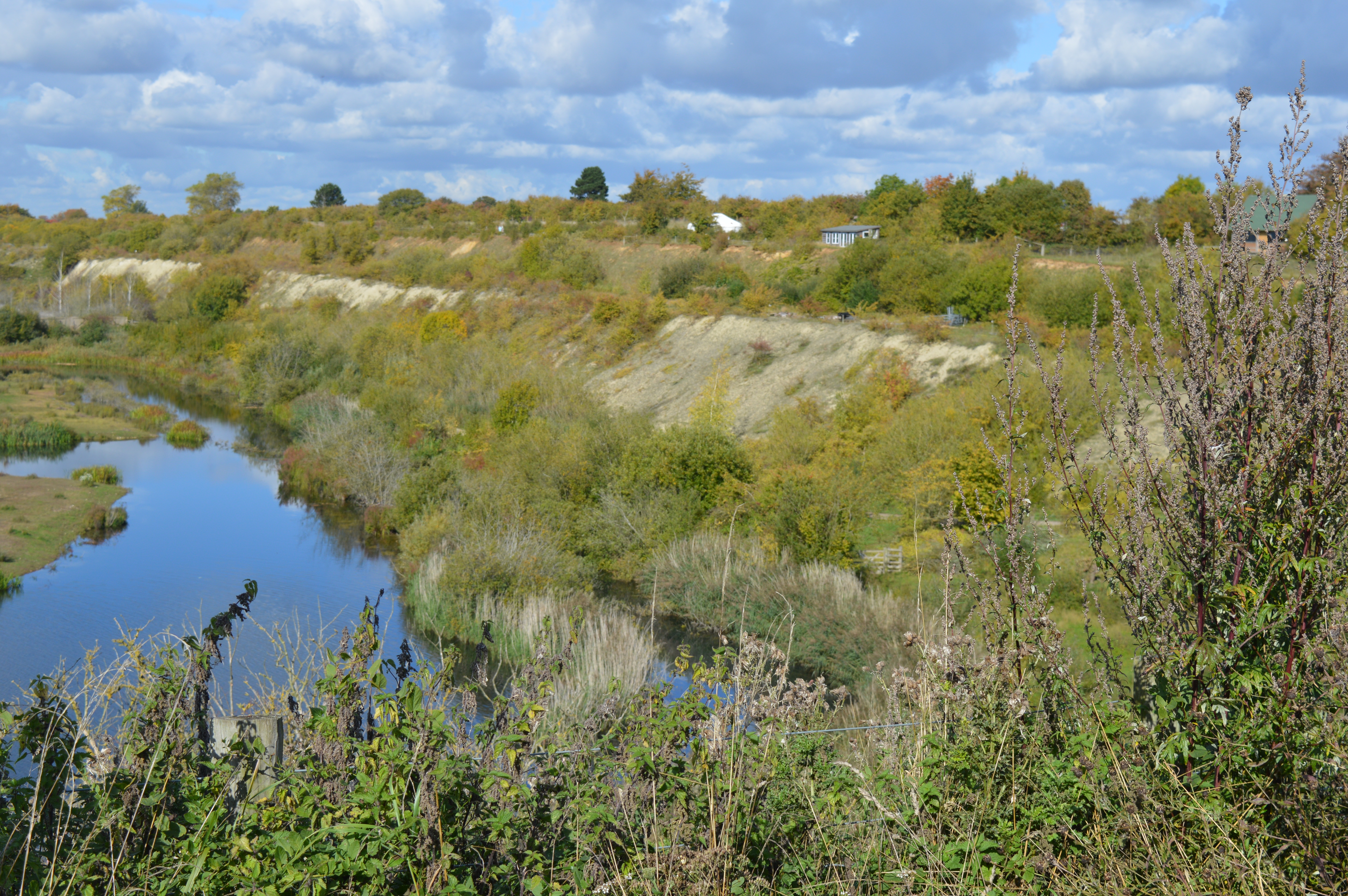
The reservoir covers an area of approximately 120 acres and is surrounded by picturesque countryside, offering visitors stunning views and a tranquil atmosphere. It is primarily used for water supply purposes, with its main function being to provide water for the Grand Union Canal. The reservoir is fed by a combination of natural springs and rainwater runoff, ensuring a constant supply of fresh water.

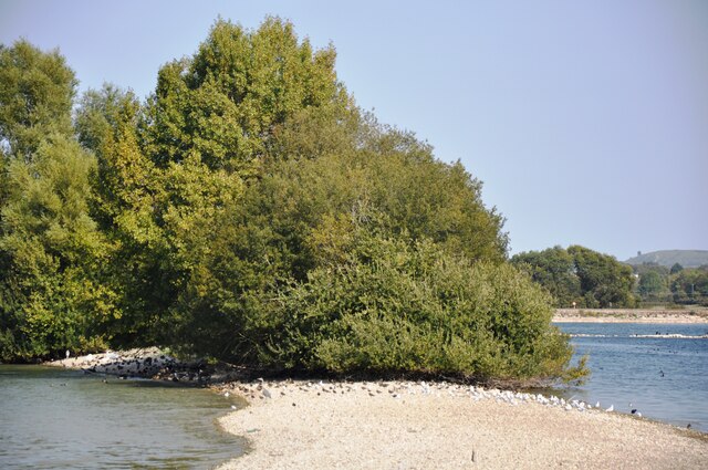
Startopsend Reservoir is home to a diverse range of flora and fauna, making it a popular destination for nature enthusiasts and wildlife watchers. The surrounding marshland provides a habitat for various species of birds, including ducks, swans, and herons. The reservoir is also inhabited by fish, such as carp, perch, and pike, making it a popular spot for anglers.

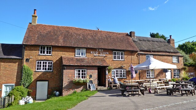
The reservoir offers several recreational activities, including fishing, birdwatching, and walking. There are footpaths and trails that surround the reservoir, allowing visitors to explore the area and enjoy the natural beauty of the surroundings. Additionally, there is a nearby pub and cafe, providing refreshments for those visiting the reservoir.

Overall, Startopsend Reservoir is a scenic and peaceful location, offering a range of recreational opportunities for visitors to enjoy while appreciating the natural beauty and wildlife of Hertfordshire.

If you have any feedback on the listing, please let us know in the comments section below.

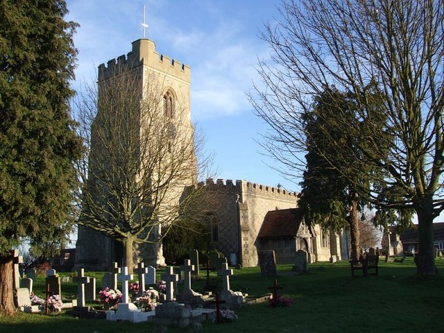
Startopsend Reservoir Images

Images are sourced within 2km of 51.815417/-0.66882197 or Grid Reference SP9113. Thanks to Geograph Open Source API. All images are credited.

The Red Lion, Marsworth
Vicarage Road Canal Bridge 130
The former Ship Inn, Marsworth
Wilstone reservoir looking west A view of Wilstone Reservoir from the footpath bordering it.  The reservoir was built to provide water for the nearby Grand Union Canal and is now a haven for wildlife.
Wilstone reservoir looking west
A view of Wilstone Reservoir from the footpath bordering it. The reservoir was built to provide water for the nearby Grand Union Canal and is now a haven for wildlife.
View from the hide at Wilstone Reservoir Birds and trees on the spit of land running across the reservoir.
View from the hide at Wilstone Reservoir
Birds and trees on the spit of land running across the reservoir.
The Ship, Ship Lane, Lower End, Marsworth Grade II Listed 17th century former public house and shop. Canal side pubs generate many tales including here rumours of highwaymen bedding down for the evening. Information on the pub is thin on the ground but in 1941 a Bucks Herald obituary refers to a Mr Alfred Bird who had resided with his sister 'of the "Ship" Inn'. Searching directories under Marsworth (aka Masworth) I find no Ship but perhaps it is just listed as beer retailer, 1853 two beer retailers Thomas Lines and Robert Russell (& shopkeeper), 1876 John Jellis beer retailer (& grocer & coal merchant), 1883 two beer retailers George and John Jellis (George is John’s son and pubwiki lists John at the Ship from 1864 to 1891 when he’s shown as a publican in the census), 1899-1903 John Smith beer retailer and 1907-1915 Thomas Chamberlain beer retailer. Before 1853 Ma(r)sworth is not in my directories.
The Ship, Ship Lane, Lower End, Marsworth
Grade II Listed 17th century former public house and shop. Canal side pubs generate many tales including here rumours of highwaymen bedding down for the evening. Information on the pub is thin on the ground but in 1941 a Bucks Herald obituary refers to a Mr Alfred Bird who had resided with his sister 'of the "Ship" Inn'. Searching directories under Marsworth (aka Masworth) I find no Ship but perhaps it is just listed as beer retailer, 1853 two beer retailers Thomas Lines and Robert Russell (& shopkeeper), 1876 John Jellis beer retailer (& grocer & coal merchant), 1883 two beer retailers George and John Jellis (George is John’s son and pubwiki lists John at the Ship from 1864 to 1891 when he’s shown as a publican in the census), 1899-1903 John Smith beer retailer and 1907-1915 Thomas Chamberlain beer retailer. Before 1853 Ma(r)sworth is not in my directories.
Looking towards Lock No. 41 The view from near Lock 40 towards Lock 41 on the Marsworth flight of the Grand Union Canal.
Looking towards Lock No. 41
The view from near Lock 40 towards Lock 41 on the Marsworth flight of the Grand Union Canal.
Grand Union Canal Canal at Bulbourne.
Grand Union Canal
Canal at Bulbourne.
Grand Union Canal Canal near Bulbourne.
Grand Union Canal
Canal near Bulbourne.
Bulbourne Canal Works Building on the Grand Union Canal.
Bulbourne Canal Works
Building on the Grand Union Canal.
Tring Reservoirs Reservoirs next to the Grand Union Canal.
Tring Reservoirs
Reservoirs next to the Grand Union Canal.
Marsworth Lock 39 Lock on the Grand Union Canal.
Marsworth Lock 39
Lock on the Grand Union Canal.
Vicarage Road Grand Union Canal in Marsworth.
Vicarage Road
Grand Union Canal in Marsworth.
Lower Icknield Way Road leading north from Marsworth.
Lower Icknield Way
Road leading north from Marsworth.
An Avanti West Coast train going south An Avanti West Coast 'Pendolino' express heads south towards London.
An Avanti West Coast train going south
An Avanti West Coast 'Pendolino' express heads south towards London.
Startops End Reservoir A view through the trees from the road causeway over the reservoir.
Startops End Reservoir
A view through the trees from the road causeway over the reservoir.
Town Field Farm bridge 130 (Grand Union Canal)  Bridge 130 carries the road over the canal towards Long Marston
Town Field Farm bridge 130 (Grand Union Canal)
Bridge 130 carries the road over the canal towards Long Marston
Manor Farm bridge 129 (Grand Union Canal)  Bridge 129 carries a track over the canal
Manor Farm bridge 129 (Grand Union Canal)
Bridge 129 carries a track over the canal
Show me another place!

Startopsend Reservoir is located at Grid Ref: SP9113 (Lat: 51.815417, Lng: -0.66882197)

Administrative County: Hertfordshire

District: Dacorum

Police Authority: Hertfordshire

What 3 Words

///routs.kidney.imposes. Near Pitstone, Buckinghamshire

Related Wikis

Tring Reservoirs

Tring Reservoirs is a group of four reservoirs close to Tring on the border of Hertfordshire and Buckinghamshire, England. Their purpose is to feed the...

Marsworth

Marsworth is a village and a civil parish within the unitary authority area of Buckinghamshire, England. It is about 2 miles (3.2 km) north of Tring, Hertfordshire...

College Lake nature reserve

College Lake is a 65 hectare nature reserve in a former chalk quarry in Pitstone in the Aylesbury Vale district of Buckinghamshire. It is one of the flagship...

Wilstone

Wilstone is the name of an English village and a reservoir approximately two miles north-west of Tring, Hertfordshire. The village lies within the civil...

Pitstone Quarry

Pitstone Quarry is a 10.3-hectare (25-acre) geological Site of Special Scientific Interest in Pitstone, Buckinghamshire. It is the area between the lake...

Goldfield Mill, Tring

Goldfield Mill or Grover's Mill is a Grade II listed tower mill at Tring, Hertfordshire, England which has been converted to residential accommodation...

Pitstone & Ivinghoe F.C.

Pitstone & Ivinghoe Football Club are a football club based in Pitstone, near Leighton Buzzard, England. They are members of the Spartan South Midlands...

Tring School

Tring School is a secondary school with academy status, with approximately 1,500 students aged between 11 and 18. It is located on Mortimer Hill on the...

Nearby Amenities

Located within 500m of 51.815417,-0.66882197
Seamark Type: gate
Waterway: lock_gate
Lat/Long: 51.8183131/-0.6666645
Seamark Type: gate
Source: npe
Waterway: lock_gate
Lat/Long: 51.8168611/-0.663446
Seamark Type: gate
Waterway: lock_gate
Lat/Long: 51.8185157/-0.6668481
Traffic Calming: island
Lat/Long: 51.8154942/-0.6735326
Tringforde
Created By: Potlatch 0.8a
Place: hamlet
Lat/Long: 51.8133397/-0.6715287
Bus Stop
Crossroads
Bus: yes
Naptan AtcoCode: 210021424640
Naptan Bearing: SE
Naptan CommonName: Crossroads
Naptan Crossing: Tringford Piggeries
Naptan Indicator: S-bound
Naptan Landmark: Tringford Piggeries
Naptan NaptanCode: hrtdawgw
Naptan ShortCommonName: NA
Naptan Street: Tringford
Naptan Verified: no
Public Transport: platform
Source: naptan_import
Lat/Long: 51.8151649/-0.6729157
Bus Stop
Crossroads
Bus: yes
Naptan AtcoCode: 210021426020
Naptan Bearing: NW
Naptan CommonName: Crossroads
Naptan Crossing: James Farm
Naptan Indicator: adj
Naptan Landmark: James Farm
Naptan NaptanCode: hrtdatmp
Naptan ShortCommonName: NA
Naptan Street: Tringford
Naptan Verified: no
Public Transport: platform
Source: naptan_import
Lat/Long: 51.8150952/-0.6731063
Traffic Calming: hump
Lat/Long: 51.8189848/-0.6656628
Traffic Signals
Lat/Long: 51.8185213/-0.6670402
Traffic Signals
Lat/Long: 51.8186749/-0.6667036
Seamark Type: gate
Waterway: lock_gate
Lat/Long: 51.8167353/-0.6637801
Cafe
Marsworth Water's Edge
Addr County: Buckinghamshire
Addr Housename: Lockhouse 39
Addr Postcode: HP23 4LJ
Addr Suburb: Startops End
Addr Village: Marsworth
Fhrs Id: 369920
Fixme Addr 1: Lower Icknield Way
Internet Access: wlan
Outdoor Seating: yes
Source Addr: FHRS Open Data
Lat/Long: 51.818129/-0.6668014
Bench
Source: gpx
Lat/Long: 51.8132663/-0.6690126
Bench
Source: gpx
Lat/Long: 51.813686/-0.6693221
Bench
Backrest: no
Source: gpx
Lat/Long: 51.8160601/-0.6659109
Startop Farm
Place: farm
Source: OS_OpenData_StreetView
Wikidata: Q26626258
Lat/Long: 51.81778/-0.6699494
James Farm
Place: farm
Source: OS_OpenData_StreetView
Lat/Long: 51.8158049/-0.6750135
Post Box
Brand: Royal Mail
Brand Wikidata: Q638098
Collection Times: Mo-Fr 16:45; Sa 07:00
Operator: Royal Mail
Operator Wikidata: Q638098
Post Box Type: lamp
Ref: HP23 117
Royal Cypher: EIIR
Royal Cypher Wikidata: Q33102113
Source: survey
Lat/Long: 51.8178231/-0.6684448
Power: pole
Lat/Long: 51.8148416/-0.6760186
Power: pole
Lat/Long: 51.8142662/-0.6746426
Power: pole
Lat/Long: 51.8135312/-0.672951
Power: pole
Lat/Long: 51.8128335/-0.672631
Power: pole
Lat/Long: 51.8119787/-0.6723426
Power: pole
Lat/Long: 51.819286/-0.6708419
Power: pole
Lat/Long: 51.8188682/-0.6714937
Power: pole
Lat/Long: 51.8178734/-0.6728965
Power: pole
Lat/Long: 51.8174158/-0.6740297
Power: pole
Lat/Long: 51.8169142/-0.6752421
Barrier: kissing_gate
Lat/Long: 51.8116022/-0.6713945
Traffic Calming: island
Lat/Long: 51.8152314/-0.6735576
Traffic Calming: island
Lat/Long: 51.8154713/-0.673101
Direction: 145
Generator Method: photovoltaic
Generator Output Electricity: yes
Generator Solar Modules: 18
Generator Source: solar
Generator Type: solar_photovoltaic_panel
Location: roof
Power: generator
Lat/Long: 51.8182793/-0.6683323
Description: White post with pink hat
Marker: aerial
Utility: oil
Lat/Long: 51.8189556/-0.666137
Colour: white
Marker: post
Material: concrete
Utility: oil
Lat/Long: 51.8189564/-0.6661327
Man Made: utility_pole
Lat/Long: 51.8148491/-0.6741491
The data included in this document is from www.openstreetmap.org. The data is made available under ODbL.

Have you been to Startopsend Reservoir?

Leave your review of Startopsend Reservoir below (or comments, questions and feedback).