Great Tey

Settlement in Essex Colchester

England

Great Tey

Baldwin's Lane off Florie's Road A private track to Baldwin's Farm, but also a public footpath carrying on to Buckley's Lane.
Baldwin's Lane off Florie's Road Credit: Robin Webster

Great Tey is a small village located in the Colchester district of Essex, England. Situated approximately 6 miles southwest of Colchester town, it rests on a gentle slope, surrounded by picturesque countryside. The village is home to a close-knit community with a population of around 700 residents.

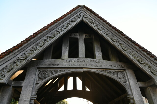
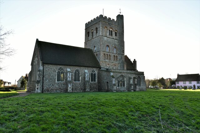
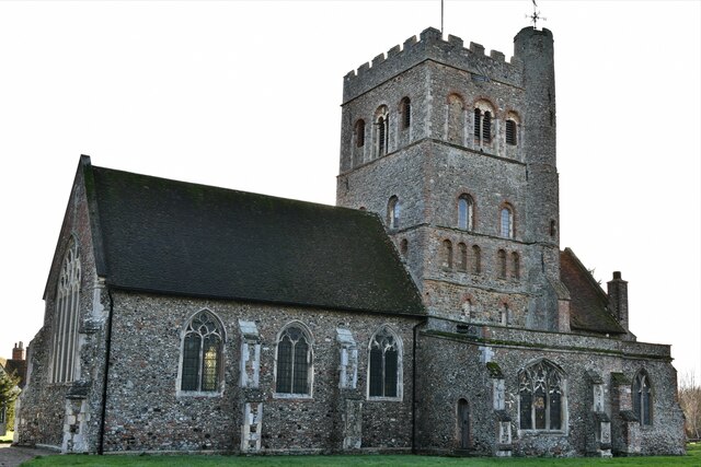
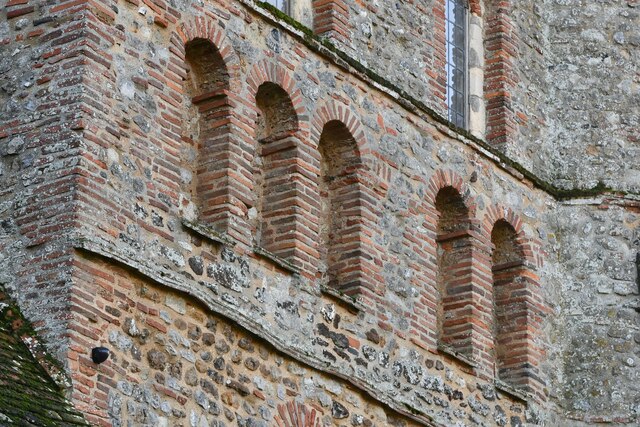
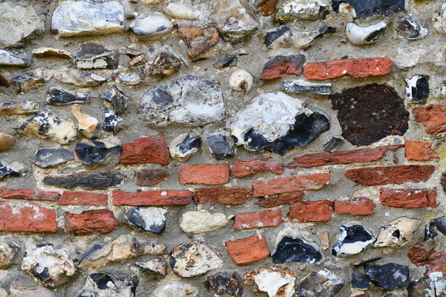
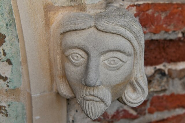
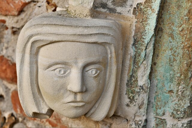
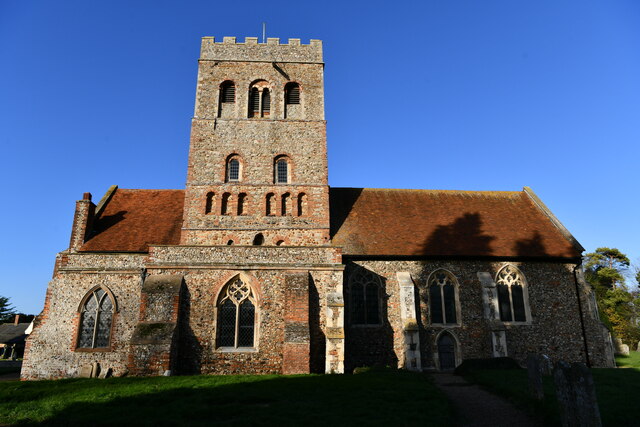
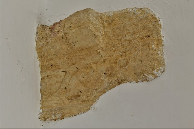
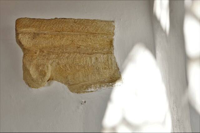
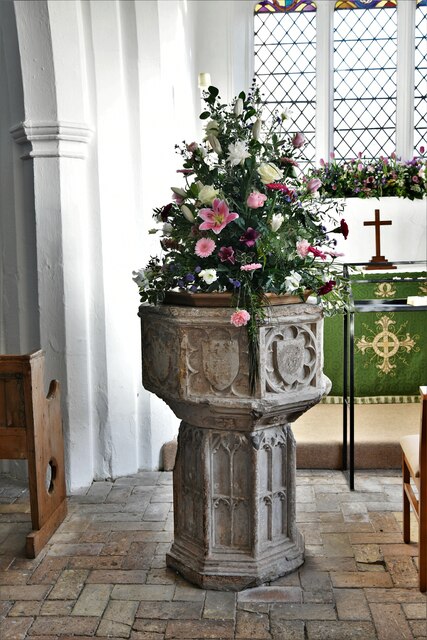
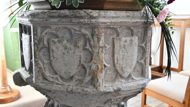
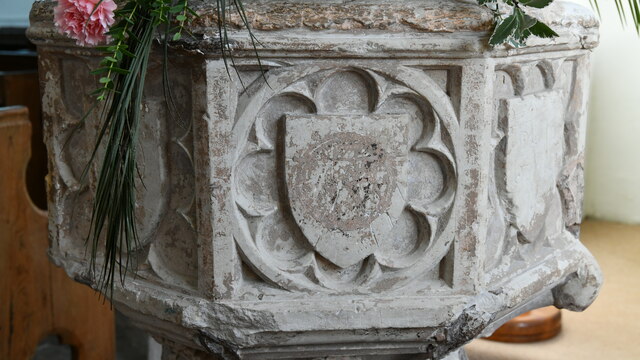
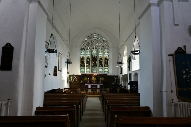
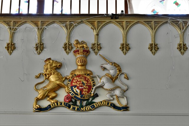
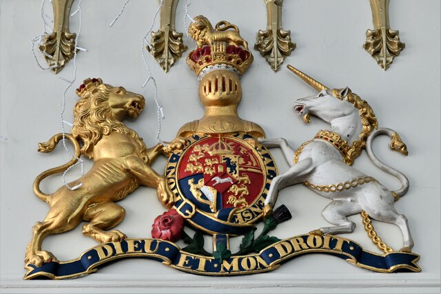
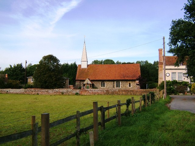
The village dates back to the Saxon era and possesses a rich historical heritage. It features an array of charming traditional buildings, including St. Barnabas Church, which dates back to the 12th century and is renowned for its unique round tower. The church's interior boasts beautiful stained glass windows and notable architectural details.

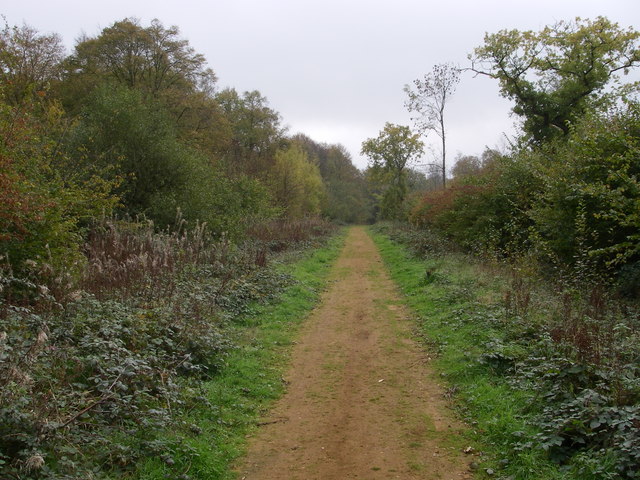
Great Tey is known for its tranquil and idyllic setting, offering residents and visitors a peaceful escape from the hustle and bustle of city life. The village is encompassed by lush green fields, scenic woodlands, and meandering country lanes, making it a haven for nature lovers and walkers.

Although primarily residential, Great Tey benefits from a thriving community spirit. It has a village hall that serves as a hub for various social events and gatherings, promoting a sense of togetherness among its residents. The village also hosts an annual summer fete, bringing locals and visitors together to enjoy traditional games, food, and entertainment.

Despite its small size, Great Tey provides some essential amenities for its residents. It has a primary school, a village shop, and a pub that serves as a social hub for locals.

Overall, Great Tey is a charming village that offers a peaceful and close-knit community, rich history, and stunning natural surroundings, making it an attractive place to live or visit in Essex.

If you have any feedback on the listing, please let us know in the comments section below.

Great Tey Images

Images are sourced within 2km of 51.900304/0.749037 or Grid Reference TL8925. Thanks to Geograph Open Source API. All images are credited.

Baldwin's Lane off Florie's Road A private track to Baldwin's Farm, but also a public footpath carrying on to Buckley's Lane.
Baldwin's Lane off Florie's Road
A private track to Baldwin's Farm, but also a public footpath carrying on to Buckley's Lane.
Teyfield Cottages, Florie's Road
Great Tey, St. Barnabas Church: Lych gate detail
Great Tey, St. Barnabas Church: North eastern aspect
Great Tey, St. Barnabas Church: Reused Roman bricks and tiles in the Norman tower
Great Tey, St. Barnabas Church: Reused Roman bricks and tiles in the west wall
Great Tey, St. Barnabas Church: Modern recarved head stop on a south doorway 1
Great Tey, St. Barnabas Church: Modern recarved head stop on a south doorway 2
Great Tey, St. Barnabas Church: Southern aspect
Great Tey, St. Barnabas Church: Filled in capital of a nave arcade Norman arch 1
Great Tey, St. Barnabas Church: Filled in capital of a nave arcade Norman arch 2
Great Tey, St. Barnabas Church: Early c15th octagonal font 1
Great Tey, St. Barnabas Church: Early c15th octagonal font 2
Great Tey, St. Barnabas Church: Early c15th octagonal font 3
Great Tey, St. Barnabas Church: The c14th Decorated period chancel
Great Tey, St. Barnabas Church: Iron set of Royal Arms below the western gallery The Arms date from 1829.
Great Tey, St. Barnabas Church: Iron set of Royal Arms below the western gallery
The Arms date from 1829.
Great Tey, St. Barnabas Church: Iron set of Royal Arms dating from 1829
Show me another place!

Great Tey is located at Grid Ref: TL8925 (Lat: 51.900304, Lng: 0.749037)

Administrative County: Essex

District: Colchester

Police Authority: Essex

What 3 Words

///embellish.spinning.vanished. Near Marks Tey, Essex

Nearby Locations

Great Tey Tey, Great

Related Wikis

Great Tey

Great Tey is a village and civil parish in the City of Colchester district of Essex, England. It is near the villages of Marks Tey and Little Tey, located...

Chappel

Chappel is a village and civil parish in the City of Colchester district of Essex, England. The River Colne flows through the village. It is significant...

Little Tey

Little Tey is a village in the City of Colchester district of Essex, England, located approximately six miles west of Colchester. It is in the civil parish...

Chappel Viaduct

The Chappel Viaduct is a railway viaduct that crosses the River Colne in the Colne Valley in Essex, England. It carries the Gainsborough Line which now...

Marks Tey Brickpit

Marks Tey Brickpit is a 29.5-hectare (73-acre) geological Site of Special Scientific Interest in Marks Tey in Essex. It is a Geological Conservation Review...

Chalkney Wood

Chalkney Wood is a 72.6-hectare (179-acre) biological Site of Special Scientific Interest south-east of Earls Colne in Essex, England. 25 hectares is owned...

Rose Green, Essex

Rose Green is a hamlet on the A1124 road and the River Colne, near the village of Wakes Colne in the Colchester district, in the English county of Essex...

Aldham, Essex

Aldham is a village and civil parish in the City of Colchester district of Essex, England. It is located 4+1⁄2 mi (7.2 km) west of Colchester. The village...

Nearby Amenities

Located within 500m of 51.900304,0.749037
Great Tey
Created By: Potlatch 0.10b
Place: village
Source: NPE
Lat/Long: 51.8988058/0.7506432
Bus Stop
Church
Naptan AtcoCode: 1500IM1375
Naptan Bearing: N
Naptan BusStopType: CUS
Naptan CommonName: Church
Naptan Crossing: The Street
Naptan Indicator: o/s
Naptan Landmark: Church
Naptan NaptanCode: esxadjmj
Naptan Street: Brook Road
Naptan Verified: no
Public Transport: platform
Source: naptan_import
Lat/Long: 51.8984403/0.7491149
Bus Stop
Church
Naptan AtcoCode: 1500IM1375B
Naptan Bearing: S
Naptan BusStopType: CUS
Naptan CommonName: Church
Naptan Crossing: The Street
Naptan Indicator: Opp
Naptan Landmark: Church
Naptan NaptanCode: esxdjpaw
Naptan Street: Brook Road
Naptan Verified: no
Public Transport: platform
Source: naptan_import
Lat/Long: 51.8983934/0.7491992
Village Hall
Kerb: raised
Naptan AtcoCode: 1500IM1708
Naptan Bearing: N
Naptan BusStopType: CUS
Naptan CommonName: Village Hall
Naptan Indicator: o/s
Naptan Landmark: Village Hall
Naptan NaptanCode: esxadmad
Naptan Street: Chappel Road
Public Transport: platform
Source: naptan_import;survey
Lat/Long: 51.8997908/0.7489327
Man Made: beacon
Lat/Long: 51.8973166/0.74789
Power: pole
Source: bing
Lat/Long: 51.8963706/0.7468011
Power: pole
Source: bing
Lat/Long: 51.8968286/0.7471716
Power: pole
Source: bing
Lat/Long: 51.8970868/0.7473479
Power: pole
Source: bing
Lat/Long: 51.8980226/0.7474263
Barrier: entrance
Foot: yes
Lat/Long: 51.8988191/0.7489507
Bus Stop
Village Hall
Kerb: raised
Naptan AtcoCode: 1500IM1708B
Naptan Bearing: S
Naptan CommonName: Village Hall
Naptan Indicator: Opp
Naptan Landmark: Village Hall
Naptan NaptanCode: esxadwjg
Naptan Street: Chappel Road
Public Transport: platform
Shelter: yes
Source: naptan_import
Timetable Case: yes
Lat/Long: 51.8998345/0.74909
Public Bookcase
Note: in bus shelter
Public Bookcase Type: shelf
Lat/Long: 51.8998202/0.7490912
The data included in this document is from www.openstreetmap.org. The data is made available under ODbL.

Have you been to Great Tey?

Leave your review of Great Tey below (or comments, questions and feedback).