Brickkiln Ponds

Lake, Pool, Pond, Freshwater Marsh in Sussex Chichester

England

Brickkiln Ponds

Path on Mill Lane Millstream by path on Mill Lane
Path on Mill Lane Credit: Shaun Ferguson

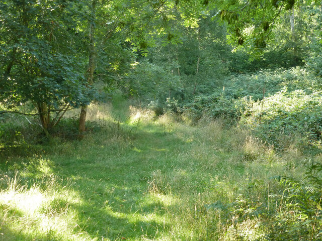
Brickkiln Ponds, located in Sussex, is a diverse and picturesque freshwater ecosystem encompassing a combination of lakes, pools, ponds, and freshwater marshes. The site covers a substantial area, providing a habitat for a wide range of flora and fauna.

The main feature of Brickkiln Ponds is its interconnected network of water bodies, which are primarily fed by streams and rainfall. These bodies of water vary in size and depth, creating a diverse landscape that supports various aquatic species. The lakes within the area are relatively large and deep, providing ideal conditions for larger fish species such as pike and perch.

In addition to the lakes, there are several smaller pools and ponds scattered throughout Brickkiln Ponds. These smaller water bodies offer a more sheltered environment and are often home to a rich diversity of amphibians, including frogs, toads, and newts. The calm and still waters of these pools provide ideal breeding grounds for these species.

Brickkiln Ponds also boasts a significant freshwater marsh, characterized by its wet and marshy terrain. This area is home to a variety of wetland plants, such as reeds, sedges, and rushes, which thrive in the moist conditions. These plants offer shelter and nesting sites for a multitude of bird species, including ducks, herons, and kingfishers.

Overall, Brickkiln Ponds provides a valuable and diverse habitat for a wide range of species. Its combination of lakes, pools, ponds, and freshwater marshes ensures a unique and thriving ecosystem that attracts nature enthusiasts and wildlife observers alike.

If you have any feedback on the listing, please let us know in the comments section below.

Brickkiln Ponds Images

Images are sourced within 2km of 50.876982/-0.9256866 or Grid Reference SU7509. Thanks to Geograph Open Source API. All images are credited.

Path on Mill Lane Millstream by path on Mill Lane
Path on Mill Lane
Millstream by path on Mill Lane
Cemetery Lane Cemetery Lane heading to South Lane
Cemetery Lane
Cemetery Lane heading to South Lane
Hollybank Woods
Hollybank Woods
Bridleway 533, Stansted Park Towards Stansted Forest.
Bridleway 533, Stansted Park
Towards Stansted Forest.
Tree clump in wheat field Nearly all, possibly not these, of the several clumps in the field are associated with excavations, according to Lidar scans, the bigger are mapped as old quarries, some might be old ponds. The field was within the park  of Stansted House, so the landscape value of the clumps would be valued. The field was not likely to be arable then.
Tree clump in wheat field
Nearly all, possibly not these, of the several clumps in the field are associated with excavations, according to Lidar scans, the bigger are mapped as old quarries, some might be old ponds. The field was within the park of Stansted House, so the landscape value of the clumps would be valued. The field was not likely to be arable then.
Tree clump in wheat field An old quarry. All of the several clumps in the field are associated with excavations, according to Lidar scans, the bigger are mapped as old quarries, some might be old ponds. The field was within the park  of Stansted House, so the landscape value of the clumps would be valued. The field was not likely to be arable then.
Tree clump in wheat field
An old quarry. All of the several clumps in the field are associated with excavations, according to Lidar scans, the bigger are mapped as old quarries, some might be old ponds. The field was within the park of Stansted House, so the landscape value of the clumps would be valued. The field was not likely to be arable then.
Tree clumps in wheat field All of the several clumps in the field are associated with excavations, according to Lidar scans, the bigger are mapped as old quarries, some might be old ponds. The field was within the park  of Stansted House, so the landscape value of the clumps would be valued. The field was not likely to be arable then.
Tree clumps in wheat field
All of the several clumps in the field are associated with excavations, according to Lidar scans, the bigger are mapped as old quarries, some might be old ponds. The field was within the park of Stansted House, so the landscape value of the clumps would be valued. The field was not likely to be arable then.
Partly harvested wheat field The combine harvester is at rest, probably for the day, nobody was around.
Partly harvested wheat field
The combine harvester is at rest, probably for the day, nobody was around.
Cattle, Stansted Park
Bridleway 535, Stansted Park A massive chestnut tree on the right.
Bridleway 535, Stansted Park
A massive chestnut tree on the right.
Stansted Forest - Lady's Walk This block of woodland had permissive access under the Defra scheme.
Stansted Forest - Lady's Walk
This block of woodland had permissive access under the Defra scheme.
Bridleway 535, Stansted Park Along the east edge of Stansted Forest.
Bridleway 535, Stansted Park
Along the east edge of Stansted Forest.
Path junction and stile, Stansted Forest Bridleway 535 goes left and right along the woodland edge, path  535_1 goes into the wood. The sign propped on the stile maps the additional permissive paths and areas offered under a Defra arrangement.
Path junction and stile, Stansted Forest
Bridleway 535 goes left and right along the woodland edge, path 535_1 goes into the wood. The sign propped on the stile maps the additional permissive paths and areas offered under a Defra arrangement.
Bridleway 535, Stansted Park Along the east edge of Stansted Forest.
Bridleway 535, Stansted Park
Along the east edge of Stansted Forest.
Footpath 535_1, Stansted Forest Towards Broad Walk.
Footpath 535_1, Stansted Forest
Towards Broad Walk.
Footpath 535_1, Stansted Forest Towards Broad Walk.
Footpath 535_1, Stansted Forest
Towards Broad Walk.
Footpath 535_1, Stansted Forest Towards the bridleway along the east edge of the forest.
Footpath 535_1, Stansted Forest
Towards the bridleway along the east edge of the forest.
Stacked timber, Stansted Forest By footpath 535_1.
Stacked timber, Stansted Forest
By footpath 535_1.
Show me another place!

Brickkiln Ponds is located at Grid Ref: SU7509 (Lat: 50.876982, Lng: -0.9256866)

Administrative County: West Sussex

District: Chichester

Police Authority: Sussex

What 3 Words

///chimp.tonsils.mermaids. Near Emsworth, Hampshire

Related Wikis

Stansted Park

Stansted Park (including Stansted House) is an Edwardian country house in the parish of Stoughton, West Sussex, England. It is near the city of Chichester...

Hollybank House, Emsworth

Hollybank House near Emsworth in Hampshire, England, is a building of historical significance and is Grade II listed on the English Heritage Register....

Westbourne, West Sussex

Westbourne is a village, civil parish and electoral ward in the Chichester District of West Sussex, England. It is located 0.5 miles (0.80 km) north east...

Racton Monument

Racton Monument (known locally as Racton Ruin) is a folly on a hill in Racton, West Sussex, England with views over Chichester Harbour and to the Isle...

Bourne (electoral division)

Bourne is an electoral division of West Sussex in the United Kingdom, and returns one member to sit on West Sussex County Council. The former County Councillor...

Racton

Racton is a hamlet in the Chichester district of West Sussex, England. It lies on the B2147 road 2.1 miles (3.4 km) northeast of Emsworth and within the...

Woodmancote, Chichester District

Woodmancote is a village in the Chichester district of West Sussex, England. It lies just off the B2147 road 2 miles (3.2 km) northeast of Emsworth. It...

Lordington House

Lordington House is a manor house near Walderton in West Sussex. It is a Grade II* listed building. == History == Lordington House was built around 1500...

Nearby Amenities

Located within 500m of 50.876982,-0.9256866
Barrier: stile
Foot: yes
Lat/Long: 50.8800519/-0.9253555
Barrier: stile
Lat/Long: 50.8726883/-0.9275052
Barrier: stile
Stile: stepover
Lat/Long: 50.8735874/-0.9258351
Barrier: stile
Lat/Long: 50.8737603/-0.926906
Barrier: stile
Lat/Long: 50.8745306/-0.9261507
Barrier: stile
Lat/Long: 50.874645/-0.9261087
The data included in this document is from www.openstreetmap.org. The data is made available under ODbL.

Have you been to Brickkiln Ponds?

Leave your review of Brickkiln Ponds below (or comments, questions and feedback).