Lovegrove's Pond

Lake, Pool, Pond, Freshwater Marsh in Oxfordshire South Oxfordshire

England

Lovegrove's Pond

Woodland, Checkendon Beeches to the west of Checkendon Court.
Woodland, Checkendon Credit: Andrew Smith

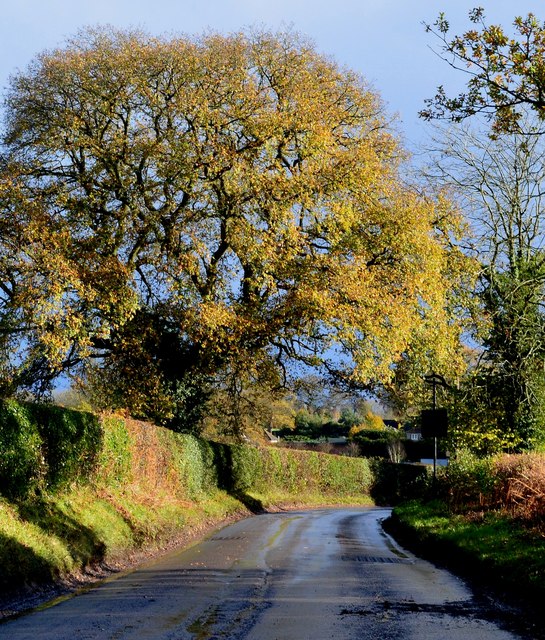
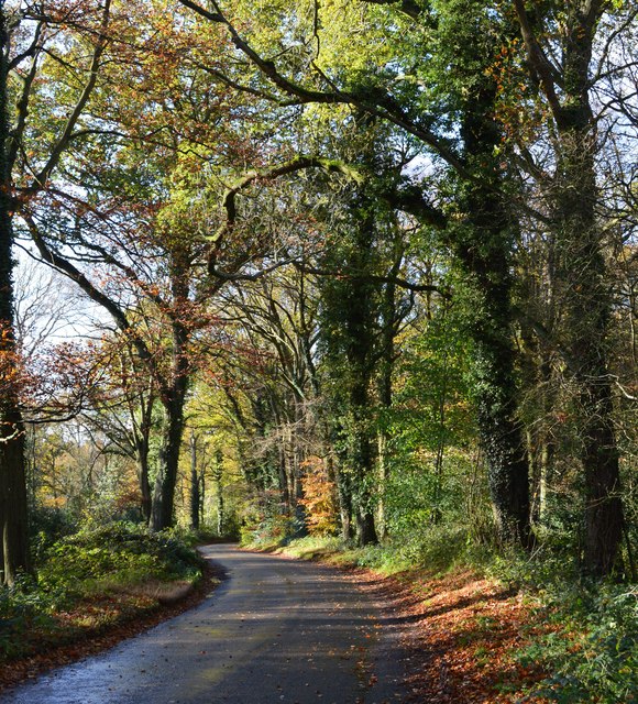
Lovegrove's Pond, located in Oxfordshire, England, is a picturesque freshwater marsh encompassing an area of approximately 5 acres. This natural beauty spot, often referred to as a pond, is a popular destination for nature enthusiasts and locals seeking tranquility in the heart of the countryside.

The pond boasts crystal-clear water, surrounded by lush vegetation that thrives in the marshy environment. Tall reeds, water lilies, and bulrushes line the edges of the pond, providing a habitat for a diverse range of wildlife. Visitors can observe various species of birds such as herons, mallards, and swans, gracefully gliding across the water or nesting in the surrounding trees.

The pond itself is relatively shallow, with an average depth of around 3 meters. It serves as a vital water source for the surrounding flora and fauna, as well as a breeding ground for amphibians and insects. The calm, still water reflects the surrounding landscape, creating a breathtaking view that changes with the seasons.

Lovegrove's Pond offers a serene and peaceful atmosphere, attracting visitors who enjoy walking, picnicking, or simply sitting by the water's edge to admire the natural beauty. The area is well-maintained, with designated paths and seating areas for visitors to appreciate the scenery comfortably.

Overall, Lovegrove's Pond in Oxfordshire is a charming freshwater marsh, providing a haven for wildlife and a tranquil retreat for those seeking solace in nature's embrace.

If you have any feedback on the listing, please let us know in the comments section below.

Lovegrove's Pond Images

Images are sourced within 2km of 51.54594/-1.0451356 or Grid Reference SU6683. Thanks to Geograph Open Source API. All images are credited.

Woodland, Checkendon Beeches to the west of Checkendon Court.
Woodland, Checkendon
Beeches to the west of Checkendon Court.
Pasture and farm buildings, Checkendon Corker's Farm viewed from the footpath passing to its west.
Pasture and farm buildings, Checkendon
Corker's Farm viewed from the footpath passing to its west.
Remains of the Polish Village After WW2 there were a lot of displaced Polish people who needed somewhere to live. Old military buildings provided accommodation for a Polish community here up until the 1960s.
Abandoned buildings from that time can still be seen in the woods.
History on <span class="nowrap"><a title="https://www.polishresettlementcampsintheuk.co.uk/checkendon.htm" rel="nofollow ugc noopener" href="https://www.polishresettlementcampsintheuk.co.uk/checkendon.htm">Link</a><img style="margin-left:2px;" alt="External link" title="External link - shift click to open in new window" src="https://s1.geograph.org.uk/img/external.png" width="10" height="10"/></span>
Remains of the Polish Village
After WW2 there were a lot of displaced Polish people who needed somewhere to live. Old military buildings provided accommodation for a Polish community here up until the 1960s. Abandoned buildings from that time can still be seen in the woods. History on LinkExternal link
Another Hut in the Woods Another one of the derelict buildings left over from WW2 which can still be seen in the woods round here. These were lived in up until the 1960s by community of Polish people displaced by the war.
History on <span class="nowrap"><a title="https://www.polishresettlementcampsintheuk.co.uk/checkendon.htm" rel="nofollow ugc noopener" href="https://www.polishresettlementcampsintheuk.co.uk/checkendon.htm">Link</a><img style="margin-left:2px;" alt="External link" title="External link - shift click to open in new window" src="https://s1.geograph.org.uk/img/external.png" width="10" height="10"/></span>
Another Hut in the Woods
Another one of the derelict buildings left over from WW2 which can still be seen in the woods round here. These were lived in up until the 1960s by community of Polish people displaced by the war. History on LinkExternal link
Houses in Stoke Row Looking towards Church View.
Houses in Stoke Row
Looking towards Church View.
Church View, Stoke Row
Kit Lane, Stoke Row
Kit Lane, Stoke Row
Basset Wood
Basset Wood
The Maharajah's Well, Stoke Row This is an unlikely looking structure to find in an Oxfordshire village. Its origins lie in the friendship that developed between Edward Anderton Reade, the son of a local squire who spent his working life in India, and the Maharajah of Benares. In Victorian times the villages of this part of Oxfordshire had only limited access to clean water bringing considerable hardship to the poor of the area. Learning of these difficulties, the Maharajah - who had remained loyal to the British during the Indian Mutiny of 1857 - determined that a charity should be set up to relieve the problem. The result was a well dug to a depth of 368 feet, a considerable engineering achievement. To honour the Maharajah, who never visited Britain, a splendid well canopy was built incorporating a gold elephant representing the Hindu god Ganesh. The well was used until the beginning of the Second World War although by that time most houses in the village had a mains connection. Today the well has been renovated and preserved and is maintained by the Maharajah's Well Trust.

The octagonal cottage to the right was built to house the well warden. The last warden died in 1979 since when it has been rented out to supplement the charity's income.
The Maharajah's Well, Stoke Row
This is an unlikely looking structure to find in an Oxfordshire village. Its origins lie in the friendship that developed between Edward Anderton Reade, the son of a local squire who spent his working life in India, and the Maharajah of Benares. In Victorian times the villages of this part of Oxfordshire had only limited access to clean water bringing considerable hardship to the poor of the area. Learning of these difficulties, the Maharajah - who had remained loyal to the British during the Indian Mutiny of 1857 - determined that a charity should be set up to relieve the problem. The result was a well dug to a depth of 368 feet, a considerable engineering achievement. To honour the Maharajah, who never visited Britain, a splendid well canopy was built incorporating a gold elephant representing the Hindu god Ganesh. The well was used until the beginning of the Second World War although by that time most houses in the village had a mains connection. Today the well has been renovated and preserved and is maintained by the Maharajah's Well Trust. The octagonal cottage to the right was built to house the well warden. The last warden died in 1979 since when it has been rented out to supplement the charity's income.
The Maharajah's Well, Stoke Row This is looking under the canopy of the well where the gold elephant takes pride of place. See <a href="https://www.geograph.org.uk/photo/7620533">SU6784 : The Maharajah's Well, Stoke Row</a> for a wider view and some historical notes.
The Maharajah's Well, Stoke Row
This is looking under the canopy of the well where the gold elephant takes pride of place. See SU6784 : The Maharajah's Well, Stoke Row for a wider view and some historical notes.
1 Langtree Cottages, Checkendon, Oxfordshire 1906 by Maxwell Ayrton in Arts and Crafts style. 

(Source:Historic England)
1 Langtree Cottages, Checkendon, Oxfordshire
1906 by Maxwell Ayrton in Arts and Crafts style. (Source:Historic England)
Foundry Cottage, Checkendon, Oxfordshire C17 with C20 windows. Brick ground floor with areas of flint; timber frame to first floor, rendered panels to left, brick infill to right. Old plain tile roof; brick stacks. 2-unit plan. 2-storey, 3-window range. Central 2-panel door with C20 gabled tile porch. 2-light casement to left. 2 single-light casements to right. Three 2-light casements to first floor. Roof hipped to right. Ridge stack to right and end stack to left.

(Source:Historic England)
Foundry Cottage, Checkendon, Oxfordshire
C17 with C20 windows. Brick ground floor with areas of flint; timber frame to first floor, rendered panels to left, brick infill to right. Old plain tile roof; brick stacks. 2-unit plan. 2-storey, 3-window range. Central 2-panel door with C20 gabled tile porch. 2-light casement to left. 2 single-light casements to right. Three 2-light casements to first floor. Roof hipped to right. Ridge stack to right and end stack to left. (Source:Historic England)
After rain, Stoke Row, Oxfordshire
Country lane, Ipsden, Oxfordshire
Byway, Checkendon, Oxfordshire
Autumn colours, Checkendon, Oxfordshire
Langtree Cottages in Checkendon
Country lane, Stoke Row, Oxfordshire
Show me another place!

Lovegrove's Pond is located at Grid Ref: SU6683 (Lat: 51.54594, Lng: -1.0451356)

Administrative County: Oxfordshire

District: South Oxfordshire

Police Authority: Thames Valley

What 3 Words

///workers.influencing.regulator. Near Rotherfield Peppard, Oxfordshire

Related Wikis

Checkendon

Checkendon is a village and civil parish about 6 miles (10 km) west of Henley-on-Thames in South Oxfordshire and about 9 miles (14 km) north west of Reading...

St Peter and St Paul, Checkendon

St Peter and St Paul is the Church of England parish church of Checkendon, a village in Oxfordshire, England. Its parish is part of the Deanery of Henley...

Exlade Street

Exlade Street is a hamlet in Checkendon civil parish in Oxfordshire, about 6 miles (9.7 km) northwest of Reading, in the Chiltern Hills. The hamlet is...

Ipsden Heath

Ipsden Heath is a 32-acre (13-hectare) woodland in the English county of Oxfordshire, within the Chiltern Area of Outstanding Natural Beauty. == References ==

The Oratory School

The Oratory School () is an HMC co-educational private Roman Catholic boarding and day school for pupils aged 11–18 located in Woodcote, 6 miles (9.7 km...

Hook End Recording Studios

Hook End Recording Studios was a recording studio located in Hook End Manor, a 16th-century Elizabethan house near Checkendon, Oxfordshire, England. Its...

Stoke Row

Stoke Row is a village and civil parish in the Chiltern Hills, about 5 miles (8 km) west of Henley-on-Thames in South Oxfordshire and about 9 miles (14...

Wyfold Court

Wyfold Court is a country house at Rotherfield Peppard in south Oxfordshire. It is a Grade II* listed building. By the year 2000, the estate had been converted...

Nearby Amenities

Located within 500m of 51.54594,-1.0451356
Created By: osmeditor2
Lat/Long: 51.543645/-1.0416583
Created By: osmeditor2
Lat/Long: 51.5431767/-1.042325
Created By: osmeditor2
Lat/Long: 51.5427417/-1.04301
Created By: osmeditor2
Lat/Long: 51.5422967/-1.0437133
Checkendon
Created By: osmeditor2
Place: village
Lat/Long: 51.5439758/-1.0403108
Bus Stop
Lat/Long: 51.5441046/-1.0412903
Bus Stop
Whitehall Lane
Naptan AtcoCode: 340001694OUT
Naptan Bearing: SW
Naptan CommonName: Whitehall Lane
Naptan Indicator: Corner
Naptan Landmark: Bus Shelter
Naptan NaptanCode: oxfgatgj
Naptan Street: Uxmore Road
Naptan Verified: no
Source: naptan_import
Lat/Long: 51.5440119/-1.0412894
Barrier: kissing_gate
Lat/Long: 51.5423068/-1.0459523
Barrier: kissing_gate
Bicycle: no
Foot: yes
Lat/Long: 51.5436233/-1.0461564
Barrier: kissing_gate
Bicycle: no
Foot: yes
Lat/Long: 51.5494198/-1.0424205
Barrier: kissing_gate
Bicycle: no
Foot: yes
Lat/Long: 51.5480189/-1.0438027
Barrier: kissing_gate
Bicycle: no
Foot: yes
Lat/Long: 51.5487398/-1.0507385
Bench
Lat/Long: 51.542238/-1.0443628
Barrier: stile
Foot: yes
Material: wood
Note: disused
Stile: stepover
Lat/Long: 51.5420915/-1.0427932
Barrier: stile
Foot: yes
Material: wood
Note: disused
Stile: stepover
Lat/Long: 51.5477845/-1.0508169
Telephone
Defibrillator
Booth: K6
Covered: booth
Defibrillator Location: inside old red phone box, Uxmore Road, Checkendon
Emergency: defibrillator
Man Made: telephone_box
Lat/Long: 51.5441303/-1.0411583
Direction: 135
Fixme: survey for panel count
Generator Method: photovoltaic
Generator Output Electricity: yes
Generator Solar Modules: 14
Generator Source: solar
Generator Type: solar_photovoltaic_panel
Location: roof
Power: generator
Lat/Long: 51.5415286/-1.0446939
Fixme: solar panel?
Lat/Long: 51.544327/-1.0384648
Direction: 200
Fixme: survey for panel count
Generator Method: photovoltaic
Generator Output Electricity: yes
Generator Solar Modules: 12
Generator Source: solar
Generator Type: solar_photovoltaic_panel
Location: roof
Power: generator
Lat/Long: 51.5449078/-1.0400448
The data included in this document is from www.openstreetmap.org. The data is made available under ODbL.

Have you been to Lovegrove's Pond?

Leave your review of Lovegrove's Pond below (or comments, questions and feedback).