Virda Water

Lake, Pool, Pond, Freshwater Marsh in Shetland

Scotland

Virda Water

Fetlar Gardens On Fetlar, sheep are everywhere - so vegetables were grown inside these little 'walled gardens' to protect them from the sheep.
Fetlar Gardens Credit: Anne Burgess

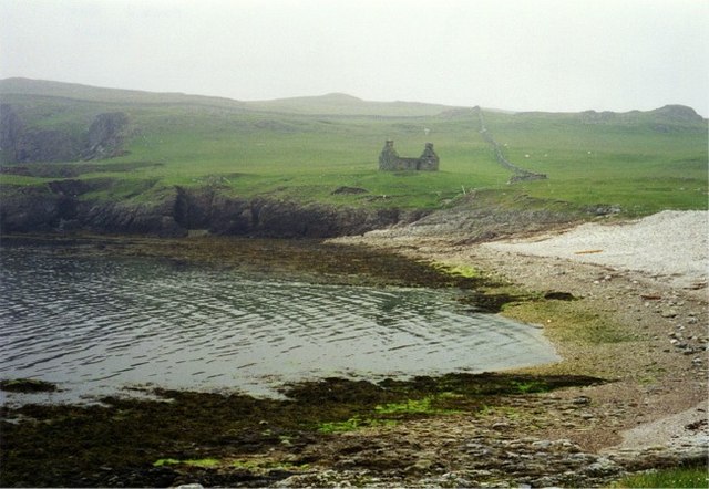
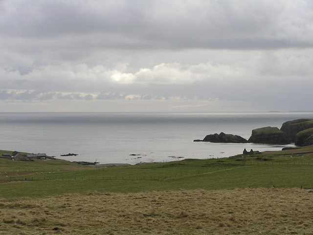
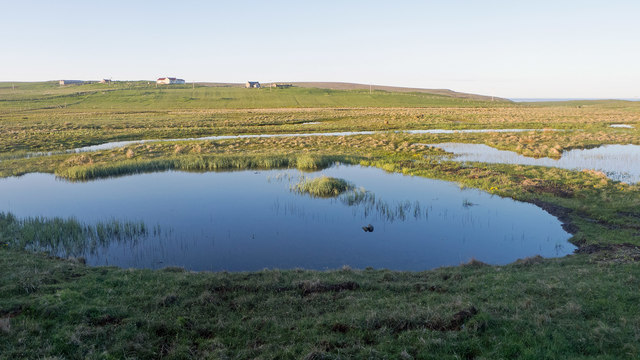
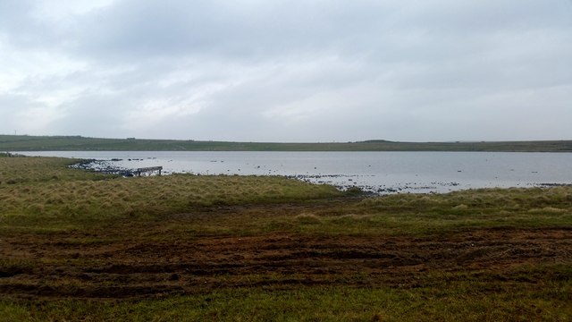
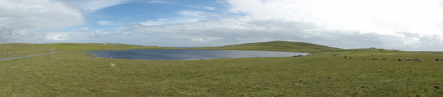
Virda Water is a freshwater loch located in the Shetland Islands, an archipelago in the North Atlantic Ocean, off the northeastern coast of Scotland. Also referred to as a lake, pool, pond, or freshwater marsh, it is a significant natural feature in the region.

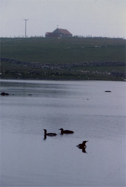
Covering an area of approximately 3 hectares, Virda Water is surrounded by a mix of moorland and peat bogs. Its crystal-clear waters, fed by rainfall and runoff from surrounding hills, support a diverse range of aquatic life. The loch is home to various species of fish, including brown trout and Arctic char, as well as a variety of waterfowl such as mallards and tufted ducks.

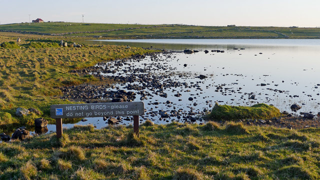
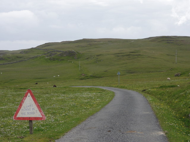
The surrounding area of Virda Water is characterized by its natural beauty. The loch is nestled amidst rolling hills and heather-covered moorlands, providing a picturesque backdrop for outdoor activities. Visitors to Virda Water can enjoy walking, hiking, and birdwatching, taking in the peaceful atmosphere and the breathtaking views.

The loch also serves as an important water source for nearby communities and agriculture. Its pristine freshwater is used for various purposes, including drinking water supply and irrigation for local farms.

Overall, Virda Water is a valuable natural resource and a haven for wildlife in the Shetland Islands. Its ecological significance, combined with its scenic beauty, make it a popular destination for both locals and tourists seeking a tranquil retreat in the midst of nature.

If you have any feedback on the listing, please let us know in the comments section below.

Virda Water Images

Images are sourced within 2km of 60.583258/-0.82254917 or Grid Reference HU6489. Thanks to Geograph Open Source API. All images are credited.

Fetlar Gardens On Fetlar, sheep are everywhere - so vegetables were grown inside these little 'walled gardens' to protect them from the sheep.
Fetlar Gardens
On Fetlar, sheep are everywhere - so vegetables were grown inside these little 'walled gardens' to protect them from the sheep.
Burn flowing into Wick of Aith, Fetlar
Funzie Bay, Fetlar
Funzie Bay, Fetlar
Aith Ness The cliffs below Gillis Field and the Head of Lambhoga are visible in the distance.
Aith Ness
The cliffs below Gillis Field and the Head of Lambhoga are visible in the distance.
Rain Geese on Loch of Funzie, Fetlar Rain Goose is the local name for Red-throated Diver (Gavia stellata).
Rain Geese on Loch of Funzie, Fetlar
Rain Goose is the local name for Red-throated Diver (Gavia stellata).
Aithbank, Fetlar The house has since been refurbished as a camping booth.
Aithbank, Fetlar
The house has since been refurbished as a camping booth.
Funzie Bay, Fetlar
Funzie Bay, Fetlar
Funzie Bay, Fetlar
Funzie Bay, Fetlar
Aith Ness from Wick of Tresta
The Mires of Fundy - RSPB Reserve The view from the hide at the Mires of Fundy.  All quiet on a sunny Spring evening although the red-necked phalaropes were thought to be resident.
The Mires of Fundy - RSPB Reserve
The view from the hide at the Mires of Fundy. All quiet on a sunny Spring evening although the red-necked phalaropes were thought to be resident.
Loch of Funzie exhortation A bird watcher was incensed having seen a Fetlar islander go fishing in his waders for trout in this section of Loch of Funzie.  And despite the notice!!  All for the protection of red-necked phalaropes, a bird uncommon in the UK but not so worldwide.
Loch of Funzie exhortation
A bird watcher was incensed having seen a Fetlar islander go fishing in his waders for trout in this section of Loch of Funzie. And despite the notice!! All for the protection of red-necked phalaropes, a bird uncommon in the UK but not so worldwide.
Funzie Bay Across the beach at Funzie  ancient cobbles are set into the cliffs; they were squashed and stretched under immense heat and pressure 400 million years ago.

See  <span class="nowrap"><a title="http://www.shetland-heritage.co.uk/downloads/resources/trailleaflets/Shetland_rocks.pdf" rel="nofollow ugc noopener" href="http://www.shetland-heritage.co.uk/downloads/resources/trailleaflets/Shetland_rocks.pdf">Link</a><img style="margin-left:2px;" alt="External link" title="External link - shift click to open in new window" src="https://s1.geograph.org.uk/img/external.png" width="10" height="10"/></span>
Funzie Bay
Across the beach at Funzie ancient cobbles are set into the cliffs; they were squashed and stretched under immense heat and pressure 400 million years ago. See LinkExternal link
Elongated cobbles in the rocks at Funzie Across the beach at Funzie  ancient cobbles are set into the cliffs; they were squashed and stretched under immense heat and pressure 400 million years ago.

See  <span class="nowrap"><a title="http://www.shetland-heritage.co.uk/downloads/resources/trailleaflets/Shetland_rocks.pdf" rel="nofollow ugc noopener" href="http://www.shetland-heritage.co.uk/downloads/resources/trailleaflets/Shetland_rocks.pdf">Link</a><img style="margin-left:2px;" alt="External link" title="External link - shift click to open in new window" src="https://s1.geograph.org.uk/img/external.png" width="10" height="10"/></span>
Elongated cobbles in the rocks at Funzie
Across the beach at Funzie ancient cobbles are set into the cliffs; they were squashed and stretched under immense heat and pressure 400 million years ago. See LinkExternal link
Loch of Funzie
Loch of Funzie
Unsurfaced track View along the non surfaced track near Aithbank.
Unsurfaced track
View along the non surfaced track near Aithbank.
Loch of Funzie View of the Loch of Funzie
Loch of Funzie
View of the Loch of Funzie
Lambs playing in the road Hand made road warning sign, "Lambs playing in the road".
Lambs playing in the road
Hand made road warning sign, "Lambs playing in the road".
Cattle Grid Cattle grid installation.
Cattle Grid
Cattle grid installation.
Show me another place!

Virda Water is located at Grid Ref: HU6489 (Lat: 60.583258, Lng: -0.82254917)

Unitary Authority: Shetland Islands

Police Authority: Highlands and Islands

What 3 Words

///clotting.magma.tomorrow. Near Houbie, Shetland Islands

Related Wikis

Fetlar

Fetlar is one of the North Isles of Shetland, Scotland, with a usually resident population of 61 at the time of the 2011 census. Its main settlement is...

Haltadans

Haltadans, also known as Fairy Ring or Haltadans stone circle, is a stone circle on the island of Fetlar in Shetland, Scotland. This site is a ring of...
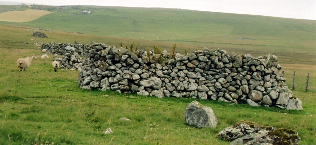
Funzie Girt

Funzie Girt (; Scots: Funyie Girt "Finns' dyke") is an ancient dividing wall that was erected from north to south across the island of Fetlar in Shetland...

Brough Lodge

Brough Lodge is a 19th-century Gothic mansion on Fetlar, one of the Shetland Islands, in northern Scotland. Built by the Nicolson family, who were responsible...

Nearby Amenities

Located within 500m of 60.583258,-0.82254917
Power: pole
Lat/Long: 60.5874947/-0.8240088
Power: pole
Lat/Long: 60.5873929/-0.823406
Power: pole
Lat/Long: 60.5872766/-0.8226686
Power: pole
Lat/Long: 60.587155/-0.8219555
Power: pole
Lat/Long: 60.5869185/-0.8205722
Power: pole
Lat/Long: 60.5867044/-0.8192482
Power: pole
Lat/Long: 60.5864797/-0.8179188
Power: pole
Lat/Long: 60.5862484/-0.8166028
The data included in this document is from www.openstreetmap.org. The data is made available under ODbL.

Have you been to Virda Water?

Leave your review of Virda Water below (or comments, questions and feedback).