Bradder's Pond
Lake, Pool, Pond, Freshwater Marsh in Nottinghamshire Newark and Sherwood
England
Bradder's Pond

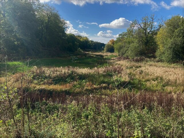
Bradder's Pond, located in Nottinghamshire, is a pristine freshwater pond nestled in the heart of a picturesque landscape. This serene body of water, often referred to as a pond or a pool, covers an area of approximately 2 acres and is surrounded by lush vegetation and diverse wildlife. It is a popular destination for nature enthusiasts, anglers, and those seeking tranquility away from the hustle and bustle of urban life.
The pond is characterized by its crystal-clear waters, which shimmer under the sunlight. It is fed by natural springs and rainfall, ensuring a constant supply of fresh water and contributing to its remarkable clarity. The depth of the pond varies, with some areas reaching up to 10 feet, making it an ideal habitat for a wide range of aquatic fauna and flora.
The shores of Bradder's Pond are lined with reeds, bulrushes, and water lilies, creating a vibrant and colorful ecosystem. This lush vegetation provides habitat and shelter for various species of birds, insects, and amphibians. Visitors to the pond can often spot ducks, swans, and herons gracefully gliding across the water or resting on the banks.
Anglers are drawn to Bradder's Pond due to its abundant fish population. It is home to a variety of freshwater fish, including perch, roach, bream, and carp. Fishing enthusiasts can be seen casting their lines from the banks, hoping to catch a prized specimen.
Bradder's Pond offers a peaceful and idyllic setting for visitors to relax and immerse themselves in the beauty of nature. Its tranquil ambiance, diverse wildlife, and recreational opportunities make it a cherished natural gem in Nottinghamshire.
If you have any feedback on the listing, please let us know in the comments section below.
Bradder's Pond Images
Images are sourced within 2km of 53.119527/-1.1403704 or Grid Reference SK5758. Thanks to Geograph Open Source API. All images are credited.


Bradder's Pond is located at Grid Ref: SK5758 (Lat: 53.119527, Lng: -1.1403704)
Administrative County: Nottinghamshire
District: Newark and Sherwood
Police Authority: Nottinghamshire
What 3 Words
///dignity.upwardly.motels. Near Rainworth, Nottinghamshire
Nearby Locations
Related Wikis

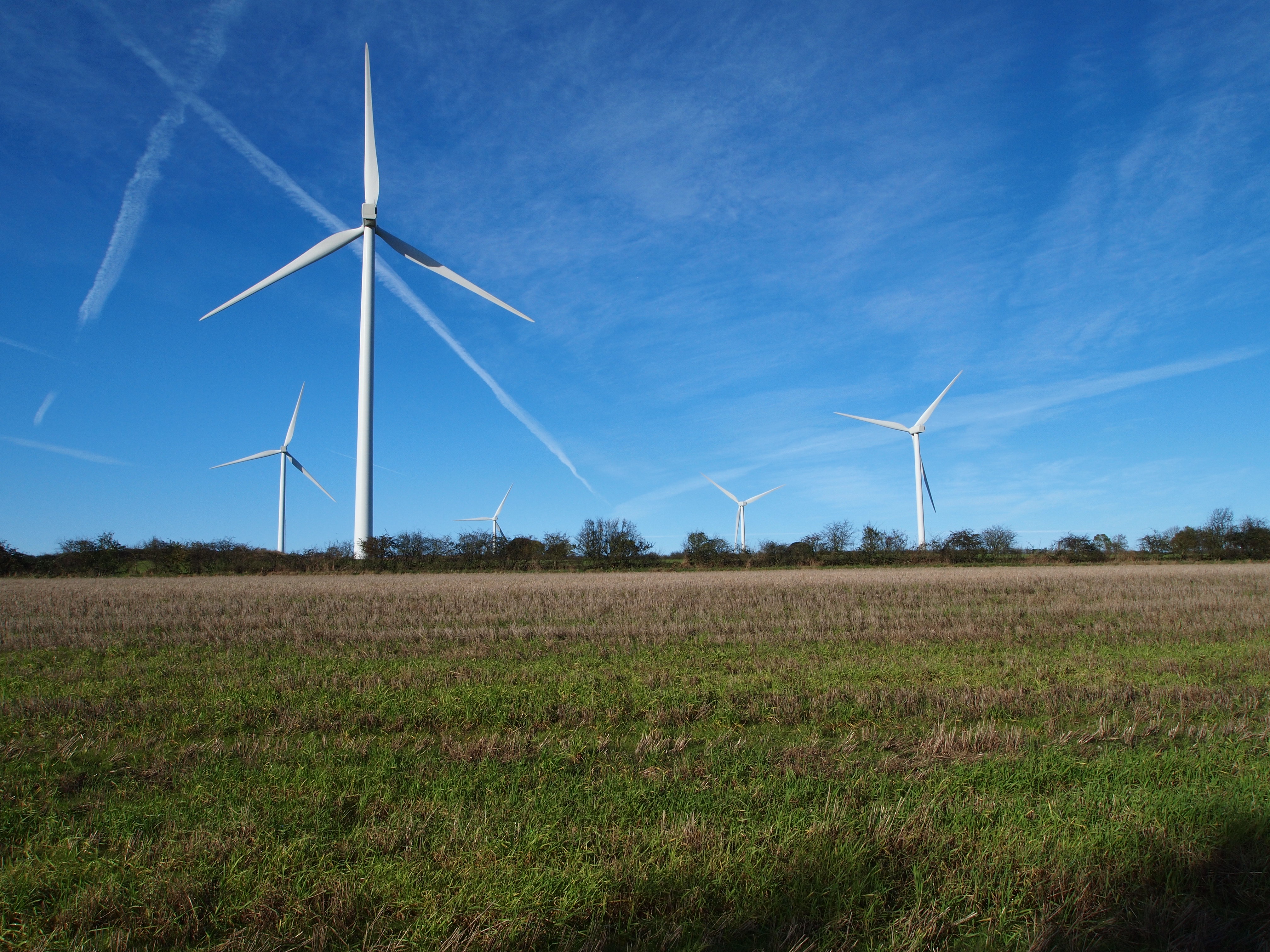
Lindhurst Wind Farm
Lindhurst Wind Farm is a power-producing wind farm in Lindhurst parish near Mansfield, England. Built for Npower Renewables, it produces electricity from...
Dawn House School
Dawn House School (commonly referred to as Dawn House) is a specialist school run by the charity Speech and Language UK for children with severe or complex...
Rainworth
Rainworth is a village in the ceremonial county of Nottinghamshire in the East Midlands of England. It is split between the local government districts...
Lindhurst
Lindhurst is a civil parish and hamlet in the Newark and Sherwood district, is 120 miles (190 km) north west of London, 11 miles (18 km) north of Nottingham...
Joseph Whitaker School
Joseph Whitaker School is a secondary school with academy status in Rainworth near Mansfield, Nottinghamshire in England. The school takes its name from...
Rainworth Miners Welfare F.C.
Rainworth Miners Welfare Football Club is a football club formed in 1922 and based in Rainworth, near Mansfield, Nottinghamshire, England. == History... ==
Blidworth and Rainworth railway station
Blidworth and Rainworth railway station was a railway station which served the villages of Blidworth and Rainworth, Nottinghamshire, England. == History... ==
Blidworth Welfare F.C.
Blidworth Welfare Football Club is a football club based in Blidworth, near Mansfield, Nottinghamshire, England. They are currently members of the Central...
Related Videos

Keep walking
Date 18/09/2022 Tune in Sunday: https://sfcc.online.church Romans 14:11 Micah 6:8 Isaiah 1:17.


FSTV1 Central during Holiday, 3/7/21
0:00 FSTV2 ident 0:04 FSTV2 programme bumper 0:07 Fourplus sponsor 0:12 FSTV2 break bumper Only broadcasts to world ...

DD HAMMOCK TARP CAMPING in the woods - wild camping #wildcampinguk #tarptent #ddtarp #woodlandcamp
First wild camp of the year, decided to take the tarp out and try a new configuration. Nice cold night for it, dropped to minus 4.
Nearby Amenities
Located within 500m of 53.119527,-1.1403704Have you been to Bradder's Pond?
Leave your review of Bradder's Pond below (or comments, questions and feedback).