Drayton Reservoir

Lake, Pool, Pond, Freshwater Marsh in Northamptonshire

England

Drayton Reservoir

Braunston Tunnel, west portal One of the longer canal tunnels, at just under 2 km. It is wide enough for two narrowboats to pass. The west portal of the tunnel is Listed Grade II.
Braunston Tunnel, west portal Credit: Alan Murray-Rust

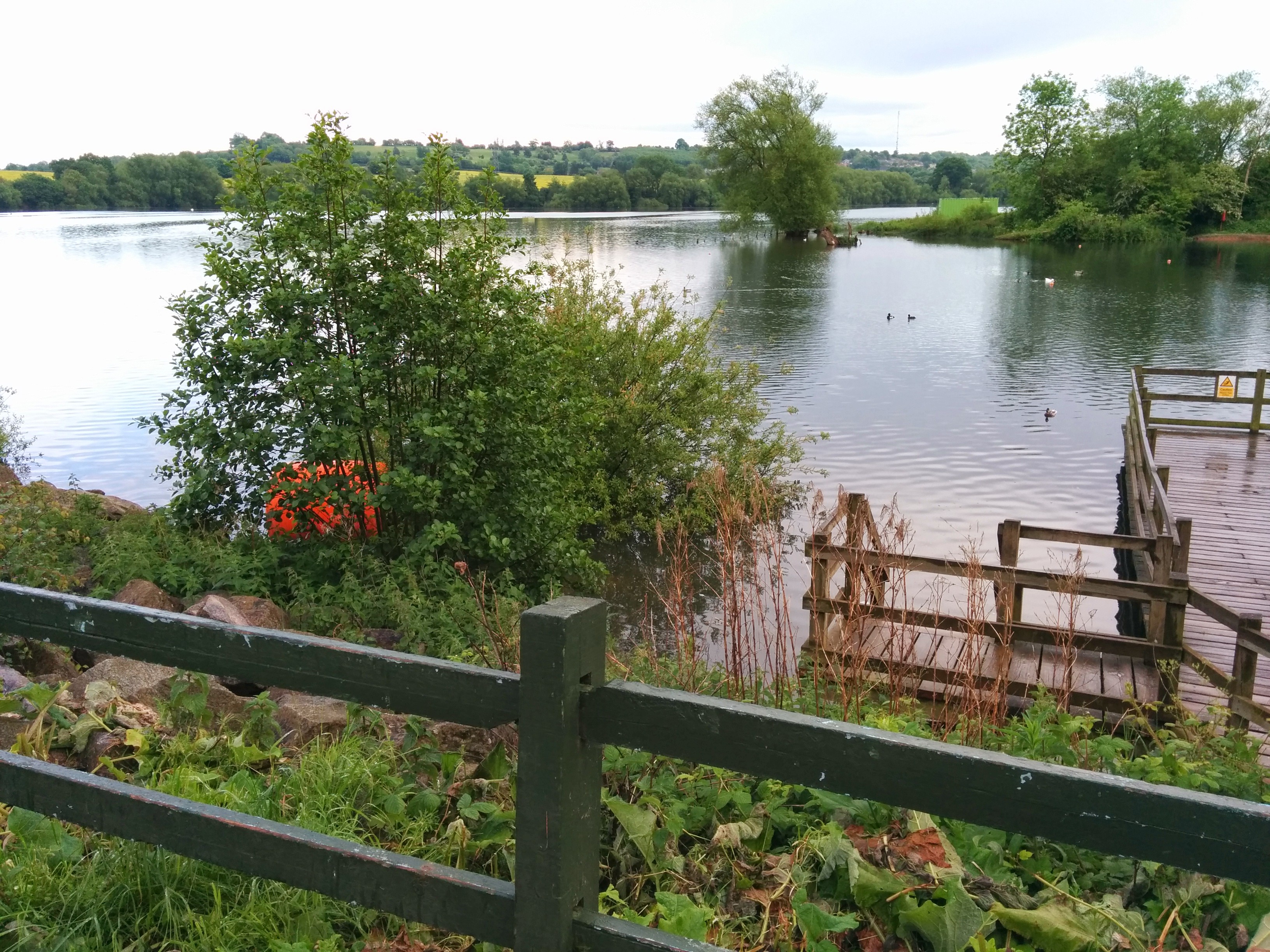
Located in the county of Northamptonshire, Drayton Reservoir is a popular freshwater lake, covering an area of approximately 100 acres. Originally constructed in the late 1960s as a water supply reservoir, it has since become a renowned destination for anglers, birdwatchers, and nature enthusiasts.

The reservoir boasts a diverse range of aquatic flora and fauna, making it a haven for wildlife. Its crystal-clear waters are home to a variety of fish species, including carp, pike, roach, and bream, attracting anglers from far and wide. Fishermen can be seen lining the banks, casting their lines in search of a prized catch.

In addition to its fishing opportunities, Drayton Reservoir is a haven for birdwatchers. The surrounding marshland and reed beds provide an ideal habitat for numerous bird species, such as great crested grebes, tufted ducks, and common terns. Ornithologists can observe these birds from specially constructed hides, strategically placed around the reservoir.

The tranquil atmosphere and picturesque surroundings make Drayton Reservoir a popular destination for leisurely walks and picnics. Its well-maintained footpaths allow visitors to explore the area and take in the stunning views of the water and surrounding countryside.

Drayton Reservoir also serves as an important water source for the local area, providing a reliable supply to nearby towns and villages. Its strategic location and ample capacity ensure a steady supply of fresh water throughout the year.

Overall, Drayton Reservoir in Northamptonshire offers a diverse range of recreational activities, from fishing to birdwatching, against a backdrop of natural beauty.

If you have any feedback on the listing, please let us know in the comments section below.

Drayton Reservoir Images

Images are sourced within 2km of 52.278334/-1.1693698 or Grid Reference SP5664. Thanks to Geograph Open Source API. All images are credited.

Braunston Tunnel, west portal One of the longer canal tunnels, at just under 2 km. It is wide enough for two narrowboats to pass. The west portal of the tunnel is Listed Grade II.
Braunston Tunnel, west portal
One of the longer canal tunnels, at just under 2 km. It is wide enough for two narrowboats to pass. The west portal of the tunnel is Listed Grade II.
Lock 4, Braunston, 1968 There are six locks on the Grand Union Canal up from the Oxford Canal level to Braunston Tunnel.
Lock 4, Braunston, 1968
There are six locks on the Grand Union Canal up from the Oxford Canal level to Braunston Tunnel.
In lock 5, Braunston, 1968 There are six locks on the Grand Union Canal up from the Oxford Canal level to Braunston Tunnel.
In lock 5, Braunston, 1968
There are six locks on the Grand Union Canal up from the Oxford Canal level to Braunston Tunnel.
Above top lock, Braunston, 1968 There are six locks on the Grand Union Canal up from the Oxford Canal level to Braunston Tunnel.
Above top lock, Braunston, 1968
There are six locks on the Grand Union Canal up from the Oxford Canal level to Braunston Tunnel.
Looking out of Braunston Tunnel, west end, 1968 No towpath, the ramp up for horses to cross over the top may just be made out.
Looking out of Braunston Tunnel, west end, 1968
No towpath, the ramp up for horses to cross over the top may just be made out.
Welton Wharf A few narrowboats are normally moored here on the Grand Union Canal by bridge 6, just east of Braunston Tunnel.
Welton Wharf
A few narrowboats are normally moored here on the Grand Union Canal by bridge 6, just east of Braunston Tunnel.
Approaching Braunston Tunnel Here the Grand Union Canal approaches the eastern portal of the 2,042 yard Braunston Tunnel. To the right are Bridge Spinneys whose trees reach down to the water's edge and overhang the canal. Autumn conditions on the canals, with golden leaves and milky light, can be stunningly beautiful but create a headache for boaters when fallen leaves clog the propeller. A short sharp burst of reverse usually clears the problem.
Approaching Braunston Tunnel
Here the Grand Union Canal approaches the eastern portal of the 2,042 yard Braunston Tunnel. To the right are Bridge Spinneys whose trees reach down to the water's edge and overhang the canal. Autumn conditions on the canals, with golden leaves and milky light, can be stunningly beautiful but create a headache for boaters when fallen leaves clog the propeller. A short sharp burst of reverse usually clears the problem.
Approaching Braunston Tunnel Trees overhang the Grand Union Canal to the east of the 2,042 yard Braunston Tunnel.
Approaching Braunston Tunnel
Trees overhang the Grand Union Canal to the east of the 2,042 yard Braunston Tunnel.
Braunston Road, Daventry
Braunston Road, Daventry At the end of Western Avenue
Braunston Road, Daventry
At the end of Western Avenue
Braunston Road, Daventry
Braunston Tunnel Western Portal Opened in 1976, the tunnel is 2042 yards / 1867 metres long. Construction was hindered by quicksand. A directional error during the building left the tunnel with a slight bend.

The tunnel is wide enough to allow two narrowboats to pass in opposite directions. Widebeam boats must get permission before entering.
Braunston Tunnel Western Portal
Opened in 1976, the tunnel is 2042 yards / 1867 metres long. Construction was hindered by quicksand. A directional error during the building left the tunnel with a slight bend. The tunnel is wide enough to allow two narrowboats to pass in opposite directions. Widebeam boats must get permission before entering.
Braunston Tunnel Eastern Portal Braunston Tunnel is 2,042 yards (1,867m) long.  Built by Jessop and Barnes and completed in 1796, the tunnel has no towpath and is 4.8m wide by 3.76m high.

Construction was delayed by soil movement which has left the tunnel with a slight 'S' bend. There is room for two 7ft (2.13m) beam boats to pass. There are three air shafts along its length.

The tunnel passes underground alongside another Grand Union Canal feature, Drayton Reservoir, from which the feeder enters the canal at the east end of the tunnel.
Braunston Tunnel Eastern Portal
Braunston Tunnel is 2,042 yards (1,867m) long. Built by Jessop and Barnes and completed in 1796, the tunnel has no towpath and is 4.8m wide by 3.76m high. Construction was delayed by soil movement which has left the tunnel with a slight 'S' bend. There is room for two 7ft (2.13m) beam boats to pass. There are three air shafts along its length. The tunnel passes underground alongside another Grand Union Canal feature, Drayton Reservoir, from which the feeder enters the canal at the east end of the tunnel.
On the Grand Union Canal Near Welton.
On the Grand Union Canal
Near Welton.
The Grand Union Canal Near Welton.
The Grand Union Canal
Near Welton.
Towards Braunston Tunnel On the Grand Union Canal.
Towards Braunston Tunnel
On the Grand Union Canal.
Leamington Way, Daventry
Braunston Road, Daventry
Show me another place!

Drayton Reservoir is located at Grid Ref: SP5664 (Lat: 52.278334, Lng: -1.1693698)

Unitary Authority: West Northamptonshire

Police Authority: Northamptonshire

What 3 Words

///exit.expecting.influence. Near Daventry, Northamptonshire

Nearby Locations

Drayton Reservoir

Related Wikis

Drayton Reservoir

Drayton Reservoir is a reservoir in Daventry, Northamptonshire, England. The reservoir is accessible from the A361 near the northern edge of Daventry....
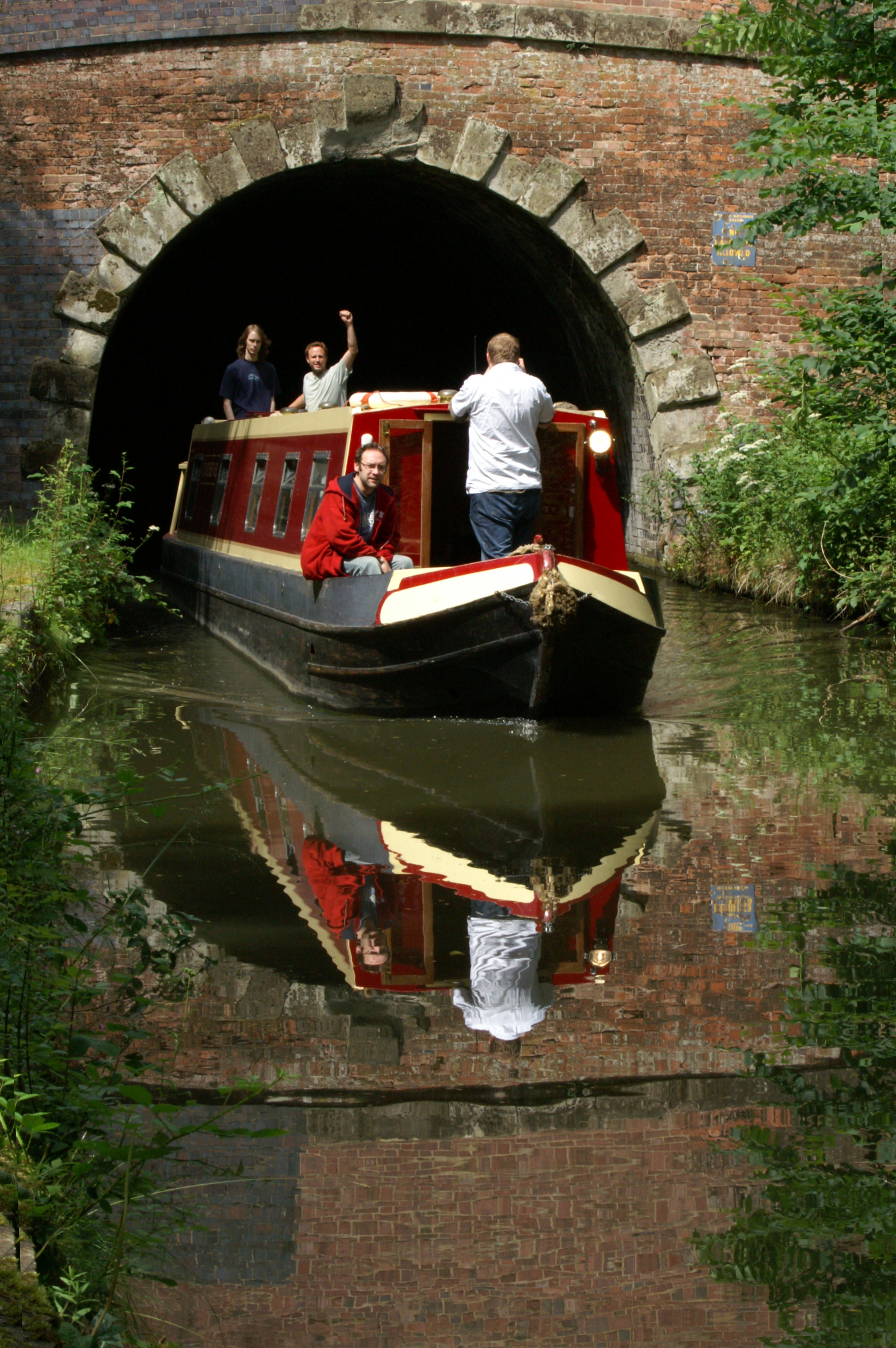
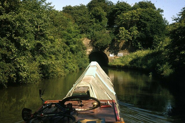
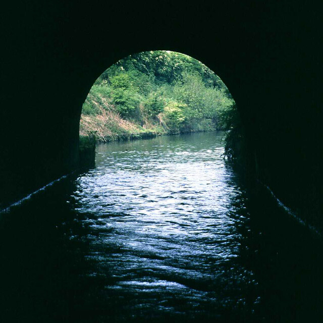
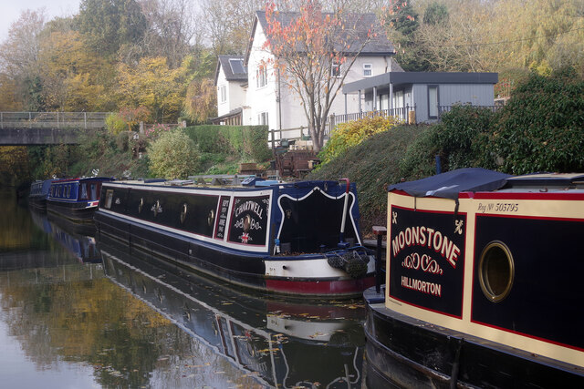
Braunston Tunnel

Braunston Tunnel is on the Grand Union Canal about 830 yards (760 m) east of Braunston, Northamptonshire, England top lock. It is in the northern outskirts...
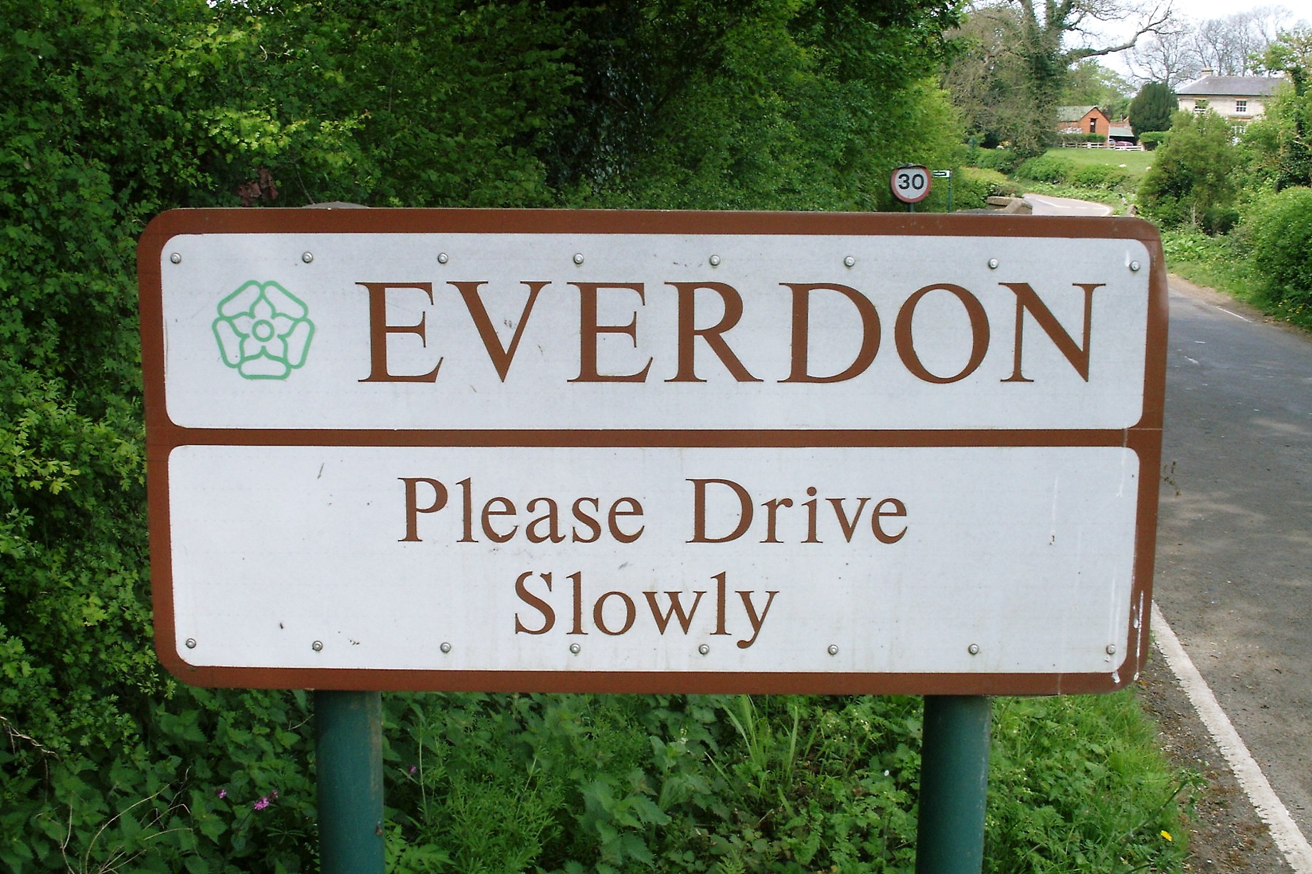
Everdon

Everdon is a village in West Northamptonshire in England, some 3 miles (4.8 km) south of Daventry. The population of the civil parish (including Little...

Daventry Country Park

Daventry Country Park is a 66-hectare (160-acre) Local Nature Reserve and country park on the north-eastern outskirts of Daventry in Northamptonshire,...

The Parker E-ACT Academy

The Parker E-ACT Academy (formerly William Parker School) is an 11–18 secondary school with academy status situated in Daventry, Northamptonshire, England...

Daventry University Technical College

Daventry University Technical College was a University technical college (UTC) in Daventry, Northamptonshire, England which opened in September 2013. The...

Welton, Northamptonshire

Welton is a village and civil parish in the English county of Northamptonshire. The village is located 2.6 miles (4.2 km) north of the nearest town Daventry...

Daventry United F.C.

Daventry United Football Club was an association football club based in Daventry, England. The club played in the United Counties League Premier Division...

Nearby Amenities

Located within 500m of 52.278334,-1.1693698
Mini Roundabout
Direction: clockwise
Fixme: looks like a real roundaout on Bing/OSSSV
Lat/Long: 52.2792961/-1.1724352
Mini Roundabout
Direction: clockwise
Fixme: is this large central island really navigable, or is it roundabout?
Lat/Long: 52.2812627/-1.1720888
Crossing
Button Operated: yes
Crossing: traffic_signals
Crossing Island: no
Crossing Markings: dots
Crossing Ref: toucan
Tactile Paving: yes
Lat/Long: 52.2762656/-1.1661744
Crossing
Button Operated: yes
Crossing: traffic_signals
Crossing Island: no
Crossing Markings: dots
Crossing Ref: toucan
Tactile Paving: yes
Lat/Long: 52.2763061/-1.1663296
Post Office
Select Convenience Store
Addr City: Daventry
Addr Country: GB
Addr Housenumber: 1
Addr Postcode: NN11 8AQ
Addr Street: Hardwick Hall Way
Fhrs Authority: Daventry
Fhrs Id: 170584
Fhrs Local Authority Id: PI/000017976
Ref Pol Id: 144683
Shop: convenience
Source: Bing
Lat/Long: 52.2805111/-1.1713744
Post Box
Operator: Royal Mail
Operator Wikidata: Q638098
Post Box Type: pillar
Ref: NN11 153
Source: Bing
Lat/Long: 52.2809615/-1.1707054
Pub
Middlemore Farm
Addr City: Daventry
Addr Country: GB
Addr Postcode: NN11 8AE
Addr Street: Hidcote Way
Fhrs Authority: Daventry
Fhrs Id: 851326
Fhrs Local Authority Id: PI/000047499
Outdoor Seating: terrace
Smoking: outside
Lat/Long: 52.2814674/-1.1728169
Noexit: yes
Lat/Long: 52.2821174/-1.1715122
Daventry Court Hotel
Aeroway: helipad
Lat/Long: 52.2786622/-1.1641702
Crossing
Kerb: lowered
Lat/Long: 52.2815819/-1.1681027
Crossing
Lat/Long: 52.2820465/-1.1682749
Crossing
Kerb: lowered
Lat/Long: 52.281607/-1.1679364
Crossing
Lat/Long: 52.281994/-1.1684229
Artwork Type: sculpture
Material: steel
Tourism: artwork
Lat/Long: 52.2797821/-1.1706612
Entrance: main
Lat/Long: 52.2814336/-1.1728536
Middlemore
Place: suburb
Lat/Long: 52.2801518/-1.1733774
Generator Method: photovoltaic
Generator Output Electricity: yes
Generator Source: solar
Generator Type: solar_photovoltaic_panel
Location: roof
Power: generator
Lat/Long: 52.2762948/-1.1635637
Generator Method: photovoltaic
Generator Output Electricity: yes
Generator Source: solar
Generator Type: solar_photovoltaic_panel
Location: roof
Power: generator
Lat/Long: 52.2766/-1.1667985
Generator Method: photovoltaic
Generator Output Electricity: yes
Generator Source: solar
Generator Type: solar_photovoltaic_panel
Location: roof
Power: generator
Lat/Long: 52.2758123/-1.1658999
Generator Method: photovoltaic
Generator Output Electricity: yes
Generator Source: solar
Generator Type: solar_photovoltaic_panel
Location: roof
Power: generator
Lat/Long: 52.2757959/-1.1657229
Generator Method: photovoltaic
Generator Output Electricity: yes
Generator Source: solar
Generator Type: solar_photovoltaic_panel
Location: roof
Power: generator
Lat/Long: 52.2757582/-1.1654359
Generator Method: photovoltaic
Generator Output Electricity: yes
Generator Source: solar
Generator Type: solar_photovoltaic_panel
Location: roof
Power: generator
Lat/Long: 52.2757253/-1.1651543
Generator Method: photovoltaic
Generator Output Electricity: yes
Generator Source: solar
Generator Type: solar_photovoltaic_panel
Location: roof
Power: generator
Lat/Long: 52.275512/-1.1656156
Generator Method: photovoltaic
Generator Output Electricity: yes
Generator Source: solar
Generator Type: solar_photovoltaic_panel
Location: roof
Power: generator
Lat/Long: 52.2754923/-1.1654788
Generator Method: photovoltaic
Generator Output Electricity: yes
Generator Source: solar
Generator Type: solar_photovoltaic_panel
Location: roof
Power: generator
Lat/Long: 52.2747373/-1.1659455
Generator Method: photovoltaic
Generator Output Electricity: yes
Generator Source: solar
Generator Type: solar_photovoltaic_panel
Location: roof
Power: generator
Lat/Long: 52.2751247/-1.1671472
Generator Method: photovoltaic
Generator Output Electricity: yes
Generator Source: solar
Generator Type: solar_photovoltaic_panel
Location: roof
Power: generator
Lat/Long: 52.2746706/-1.1657067
Generator Method: photovoltaic
Generator Output Electricity: yes
Generator Source: solar
Generator Type: solar_photovoltaic_panel
Location: roof
Power: generator
Lat/Long: 52.2745355/-1.1666295
Generator Method: photovoltaic
Generator Output Electricity: yes
Generator Source: solar
Generator Type: solar_photovoltaic_panel
Location: roof
Power: generator
Lat/Long: 52.2795654/-1.1740994
Generator Method: photovoltaic
Generator Output Electricity: yes
Generator Source: solar
Generator Type: solar_photovoltaic_panel
Location: roof
Power: generator
Lat/Long: 52.2796081/-1.1740646
Generator Method: photovoltaic
Generator Output Electricity: yes
Generator Source: solar
Generator Type: solar_photovoltaic_panel
Location: roof
Power: generator
Lat/Long: 52.2796442/-1.1740378
Generator Method: photovoltaic
Generator Output Electricity: yes
Generator Source: solar
Generator Type: solar_photovoltaic_panel
Location: roof
Power: generator
Lat/Long: 52.2801775/-1.1743301
Generator Method: photovoltaic
Generator Output Electricity: yes
Generator Source: solar
Generator Type: solar_photovoltaic_panel
Location: roof
Power: generator
Lat/Long: 52.2801693/-1.1742389
Generator Method: photovoltaic
Generator Output Electricity: yes
Generator Source: solar
Generator Type: solar_photovoltaic_panel
Location: roof
Power: generator
Lat/Long: 52.2801595/-1.1741611
Generator Method: photovoltaic
Generator Output Electricity: yes
Generator Source: solar
Generator Type: solar_photovoltaic_panel
Location: roof
Power: generator
Lat/Long: 52.280148/-1.1740968
Defibrillator
Emergency: defibrillator
Ref GB The Circuit: 7A2A1565-A603-4A6F-A5D7-13E8106E9860
Lat/Long: 52.2804973/-1.1712625
Generator Method: photovoltaic
Generator Output Electricity: yes
Generator Source: solar
Generator Type: solar_photovoltaic_panel
Power: generator
Lat/Long: 52.2744037/-1.1687174
Generator Method: photovoltaic
Generator Output Electricity: yes
Generator Source: solar
Generator Type: solar_photovoltaic_panel
Power: generator
Lat/Long: 52.2746935/-1.1698415
Generator Method: photovoltaic
Generator Output Electricity: yes
Generator Source: solar
Generator Type: solar_photovoltaic_panel
Power: generator
Lat/Long: 52.2743441/-1.1713352
Generator Method: photovoltaic
Generator Output Electricity: yes
Generator Source: solar
Generator Type: solar_photovoltaic_panel
Power: generator
Lat/Long: 52.2745188/-1.1709856
Generator Method: photovoltaic
Generator Output Electricity: yes
Generator Source: solar
Generator Type: solar_photovoltaic_panel
Location: roof
Power: generator
Lat/Long: 52.2742719/-1.166408
Generator Method: photovoltaic
Generator Output Electricity: yes
Generator Source: solar
Generator Type: solar_photovoltaic_panel
Location: roof
Power: generator
Lat/Long: 52.2746054/-1.1657085
Barrier: bollard
Lat/Long: 52.2804723/-1.1700557
Barrier: bollard
Lat/Long: 52.2805113/-1.1697192
Bench
Lat/Long: 52.278906/-1.1625589
Generator Method: photovoltaic
Generator Output Electricity: yes
Generator Source: solar
Generator Type: solar_photovoltaic_panel
Location: roof
Power: generator
Lat/Long: 52.275529/-1.1657266
Power: substation
Lat/Long: 52.2744177/-1.1676292
Generator Method: photovoltaic
Generator Output Electricity: yes
Generator Source: solar
Generator Type: solar_photovoltaic_panel
Location: roof
Power: generator
Lat/Long: 52.2750427/-1.1696165
Bus Stop
Bus: yes
Public Transport: platform
Shelter: no
Lat/Long: 52.2741496/-1.1668208
Crossing
Lat/Long: 52.2816514/-1.1685358
Crossing
Lat/Long: 52.2817239/-1.1685999
Traffic Signals
Traffic Signals: crossing
Lat/Long: 52.2762823/-1.1663971
Traffic Signals
Traffic Signals: crossing
Lat/Long: 52.2762735/-1.1661087
The data included in this document is from www.openstreetmap.org. The data is made available under ODbL.

Have you been to Drayton Reservoir?

Leave your review of Drayton Reservoir below (or comments, questions and feedback).