Great Sampford

Settlement in Essex Uttlesford

England

Great Sampford

Great Sampford, Essex In this village view of Great Sampford, you can see the parish church of St. Michael, which dates from the 13th century. The house on the left is a fine timber-framed building.
Great Sampford, Essex Credit: Robert Edwards

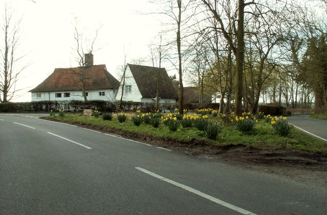
Great Sampford is a small village located in the Uttlesford district of Essex, England. It lies approximately 45 miles north of London and is surrounded by picturesque countryside. The village is situated on a gentle slope, providing scenic views of the surrounding area.

Great Sampford is known for its historic charm, with several listed buildings that date back to the medieval period. St. Michael's Church, a Grade I listed building, is a prominent feature of the village. The church, constructed in the 12th century, boasts a stunning Norman doorway and a 15th-century font.

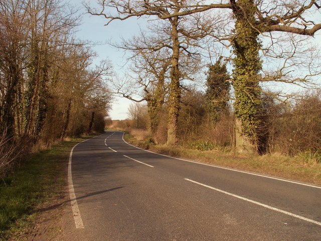
The village is well-connected, with good transportation links to nearby towns and cities. The A120 road passes through Great Sampford, providing easy access to Braintree and Stansted Airport. The nearest railway station is in Newport, just a few miles away.

Despite its small size, Great Sampford has a strong sense of community. The village is home to a primary school, a village hall, and a pub. The local community organizes various events throughout the year, including a summer fete and a Christmas market.

Surrounded by beautiful countryside, Great Sampford offers plenty of opportunities for outdoor activities such as walking, cycling, and horse riding. The village is also close to several nature reserves, including the RSPB's Wallasea Island and the Essex Wildlife Trust's Hanningfield Reservoir.

Overall, Great Sampford is a charming village that offers a tranquil and picturesque setting, making it an ideal place for those seeking a peaceful rural lifestyle.

If you have any feedback on the listing, please let us know in the comments section below.

Great Sampford Images

Images are sourced within 2km of 51.992394/0.391247 or Grid Reference TL6435. Thanks to Geograph Open Source API. All images are credited.

Great Sampford, Essex In this village view of Great Sampford, you can see the parish church of St. Michael, which dates from the 13th century. The house on the left is a fine timber-framed building.
Great Sampford, Essex
In this village view of Great Sampford, you can see the parish church of St. Michael, which dates from the 13th century. The house on the left is a fine timber-framed building.
Road junction for the B.1055, near Great Sampford, Essex
Greenlane at Free Roberts The entrance to a well maintained byway at a small hamlet called Free Roberts.
Greenlane at Free Roberts
The entrance to a well maintained byway at a small hamlet called Free Roberts.
Thatched cottage
Thatched cottage
St Michael, Great Sampford, Essex
St Michael, Great Sampford, Essex - East end
St Michael, Great Sampford, Essex - Chancel
A road junction at Little Sampford
The B.1053 heading towards Great Sampford
Public footpath
Public footpath
Farmhouse at Ivytodd's Farm
Looking across a field to Goddards Farm
The B.1051, heading towards Thaxted The house is known as South Shields.
The B.1051, heading towards Thaxted
The house is known as South Shields.
Country Lane to the south This lane has no name on the map!
Country Lane to the south
This lane has no name on the map!
Country lane to the north This lane almost crosses the square and is edged with thick and high hedges on both sides with little possibility of seeing what is hidden on either side!
Country lane to the north
This lane almost crosses the square and is edged with thick and high hedges on both sides with little possibility of seeing what is hidden on either side!
Harvest Home & Parsonage Farm Harvest is home but ploughing for next year has not yet reached these fields. The buildings in the background are Parsonage Farm.
Harvest Home & Parsonage Farm
Harvest is home but ploughing for next year has not yet reached these fields. The buildings in the background are Parsonage Farm.
Calthorpes Farm Lane This lane is effectively the drive to the farm it is classified as “other route with public access”
Calthorpes Farm Lane
This lane is effectively the drive to the farm it is classified as “other route with public access”
Show me another place!

Great Sampford is located at Grid Ref: TL6435 (Lat: 51.992394, Lng: 0.391247)

Administrative County: Essex

District: Uttlesford

Police Authority: Essex

What 3 Words

///choppers.tensions.reported. Near Thaxted, Essex

Related Wikis

Great Sampford

Great Sampford is a village and civil parish on the junction of the B1053 and B1051 roads in the Uttlesford district, in the north-west of the English...
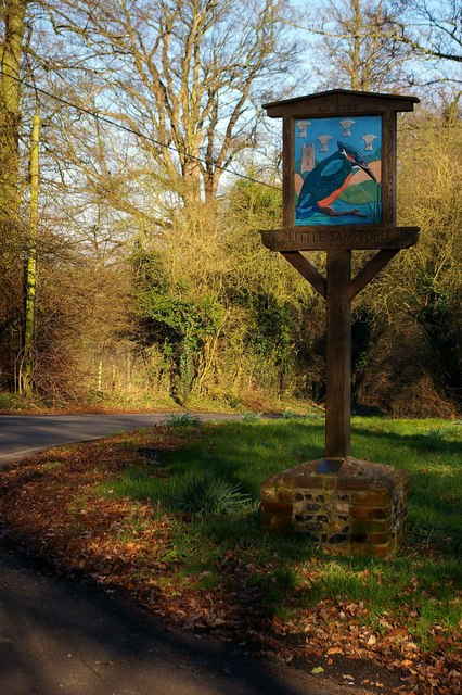
Little Sampford

Little Sampford is a village and a civil parish on the B1053 road, in the Uttlesford district, in the county of Essex, England. The population of the civil...

RAF Great Sampford

Royal Air Force Great Sampford or more simply RAF Great Sampford is a former Royal Air Force satellite station located 1.7 miles (2.7 km) west of Great...

Hempstead, Essex

Hempstead is a village and civil parish in the Uttlesford district of Essex, England. The village is 7 miles (11 km) east from Saffron Walden and 6 miles...

Nearby Amenities

Located within 500m of 51.992394,0.391247
Bus Stop
Willetts Field
Bus: yes
Naptan AtcoCode: 150018018003
Naptan Bearing: NE
Naptan BusStopType: CUS
Naptan CommonName: Willetts Field
Naptan Crossing: Willetts Field
Naptan Indicator: Opp
Naptan Landmark: Willetts Field
Naptan NaptanCode: esxdapam
Naptan Street: Walden Road
Naptan Verified: no
Public Transport: platform
Source: naptan_import
Lat/Long: 51.9927506/0.3926547
Bus Stop
Parsonage Farm Lane
Bus: yes
Naptan AtcoCode: 150018018004
Naptan Bearing: NW
Naptan BusStopType: CUS
Naptan CommonName: Parsonage Farm Lane
Naptan Crossing: Parsonage Farm Lane
Naptan Indicator: Opp
Naptan Landmark: Parsonage Farm Lane
Naptan NaptanCode: esxdapap
Naptan Street: B1053 Walden Road
Naptan Verified: no
Public Transport: platform
Source: naptan_import
Lat/Long: 51.9931004/0.3958886
Bus Stop
Willetts Field
Bus: yes
Naptan AtcoCode: 1500180180Y3
Naptan Bearing: SW
Naptan BusStopType: CUS
Naptan CommonName: Willetts Field
Naptan Crossing: Willetts Field
Naptan Indicator: Adj
Naptan Landmark: Willetts Field
Naptan NaptanCode: esxgpajw
Naptan Street: Walden Road
Naptan Verified: no
Public Transport: platform
Source: naptan_import
Lat/Long: 51.9929797/0.3943089
Bus Stop
Parsonage Farm Lane
Bus: yes
Naptan AtcoCode: 1500180180Y4
Naptan Bearing: SE
Naptan BusStopType: CUS
Naptan CommonName: Parsonage Farm Lane
Naptan Crossing: Parsonage Farm Lane
Naptan Indicator: Adj
Naptan Landmark: Parsonage Farm Lane
Naptan NaptanCode: esxgtdgp
Naptan Street: B1053 Walden Road
Naptan Verified: no
Public Transport: platform
Source: naptan_import
Lat/Long: 51.9931441/0.3959492
Bus Stop
Playing Field
Bus: yes
Naptan AtcoCode: 150018019002
Naptan Bearing: SE
Naptan BusStopType: CUS
Naptan CommonName: Moor End Road
Naptan Crossing: Hill Road
Naptan Indicator: SE-bound
Naptan Landmark: Moor End Road
Naptan NaptanCode: esxdapaj
Naptan Street: Moor End Road
Naptan Verified: no
Public Transport: platform
Source: naptan_import
Lat/Long: 51.9941114/0.3903923
Bus Stop
Playing Field
Bus: yes
Naptan AtcoCode: 1500180190Y2
Naptan Bearing: NW
Naptan BusStopType: CUS
Naptan CommonName: Moor End Road
Naptan Crossing: Hill Road
Naptan Indicator: NW-bound
Naptan Landmark: Moor End Road
Naptan NaptanCode: esxgtjwa
Naptan Street: Moor End Road
Naptan Verified: no
Public Transport: platform
Source: naptan_import
Lat/Long: 51.994086/0.3903181
Bus Stop
The Red Lion
Bus: yes
Naptan AtcoCode: 1500IM1884
Naptan Bearing: SW
Naptan CommonName: The Red Lion
Naptan Indicator: Opp
Naptan Landmark: The Red Lion
Naptan NaptanCode: esxdgapm
Naptan Street: Walden Road
Naptan Verified: no
Public Transport: platform
Source: naptan_import
Lat/Long: 51.9924468/0.3922119
Bus Stop
The Red Lion
Bus: yes
Naptan AtcoCode: 1500IM1884A
Naptan Bearing: NE
Naptan BusStopType: CUS
Naptan CommonName: The Red Lion
Naptan Indicator: o/s
Naptan Landmark: The Red Lion
Naptan NaptanCode: esxgpajt
Naptan Street: Walden Road
Naptan Verified: no
Public Transport: platform
Source: naptan_import
Lat/Long: 51.9925013/0.3921857
Power: tower
Lat/Long: 51.9902218/0.3927004
Power: tower
Lat/Long: 51.9911867/0.3974962
Power: tower
Lat/Long: 51.9890427/0.3871053
Great Sampford
Place: village
Lat/Long: 51.9935978/0.3927475
Man Made: windmill
Lat/Long: 51.9936354/0.3913862
Defibrillator
Access: yes
Defibrillator Location: Mounted on external wall of school building. Inside locked cabinet, call 999 for code.
Emergency: defibrillator
Emergency Phone: 999
Indoor: yes
Locked: yes
Opening Hours: 24/7
Phone: +44 1799 586280
Ref GB The Circuit: 1735E49E-2DA6-4AD6-8029-AEEB0114E838
Lat/Long: 51.9929705/0.3937702
TODO: Check this is actually passable.
Ford: yes
Lat/Long: 51.9911304/0.3912933
Post Box
Operator: Royal Mail
Operator Wikidata: Q638098
Post Box Mounting: pier
Post Box Type: lamp
Ref: CB10 30
Lat/Long: 51.9926264/0.3931616
Public Bookcase
Booth: K6
Disused Amenity: telephone
Man Made: telephone_box
Note: this telephone box was set fire to and did disappear in 2022 but has now been restored
Public Bookcase Type: phone_box
Lat/Long: 51.9914817/0.3912313
Bench
Lat/Long: 51.9913967/0.391193
Bench
Lat/Long: 51.9945248/0.3933011
The data included in this document is from www.openstreetmap.org. The data is made available under ODbL.

Have you been to Great Sampford?

Leave your review of Great Sampford below (or comments, questions and feedback).