Osney Weir Pool

Lake, Pool, Pond, Freshwater Marsh in Oxfordshire Oxford

England

Osney Weir Pool

St Lawrence Church
St Lawrence Church Credit: AJD

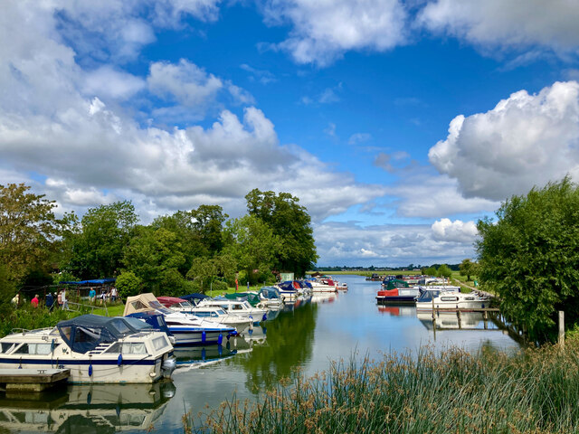
Osney Weir Pool is a picturesque freshwater marsh located in Oxfordshire, England. Spanning over an area of approximately 12 acres, it serves as a popular recreational spot for locals and visitors alike. Nestled alongside the River Thames, this enchanting pool is a haven for various species of plants and animals.

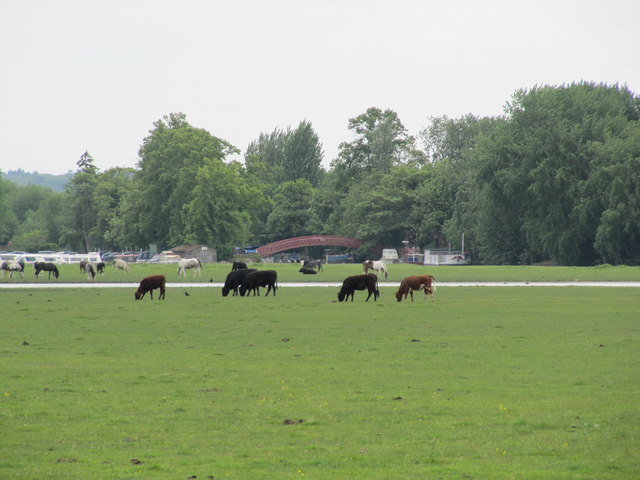
The pool itself is relatively shallow, with an average depth of around 2 meters. Its tranquil waters are home to a diverse range of aquatic plants, such as water lilies and reeds, which provide a habitat for numerous species of fish, amphibians, and invertebrates. The lush vegetation surrounding the pool creates a serene and serene environment, attracting numerous bird species, including kingfishers, herons, and ducks.

Osney Weir Pool is not only a haven for wildlife but also a popular spot for leisure activities. It offers opportunities for fishing, boating, and wildlife spotting. Fishing enthusiasts can try their luck with various species of fish, such as pike, perch, and roach, while boaters can explore the pool's calm waters and enjoy the scenic views.

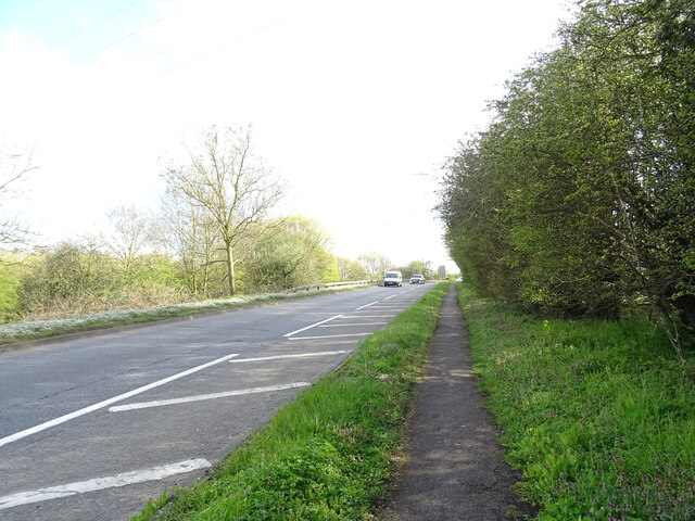
Visitors can access Osney Weir Pool through well-maintained footpaths and bridges, allowing them to immerse themselves in the natural beauty of the area. The pool is surrounded by lush greenery, offering a peaceful escape from the hustle and bustle of city life.

Overall, Osney Weir Pool is a delightful freshwater marsh that offers a range of activities for nature lovers and outdoor enthusiasts. Its serene atmosphere, diverse wildlife, and scenic setting make it a must-visit destination for anyone seeking a tranquil and immersive experience in Oxfordshire.

If you have any feedback on the listing, please let us know in the comments section below.

Osney Weir Pool Images

Images are sourced within 2km of 51.749115/-1.2729473 or Grid Reference SP5005. Thanks to Geograph Open Source API. All images are credited.

St Lawrence Church
St Lawrence Church
Ferry Hinksey Road Spine road for the Osney Mead insutrial estate.
Ferry Hinksey Road
Spine road for the Osney Mead insutrial estate.
Restoration Church, Helen Road, Osney Only a few years ago this was the Elim Chapel <a href="https://www.geograph.org.uk/photo/6217755">SP4906 : Elim Chapel, Helen Road</a> but it was probably not built as a church, as the 1921 map labels it a 'hall'. The style looks to be late 19th / early 20th century.
Restoration Church, Helen Road, Osney
Only a few years ago this was the Elim Chapel SP4906 : Elim Chapel, Helen Road but it was probably not built as a church, as the 1921 map labels it a 'hall'. The style looks to be late 19th / early 20th century.
Shops on Botley Road Currently comprising a cycle sales / repair business, high quality greengrocer and an antique shop specialising in Tuscan pottery. All very Oxford.
Shops on Botley Road
Currently comprising a cycle sales / repair business, high quality greengrocer and an antique shop specialising in Tuscan pottery. All very Oxford.
Binsey Lane bridge A narrow bridge taking a country lane over the Bulstake Stream, one of the many minor branches of the Thames around Oxford. <a href="https://www.geograph.org.uk/photo/6606806">SP4906 : Bridge over Bulstake Stream</a> shows it from the side.
Binsey Lane bridge
A narrow bridge taking a country lane over the Bulstake Stream, one of the many minor branches of the Thames around Oxford. SP4906 : Bridge over Bulstake Stream shows it from the side.
Binsey Lane A country lane from Osney to Binsey. There's something not quite right about those trees to the left: diseased, or badly pruned? The metal gates to the right are the access to an electricity substation.
Binsey Lane
A country lane from Osney to Binsey. There's something not quite right about those trees to the left: diseased, or badly pruned? The metal gates to the right are the access to an electricity substation.
DFS on Botley Road, Oxford I seem to remember DFS stands for Direct Furniture Services. I haven't been able to confirm it online.
DFS on Botley Road, Oxford
I seem to remember DFS stands for Direct Furniture Services. I haven't been able to confirm it online.
View across the Thames and bridge from the Towing Path Looking across the river toward Bossom's boatyard and Binsey from the towpath (seated at path level).
View across the Thames and bridge from the Towing Path
Looking across the river toward Bossom's boatyard and Binsey from the towpath (seated at path level).
Seacourt Lane
Seacourt Lane
Cycle Path beside the A34
Marina on the Thames near Binsey A view from the footpath over the Thames.
Marina on the Thames near Binsey
A view from the footpath over the Thames.
Medley Beer Garden by the Thames Not a pub, just a beer garden.
Medley Beer Garden by the Thames
Not a pub, just a beer garden.
Louie Memorial Playing Field
Rainbow Bridge View from Round Hill towards Rainbow Bridge over the Thames, with cattle and horses grazing on Port Meadow.
Rainbow Bridge
View from Round Hill towards Rainbow Bridge over the Thames, with cattle and horses grazing on Port Meadow.
A34 access to Harcourt Hill
A34 and Southern By-pass at Botley Restricted by an oft violated 50 MPH speed limit and corralled by high fencing, it's possible that some long distance travellers on the A34 see the Southern By-pass as a hindrance rather than a help.
A34 and Southern By-pass at Botley
Restricted by an oft violated 50 MPH speed limit and corralled by high fencing, it's possible that some long distance travellers on the A34 see the Southern By-pass as a hindrance rather than a help.
A420 slip road for Botley Interchange The A34 has now morphed from the Southern By-pass to the Western By-pass!
A420 slip road for Botley Interchange
The A34 has now morphed from the Southern By-pass to the Western By-pass!
Buildings at the Harcourt Hill Campus of Oxford Brookes University The spire of the church is visible in the background
Buildings at the Harcourt Hill Campus of Oxford Brookes University
The spire of the church is visible in the background
Show me another place!

Osney Weir Pool is located at Grid Ref: SP5005 (Lat: 51.749115, Lng: -1.2729473)

Administrative County: Oxfordshire

District: Oxford

Police Authority: Thames Valley

What 3 Words

///fear.plug.zones. Near Oxford, Oxfordshire

Related Wikis

Osney Lock Hydro

Osney Lock Hydro is a micro hydroelectric scheme in Oxford, England. It is located on the River Thames, using the head of water provided by the weir at...

Osney Mill

Osney Mill is a former flour mill on a branch of the River Thames in Oxford, England, located south of the Botley Road, down Mill Street. While the mill...

Osney Lock

Osney Lock is a lock on the River Thames in Oxford, England, where the village or island of Osney is next to the river. The first lock was built of stone...

Mill Street, Oxford

Mill Street is a street in Oxford, England. It is a cul-de-sac that runs south from the Botley Road close to Oxford railway station. It includes residential...

Osney Abbey

Osney Abbey or Oseney Abbey, later Osney Cathedral, was a house of Augustinian canons at Osney in Oxfordshire. The site is south of the modern Botley...

Osney Cemetery

Osney Cemetery (also known as Osney St Mary Cemetery) is a disused Church of England cemetery in Osney, west Oxford, England. Its entrance is in Osney...
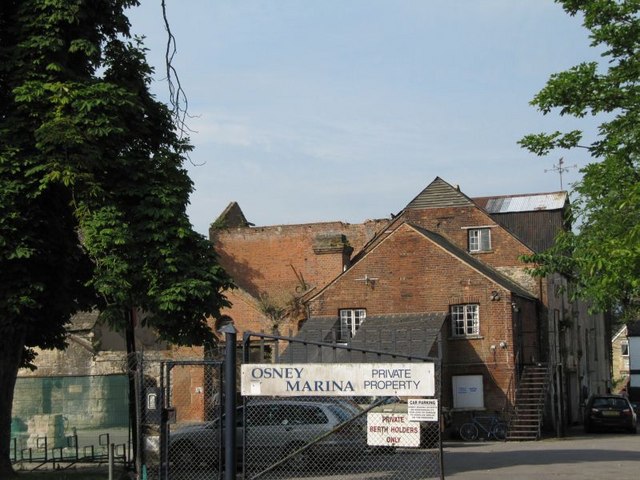
Osney Mill Marina

Osney Mill Marina (aka Osney Marina) is a private marina on a branch off the River Thames in Oxford, England. It is located south from the Botley Road...

Ferry Hinksey Road

Ferry Hinksey Road is a road in west Oxford, England, leading south from the Botley Road. The road leads to the Osney Mead Industrial Estate to the east...

Nearby Amenities

Located within 500m of 51.749115,-1.2729473
Traffic Signals
Lat/Long: 51.7524021/-1.2759593
Mini Roundabout
Direction: clockwise
Lat/Long: 51.7490892/-1.2779238
Traffic Calming: cushion
Lat/Long: 51.7496781/-1.2775936
Traffic Signals
Bicycle: yes
Crossing: traffic_signals
Traffic Calming: table
Lat/Long: 51.7507827/-1.2765382
Traffic Calming: cushion
Lat/Long: 51.7513148/-1.276144
Maxspeed: 20 mph
Maxspeed Note: Oxford 20 mph zone
Maxspeed Spec: 10m E of jn w/ Abbey Rd
Lat/Long: 51.7525531/-1.271837
Barrier: cycle_barrier
Bicycle: yes
Cycle Barrier: double
Cycle Barrier Installation: fixed
Foot: yes
Lat/Long: 51.7486672/-1.2718326
Barrier: cycle_barrier
Bicycle: yes
Cycle Barrier: double
Cycle Barrier Installation: fixed
Foot: yes
Lat/Long: 51.7489531/-1.2718438
Operator: Network Rail
Railway: switch
Lat/Long: 51.7518769/-1.2699211
Railway: switch
Lat/Long: 51.7503002/-1.2693719
Osney
Is In: Oxford, Oxfordshire, England, UK
Place: suburb
Lat/Long: 51.7500805/-1.2737942
Barrier: stile
Material: wood
Stile: stepover
Lat/Long: 51.7466446/-1.2674463
Crossing
Button Operated: yes
Crossing: traffic_signals
Crossing Island: no
Tactile Paving: yes
Traffic Signals Sound: yes
Traffic Signals Vibration: yes
Lat/Long: 51.7524971/-1.274216
Operator: National Grid
Operator Wikidata: Q1465461
Power: tower
Ref: 4TE 24
Lat/Long: 51.7485303/-1.278992
Fast Food
Country Griddle
Cuisine: burger
Delivery: no
Drive Through: no
Takeaway: only
Lat/Long: 51.7480946/-1.2747842
Created By: osm2go v0.5-5
Lat/Long: 51.751063/-1.2670288
Fast Food
Currydor
Addr City: Oxford
Addr Housenumber: 25
Addr Postcode: OX2 0BN
Addr Street: Botley Road
Cuisine: indian
Delivery: yes
Fhrs Id: 723651
Opening Hours: Mo-Th 18:00-22:00, Fr,Sa 18:00-22:30, Tu-Sa 12:00-14:00
Phone: +44 1865 424343
Takeaway: yes
Lat/Long: 51.7522826/-1.2760978
Power: tower
Lat/Long: 51.7463717/-1.2755612
Created By: osm2go v0.6-8
Lat/Long: 51.7518582/-1.2673073
Post Box
Brand: Royal Mail
Brand Wikidata: Q638098
Brand Wikipedia: en:Royal Mail
Collection Times: Mo-Fr 19:15; Sa 12:00
Mail Meter: yes
Operator: Royal Mail
Operator Wikidata: Q638098
Post Box Apertures: 2
Post Box Type: wall
Postal Code: OX1
Ref: OX1 2002
Royal Cypher: no
Lat/Long: 51.7506182/-1.2671456
Post Box
Brand: Royal Mail
Brand Wikidata: Q638098
Brand Wikipedia: en:Royal Mail
Collection Times: Mo-Fr 17:30; Sa 11:00
Operator: Royal Mail
Operator Wikidata: Q638098
Post Box Type: pillar
Postal Code: OX2
Ref: OX2 38
Royal Cypher: EIIR
Royal Cypher Wikidata: Q33102113
Source: survey
Survey Date: 2013-03-01
Lat/Long: 51.7522841/-1.2776249
Recycling
Recycling Cans: yes
Recycling Clothes: yes
Recycling Glass Bottles: yes
Recycling Paper: yes
Recycling Plastic Bottles: yes
Recycling Small Appliances: yes
Lat/Long: 51.7506377/-1.2768321
Post Box
Brand: Royal Mail
Brand Wikidata: Q638098
Brand Wikipedia: en:Royal Mail
Collection Times: Mo-Fr 17:30; Sa 11:00
Operator: Royal Mail
Operator Wikidata: Q638098
Post Box Type: pillar
Postal Code: OX2
Ref: OX2 830
Royal Cypher: EIIR
Royal Cypher Wikidata: Q33102113
Source: survey
Survey Date: 2014-01-23
Lat/Long: 51.7484895/-1.2758009
M&S Simply Food
Brand: M&S Simply Food
Brand Wikidata: Q714491
Brand Wikipedia: en:Marks & Spencer
Contact Website: https://www.marksandspencer.com/stores/oxford-rail-simply-food-120
Opening Hours: Mo-We 07:00-20:00; Th-Sa 07:00-22:00; Su 10:00-18:00
Shop: convenience
Source: local_knowledge
Wheelchair: yes
Lat/Long: 51.7532066/-1.2699836
Bicycle Parking
Bicycle Parking: stands
Capacity: 14
Covered: no
Lat/Long: 51.7527198/-1.2751377
Traffic Signals
Lat/Long: 51.7520215/-1.2760029
Crossing
Button Operated: yes
Crossing: traffic_signals
Crossing Island: no
Tactile Paving: yes
Traffic Signals Sound: yes
Traffic Signals Vibration: yes
Lat/Long: 51.7523667/-1.2773025
Crossing
Button Operated: yes
Crossing: traffic_signals
Crossing Island: no
Crossing Markings: dashes
Crossing Ref: pelican
Tactile Paving: yes
Traffic Signals Sound: yes
Traffic Signals Vibration: no
Lat/Long: 51.752577/-1.271608
Barrier: cycle_barrier
Bicycle: yes
Cycle Barrier: double
Cycle Barrier Installation: fixed
Foot: yes
Lat/Long: 51.7496471/-1.2724928
Edgar George Wilson
Description: In memory of Edgar George Wilson
Historic: memorial
Inscription: IN MEMORY OF EDGAR GEORGE WILSON WHO, IN RESCUING TWO BOYS FROM DROWNING, LOST HIS LIFE, JUNE 15, 1889, AGED 21 YEARS
Man Made: obelisk
Memorial: obelisk
Source: photograph
Source Ref: http://www.oxfordhistory.org.uk/streets/inscriptions/south_west/wilson_drowning.html
Lat/Long: 51.7469047/-1.2675544
Bench
Backrest: yes
Covered: no
Operator: Oxford City Council
Lat/Long: 51.747025/-1.268108
Bench
Backrest: yes
Covered: no
Operator: Oxford City Council
Lat/Long: 51.747157/-1.268529
Bench
Backrest: yes
Lat/Long: 51.7477154/-1.269662
Bench
Backrest: yes
Covered: no
Operator: Oxford City Council
Lat/Long: 51.748459/-1.271439
Bench
Backrest: yes
Lat/Long: 51.7502254/-1.2725583
Barrier: bollard
Lat/Long: 51.7459602/-1.2752186
Crossing
Crossing: unmarked
Crossing Island: no
Crossing Markings: no
Kerb: lowered
Tactile Paving: yes
Lat/Long: 51.7524428/-1.2737864
Maxspeed: 20 mph
Maxspeed Note: Oxford 20 mph zone
Lat/Long: 51.7506972/-1.2670028
Maxspeed: 20 mph
Maxspeed Note: Oxford 20 mph zone
Lat/Long: 51.7509396/-1.2671098
Post Box
Brand: Royal Mail
Brand Wikidata: Q638098
Brand Wikipedia: en:Royal Mail
Collection Times: Mo-Fr 09:00; Sa 07:00
Operator: Royal Mail
Operator Wikidata: Q638098
Post Box Type: wall
Postal Code: OX2
Ref: OX2 460
Royal Cypher: GR
Royal Cypher Wikidata: Q33102273
Source: survey
Survey Date: 2016-03-30
Lat/Long: 51.75042/-1.273413
Bus Stop
Osney Island
Bench: yes
Bin: yes
Bus: yes
Lit: yes
Local Ref: W-bound
Naptan AtcoCode: 340001093BSC
Naptan Bearing: W
Naptan CommonName: Osney Island
Naptan Indicator: Bridge St corner
Naptan Landmark: Osney Bridge
Naptan NaptanCode: oxfadgma
Naptan PlusbusZoneRef: OXFD
Naptan Street: Botley Road
Park And Ride: 400
Public Transport: platform
Shelter: yes
Source: naptan_import
Tactile Paving: no
Lat/Long: 51.7524372/-1.274493
Bus Stop
Osney Island
Bench: yes
Bin: yes
Bus: yes
Covered: yes
Lit: yes
Local Ref: E-bound
Naptan AtcoCode: 340001093OPB
Naptan Bearing: E
Naptan CommonName: Osney Island
Naptan Indicator: Opposite Bridge St
Naptan Landmark: Osney Bridge
Naptan NaptanCode: oxfadgjw
Naptan PlusbusZoneRef: OXFD
Naptan Street: Botley Road
Park And Ride: 400
Public Transport: platform
Ref: 69323459
Route Ref: 33;4A;400;S1;NS1;S6;S9;NU1;X9;63
Shelter: yes
Source: naptan_import
Tactile Paving: no
Lat/Long: 51.7525502/-1.2738394
Crossing
Crossing: zebra
Crossing Island: no
Source: Bing
Tactile Paving: yes
Lat/Long: 51.7511497/-1.2671615
Becket House B&B
Addr Housenumber: 5
Addr Postcode: OX1 1PP
Addr Street: Becket Street
Disused Tourism: guest_house
Phone: +44 1865 724675
Lat/Long: 51.7521313/-1.268827
Fast Food
Domino's
Addr City: Oxford
Addr Country: GB
Addr Housenumber: 18
Addr Postcode: OX1 1HU
Addr Street: Park End Street
Brand: Domino's
Brand Wikidata: Q839466
Brand Wikipedia: en:Domino's Pizza
Contact Phone: +44 1865 200222
Contact Website: https://www.dominos.co.uk/pizza-near-me/oxford/18-19-park-end-street
Cuisine: pizza
Fhrs Id: 269148
Takeaway: yes
Lat/Long: 51.7525133/-1.2688666
Finders Keepers
Addr Housenumber: 20-21
Addr Postcode: OX1 1HU
Addr Street: Park End Street
Cuisine: chinese
Phone: +44 1865 250988
Shop: estate_agent
Lat/Long: 51.752519/-1.268527
Addr Housenumber: 34
Addr Street: East Street
Lat/Long: 51.7505013/-1.2727417
Bicycle Parking
Bicycle Parking: stands
Capacity: 8
Check Date Capacity: 2023-01-29
Covered: no
Fee: no
Lat/Long: 51.7503978/-1.2725472
Barrier: lift_gate
Source: Bing
Lat/Long: 51.7518188/-1.2690855
Westgate Cafe
Door: hinged
Entrance: yes
Lat/Long: 51.7524921/-1.2710927
Bicycle Parking
Bicycle Parking: stands
Capacity: 8
Covered: no
Lat/Long: 51.7507563/-1.272486
Bicycle Parking
Bicycle Parking: stands
Capacity: 8
Covered: no
Lat/Long: 51.7519645/-1.2726478
Addr Housenumber: 49
Addr Street: Oatlands Road
Lat/Long: 51.7510222/-1.2786037
Addr Housenumber: 52
Addr Street: Oatlands Road
Lat/Long: 51.7510515/-1.2788958
Barrier: bollard
Lat/Long: 51.7506528/-1.2700317
Man Made: surveillance
Source: survey;Bing
Source Man Made: survey
Surveillance: outdoor
Lat/Long: 51.7526234/-1.2699446
Bicycle Rental
Brompton Dock Oxford - 2624
Access: private
Bicycle Parking: lockers
Capacity: 10
Covered: yes
Lockable: yes
Operator: Brompton Dock
Ref: 2624
Source: survey
Website: http://www.bromptondock.co.uk/our-docks/oxford-2624/
Lat/Long: 51.7529843/-1.2699294
Man Made: surveillance
Source Man Made: survey
Lat/Long: 51.7530963/-1.2700311
Man Made: surveillance
Source: survey;Bing
Source Man Made: survey
Surveillance: outdoor
Lat/Long: 51.7528173/-1.2698364
Board Type: notice
Check Date: 2022-05-01
Information: board
Source: local_knowledge
Tourism: information
Lat/Long: 51.7528615/-1.2691423
Uni Food and Wine
Shop: kiosk
Lat/Long: 51.7525159/-1.2687975
Traffic Calming: cushion
Lat/Long: 51.7518505/-1.2760279
White Walls
Shop: estate_agent
Lat/Long: 51.7516924/-1.2670783
Material: wood
Power: pole
Lat/Long: 51.7456501/-1.2730836
Material: wood
Power: pole
Lat/Long: 51.7457032/-1.2730595
Power: pole
Lat/Long: 51.7462612/-1.274422
Material: wood
Power: pole
Lat/Long: 51.7458892/-1.2743899
Material: wood
Power: pole
Lat/Long: 51.7455072/-1.2716352
Power: pole
Lat/Long: 51.7458394/-1.2745132
Material: wood
Power: pole
Lat/Long: 51.7454591/-1.2716835
Material: wood
Power: pole
Lat/Long: 51.7462496/-1.2743121
Power: tower
Lat/Long: 51.7501155/-1.2764203
Power: tower
Lat/Long: 51.7500092/-1.2759724
Power: tower
Lat/Long: 51.7467212/-1.272346
Power: tower
Lat/Long: 51.7485056/-1.2760372
Power: tower
Lat/Long: 51.7487559/-1.27494
Traffic Calming: cushion
Lat/Long: 51.7505176/-1.2768671
Traffic Calming: cushion
Lat/Long: 51.7501143/-1.2772592
The Tattooed Hare
Addr Housenumber: 74
Addr Street: Botley Road
Postal Code: OX2 0BU
Shop: tattoo
Lat/Long: 51.7524942/-1.2772931
Crossing
Crossing: uncontrolled
Crossing Markings: surface
Tactile Paving: yes
Lat/Long: 51.7526184/-1.2718504
Crossing
Crossing: unmarked
Crossing Island: no
Crossing Markings: no
Kerb: lowered
Tactile Paving: yes
Lat/Long: 51.7524114/-1.2768487
Crossing
Crossing: unmarked
Crossing Island: no
Crossing Markings: no
Kerb: lowered
Tactile Paving: yes
Lat/Long: 51.7523255/-1.2768671
Bicycle Parking: wall_loops
Covered: yes
Lat/Long: 51.7484037/-1.2717706
Man Made: tank
Source: Bing
Lat/Long: 51.7475337/-1.2757061
Crossing
Crossing: informal
Crossing Island: yes
Kerb: flush
Tactile Paving: yes
Lat/Long: 51.7525978/-1.2689528
Addr Housenumber: 9
Addr Street: South Street
Source: survey
Lat/Long: 51.7501783/-1.2727789
Addr Housenumber: 56
Addr Street: Hill View Road
Lat/Long: 51.7509485/-1.2773264
Addr Housenumber: 2
Addr Street: Hill View Road
Lat/Long: 51.7520376/-1.2770652
Addr Housenumber: 1
Addr Street: Hill View Road
Lat/Long: 51.7520375/-1.276768
Addr Housenumber: 51
Addr Street: Hill View Road
Lat/Long: 51.7509083/-1.2770308
FMB Oxford
Website: https://www.fmb-oxford.com/
Lat/Long: 51.7486188/-1.2745305
Operator: Network Rail
Railway: switch
Lat/Long: 51.7524811/-1.2699914
Operator: Network Rail
Railway: switch
Lat/Long: 51.7518448/-1.269862
WHSmith
Addr City: Oxford
Addr Housename: Oxford Railway Station
Addr Postcode: OX1 1HS
Addr Street: Park End Street
Brand: WHSmith
Brand Wikidata: Q1548712
Brand Wikipedia: en:WHSmith
Fhrs Id: 269158
Opening Hours: Mo-Th 06:00-20:30; Fr 06:00-21:00; Sa 06:30-21:00; Su 09:00-20:30
Shop: newsagent
Source Addr: FHRS Open Data
Wheelchair: yes
Lat/Long: 51.7531564/-1.269782
Addr Housenumber: 31
Addr Street: Harley Road
Lat/Long: 51.7510561/-1.2794396
Addr Housenumber: 1
Addr Street: Osney Lane
Lat/Long: 51.7511569/-1.2665574
Addr Housenumber: 5
Addr Street: Osney Lane
Lat/Long: 51.7510996/-1.2669349
Pharmacy
Woodlands Pharmacy
Addr City: Oxford
Addr Housenumber: 82
Addr Postcode: OX2 0BU
Addr Street: Botley Road
Drive Through: no
Healthcare: pharmacy
Opening Hours: Mo-Fr 09:00-17:30; Sa 09:00-13:00
Phone: +44 1865 242649
Source: local_knowledge
Website: http://www.woodlands-pharmacy.com
Lat/Long: 51.7524936/-1.2775975
Barrier: bollard
Lat/Long: 51.7492447/-1.2780377
Addr Housenumber: 1
Addr Street: East Street
Lat/Long: 51.7519972/-1.2727967
Courtney Pianos
Addr City: Oxford
Addr Country: GB
Addr Housename: Courtney Pianos
Addr Housenumber: 43
Addr Postcode: OX2 0BN
Addr Street: Botley Road
Opening Hours: Tu-Th 09:30-17:30; Sa 09:30-18:00
Phone: +44 1865 790400
Shop: musical_instrument
Website: https://www.courtneypianos.co.uk/
Lat/Long: 51.7522611/-1.2767772
Capelli's Barber Shop
Addr City: Oxford
Addr Housenumber: 64
Addr Postcode: OX2 0BT
Addr Street: Botley Road
Female: yes
Male: yes
Opening Hours: Mo-Th 09:00-18:00; Fr 09:00-19:00; Sa 09:00-17:00; Su 11:00-16:00
Phone: +44 1865 432511
Shop: hairdresser
Website: http://capellioxford.co.uk
Lat/Long: 51.7525041/-1.2767194
Pearce Alder & Co.
Addr City: Oxford
Addr Housenumber: 33
Addr Postcode: OX2 0BN
Addr Street: Botley Road
Email: office@pearcealder.com
Fax: +44 1865 248482
Level: 0
Office: estate_agent
Phone: +44 1865 246502
Source: local knowledge
Website: http://pearcealder.com
Lat/Long: 51.7522711/-1.2764144
The First Superconducting Magnet for MRI Scanning
Historic: memorial
Memorial: blue_plaque
Openplaques Id: 998
Lat/Long: 51.7480916/-1.2728879
Entrance: main
Lat/Long: 51.7477096/-1.2720028
Entrance: yes
Lat/Long: 51.7480455/-1.2716078
Entrance: yes
Lat/Long: 51.7481081/-1.2715314
Addr Housenumber: 1
Addr Street: South Street
Lat/Long: 51.7503137/-1.2733789
Bicycle Parking
Bicycle Parking: stands
Capacity: 4
Covered: no
Fee: no
Lat/Long: 51.7482114/-1.2740103
Bicycle Parking
Bicycle Parking: stands
Capacity: 8
Covered: no
Fee: no
Lat/Long: 51.7516387/-1.2717288
Bicycle Parking
Bicycle Parking: stands
Capacity: 8
Check Date Capacity: 2024-01-26
Covered: no
Lat/Long: 51.7520188/-1.2736793
Bicycle Parking
Bicycle Parking: stands
Capacity: 8
Covered: no
Fee: no
Lat/Long: 51.7505491/-1.2734309
Post Box
Brand: Royal Mail
Brand Wikidata: Q638098
Brand Wikipedia: en:Royal Mail
Collection Times: Mo-Fr 17:30; Sa 11:00
Operator: Royal Mail
Operator Wikidata: Q638098
Post Box Type: wall
Postal Code: OX2
Ref: OX2 103
Royal Cypher: GR
Royal Cypher Wikidata: Q33102273
Source: survey
Survey Date: 2014-01-15
Lat/Long: 51.7527466/-1.2712478
Meatmaster Cash & Carry
Addr Housename: unit 2
Addr Postcode: OX2 0ES
Addr Street: Centremead
Shop: butcher
Website: https://meatmaster.info/
Lat/Long: 51.7496477/-1.2746293
Bench
Backrest: yes
Covered: no
Lat/Long: 51.7493665/-1.2799774
Bicycle Parking
Bicycle Parking: stands
Capacity: 24
Covered: yes
Fee: no
Lat/Long: 51.748058/-1.272202
Bicycle Parking
Bicycle Parking: stands
Capacity: 6
Covered: no
Lat/Long: 51.748984/-1.277724
Bicycle Parking
Bicycle Parking: stands
Capacity: 3
Covered: no
Lat/Long: 51.748948/-1.277621
Bench
Covered: no
Lat/Long: 51.7509674/-1.2792224
Bench
Covered: no
Operator: Oxford City Council
Lat/Long: 51.748421/-1.271363
Cafe
Tumbling Bay Cafe
Addr City: Oxford
Addr Housename: West Oxford Community Centre
Addr Postcode: OX2 0BT
Addr Street: Botley Road
Cuisine: cafe;lunch
Fhrs Id: 952041
Internet Access: wlan
Opening Hours: Mo-Fr 09:00-16:00; Sa,Su 10:00-16:00; Mo off
Outdoor Seating: yes
Source Addr: FHRS Open Data
Wheelchair: no
Lat/Long: 51.75297/-1.275232
Post Depot
Oxford Delivery Office
Opening Hours: Mo-Tu 08:00-18:00; We 08:00-20:00; Th-Fr 08:00-18:00; Sa 06:00-14:00
Operator: Royal Mail
Operator Type: private
Operator Wikidata: Q638098
Lat/Long: 51.7505353/-1.2671027
Life Ring
Check Date: 2023-01-29
Emergency: life_ring
Identification: 40
Lat/Long: 51.7469192/-1.2676373
Life Ring
Check Date: 2023-01-29
Emergency: life_ring
Identification: 39
Lat/Long: 51.7469489/-1.2666437
Crossing
Crossing: informal
Crossing Island: yes
Kerb: flush
Tactile Paving: yes
Lat/Long: 51.752746/-1.2691862
Crossing
Bicycle: yes
Crossing: uncontrolled
Crossing Island: no
Crossing Ref: zebra
Segregated: yes
Lat/Long: 51.7491576/-1.2779104
Level: 0
Lat/Long: 51.7491631/-1.2663674
Level: 0
Lat/Long: 51.7491563/-1.2663541
Level: 0.2
Lat/Long: 51.7491738/-1.2663331
Level: 0.2
Lat/Long: 51.7491804/-1.2663454
Level: 0.2
Lat/Long: 51.7493874/-1.2660534
Level: 0.2
Lat/Long: 51.7493922/-1.2660623
Level: 0
Lat/Long: 51.7493997/-1.2660354
Level: 0
Lat/Long: 51.7494058/-1.2660451
Entrance: main
Level: 0.2
Lat/Long: 51.7493871/-1.2660691
Entrance: main
Level: 0.2
Lat/Long: 51.7493613/-1.2661036
Entrance: main
Level: 0.2
Lat/Long: 51.749318/-1.2661615
Entrance: main
Level: 0.2
Lat/Long: 51.7492588/-1.2662407
Entrance: main
Level: 0.2
Lat/Long: 51.7492027/-1.2663157
Camera Mount: pole
Man Made: surveillance
Surveillance Type: camera
Lat/Long: 51.7490671/-1.2664524
Coworking Space
URBANOID® WORKSPACE OXFORD
Fee: yes
Website: https://workspaceoxford.com/
Lat/Long: 51.7488758/-1.2777499
Note: not sure how far back this was but I think it ran prpincular out from the back of these buildings [the fenceline]
Source: visit
Lat/Long: 51.7523906/-1.2686499
Mini Roundabout
Direction: clockwise
Lat/Long: 51.7509652/-1.2671167
Mini Roundabout
Direction: clockwise
Lat/Long: 51.7527509/-1.2689472
Power: pole
Source: Bing
Lat/Long: 51.7468758/-1.2774709
Power: pole
Source: Bing
Lat/Long: 51.7479153/-1.2763953
Power: pole
Source: Bing
Lat/Long: 51.7484816/-1.2757408
Power: pole
Source: Bing
Lat/Long: 51.7485712/-1.2756201
Power: pole
Source: Bing
Lat/Long: 51.7457913/-1.2773904
Parking
Osney Osteopaths
Access: private
Addr Street: South Street
Parking: surface
Lat/Long: 51.7503641/-1.2728836
Barrier: bollard
Lat/Long: 51.7525853/-1.2690423
Description: Portacabin classroom and tunnel for West Oxford Primary School
Lat/Long: 51.7512577/-1.2756416
Shirtworks
Shop: clothes
Website: https://www.shirtworks.co.uk/
Lat/Long: 51.748538/-1.2740733
Barrier: stile
Lat/Long: 51.7480881/-1.2787464
West Oxford Democrats Club
Addr City: Oxford
Addr Housenumber: 1
Addr Postcode: OX2 0AY
Addr Street: North Street
Check Date: 2024-01-26
Club: yes
Website: http://thedemos.co.uk/
Lat/Long: 51.7521716/-1.272882
St Thomas'
Alt Name: Oxpens
Place: neighbourhood
Lat/Long: 51.7517441/-1.2671892
Bench
Backrest: no
Lat/Long: 51.7526704/-1.2687238
Bench
Lat/Long: 51.7526538/-1.2687445
Oxford Flow
Office: company
Website: https://oxford-flow.com/
Lat/Long: 51.7473631/-1.2722195
Bicycle Parking
Capacity: 8
Source: Oxfordshire County Council
Lat/Long: 51.7515255/-1.2736729
Barrier: bollard
Bollard: removable
Lat/Long: 51.7469209/-1.2678398
Board Type: notice
Information: board
Tourism: information
Lat/Long: 51.7525659/-1.2749472
Oxpens
Place: neighbourhood
Lat/Long: 51.7496231/-1.2662038
Addr Housenumber: 38
Addr Street: South Street
Lat/Long: 51.7503393/-1.2735954
Addr Housenumber: 33
Addr Street: South Street
Lat/Long: 51.7503193/-1.2739011
Addr Housenumber: 32
Addr Street: South Street
Lat/Long: 51.7500854/-1.2742981
Addr Housenumber: 20
Addr Street: South Street
Lat/Long: 51.7501254/-1.2735655
Addr Housenumber: 19
Addr Street: South Street
Lat/Long: 51.7501485/-1.2733393
Addr Housenumber: 6
Addr Street: South Street
Lat/Long: 51.7503322/-1.2730799
Cafe
Spring Greens Cafe
Addr City: Oxford
Addr Housename: Roger House
Addr Postcode: OX2 0ES
Addr Street: Osney Mead
Cuisine: burger;thai;salad;breakfast
Opening Hours: Mo-Su 08:00-21:00
Phone: +44 1865 575050
Website: http://www.springgreenscafe.com/
Lat/Long: 51.7475205/-1.2725475
Jericho Coffee Traders
Addr City: Oxford
Addr Housename: Unit 2, Oxford Eco Centre
Addr Postcode: OX2 0ES
Addr Street: Osney Mead
Opening Hours: Mo-Fr 08:00-14:00; Sa 10:00-14:00
Shop: coffee
Website: https://jerichocoffeetraders.com/
Lat/Long: 51.7474961/-1.2724441
The Athlete Centre
Disused Leisure: fitness_centre
Lat/Long: 51.7461433/-1.2728598
CoreFiling
Office: yes
Lat/Long: 51.7463649/-1.2729852
Crossing
Lat/Long: 51.7491991/-1.2707018
Vishuddha Yoga Centre
Addr City: Oxford
Addr Housenumber: 16
Addr Postcode: OX2 0AU
Addr Street: East Street
Leisure: fitness_centre
Sport: yoga
Website: https://www.vishuddhayoga.org/
Lat/Long: 51.7512456/-1.2726947
Direction: 175
Generator Method: photovoltaic
Generator Output Electricity: yes
Generator Solar Modules: 16
Generator Source: solar
Generator Type: solar_photovoltaic_panel
Location: roof
Power: generator
Lat/Long: 51.7520381/-1.2674989
Direction: 150
Generator Method: photovoltaic
Generator Output Electricity: yes
Generator Solar Modules: 152
Generator Source: solar
Generator Type: solar_photovoltaic_panel
Location: roof
Power: generator
Tilt: 10
Lat/Long: 51.7466073/-1.2690921
Direction: 255
Generator Method: photovoltaic
Generator Output Electricity: yes
Generator Solar Modules: 76
Generator Source: solar
Generator Type: solar_photovoltaic_panel
Location: roof
Power: generator
Tilt: 20
Lat/Long: 51.7465642/-1.2712978
Direction: 75
Generator Method: photovoltaic
Generator Output Electricity: yes
Generator Solar Modules: 76
Generator Source: solar
Generator Type: solar_photovoltaic_panel
Location: roof
Power: generator
Tilt: 20
Lat/Long: 51.7465876/-1.271162
Direction: 205
Generator Method: photovoltaic
Generator Output Electricity: yes
Generator Solar Modules: 72
Generator Source: solar
Generator Type: solar_photovoltaic_panel
Location: roof
Power: generator
Lat/Long: 51.7475356/-1.272654
Direction: 120
Generator Method: photovoltaic
Generator Output Electricity: yes
Generator Solar Modules: 391
Generator Source: solar
Generator Type: solar_photovoltaic_panel
Location: roof
Power: generator
Tilt: 10
Lat/Long: 51.7478689/-1.2718526
Direction: 205
Generator Method: photovoltaic
Generator Output Electricity: yes
Generator Solar Modules: 79
Generator Source: solar
Generator Type: solar_photovoltaic_panel
Location: roof
Power: generator
Tilt: 20
Lat/Long: 51.7480145/-1.2725356
Direction: 205
Generator Method: photovoltaic
Generator Output Electricity: yes
Generator Solar Modules: 210
Generator Source: solar
Generator Type: solar_photovoltaic_panel
Location: roof
Power: generator
Tilt: 20
Lat/Long: 51.7482809/-1.2729618
Fixme: solar panels?
Lat/Long: 51.7515016/-1.2768056
Crossing
Crossing: unmarked
Crossing Markings: no
Lat/Long: 51.7524149/-1.2777181
Direction: 90
Generator Method: photovoltaic
Generator Output Electricity: yes
Generator Solar Modules: 13
Generator Source: solar
Generator Type: solar_photovoltaic_panel
Location: roof
Power: generator
Lat/Long: 51.7496338/-1.2726876
Direction: 270
Generator Method: photovoltaic
Generator Output Electricity: yes
Generator Solar Modules: 14
Generator Source: solar
Generator Type: solar_photovoltaic_panel
Location: roof
Power: generator
Lat/Long: 51.7496343/-1.2727126
Give Way
Direction: backward
Lat/Long: 51.7502374/-1.2733862
Give Way
Direction: forward
Lat/Long: 51.7502317/-1.2734877
Power: substation
Lat/Long: 51.7503334/-1.2735474
Direction: 170
Generator Method: photovoltaic
Generator Output Electricity: yes
Generator Solar Modules: 10
Generator Source: solar
Generator Type: solar_photovoltaic_panel
Location: roof
Power: generator
Lat/Long: 51.7503091/-1.2736233
Direction: 170
Generator Method: photovoltaic
Generator Output Electricity: yes
Generator Solar Modules: 10
Generator Source: solar
Generator Type: solar_photovoltaic_panel
Location: roof
Power: generator
Lat/Long: 51.7502822/-1.2736707
Direction: 170
Generator Method: photovoltaic
Generator Output Electricity: yes
Generator Solar Modules: 10
Generator Source: solar
Generator Type: solar_photovoltaic_panel
Location: roof
Power: generator
Lat/Long: 51.7502757/-1.2737303
Direction: 170
Generator Method: photovoltaic
Generator Output Electricity: yes
Generator Solar Modules: 10
Generator Source: solar
Generator Type: solar_photovoltaic_panel
Location: roof
Power: generator
Lat/Long: 51.7502734/-1.2737968
Direction: 170
Generator Method: photovoltaic
Generator Output Electricity: yes
Generator Solar Modules: 10
Generator Source: solar
Generator Type: solar_photovoltaic_panel
Location: roof
Power: generator
Lat/Long: 51.7502694/-1.2738468
Direction: 170
Generator Method: photovoltaic
Generator Output Electricity: yes
Generator Solar Modules: 7
Generator Source: solar
Generator Type: solar_photovoltaic_panel
Location: roof
Power: generator
Lat/Long: 51.751074/-1.2748281
Direction: 170
Generator Method: photovoltaic
Generator Output Electricity: yes
Generator Solar Modules: 10
Generator Source: solar
Generator Type: solar_photovoltaic_panel
Location: roof
Power: generator
Lat/Long: 51.7511708/-1.2748937
Direction: 170
Generator Method: photovoltaic
Generator Output Electricity: yes
Generator Solar Modules: 9
Generator Source: solar
Generator Type: solar_photovoltaic_panel
Location: roof
Power: generator
Lat/Long: 51.751274/-1.274905
Direction: 175
Generator Method: photovoltaic
Generator Output Electricity: yes
Generator Solar Modules: 4
Generator Source: solar
Generator Type: solar_photovoltaic_panel
Location: roof
Power: generator
Lat/Long: 51.7506307/-1.270978
Direction: 85
Generator Method: photovoltaic
Generator Output Electricity: yes
Generator Solar Modules: 3
Generator Source: solar
Generator Type: solar_photovoltaic_panel
Location: roof
Power: generator
Lat/Long: 51.7506391/-1.2708935
Traffic Calming: bump
Lat/Long: 51.7531839/-1.2708187
Bicycle Parking
Bicycle Parking: stands
Capacity: 14
Covered: no
Lat/Long: 51.7528079/-1.2752982
Restaurant
Lula’s Ethiopian and Eritrean Cuisine
Addr City: Oxford
Addr Housename: Makespace Oxford’s The Community Works
Addr Housenumber: 21
Addr Postcode: OX1 1HU
Addr Street: Park End Street
Cuisine: ethiopian;eritrean;coffee_shop
Diet Gluten Free: yes
Diet Non-vegetarian: yes
Diet Vegan: yes
Diet Vegetarian: yes
Opening Hours: Tu-Sa 09:00-22:00
Outdoor Seating: yes
Phone: +44 7843 916756
Website: https://www.lulasethiopiancuisine.co.uk/
Lat/Long: 51.7525298/-1.2686898
Rainbow and Spoon Boutique
Addr City: Oxford
Addr Housenumber: 22
Addr Postcode: OX1 1HU
Addr Street: Park End Street
Clothes: women;fashion
Opening Hours: We-Sa 10:00-17:30; Mo 12:00-17:30
Phone: +44 1865 723 492
Shop: clothes
Website: https://rainbowandspoon.co.uk/
Lat/Long: 51.7524996/-1.268395
Board Type: notice
Description: Community Noticeboard
Information: board
Tourism: information
Lat/Long: 51.7524258/-1.2711315
Door: hinged
Entrance: main
Lat/Long: 51.7505791/-1.2703124
Turning Circle
Lat/Long: 51.7507813/-1.2700732
Bus Stop
Osney Island
Bench: no
Bin: no
Lit: yes
Note: [2023-12-26] temporary bus stop confirmed by customer, no OxonTime/NAPTAN plate
Public Transport: platform
Route Ref: 4A;400;E1
Shelter: no
Source: photograph
Tactile Paving: no
Lat/Long: 51.7524535/-1.2734458
Bicycle Parking
Lat/Long: 51.7495621/-1.2750079
Street Drone
Office: company
Phone: +44 1865 988883
Website: https://www.streetdrone.com/
Lat/Long: 51.7475537/-1.2726651
Cotswold Natural Stone Masonry
Craft: stonemason
Phone: +44 1865 297565
Website: https://www.apsmasonry.com/
Lat/Long: 51.7468598/-1.2722848
Bicycle Parking
Lat/Long: 51.7463692/-1.270603
Entrance: yes
Lat/Long: 51.7463583/-1.2706599
Addr City: Oxford
Addr Housenumber: 6
Addr Street: North Street
Lat/Long: 51.7522324/-1.2736401
Addr City: Oxford
Addr Housenumber: 5
Addr Street: North Street
Lat/Long: 51.7522338/-1.2736039
Addr City: Oxford
Addr Housenumber: 4a
Addr Street: North Street
Lat/Long: 51.7522222/-1.2734743
Addr City: Oxford
Addr Housenumber: 4
Addr Street: North Street
Lat/Long: 51.7522256/-1.2734159
Addr City: Oxford
Addr Housenumber: 3
Addr Street: North Street
Lat/Long: 51.7522296/-1.2733489
Addr City: Oxford
Addr Housenumber: 2
Addr Street: North Street
Lat/Long: 51.7522331/-1.2732898
Addr City: Oxford
Addr Housenumber: 107
Addr Street: Bridge Street
Lat/Long: 51.7521225/-1.2736253
Addr City: Oxford
Addr Housenumber: 109
Addr Street: Bridge Street
Lat/Long: 51.7520505/-1.2736129
Addr City: Oxford
Addr Housenumber: 111
Addr Street: Bridge Street
Lat/Long: 51.7519817/-1.273601
Addr City: Oxford
Addr Housenumber: 112
Addr Street: Bridge Street
Lat/Long: 51.7519447/-1.2735946
Addr City: Oxford
Addr Housenumber: 108
Addr Street: Bridge Street
Lat/Long: 51.7520933/-1.2736203
Addr City: Oxford
Addr Housenumber: 110
Addr Street: Bridge Street
Lat/Long: 51.752013/-1.2736064
Addr City: Oxford
Addr Housenumber: 105B
Addr Street: Bridge Street
Lat/Long: 51.7520224/-1.2738011
Addr City: Oxford
Addr Housenumber: 105A
Addr Street: Bridge Street
Lat/Long: 51.7519771/-1.2737934
Addr City: Oxford
Addr Housenumber: 105
Addr Street: Bridge Street
Lat/Long: 51.751928/-1.2737887
Addr City: Oxford
Addr Housenumber: 104
Addr Street: Bridge Street
Lat/Long: 51.7518784/-1.2737826
Addr City: Oxford
Addr Housenumber: 102
Addr Street: Bridge Street
Lat/Long: 51.7518312/-1.2737749
Addr City: Oxford
Addr Housenumber: 102A,102B
Addr Street: Bridge Street
Lat/Long: 51.7517873/-1.2737672
Addr City: Oxford
Addr Housenumber: 1
Addr Street: Alexandra Road
Lat/Long: 51.7520278/-1.2775929
Addr City: Oxford
Addr Housenumber: 37
Addr Street: Alexandra Road
Lat/Long: 51.7513116/-1.2776547
Addr City: Oxford
Addr Housenumber: 39
Addr Street: Alexandra Road
Lat/Long: 51.7512249/-1.2775917
Addr City: Oxford
Addr Housenumber: 41
Addr Street: Alexandra Road
Lat/Long: 51.7511544/-1.2776759
Addr City: Oxford
Addr Housenumber: 49
Addr Street: Alexandra Road
Lat/Long: 51.7509739/-1.2776836
Addr City: Oxford
Addr Housenumber: 48
Addr Street: Alexandra Road
Lat/Long: 51.7509995/-1.2780181
Addr City: Oxford
Addr Housenumber: 22
Addr Street: Alexandra Road
Lat/Long: 51.7515235/-1.2779819
Addr City: Oxford
Addr Housenumber: 12
Addr Street: Alexandra Road
Lat/Long: 51.7517326/-1.2779539
Addr City: Oxford
Addr Housenumber: 2
Addr Street: Alexandra Road
Lat/Long: 51.7520058/-1.2779307
Addr City: Oxford
Addr Housenumber: 1
Addr Postcode: OX2 0DG
Addr Street: Henry Road
Lat/Long: 51.7527295/-1.2770187
Addr City: Oxford
Addr Housenumber: 2
Addr Street: Barrett Street
Lat/Long: 51.7504756/-1.2711458
Addr City: Oxford
Addr Housenumber: 26
Addr Street: Barrett Street
Lat/Long: 51.7503999/-1.2719406
Addr City: Oxford
Addr Housenumber: 1
Addr Street: Barrett Street
Lat/Long: 51.750616/-1.2711561
Addr City: Oxford
Addr Housenumber: 25
Addr Street: Barrett Street
Lat/Long: 51.7505367/-1.2719919
Addr City: Oxford
Addr Housenumber: 19
Addr Street: Arthur Street
Lat/Long: 51.7508545/-1.2716927
Addr City: Oxford
Addr Housenumber: 18
Addr Street: Arthur Street
Lat/Long: 51.7508159/-1.2716884
Addr City: Oxford
Addr Housenumber: 1
Addr Street: Arthur Street
Lat/Long: 51.7515699/-1.2715671
Addr City: Oxford
Addr Housenumber: 17
Addr Street: Arthur Street
Lat/Long: 51.750845/-1.2714212
Addr City: Oxford
Addr Housenumber: 15
Addr Street: Russell Street
Lat/Long: 51.7516921/-1.2717236
Addr City: Oxford
Addr Housenumber: 16
Addr Street: Russell Street
Lat/Long: 51.7516993/-1.2716558
Addr City: Oxford
Addr Housenumber: 39
Addr Street: Bridge Street
Lat/Long: 51.7499251/-1.2732372
Addr City: Oxford
Addr Housenumber: 47
Addr Street: Bridge Street
Lat/Long: 51.7496698/-1.2731204
Addr City: Oxford
Addr Housenumber: 63
Addr Street: Bridge Street
Lat/Long: 51.7498854/-1.2735092
Addr City: Oxford
Addr Housenumber: 56
Addr Street: Bridge Street
Lat/Long: 51.7496366/-1.2733945
Addr City: Oxford
Addr Housenumber: 1
Addr Street: Doyley Road
Lat/Long: 51.7498352/-1.273757
Addr City: Oxford
Addr Housenumber: 2
Addr Street: Doyley Road
Lat/Long: 51.7498268/-1.2738117
Addr City: Oxford
Addr Housenumber: 3
Addr Street: Doyley Road
Lat/Long: 51.7498196/-1.2738843
Addr City: Oxford
Addr Housenumber: 4
Addr Street: Doyley Road
Lat/Long: 51.7498769/-1.2740527
Addr City: Oxford
Addr Housenumber: 5
Addr Street: Doyley Road
Lat/Long: 51.7499121/-1.27406
Addr City: Oxford
Addr Housenumber: 1
Addr Street: West Street
Lat/Long: 51.7518192/-1.2744888
Addr City: Oxford
Addr Housenumber: 4
Addr Street: West Street
Lat/Long: 51.7516866/-1.2745635
Addr City: Oxford
Addr Housenumber: 40
Addr Street: West Street
Lat/Long: 51.7502593/-1.2743522
Addr City: Oxford
Addr Housenumber: A
Addr Street: West Street
Lat/Long: 51.7519513/-1.2743429
Addr City: Oxford
Addr Housenumber: B
Addr Street: West Street
Lat/Long: 51.7519122/-1.2743913
Addr City: Oxford
Addr Housenumber: C
Addr Street: West Street
Lat/Long: 51.7518679/-1.274447
Addr City: Oxford
Addr Housenumber: 42
Addr Street: West Street
Lat/Long: 51.7504147/-1.2746321
Addr City: Oxford
Addr Housenumber: 45
Addr Street: West Street
Lat/Long: 51.7505703/-1.2746438
Addr City: Oxford
Addr Housenumber: 46
Addr Street: West Street
Lat/Long: 51.7506585/-1.2746768
Addr City: Oxford
Addr Housenumber: 49
Addr Street: West Street
Lat/Long: 51.7507852/-1.2746924
Addr City: Oxford
Addr Housenumber: 1
Addr Street: Swan Street
Lat/Long: 51.7507659/-1.2748858
Addr City: Oxford
Addr Housenumber: 8
Addr Street: Swan Street
Lat/Long: 51.7507458/-1.2752835
Addr City: Oxford
Addr Housenumber: 50
Addr Street: West Street
Lat/Long: 51.7509078/-1.2746928
Addr City: Oxford
Addr Housenumber: 64
Addr Street: West Street
Lat/Long: 51.7514588/-1.2747718
Addr City: Oxford
Addr Housenumber: 66
Addr Street: Bridge Street
Lat/Long: 51.7504568/-1.2735571
Addr City: Oxford
Addr Housenumber: 95
Addr Street: Bridge Street
Lat/Long: 51.75148/-1.2736951
Addr City: Oxford
Addr Housenumber: 35
Addr Street: Bridge Street
Lat/Long: 51.7504579/-1.2733642
Addr City: Oxford
Addr Housenumber: 1
Addr Street: Bridge Street
Lat/Long: 51.7517999/-1.2735447
Addr City: Oxford
Addr Housenumber: 66
Addr Street: Botley Road
Lat/Long: 51.7524948/-1.2769992
Addr City: Oxford
Addr Housenumber: 54
Addr Street: Botley Road
Lat/Long: 51.7525041/-1.2763526
Addr City: Oxford
Addr Housenumber: 1
Addr Street: Ferry Hinksey Road
Lat/Long: 51.7520844/-1.2761977
Addr City: Oxford
Addr Housenumber: 8
Addr Street: Ferry Hinksey Road
Lat/Long: 51.7517596/-1.2762573
Addr City: Oxford
Addr Housenumber: 101
Addr Street: Ferry Hinksey Road
Lat/Long: 51.7522568/-1.2756986
Addr City: Oxford
Addr Housenumber: 110
Addr Street: Ferry Hinksey Road
Lat/Long: 51.7517572/-1.2757811
Addr City: Oxford
Addr Housenumber: 47
Addr Street: Botley Road
Lat/Long: 51.7522546/-1.2771242
Addr City: Oxford
Addr Housenumber: 49
Addr Street: Botley Road
Lat/Long: 51.7522457/-1.2774663
Osney Lock
Board Type: information
Information: board
Subject Wikidata: Q7107288
Subject Wikipedia: en:Osney Lock
Tourism: information
Lat/Long: 51.7496077/-1.2724978
Thames Path
Board Type: information
Information: board
Subject Wikidata: Q1324561
Subject Wikipedia: en:Thames Path
Tourism: information
Lat/Long: 51.7496208/-1.2725014
Construction Electrified: contact_line
Construction Frequency: 50
Construction Voltage: 25000
Electrified: no
Gauge: 1435
Loading Gauge: W10
Lat/Long: 51.7528172/-1.2703942
Defibrillator
Defibrillator Location: Outside wall to the right of the main entrance
Emergency: defibrillator
Indoor: no
Lat/Long: 51.7528006/-1.2750253
Entrance: yes
Lat/Long: 51.7527892/-1.2751052
Defibrillator
Defibrillator Location: Outside wall of 19 Arthur Street
Emergency: defibrillator
Indoor: no
Lat/Long: 51.7508625/-1.2716366
Entrance: yes
Lat/Long: 51.7500751/-1.2711106
The data included in this document is from www.openstreetmap.org. The data is made available under ODbL.

Have you been to Osney Weir Pool?

Leave your review of Osney Weir Pool below (or comments, questions and feedback).