Beena Water

Lake, Pool, Pond, Freshwater Marsh in Shetland

Scotland

Beena Water

North-west shore of Gossa Water Looking towards Fugla Field.
North-west shore of Gossa Water Credit: Mike Pennington

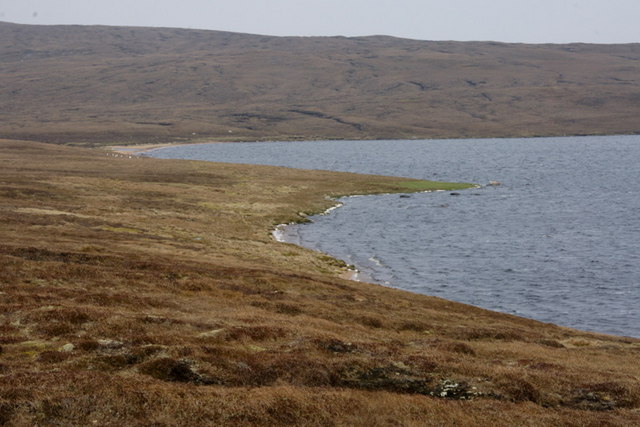
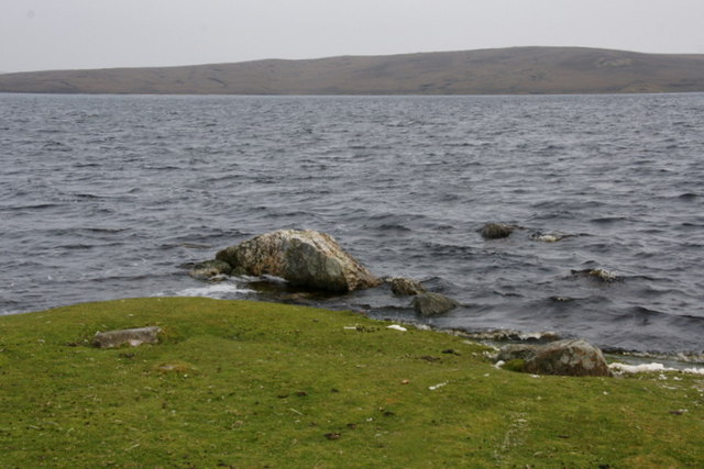
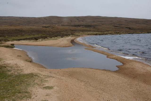
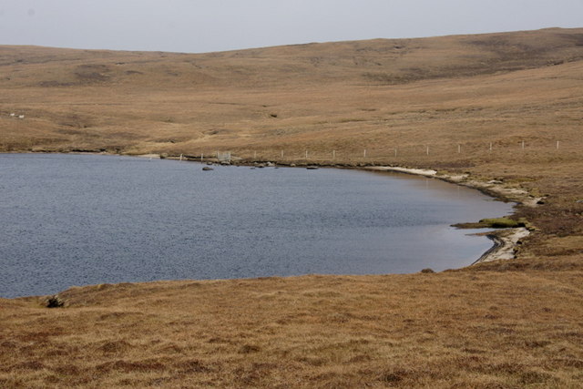
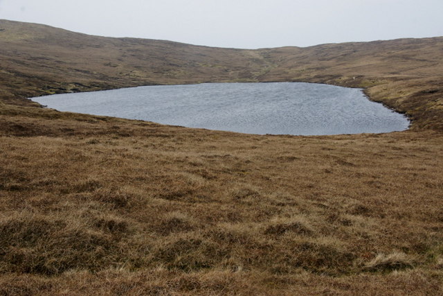
Beena Water is a small freshwater marsh located in the Shetland Islands, which are part of Scotland. It is situated in the central part of the main island of Shetland, known as Mainland. Beena Water is often described as a combination of a lake, pool, pond, and marsh due to its unique characteristics.

Covering an area of approximately 2 hectares, Beena Water is surrounded by lush vegetation, including reeds, sedges, and grasses. The water body itself is relatively shallow, with an average depth of around 2 meters. It is fed by several small streams that originate from the surrounding hills and moorland. The water is clear and usually exhibits a slight greenish tint due to the presence of algae.

The marshy area surrounding Beena Water is an important habitat for a variety of plant and animal species. It provides a breeding ground for waterfowl, such as ducks and geese, and is also home to a diverse range of insects and amphibians. The vegetation in and around the water supports a rich community of plant life, including water lilies, rushes, and various types of aquatic mosses.

Beena Water is a popular spot for nature enthusiasts and birdwatchers due to its tranquil setting and the abundance of wildlife. Visitors can enjoy walking along the shoreline or exploring the surrounding wetland areas. The area is also known for its picturesque views, especially during the summer months when the surrounding hills are covered in vibrant heather.

Overall, Beena Water is a small but ecologically significant freshwater marsh in the Shetland Islands, offering a glimpse into the diverse and beautiful natural landscapes of this remote region of Scotland.

If you have any feedback on the listing, please let us know in the comments section below.

Beena Water Images

Images are sourced within 2km of 60.66699/-1.0967954 or Grid Reference HU4998. Thanks to Geograph Open Source API. All images are credited.

North-west shore of Gossa Water Looking towards Fugla Field.
North-west shore of Gossa Water
Looking towards Fugla Field.
Green headland, Gossa Water Green headlands like this are usually formed by extensive eutropication caused by many years of accumulated droppings left behind by roosting gulls and skuas.
Green headland, Gossa Water
Green headlands like this are usually formed by extensive eutropication caused by many years of accumulated droppings left behind by roosting gulls and skuas.
Geomorphology in miniature, Gossa Water A beach-head bar damming a stream and forming a lake behind the beach, but all contained in a few square metres. The dammed burn is the wonderfully-named Burn of Rimminimartha.
Geomorphology in miniature, Gossa Water
A beach-head bar damming a stream and forming a lake behind the beach, but all contained in a few square metres. The dammed burn is the wonderfully-named Burn of Rimminimartha.
North-east shore of Gossa Water Looking east towards the outflow.
North-east shore of Gossa Water
Looking east towards the outflow.
North-east shore of Gossa Water Looking west.
North-east shore of Gossa Water
Looking west.
Burn of Gossawater There has clearly been some work carried out here recently, presumably adding Gossa Water to the Yell water system, as there is also work being carried out nearby at Dalsetter.
Burn of Gossawater
There has clearly been some work carried out here recently, presumably adding Gossa Water to the Yell water system, as there is also work being carried out nearby at Dalsetter.
Sandy Water, near Dalsetter The north shore, with its sandy beach which gives the loch its name.
Sandy Water, near Dalsetter
The north shore, with its sandy beach which gives the loch its name.
Sandy Water, near Dalsetter Looking south from the north shore.
Sandy Water, near Dalsetter
Looking south from the north shore.
Sandy Water, near Dalsetter Looking along the north shore.
Sandy Water, near Dalsetter
Looking along the north shore.
Sandy Water, near Dalsetter From the slopes of Green Hill to the west, and showing the sandy beach at the north end of the loch.
Sandy Water, near Dalsetter
From the slopes of Green Hill to the west, and showing the sandy beach at the north end of the loch.
Green Hill, near Dalsetter Looking north along the plateau-like summit.
Green Hill, near Dalsetter
Looking north along the plateau-like summit.
Gossa Water from Green Hill With Little Gossa Water on the left.
Gossa Water from Green Hill
With Little Gossa Water on the left.
Fence south of Gossa Water The fence crosses Little Gossa Water, although all the fence posts have collapsed. Gossa Water itself is in the background.
Fence south of Gossa Water
The fence crosses Little Gossa Water, although all the fence posts have collapsed. Gossa Water itself is in the background.
Small burn south of Gossa Water The burn flows off the flanks of the Knowes of Bratta. A rather poorly-looking sheep sits by the bank. A long-dead sheep is beside the burn.
Small burn south of Gossa Water
The burn flows off the flanks of the Knowes of Bratta. A rather poorly-looking sheep sits by the bank. A long-dead sheep is beside the burn.
Little Gossa Water and Gossa Water Little Gossa Water is in the foreground. The hill in the background is Fugla Field.
Little Gossa Water and Gossa Water
Little Gossa Water is in the foreground. The hill in the background is Fugla Field.
Little Gossa Water The south end of the loch. Green Hill is in the background.
Little Gossa Water
The south end of the loch. Green Hill is in the background.
Sheep beside Gossa Water Looking up the west shore of the loch.
Sheep beside Gossa Water
Looking up the west shore of the loch.
Loch west of Gossa Water This loch has no name on any OS maps, although the outflow burn, flowing into Gossa Water, is named the Burn of Rack.
Loch west of Gossa Water
This loch has no name on any OS maps, although the outflow burn, flowing into Gossa Water, is named the Burn of Rack.
Show me another place!

Beena Water is located at Grid Ref: HU4998 (Lat: 60.66699, Lng: -1.0967954)

Unitary Authority: Shetland Islands

Police Authority: Highlands and Islands

What 3 Words

///parsnips.shortcuts.cooks. Near Gutcher, Shetland Islands

Nearby Locations

Sandy Water Beena Water

Related Wikis

Ern Stack

Ern Stack is a sea stack off Yell, in Shetland, Scotland. The word "ern" means an eagle (it is a cognate of, for example, Swedish "örn"), and it is said...

Yell, Shetland

Yell (Scots: Yell) is one of the North Isles of Shetland, Scotland. In the 2011 census it had a usually resident population of 966. It is the second largest...

Basta, Shetland

Basta is a hamlet on the island of Yell in the Shetland islands of Scotland. It is on the shores of Basta Voe and is in the parish of Yell. == References... ==

North Isles

The North Isles are the northern islands of the Shetland Islands, Scotland. The main islands in the group are Yell, Unst and Fetlar. Sometimes the islands...

Gutcher

Gutcher is a settlement on the northeast coast of Yell in the Shetland islands. From here, rollon/roll off ferry services to Belmont on Unst and Hamars...

Linga, Bluemull Sound

Linga is a very small uninhabited island in the Bluemull Sound, Shetland, Scotland. It is one of many islands in Shetland called Linga. It has an area...

Bluemull Sound

Bluemull Sound is the strait between Unst and Yell in Shetland's North Isles. A ferry service crosses it regularly. Cullivoe is on the Yell side, and the...

Gloup

Note: Gloup is common in Scottish placenames referring to a sea jet. Gloup is a village in the far north of the island of Yell in the Shetland Islands...

Have you been to Beena Water?

Leave your review of Beena Water below (or comments, questions and feedback).