Sandy Loch

Lake, Pool, Pond, Freshwater Marsh in Shetland

Scotland

Sandy Loch

Pullar's Loch, Sound, from the air
Pullar's Loch, Sound, from the air Credit: Mike Pennington

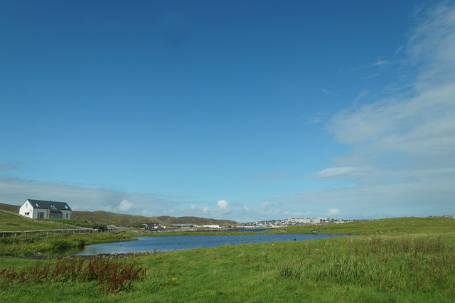
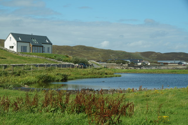
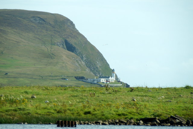
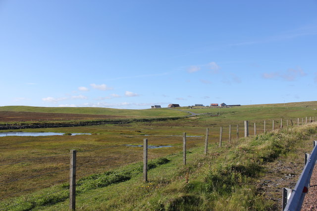
Sandy Loch is a small, picturesque freshwater loch located in the beautiful Shetland Islands, Scotland. This tranquil body of water is often referred to as a pool or pond due to its relatively small size. It covers an area of approximately 2 acres and is surrounded by rolling hills and lush vegetation, creating a serene and peaceful atmosphere.

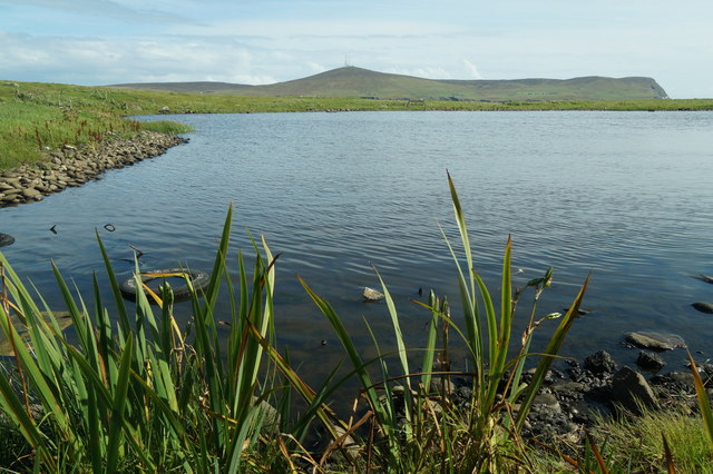
The water in Sandy Loch is crystal clear and is fed by natural springs and rainwater runoff. This ensures a constant supply of fresh, clean water, making it an ideal habitat for a variety of aquatic plants and animals. The shoreline of the loch is primarily sandy, giving it its name, and is dotted with reeds and rushes that provide shelter and nesting grounds for various bird species.

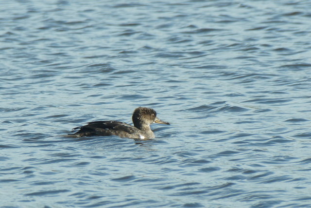
The surrounding area of Sandy Loch is a haven for wildlife enthusiasts and nature lovers. It is home to a diverse range of bird species, including ducks, swans, and herons, which can often be spotted gracefully gliding across the water or nesting along the shores. The loch also supports a healthy population of fish, such as brown trout and perch, providing excellent opportunities for anglers.

Visitors to Sandy Loch can enjoy peaceful walks along the water's edge, taking in the stunning views and observing the abundant wildlife. The loch is easily accessible by a small path leading from the nearby village, and there are picnic areas available for those who wish to relax and soak in the tranquility of the surroundings.

Overall, Sandy Loch is a hidden gem in the Shetland Islands, offering a unique and enchanting experience for nature enthusiasts and a welcoming habitat for a variety of plants and animals.

If you have any feedback on the listing, please let us know in the comments section below.

Sandy Loch Images

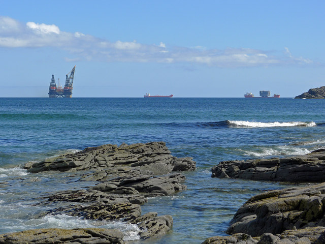
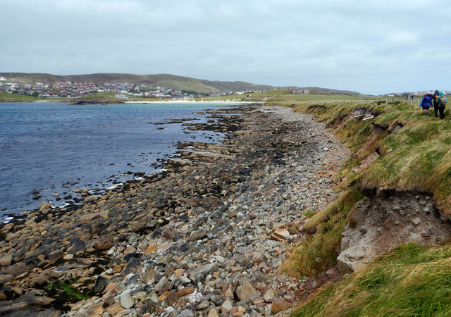
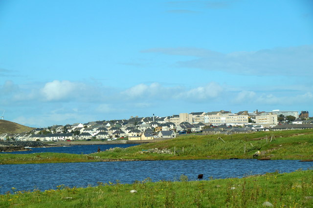
Images are sourced within 2km of 60.14555/-1.1909929 or Grid Reference HU4540. Thanks to Geograph Open Source API. All images are credited.

Pullar's Loch, Sound, from the air
Marine activity in Gulber Wick A reminder that despite the problems in the oil industry there is still activity in Shetland's waters.
Marine activity in Gulber Wick
A reminder that despite the problems in the oil industry there is still activity in Shetland's waters.
Homes with a view of Gulber Wick The area around Gulber Wick has become a centre for new housing for those working in Lerwick closeby. Extending the suburbs into the real country!
Homes with a view of Gulber Wick
The area around Gulber Wick has become a centre for new housing for those working in Lerwick closeby. Extending the suburbs into the real country!
New OSBM Bolt Ordnance Survey benchmark bolt at Hollander's Knowe, described as: NEW OSBM BOLT LIVING ROCK 10.0M NW SIDE RD 53.2M SW PRODN FENCE OPP (105.037m above Lerwick datum, 2nd order, new 1978).
New OSBM Bolt
Ordnance Survey benchmark bolt at Hollander's Knowe, described as: NEW OSBM BOLT LIVING ROCK 10.0M NW SIDE RD 53.2M SW PRODN FENCE OPP (105.037m above Lerwick datum, 2nd order, new 1978).
Hollander's Knowe Ordnance Survey benchmark in rock described as : NEW OSBM BOLT LIVING ROCK 10.0M NW SIDE RD 53.2M SW PRODN FENCE OPP (105.037m above Lerwick datum, 2nd order, new 1978).
Hollander's Knowe
Ordnance Survey benchmark in rock described as : NEW OSBM BOLT LIVING ROCK 10.0M NW SIDE RD 53.2M SW PRODN FENCE OPP (105.037m above Lerwick datum, 2nd order, new 1978).
Voe of Sound This is the low western side of Ness of Sound, with no cliffs and a short drop to the bouldery beach overlooking Voe of Sound. Although the Voe is not very wide, and doesn't have much in the way of waves even in the fresh gusty wind, it is clear that it can get a lot rougher. Much of the shoreline vegetation was blackened by dehydration caused by the salt spray which blows over - anything brave enough to stick up above the surrounding grasses seemed badly affected, particularly the nettles.

To the left (west) of Sands of Sound, the green lump is Holm of Sound, behind which are the houses of Sound and Upper Sound (now westerly suburbs of Lerwick).
Voe of Sound
This is the low western side of Ness of Sound, with no cliffs and a short drop to the bouldery beach overlooking Voe of Sound. Although the Voe is not very wide, and doesn't have much in the way of waves even in the fresh gusty wind, it is clear that it can get a lot rougher. Much of the shoreline vegetation was blackened by dehydration caused by the salt spray which blows over - anything brave enough to stick up above the surrounding grasses seemed badly affected, particularly the nettles. To the left (west) of Sands of Sound, the green lump is Holm of Sound, behind which are the houses of Sound and Upper Sound (now westerly suburbs of Lerwick).
Pullar's Loch, Ness of Sound, Lerwick
Pullar's Loch, Ness of Sound, Lerwick Lerwick, and the Gilbert Bain Hospital, in the background.
Pullar's Loch, Ness of Sound, Lerwick
Lerwick, and the Gilbert Bain Hospital, in the background.
Pullar's Loch, Ness of Sound, Lerwick
Pullar's Loch, Ness of Sound, Lerwick Looking across Bressay Sound to the Bressay lighthouse.
Pullar's Loch, Ness of Sound, Lerwick
Looking across Bressay Sound to the Bressay lighthouse.
Hooded Merganser (Lophodytes cucullatus), Pullars Loch, Lerwick A native of North America, this adult female in moult is of 'unknown origin'.
Hooded Merganser (Lophodytes cucullatus), Pullars Loch, Lerwick
A native of North America, this adult female in moult is of 'unknown origin'.
Newpark (from the A970)
A970 approaching Lerwick The A970 runs for 71 miles across most of the length of the "Mainland" in the Shetland Islands. It is a good-quality single-carriageway road for most of its route. Travelling from south to north, the road begins at Grutness near Sumburgh Airport and winds around the many hills and inlets passing close to a number of small villages without going through any large ones before Lerwick. After looping around Lerwick, a short spur runs to Scalloway whilst the main route continues northwards towards Brae where it crosses the narrow isthmus of Mavis Grind. At Sandy Lochs the road splits and a four-mile spur goes through Urafirth to Hillswick. The main route continuing to the right towards its northern terminus at Isbister. This last part of the route tends to be narrower with passing places.

<span class="nowrap"><a title="https://www.sabre-roads.org.uk/wiki/index.php?title=A970" rel="nofollow ugc noopener" href="https://www.sabre-roads.org.uk/wiki/index.php?title=A970">Link</a><img style="margin-left:2px;" alt="External link" title="External link - shift click to open in new window" src="https://s1.geograph.org.uk/img/external.png" width="10" height="10"/></span>  SABRE
A970 approaching Lerwick
The A970 runs for 71 miles across most of the length of the "Mainland" in the Shetland Islands. It is a good-quality single-carriageway road for most of its route. Travelling from south to north, the road begins at Grutness near Sumburgh Airport and winds around the many hills and inlets passing close to a number of small villages without going through any large ones before Lerwick. After looping around Lerwick, a short spur runs to Scalloway whilst the main route continues northwards towards Brae where it crosses the narrow isthmus of Mavis Grind. At Sandy Lochs the road splits and a four-mile spur goes through Urafirth to Hillswick. The main route continuing to the right towards its northern terminus at Isbister. This last part of the route tends to be narrower with passing places. LinkExternal link SABRE
Bus Shelter on the A970 The A970 runs for 71 miles across most of the length of the "Mainland" in the Shetland Islands. It is a good-quality single-carriageway road for most of its route. Travelling from south to north, the road begins at Grutness near Sumburgh Airport and winds around the many hills and inlets passing close to a number of small villages without going through any large ones before Lerwick. After looping around Lerwick, a short spur runs to Scalloway whilst the main route continues northwards towards Brae where it crosses the narrow isthmus of Mavis Grind. At Sandy Lochs the road splits and a four-mile spur goes through Urafirth to Hillswick. The main route continuing to the right towards its northern terminus at Isbister. This last part of the route tends to be narrower with passing places.

<span class="nowrap"><a title="https://www.sabre-roads.org.uk/wiki/index.php?title=A970" rel="nofollow ugc noopener" href="https://www.sabre-roads.org.uk/wiki/index.php?title=A970">Link</a><img style="margin-left:2px;" alt="External link" title="External link - shift click to open in new window" src="https://s1.geograph.org.uk/img/external.png" width="10" height="10"/></span>  SABRE
Bus Shelter on the A970
The A970 runs for 71 miles across most of the length of the "Mainland" in the Shetland Islands. It is a good-quality single-carriageway road for most of its route. Travelling from south to north, the road begins at Grutness near Sumburgh Airport and winds around the many hills and inlets passing close to a number of small villages without going through any large ones before Lerwick. After looping around Lerwick, a short spur runs to Scalloway whilst the main route continues northwards towards Brae where it crosses the narrow isthmus of Mavis Grind. At Sandy Lochs the road splits and a four-mile spur goes through Urafirth to Hillswick. The main route continuing to the right towards its northern terminus at Isbister. This last part of the route tends to be narrower with passing places. LinkExternal link SABRE
A970 at Windyknowe The A970 runs for 71 miles across most of the length of the "Mainland" in the Shetland Islands. It is a good-quality single-carriageway road for most of its route. Travelling from south to north, the road begins at Grutness near Sumburgh Airport and winds around the many hills and inlets passing close to a number of small villages without going through any large ones before Lerwick. After looping around Lerwick, a short spur runs to Scalloway whilst the main route continues northwards towards Brae where it crosses the narrow isthmus of Mavis Grind. At Sandy Lochs the road splits and a four-mile spur goes through Urafirth to Hillswick. The main route continuing to the right towards its northern terminus at Isbister. This last part of the route tends to be narrower with passing places.

<span class="nowrap"><a title="https://www.sabre-roads.org.uk/wiki/index.php?title=A970" rel="nofollow ugc noopener" href="https://www.sabre-roads.org.uk/wiki/index.php?title=A970">Link</a><img style="margin-left:2px;" alt="External link" title="External link - shift click to open in new window" src="https://s1.geograph.org.uk/img/external.png" width="10" height="10"/></span>  SABRE
A970 at Windyknowe
The A970 runs for 71 miles across most of the length of the "Mainland" in the Shetland Islands. It is a good-quality single-carriageway road for most of its route. Travelling from south to north, the road begins at Grutness near Sumburgh Airport and winds around the many hills and inlets passing close to a number of small villages without going through any large ones before Lerwick. After looping around Lerwick, a short spur runs to Scalloway whilst the main route continues northwards towards Brae where it crosses the narrow isthmus of Mavis Grind. At Sandy Lochs the road splits and a four-mile spur goes through Urafirth to Hillswick. The main route continuing to the right towards its northern terminus at Isbister. This last part of the route tends to be narrower with passing places. LinkExternal link SABRE
A970, Ward of Wick The road ahead, to the left (B9073), cuts through to the Scalloway spur of the A970, a short-cut which avoids Lerwick. It also provides a route to the Northern Isles which by-passes Lerwick.
A970, Ward of Wick
The road ahead, to the left (B9073), cuts through to the Scalloway spur of the A970, a short-cut which avoids Lerwick. It also provides a route to the Northern Isles which by-passes Lerwick.
B9073 Junction on the A970 The road to the left (B9073) cuts through to the Scalloway spur of the A970, a short-cut which avoids Lerwick. It also provides a route to the Northern Isles which by-passes Lerwick.
B9073 Junction on the A970
The road to the left (B9073) cuts through to the Scalloway spur of the A970, a short-cut which avoids Lerwick. It also provides a route to the Northern Isles which by-passes Lerwick.
Show me another place!

Sandy Loch is located at Grid Ref: HU4540 (Lat: 60.14555, Lng: -1.1909929)

Unitary Authority: Shetland Islands

Police Authority: Highlands and Islands

What 3 Words

///grows.newlyweds.state. Near Lerwick, Shetland Islands

Nearby Locations

Sandy Loch Uppersound

Related Wikis

Lerwick Observatory

Lerwick Observatory (also known as Lerwick Magnetic Observatory) is a British meteorological observatory located near the port at Lerwick, Shetland Islands...
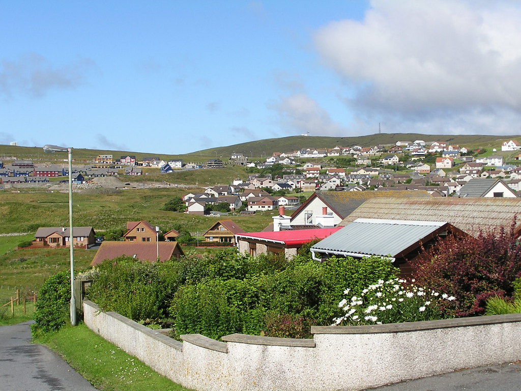
Sound, Lerwick

Sound is an area situated to the south-west of central Lerwick, the capital of Shetland, Scotland.Sound is home to a primary school, public hall, and gospel...
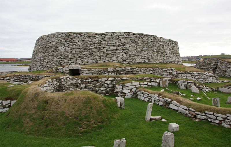
Broch of Clickimin

The Broch of Clickimin (also Clickimin or Clickhimin Broch) is a large, well-preserved but restored broch in Lerwick, Shetland, Scotland (grid reference...

Clickimin Loch

Clickimin Loch is a loch in Shetland, Scotland, west of Lerwick. A Pictish fort from the 6th century called Clickimin Broch is located on a small islet...

Nearby Amenities

Located within 500m of 60.14555,-1.1909929
Barrier: cattle_grid
Lat/Long: 60.1436619/-1.1847048
Barrier: cattle_grid
Lat/Long: 60.1439493/-1.1843445
The data included in this document is from www.openstreetmap.org. The data is made available under ODbL.

Have you been to Sandy Loch?

Leave your review of Sandy Loch below (or comments, questions and feedback).